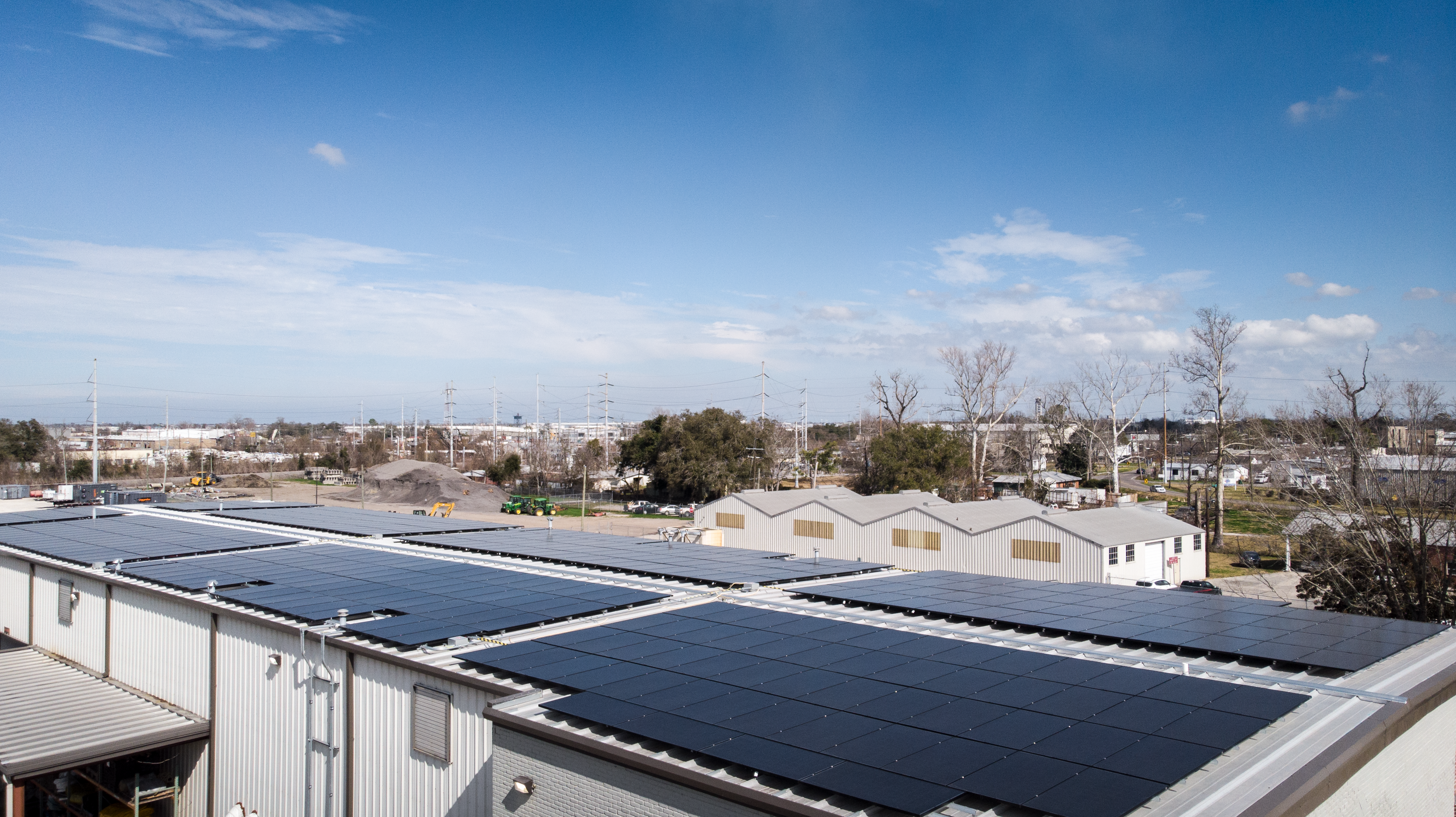
Roof leaks rarely begin where they’re first discovered. Long before water stains appear inside a building, moisture may already be trapped beneath the roofing membrane, quietly saturating insulation, reducing energy efficiency, and accelerating the deterioration of valuable roofing systems. By the time interior damage becomes visible, repairs are often far more extensive and costly than they would have been if the problem had been detected early.
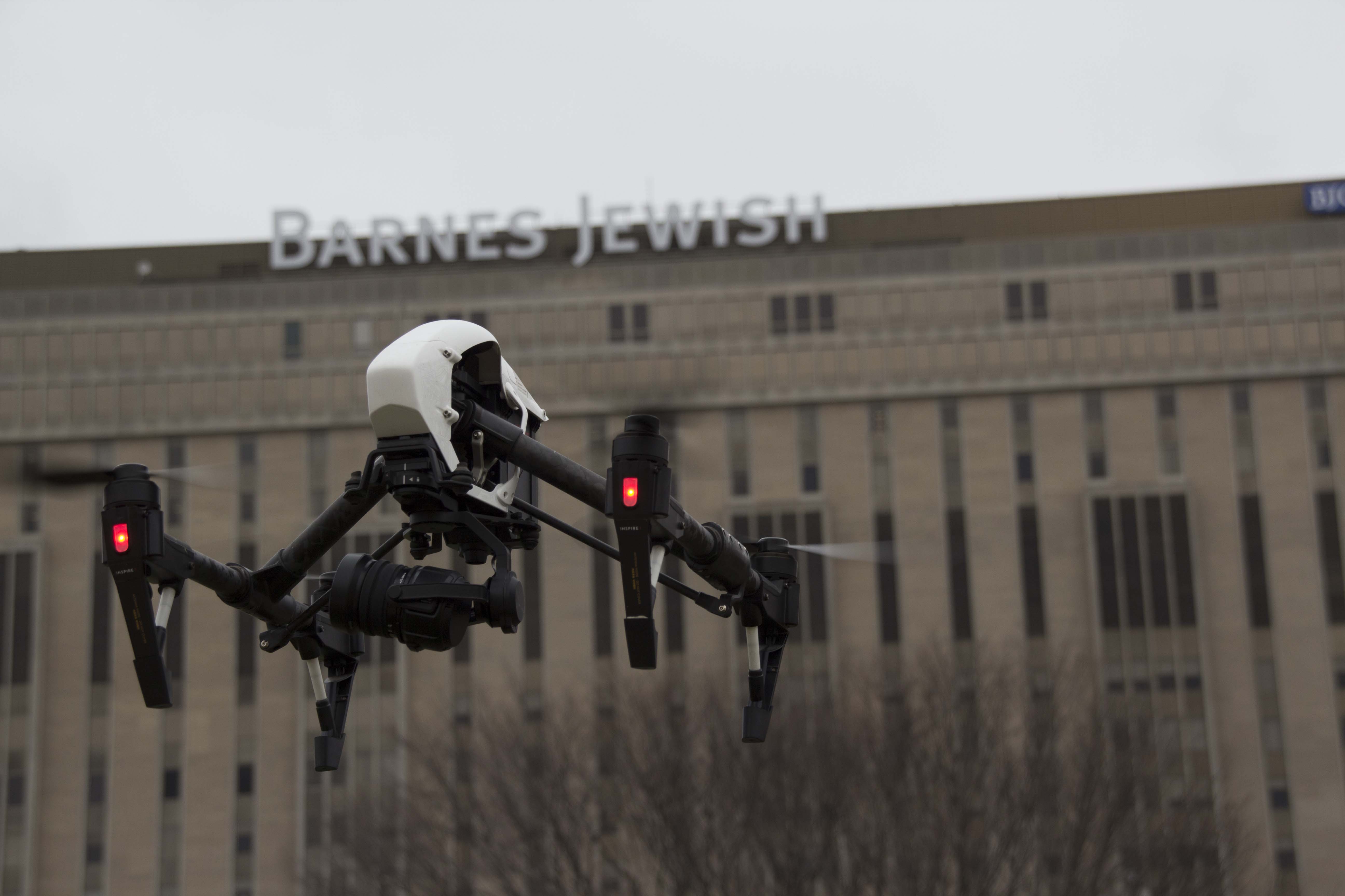
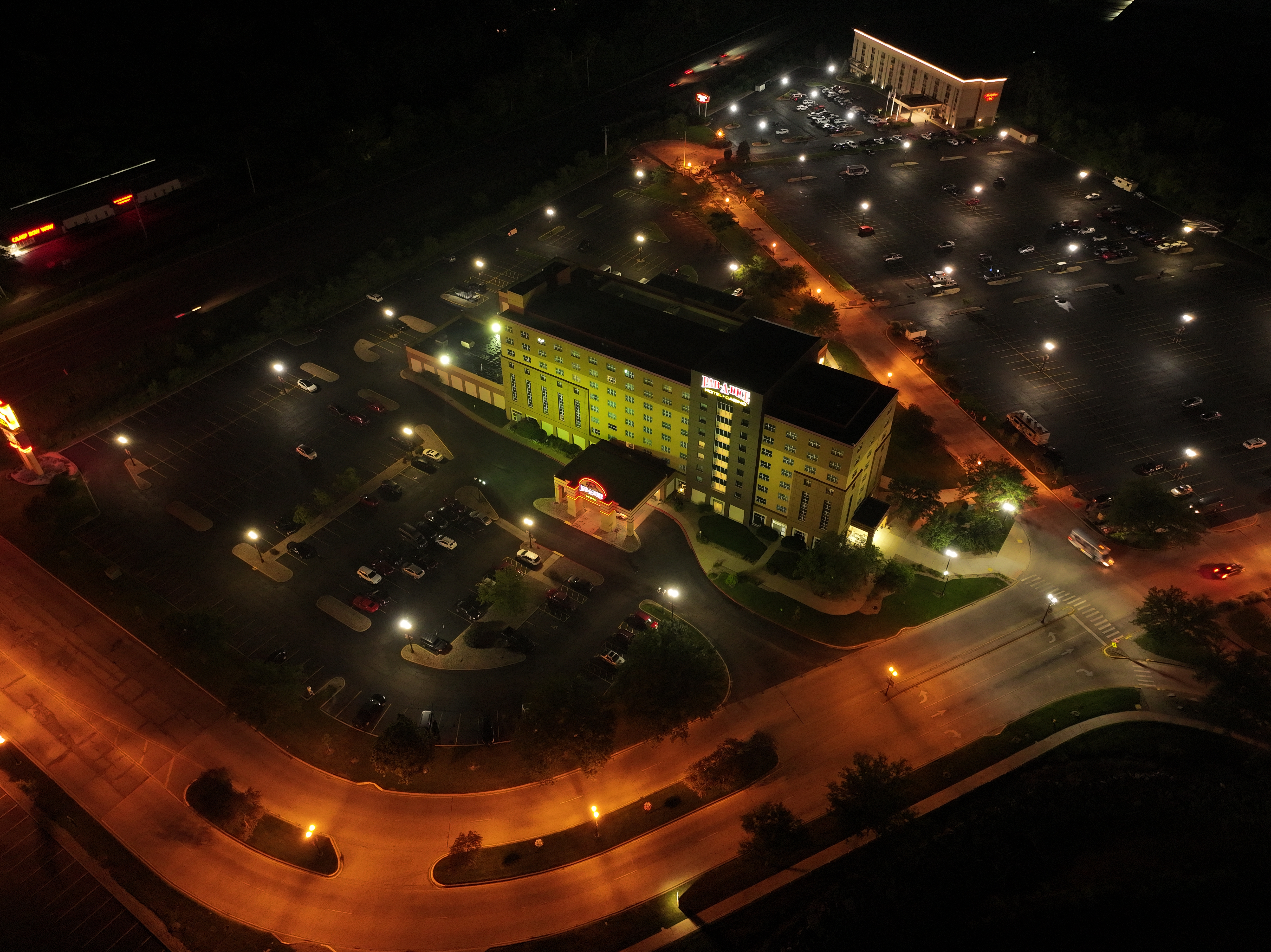
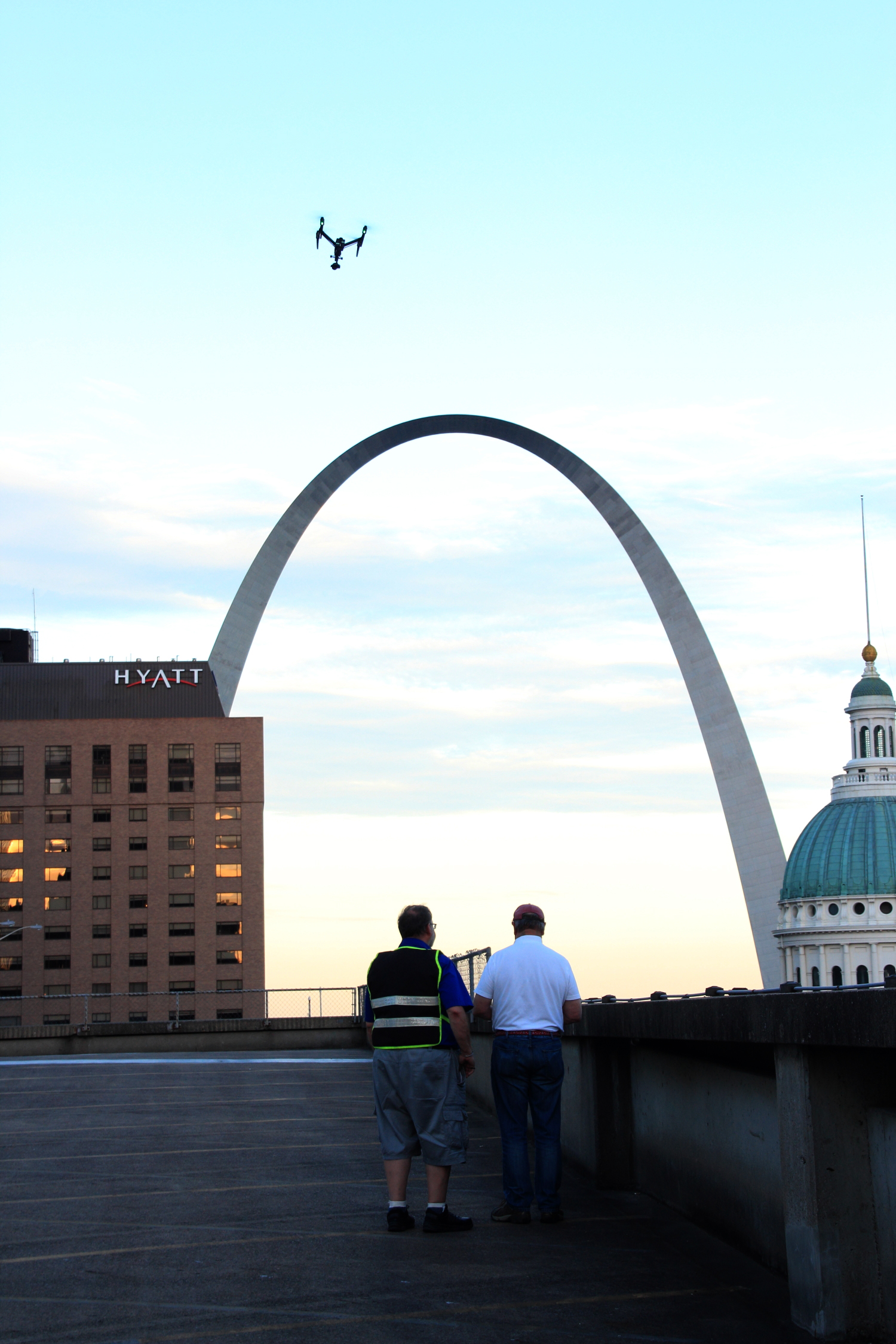
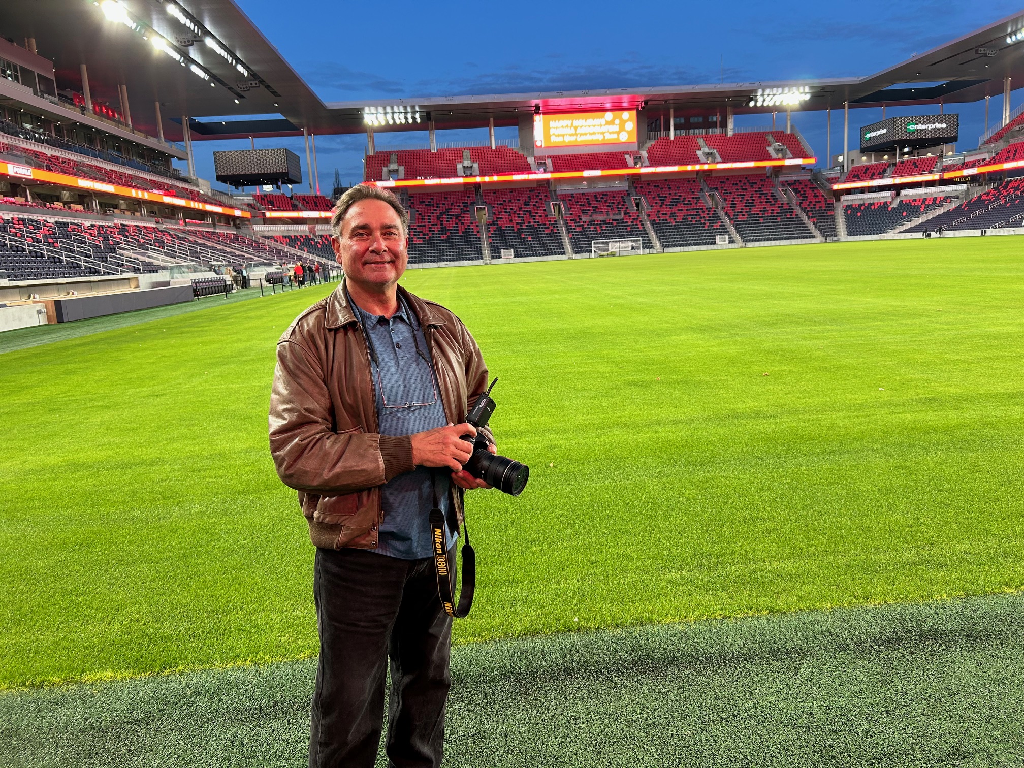
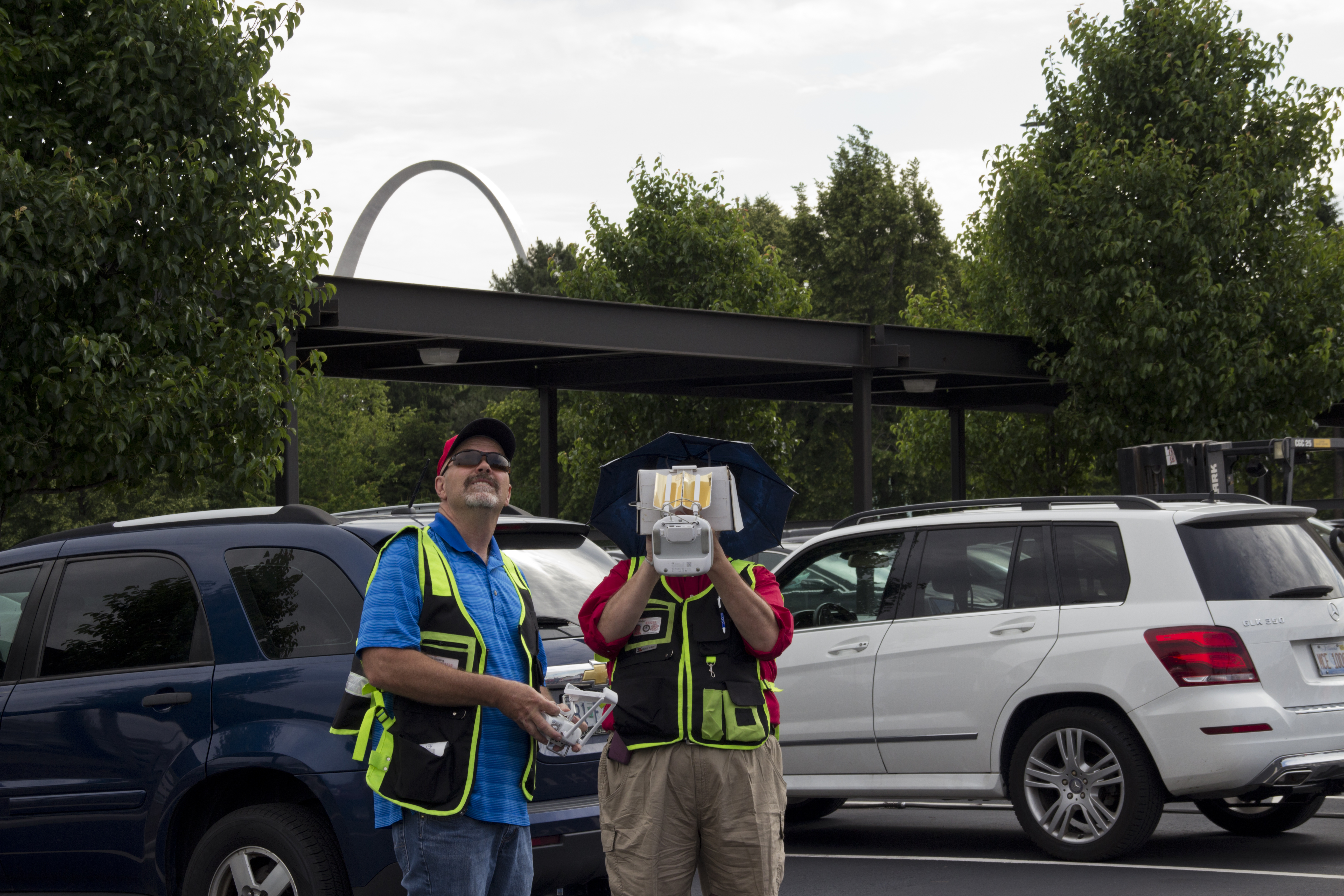
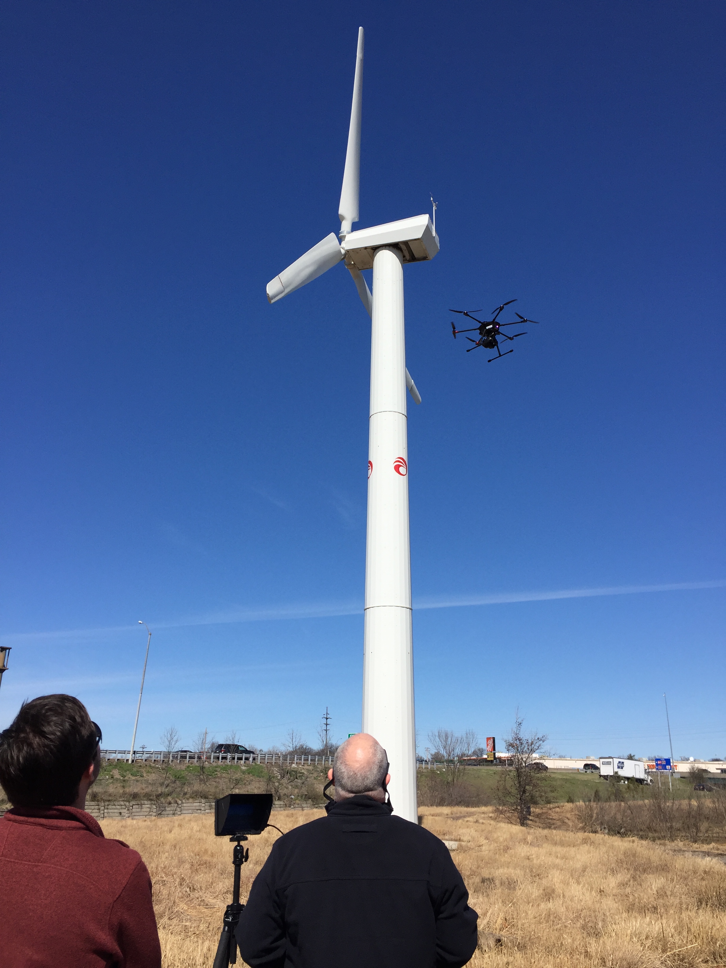
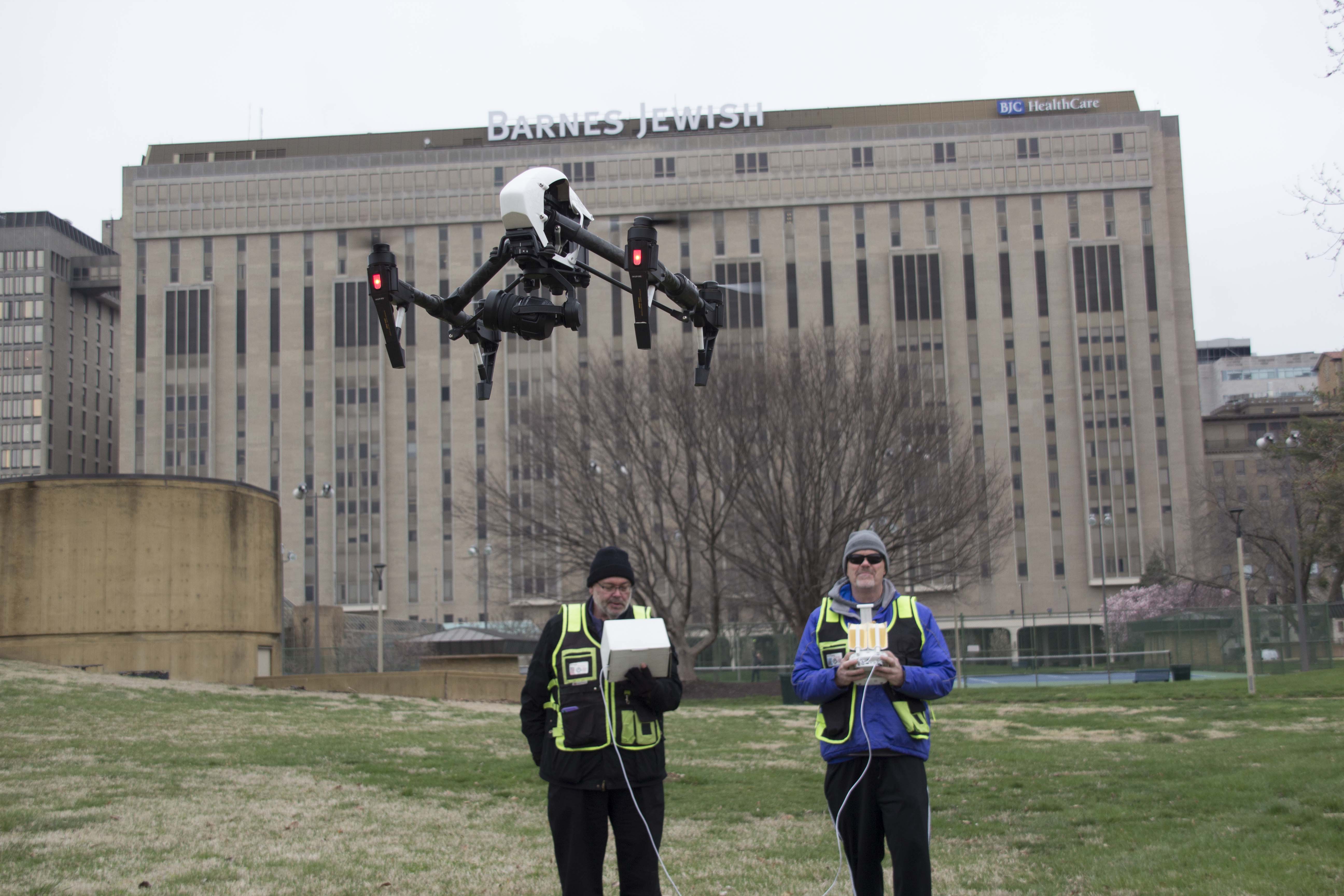
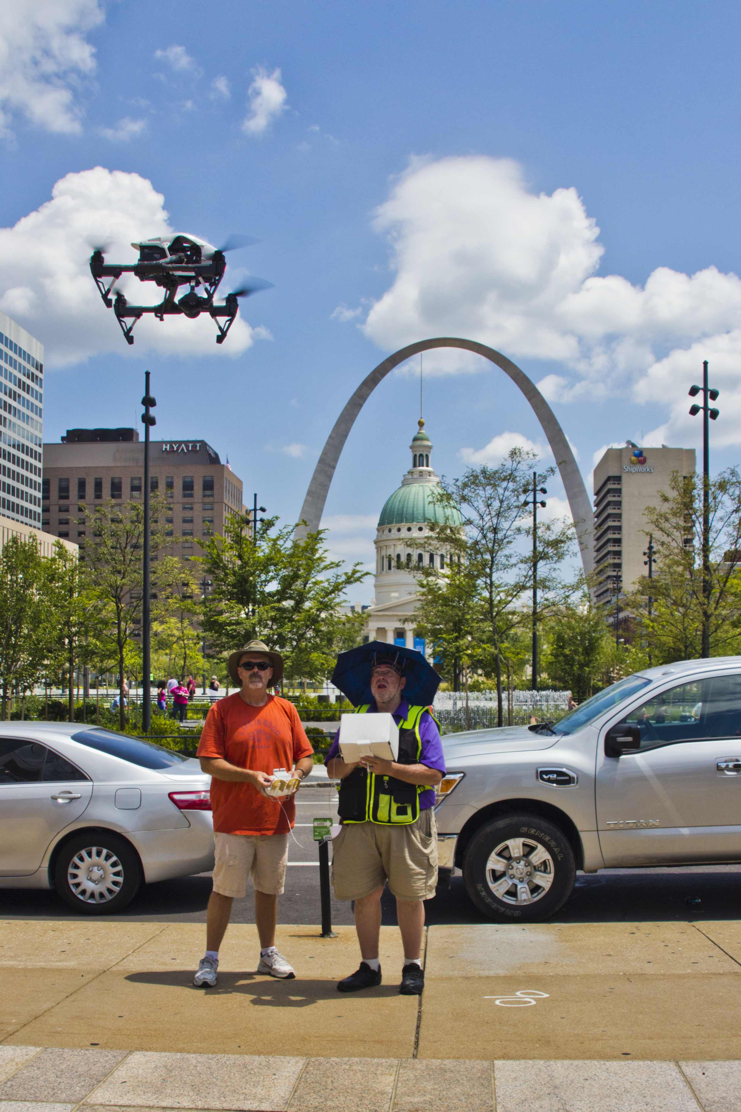
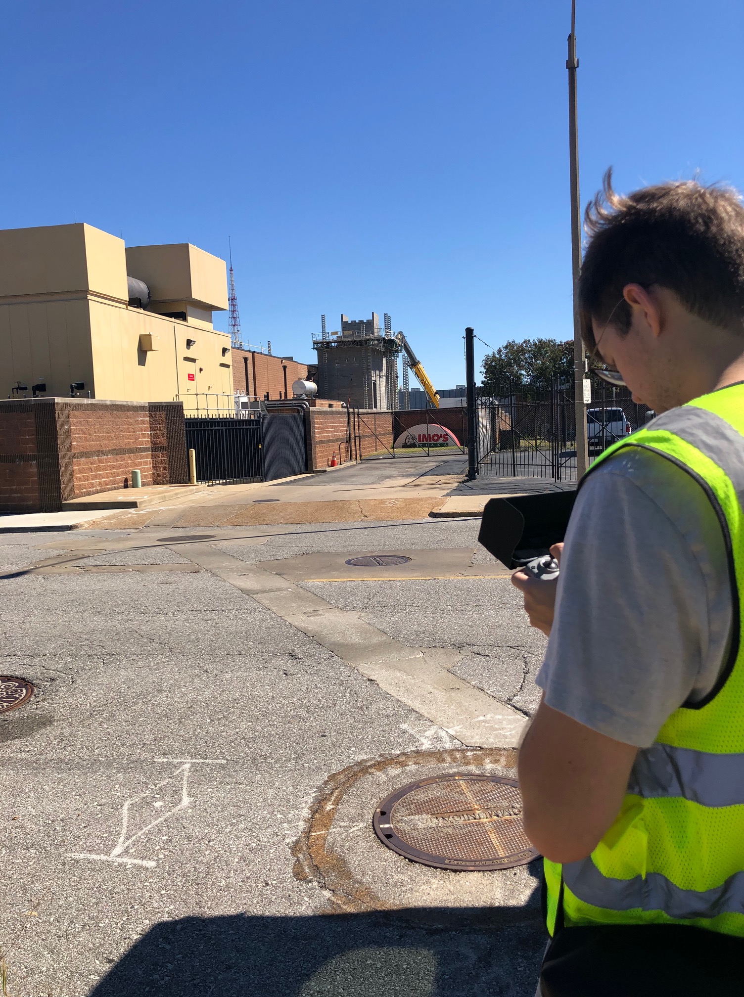
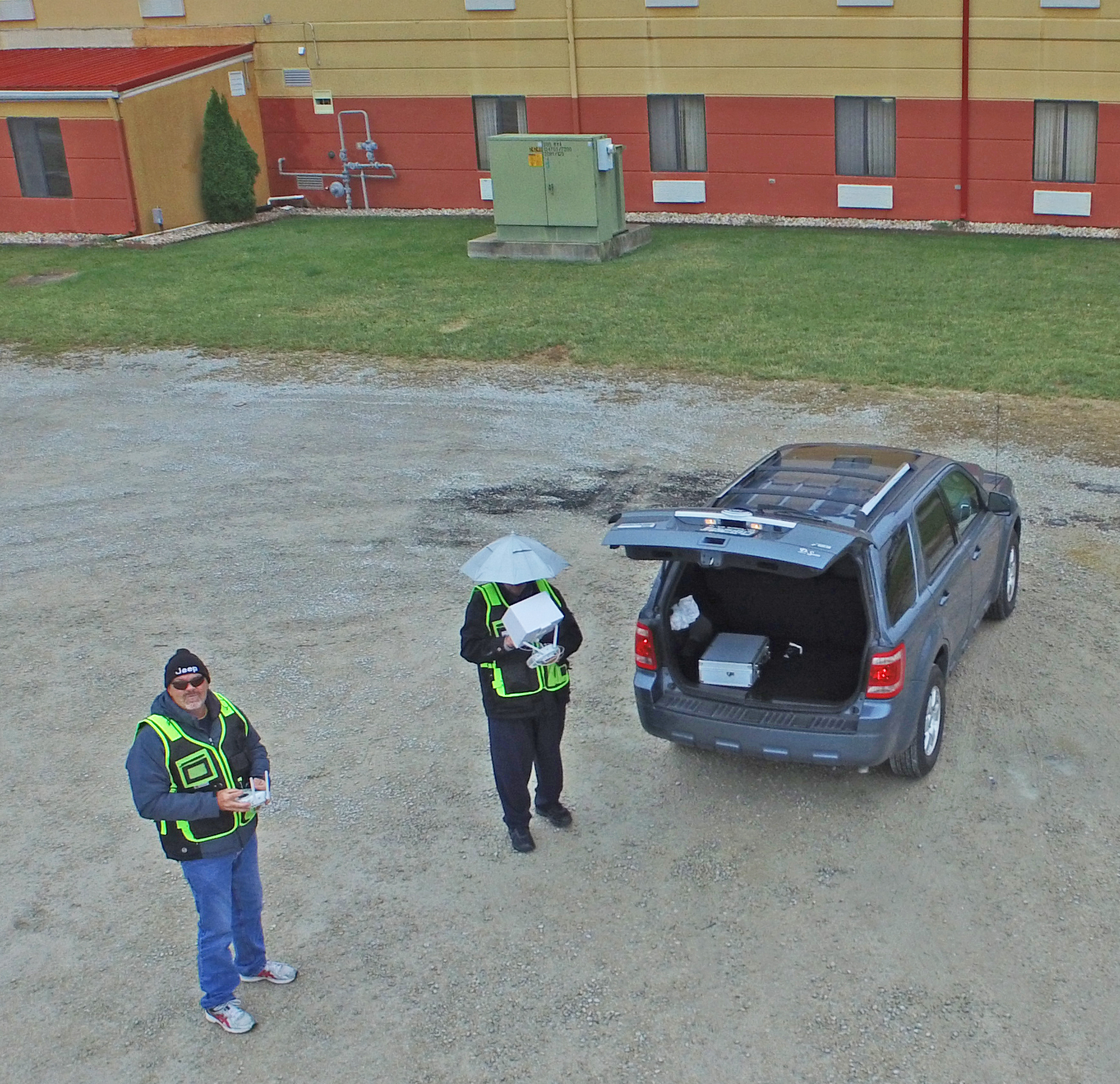
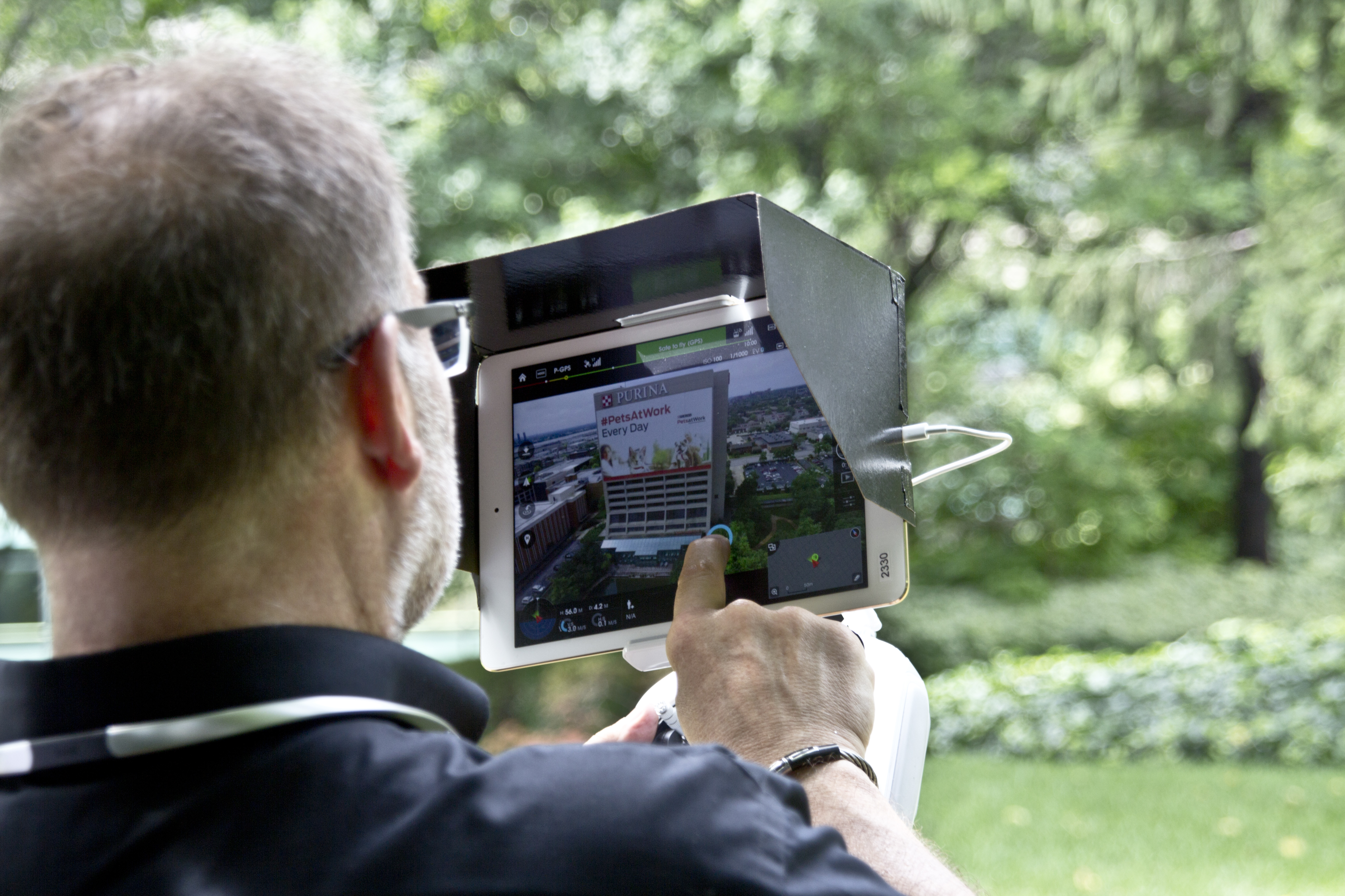
At St Louis Drones, we help facility managers, property owners, engineers, architects, and commercial building professionals identify hidden roofing issues before they become expensive emergencies. Our advanced FLIR thermal infrared drone inspections combine radiometric thermal imaging, high-resolution aerial photography, and precision mapping to deliver objective, data-driven information about the health of your roofing assets.
Rather than reacting to leaks after damage occurs, organizations can use thermal drone inspections to proactively monitor roof conditions, prioritize maintenance, and make informed decisions that extend the life of their buildings.
Why Hidden Roof Moisture Is So Difficult to Detect
Many commercial roofing systems conceal moisture beneath membranes or insulation where it cannot be identified during a traditional visual inspection. Water often travels away from the original point of entry, making the actual source of the problem difficult to locate.
Hidden moisture can result from:
Aging roofing systems
Storm or hail damage
Failed flashing
Roof penetrations around HVAC equipment
Mechanical damage
Poor drainage
Expansion joint failures
Previous repair deficiencies
Without advanced diagnostic technology, these conditions often remain unnoticed until interior leaks or structural damage occur.
How FLIR Thermal Infrared Drone Inspections Work
Thermal imaging detects temperature differences that are invisible to the human eye.
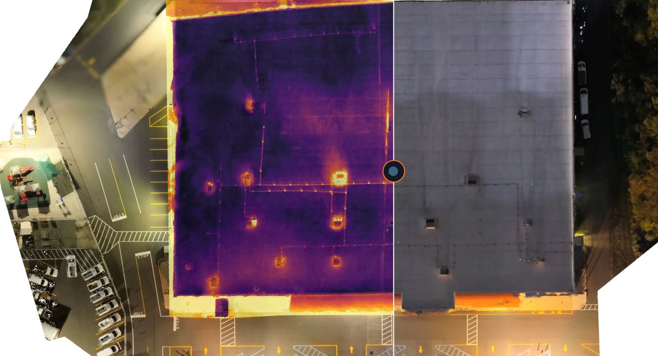
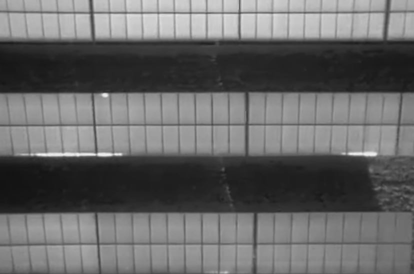
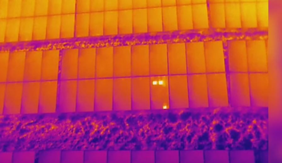
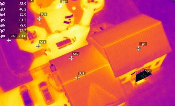
As roofing materials absorb heat throughout the day, dry insulation cools differently than insulation containing trapped moisture. Wet areas retain thermal energy longer, producing temperature patterns that can be identified using professional FLIR radiometric thermal cameras mounted on our drone platforms.
Unlike conventional infrared images, radiometric thermal imagery records precise temperature information throughout every image, providing measurable data for detailed evaluation and documentation.
Our inspections help identify:
Suspected moisture intrusion
Saturated insulation
Thermal anomalies
Potential leak locations
Areas requiring additional investigation
Heat loss patterns
Roofing system irregularities
The result is a fast, non-invasive assessment that minimizes disruption while delivering valuable insight into roof conditions.
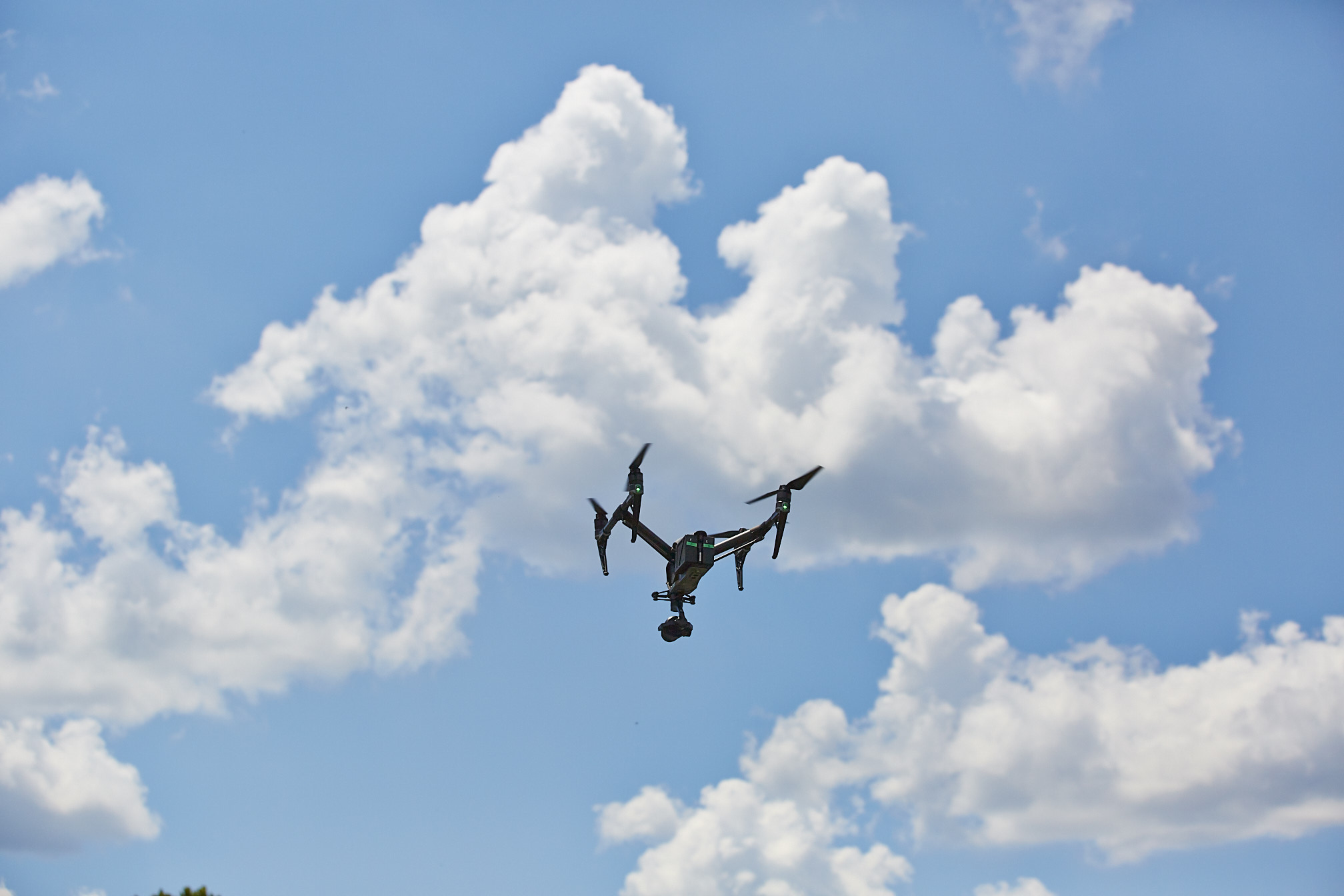
The Advantages of Drone-Based Roof Inspections
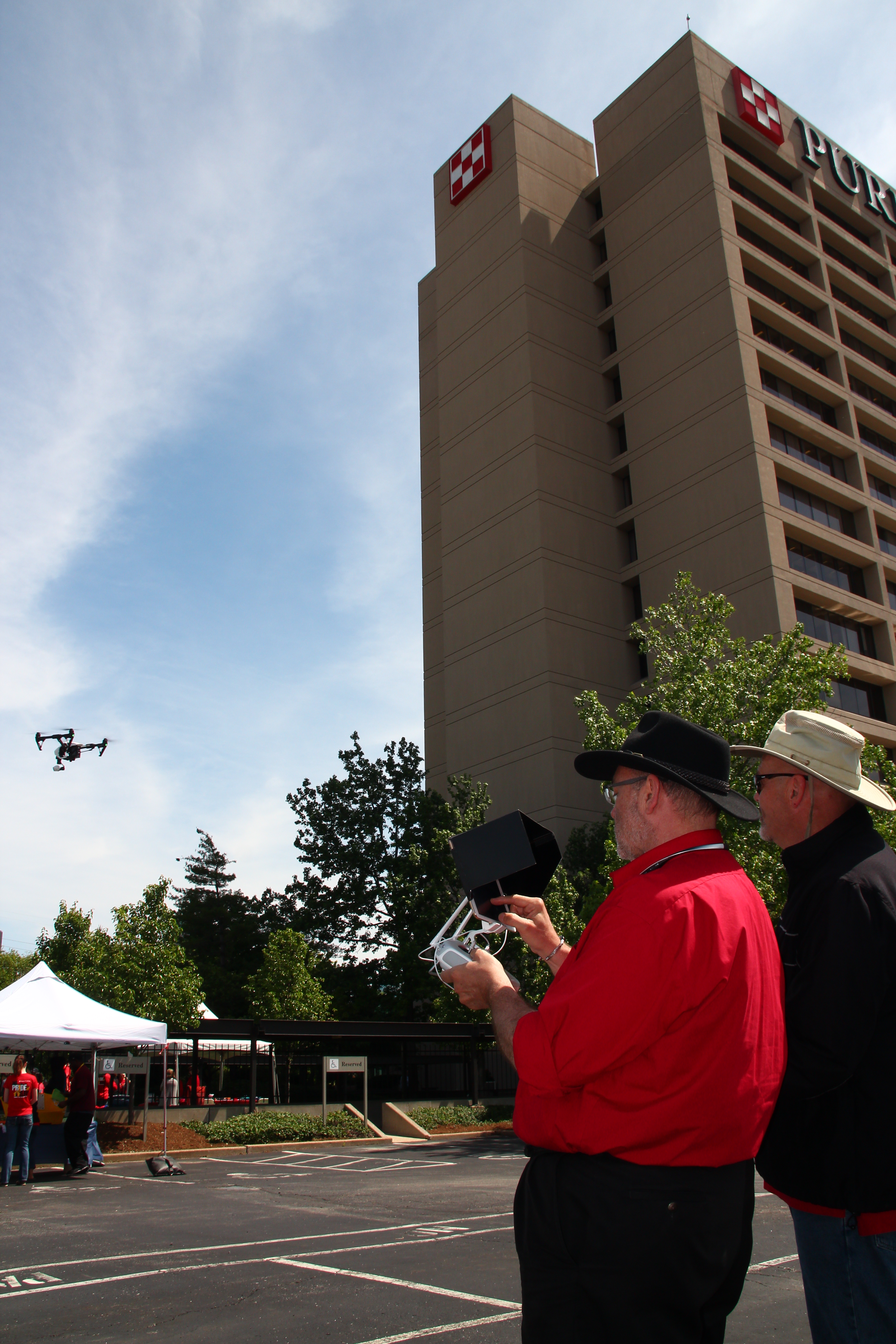
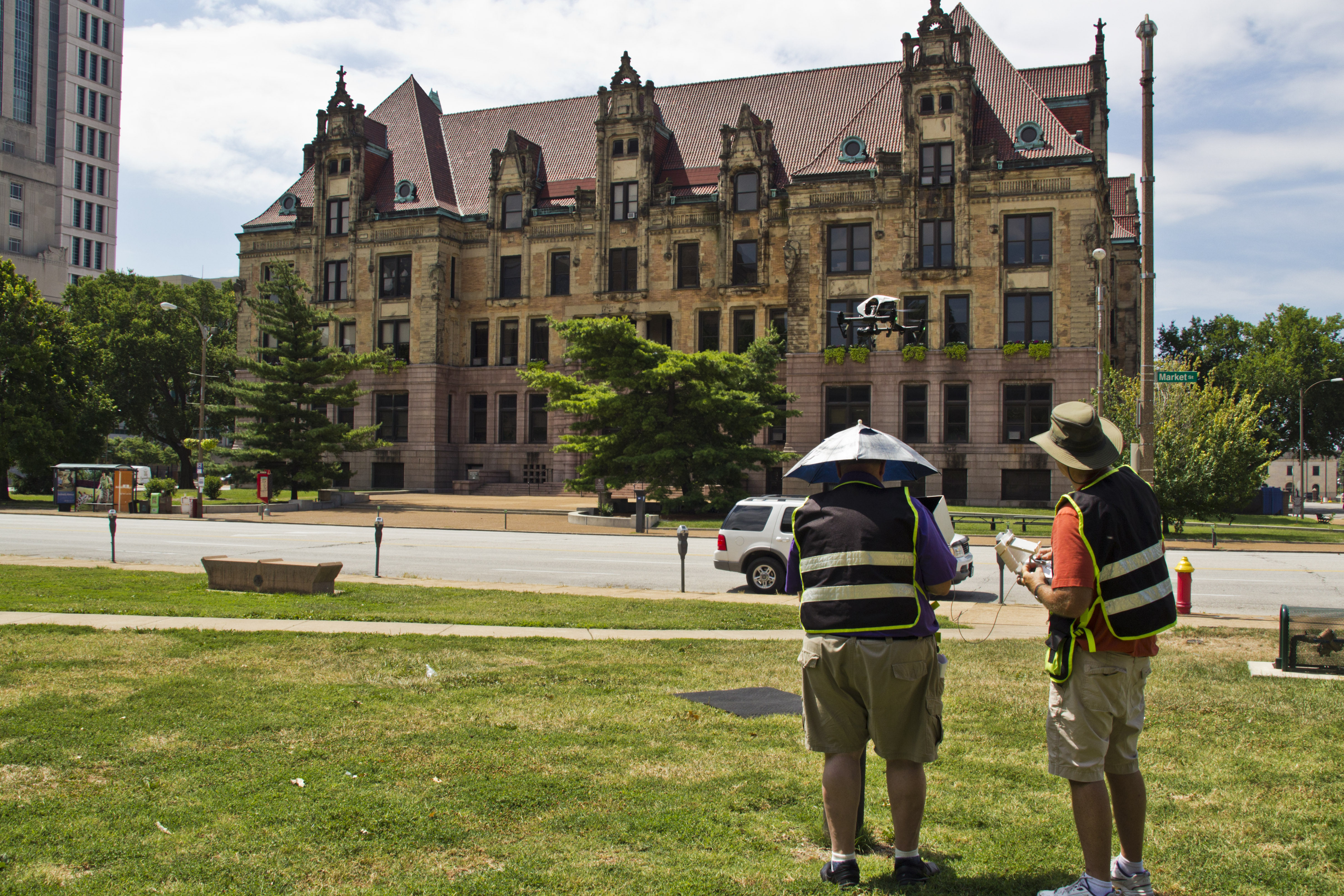
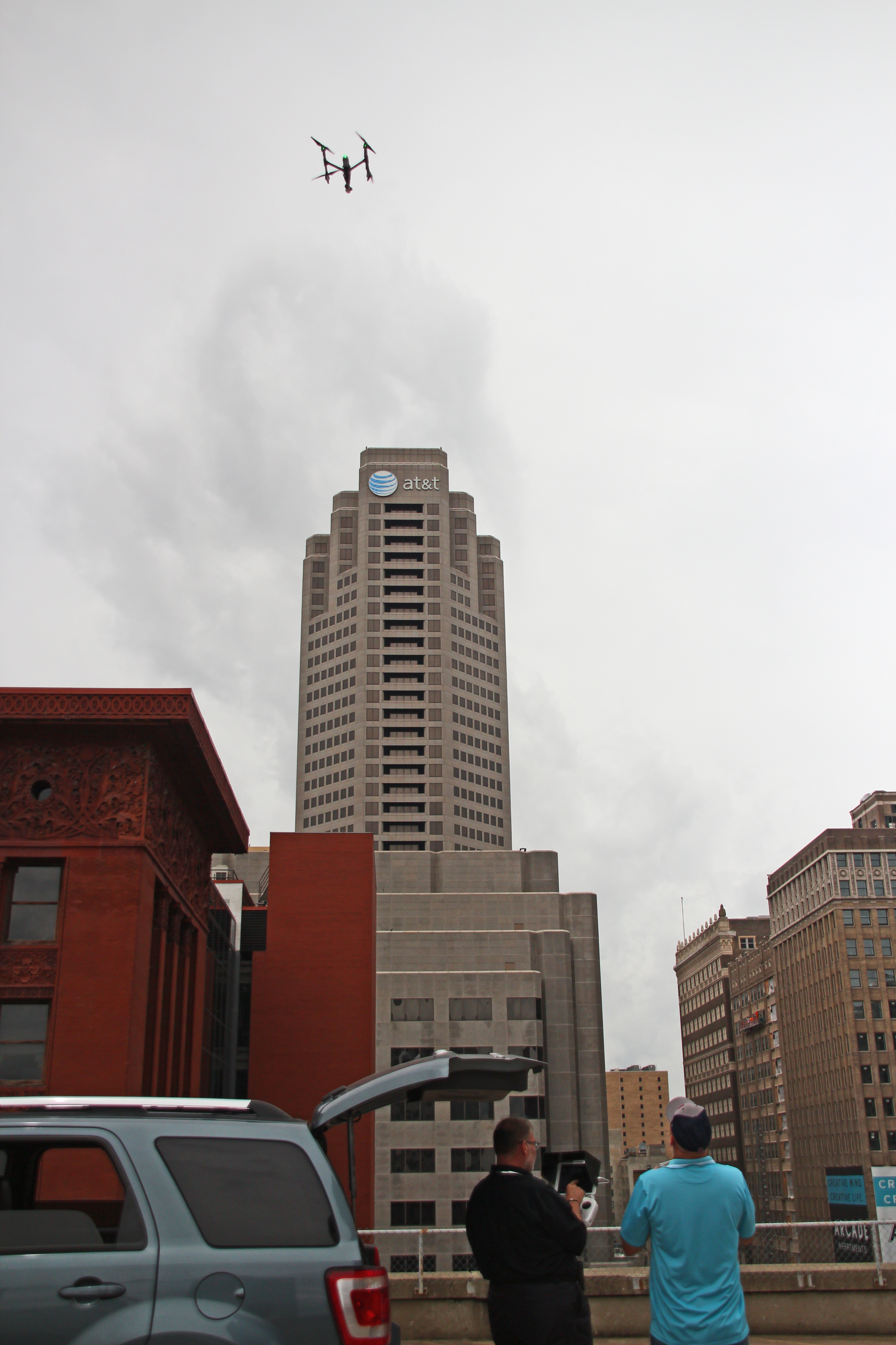
Drone technology has transformed commercial roof inspections by making them safer, faster, and more comprehensive.
Improved Safety
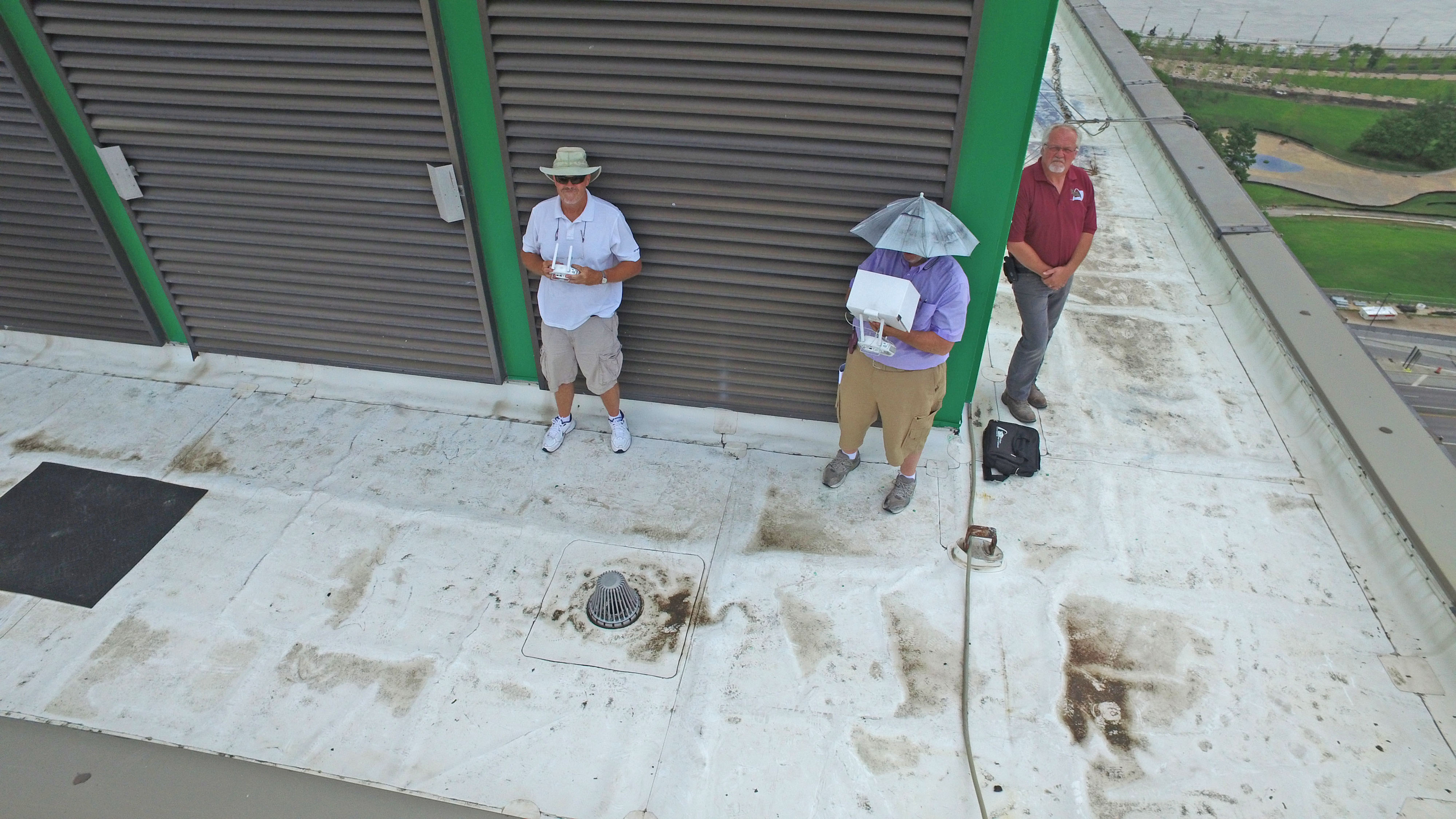
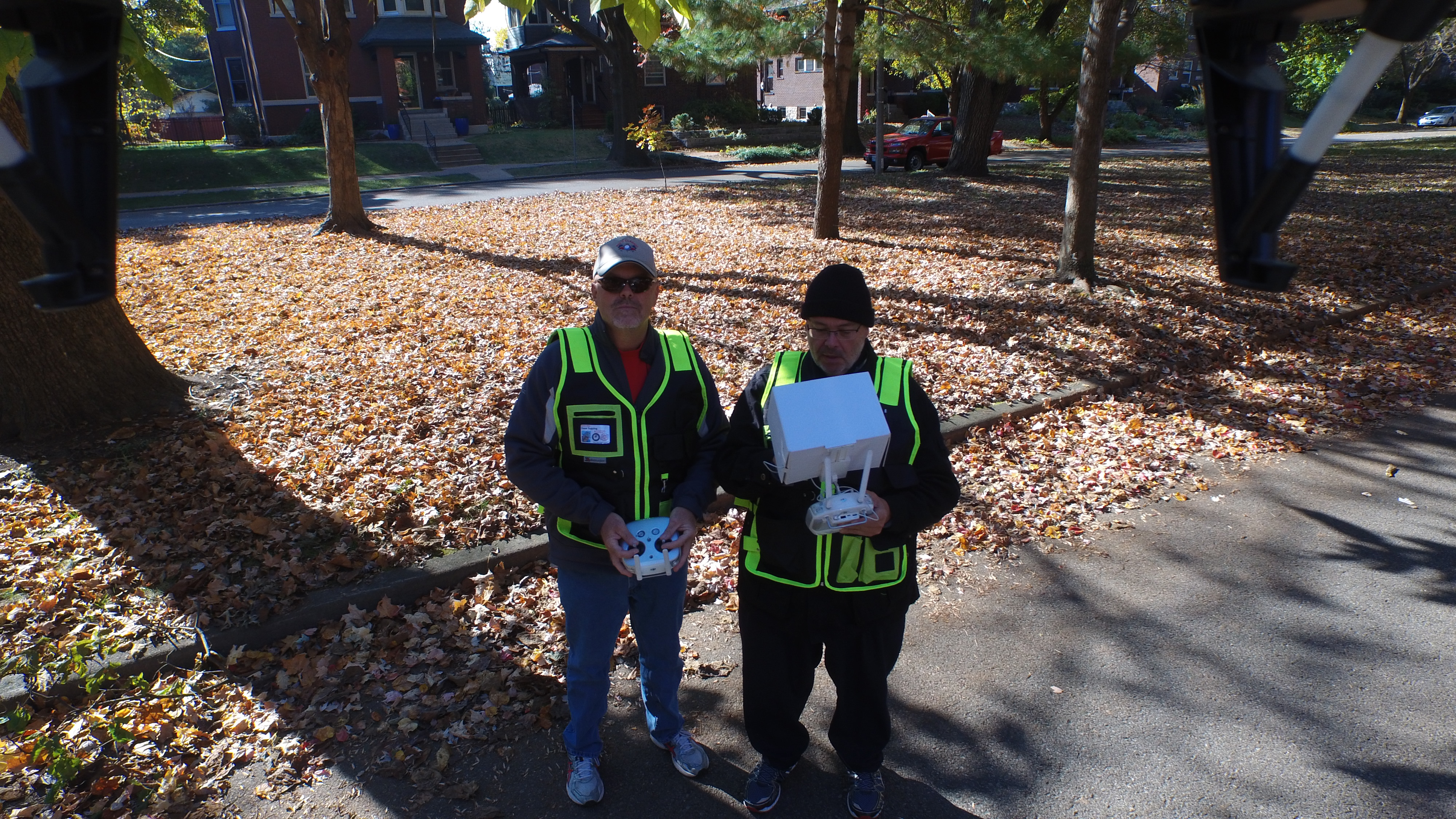
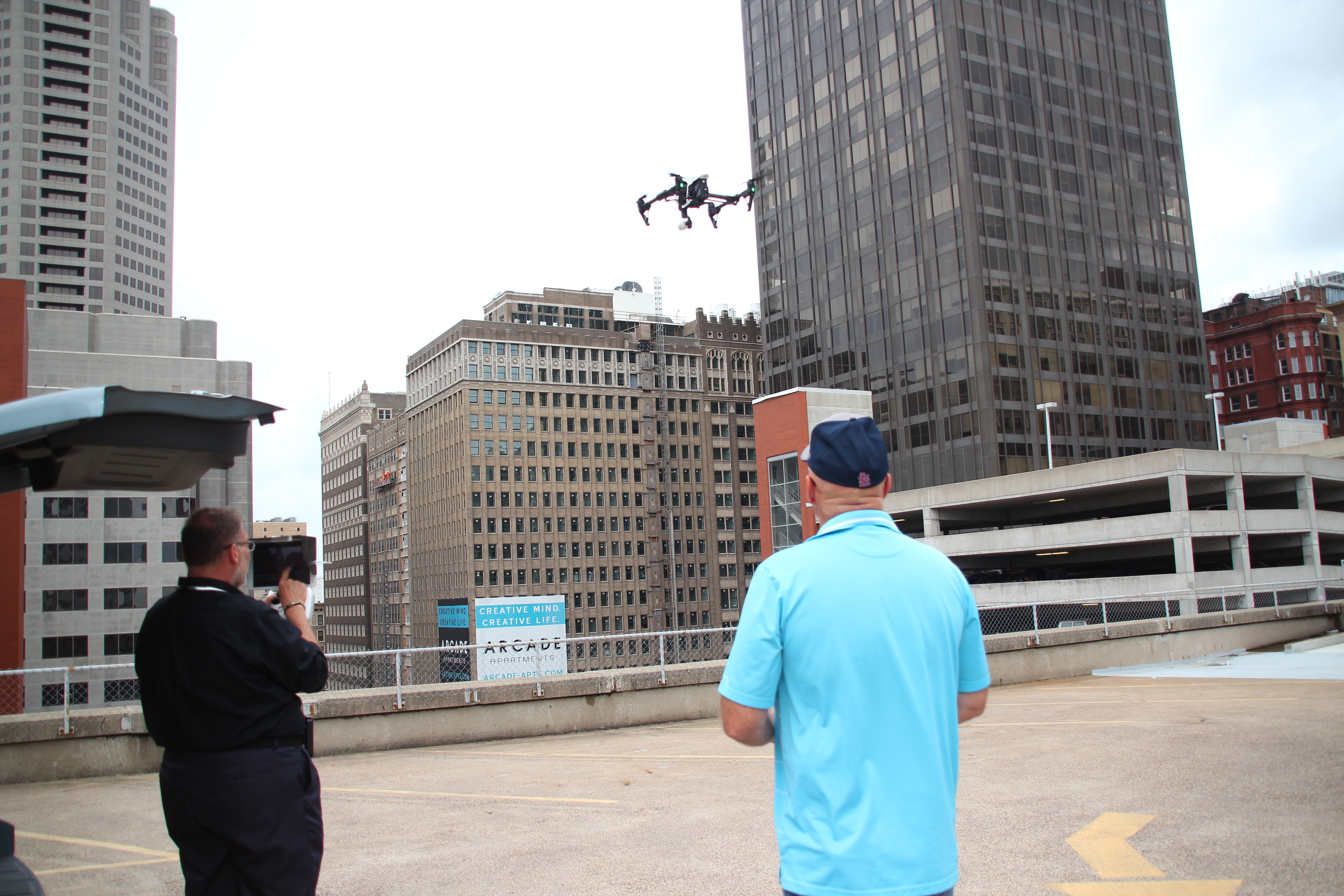
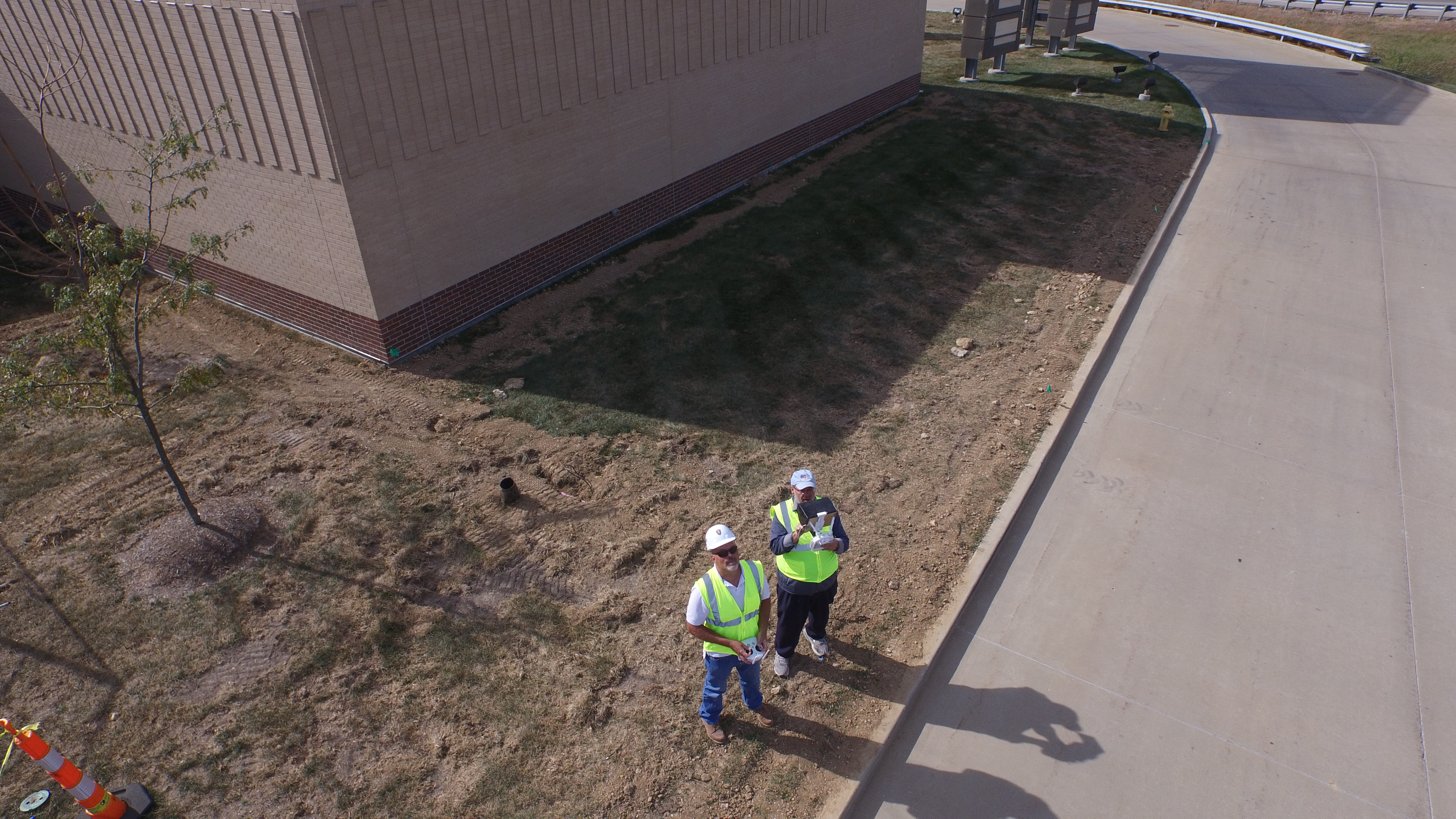
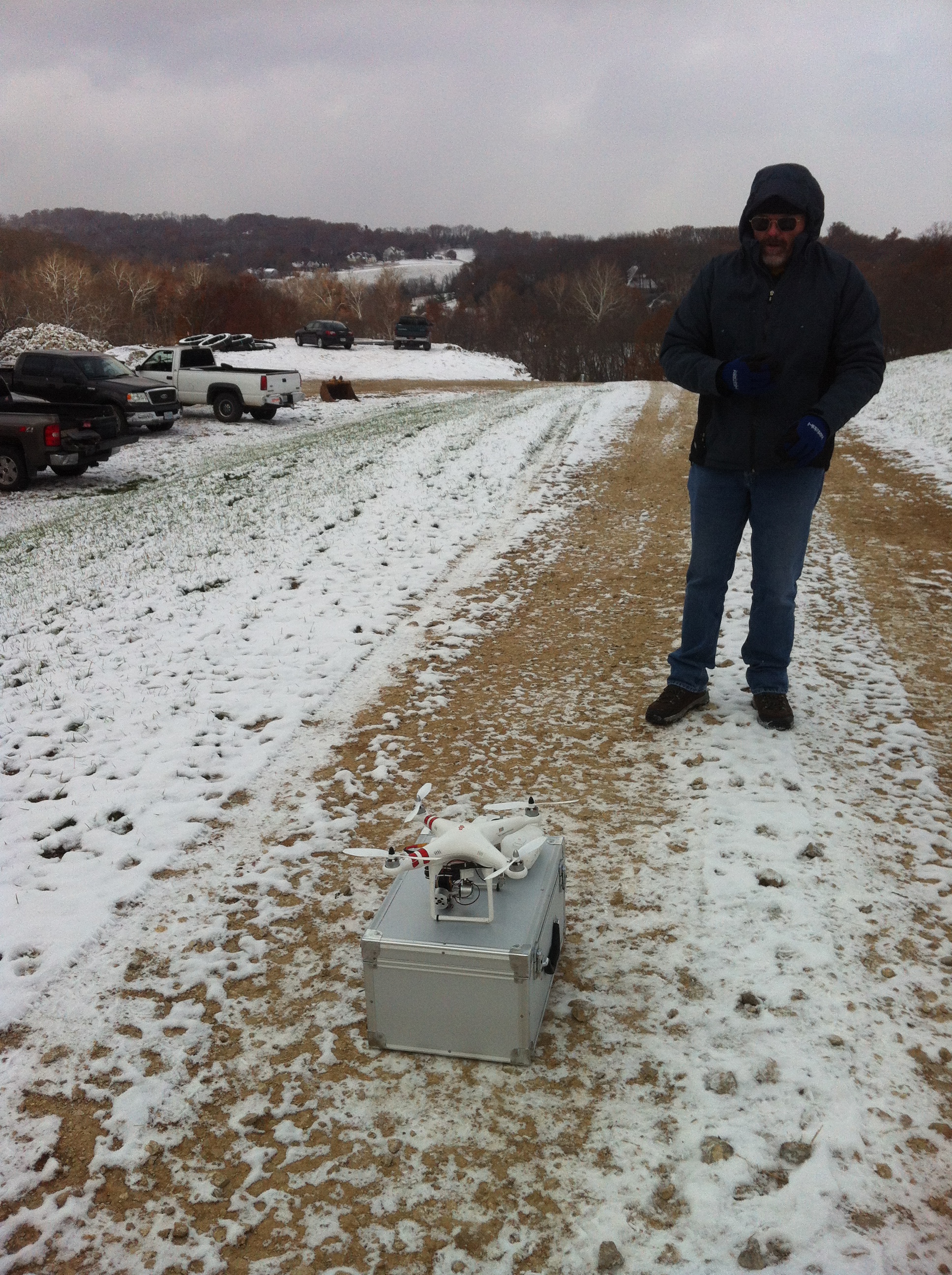
Our pilots perform inspections while remaining safely on the ground, reducing the need for personnel to walk large or difficult roofing systems.
Efficient Data Collection
Large commercial facilities can be documented quickly without interrupting daily operations.
Exceptional Image Quality
Professional thermal sensors and high-resolution cameras capture detailed imagery suitable for engineering analysis, maintenance planning, and documentation.
Access to Challenging Roofs
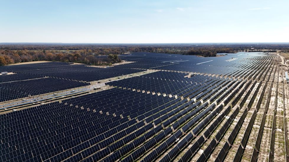
Drones efficiently inspect multi-level buildings, steep roof sections, mechanical equipment areas, solar arrays, and other locations that may be difficult to reach safely.
Repeatable Documentation
Routine inspections establish valuable historical records that help facility managers monitor roof conditions over time and identify developing issues before they become costly failures.
Radiometric Data Supports Better Decisions
Every inspection performed by St Louis Drones produces timestamped thermal imagery and measurable radiometric data that can become part of your long-term facility management strategy.
Objective documentation can support:
Preventive maintenance planning
Insurance claims
Warranty evaluations
Contractor verification
Capital improvement planning
Historical roof condition records
Asset management programs
Reliable data helps eliminate guesswork while supporting informed maintenance decisions.
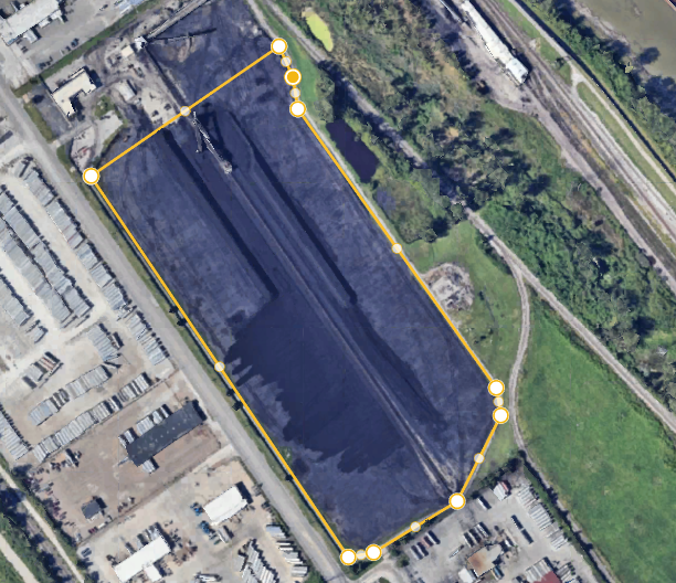
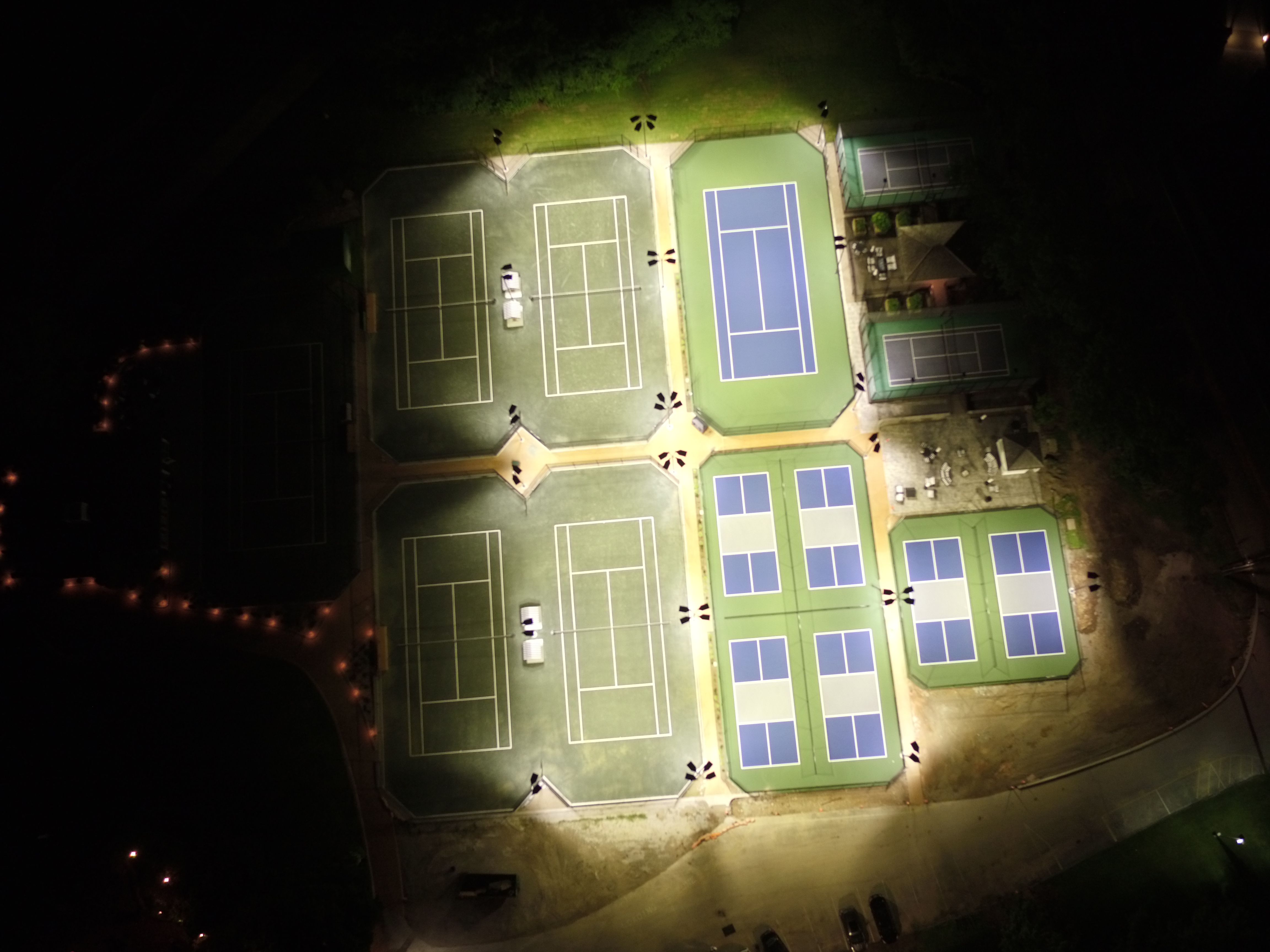
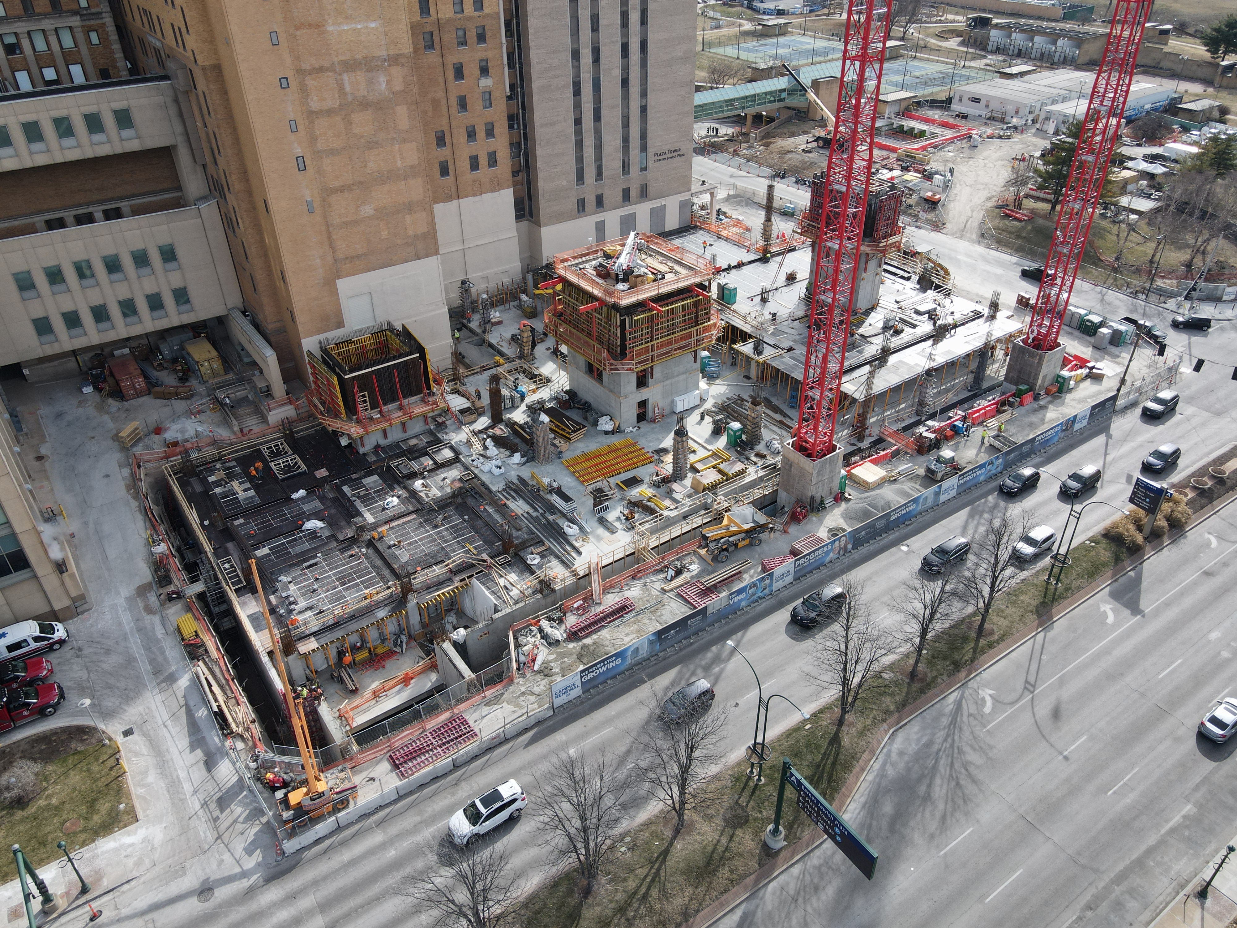
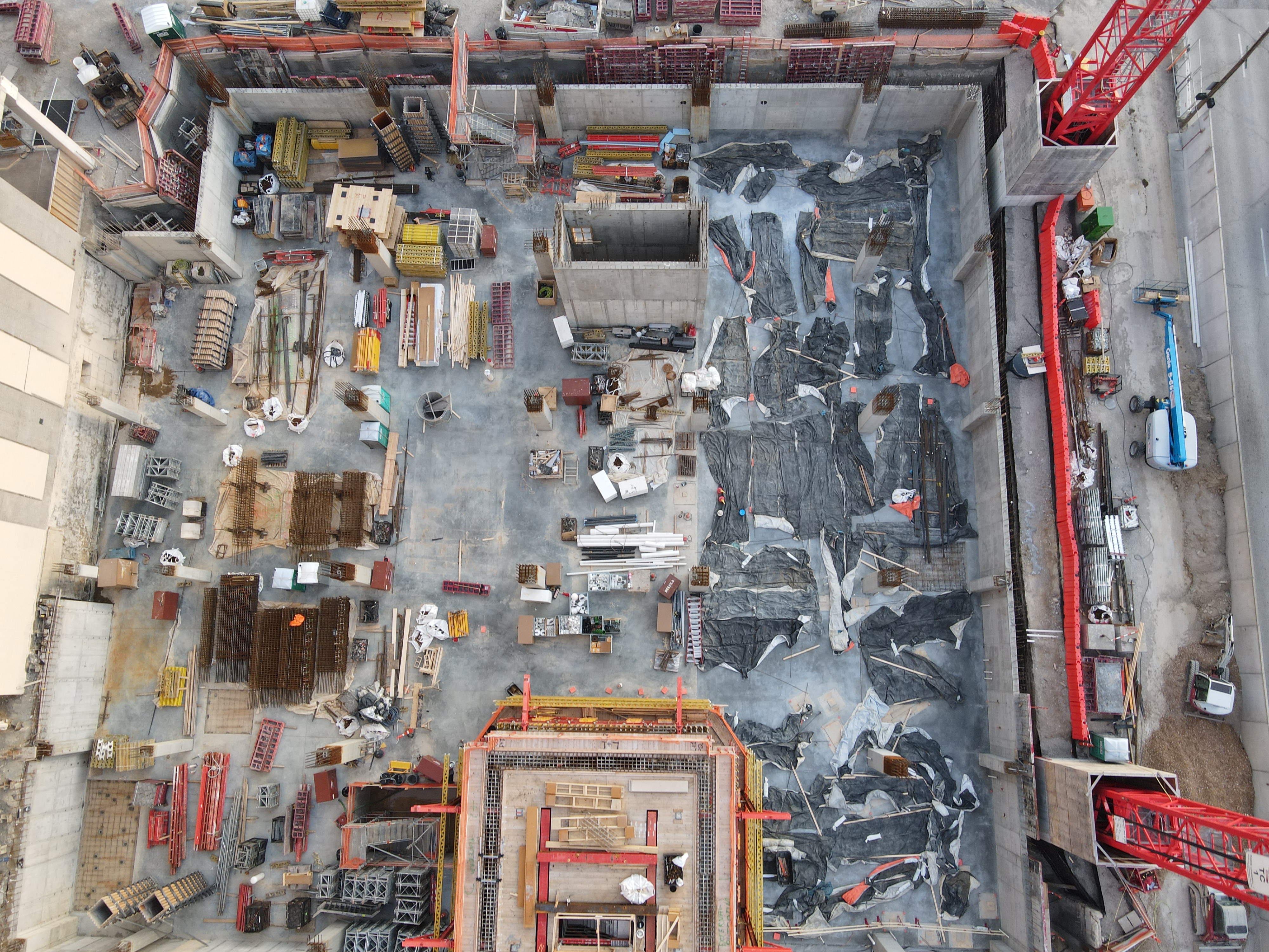
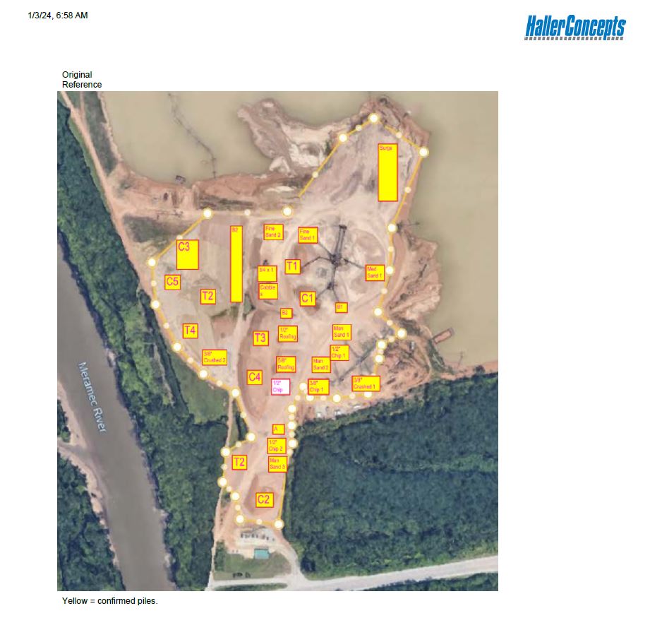
High-Resolution Roof Mapping
Our aerial mapping services produce highly detailed orthomosaic images by combining hundreds of overlapping photographs into one accurate, high-resolution map.
These detailed maps allow facility managers to:
Measure roof areas
Locate defects precisely
Document rooftop equipment
Monitor repairs
Share accurate information with consultants, contractors, and insurance providers
Combining thermal imagery with aerial mapping provides a comprehensive understanding of roofing conditions.
Supporting Schools, Healthcare, Manufacturing, and Commercial Facilities
Every facility has unique operational requirements, but they all share the same goal—protecting valuable infrastructure while minimizing unexpected costs.
Our drone inspection services are ideal for:
School districts managing multiple campuses
Hospitals and healthcare facilities protecting critical operations
Routine thermal inspections help identify developing issues before they interrupt operations or require costly emergency repairs.
Building Long-Term Facility Intelligence
At St Louis Drones, we believe inspections should provide more than images—they should generate actionable information.
We help organizations establish proactive maintenance programs through:
FLIR thermal infrared inspections
Radiometric temperature analysis
High-resolution aerial photography
Orthomosaic mapping
Timestamped inspection records
Historical condition monitoring
Repeatable inspection workflows
This data-driven approach gives facility managers greater confidence when making maintenance and capital planning decisions.
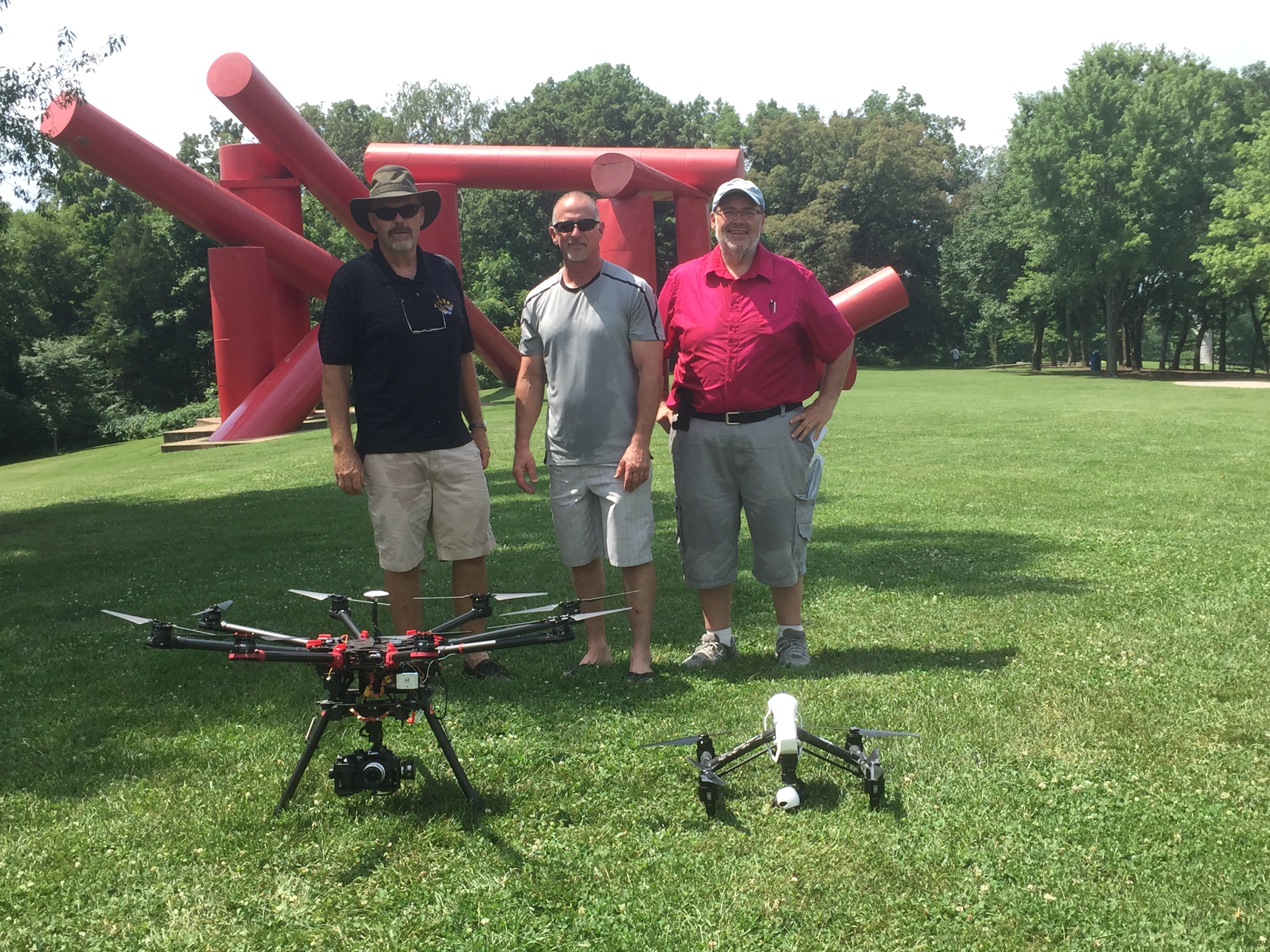
Advanced Drone LiDAR Services
In addition to thermal roof inspections, St Louis Drones provides professional Drone LiDAR services for engineering, surveying, construction, and infrastructure applications.
LiDAR technology rapidly captures millions of elevation points to create highly accurate three-dimensional models for:
Topographic surveys
Construction planning
Engineering projects
Utility corridor mapping
Infrastructure inspections
Site development
Earthwork analysis
Environmental documentation
These highly accurate datasets support architects, engineers, surveyors, contractors, and public agencies with dependable geospatial information.
Professional Aerial Cinematography
Drone technology also offers tremendous creative possibilities.
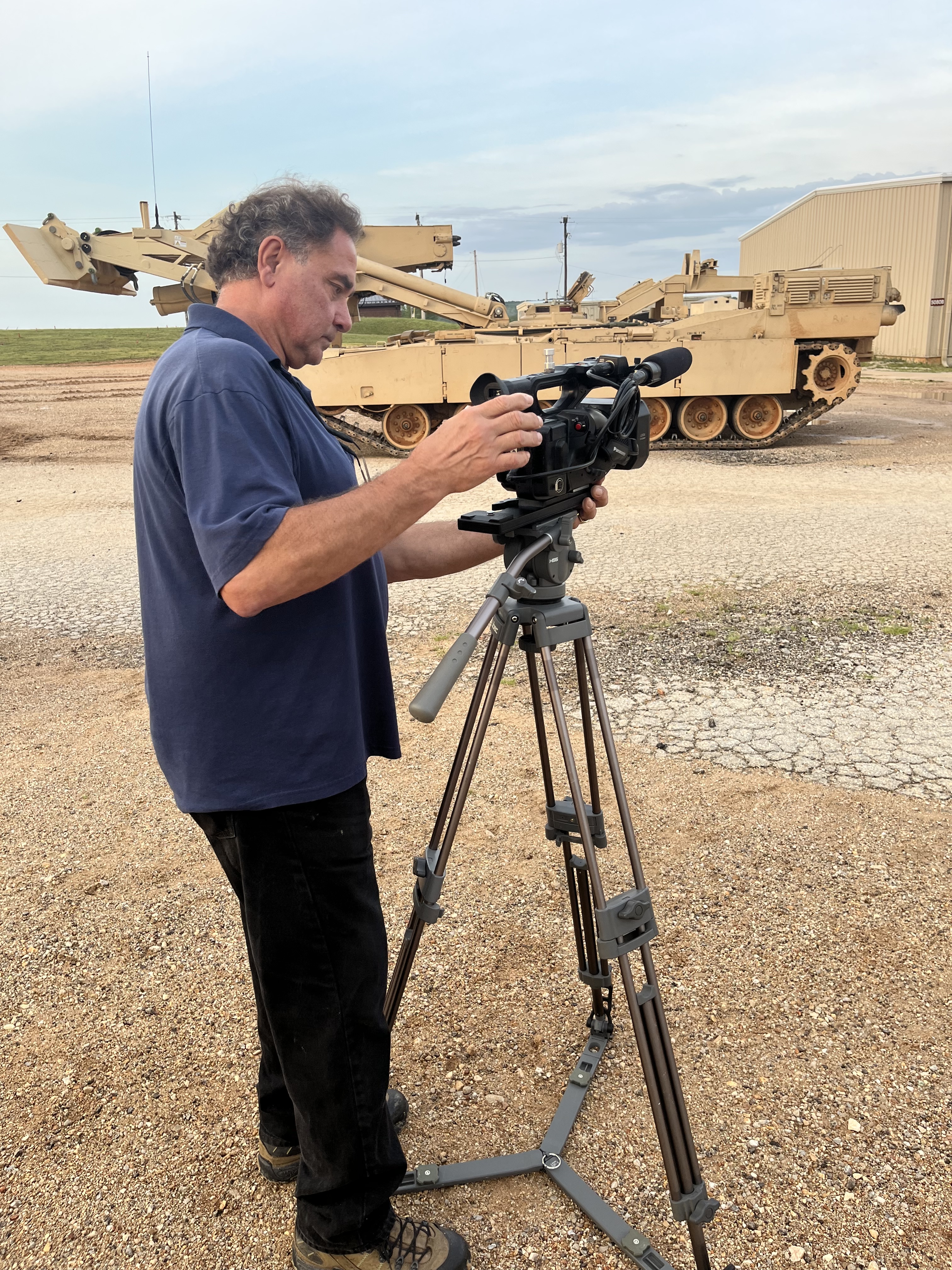
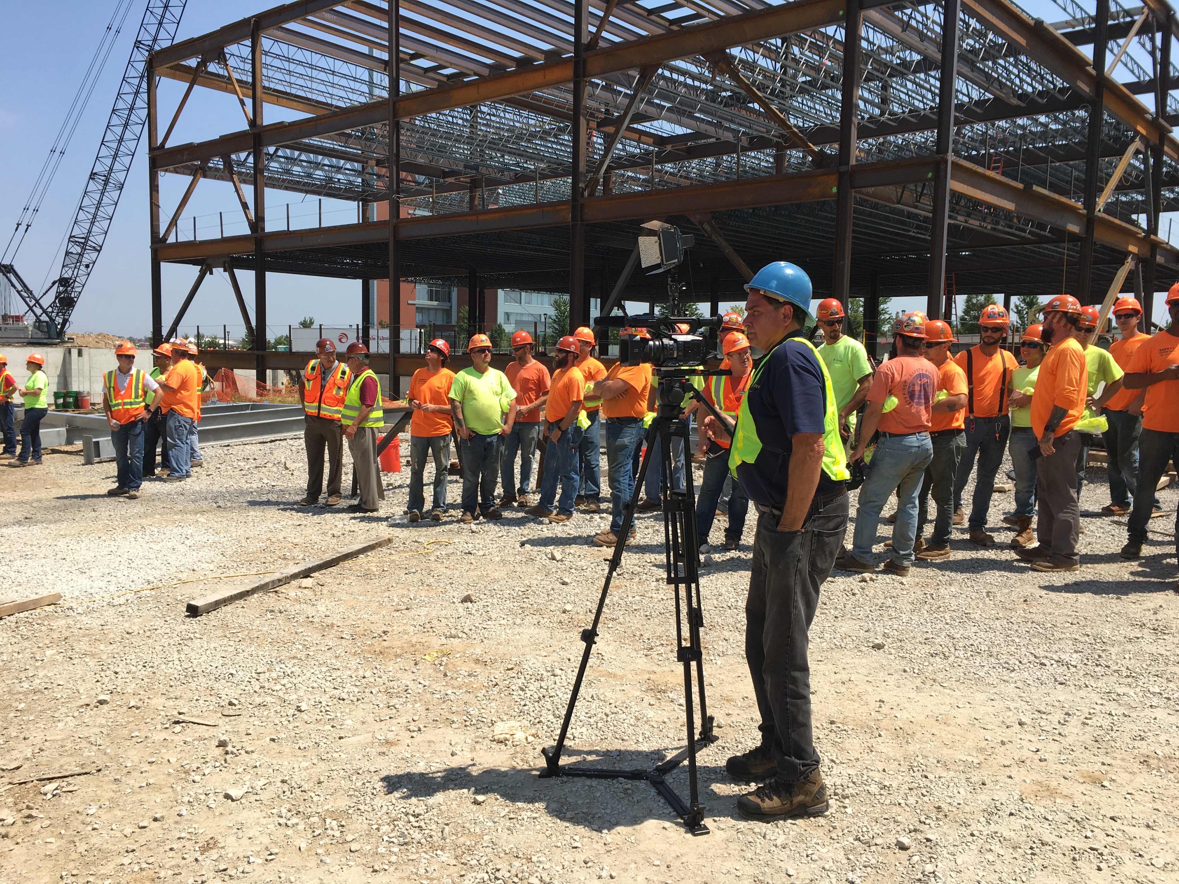
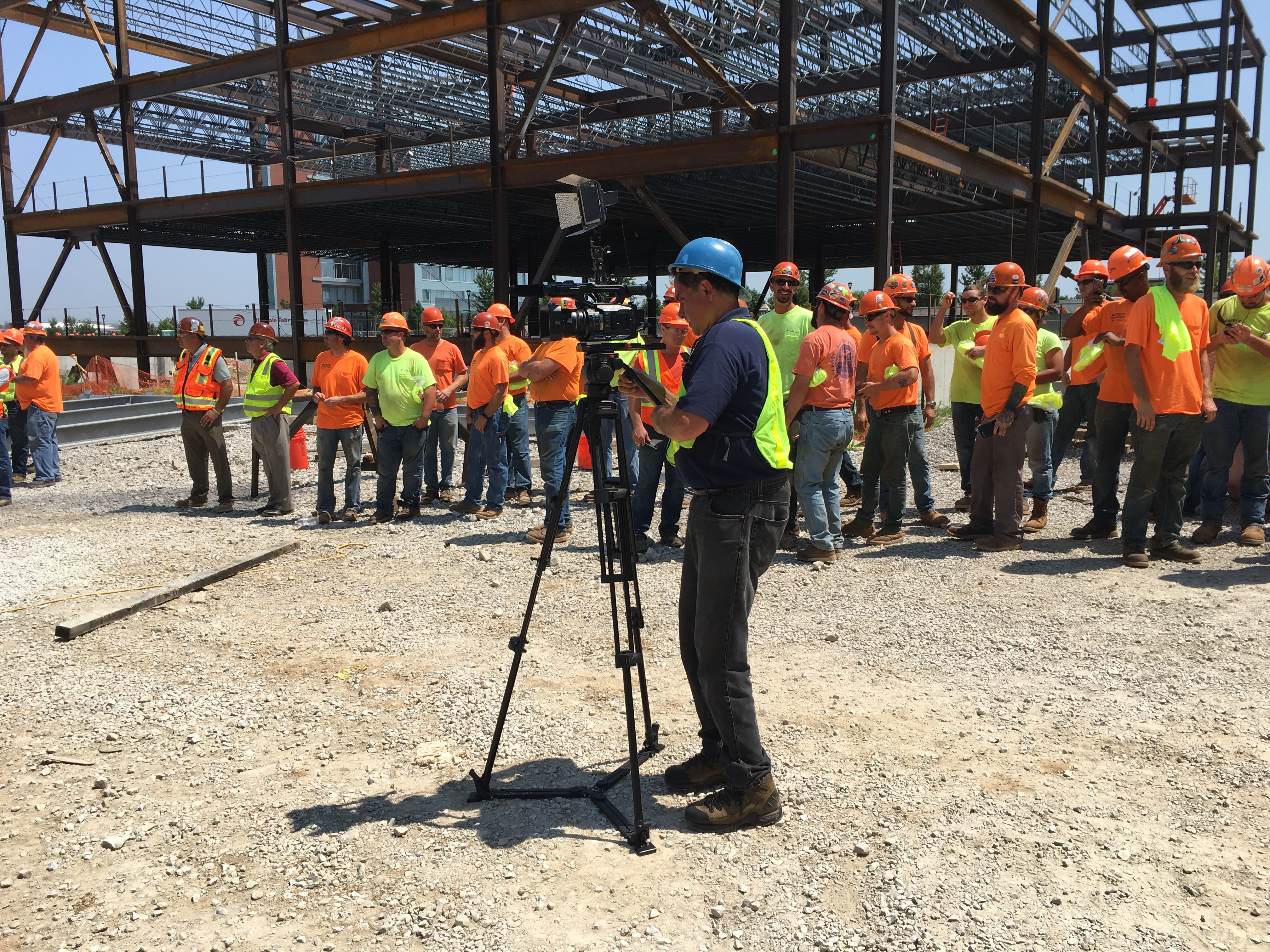
St Louis Drones produces cinematic aerial photography and video for marketing, corporate communications, construction progress documentation, tourism, industrial promotions, commercial real estate, and broadcast-quality productions.
Our experienced drone pilots combine advanced flight techniques with professional imaging equipment to create compelling aerial visuals that strengthen marketing campaigns and tell engaging stories from perspectives impossible to achieve from the ground.
Why Choose St Louis Drones?
Commercial drone operations require far more than simply flying an aircraft. They require experience, planning, regulatory compliance, technical expertise, and a commitment to delivering accurate, dependable results.
At St Louis Drones, we combine advanced drone technology with professional imaging expertise to provide actionable information that helps clients protect valuable assets, improve maintenance planning, and make confident business decisions.
Whether performing FLIR thermal roof inspections, generating high-resolution aerial maps, capturing LiDAR datasets, or producing cinematic aerial content, our focus is on delivering exceptional quality, precise data, and outstanding customer service.
Protect Your Roofing Investment with Advanced Drone Technology
A commercial roof is one of the most valuable assets a facility owner manages. Detecting hidden moisture early can reduce repair costs, extend roof life, improve maintenance planning, and help prevent costly operational disruptions.
With advanced FLIR thermal infrared drone inspections from St Louis Drones, hidden roofing problems become visible before they become expensive failures.
Partner with St Louis Drones
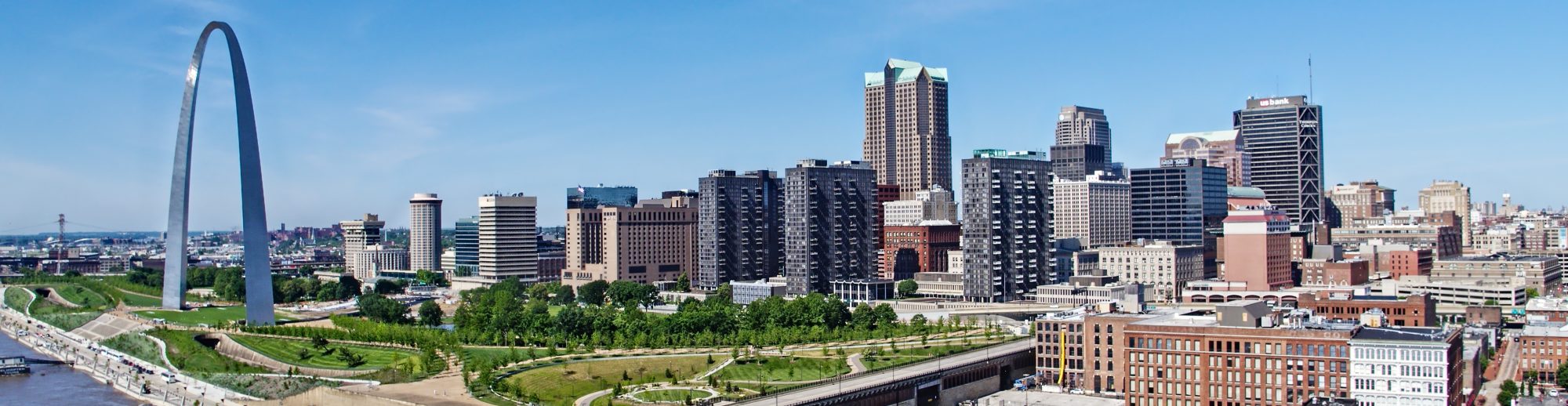
St Louis Drones provides professional commercial drone services for businesses, government agencies, schools, healthcare systems, manufacturers, engineers, architects, contractors, and commercial property owners throughout the St. Louis region and beyond. Our capabilities include FLIR thermal infrared inspections, radiometric imaging, orthomosaic mapping, Drone LiDAR, aerial photography, aerial video production, construction documentation, infrastructure inspections, and cinematic drone services. Using the latest drone technology and advanced imaging systems, we deliver accurate data, actionable insights, and exceptional aerial imagery that help organizations protect assets, improve decision-making, and elevate their visual communications.
By St. Louis Drones | Commercial Photography & Video Production
The Real Cost of “Doing It Yourself”
Every professional service business — law firms, financial advisors, healthcare providers, engineering consultancies, real estate brokerages — faces the same quiet pressure: produce compelling visual content without breaking the budget. The temptation to grab a smartphone and handle it in-house is understandable. But that decision carries hidden costs that decision-makers rarely account for upfront: lost billable hours, inconsistent brand presentation, substandard audio, poor lighting, and ultimately, content that fails to convert.
The smarter question isn’t “How do we avoid paying for professional production?” — it’s “How do we get maximum production value for every dollar we invest?”
The answer lies in strategic planning, the right production partner, and a clear understanding of how professional media assets are built, repurposed, and leveraged across platforms.
Why Visual Content Is a Business Investment, Not an Expense
Before diving into cost efficiencies, it’s worth reframing the conversation entirely. Photography and video are not line-item expenses in the way office supplies or software licenses are. They are brand-building instruments that compound in value over time — provided they are produced correctly from the start.
A well-executed brand video, shot with proper lighting, sound, and cinematic framing, can serve your business across your website, social media channels, trade show displays, sales presentations, email campaigns, and broadcast media simultaneously. That single production investment becomes dozens of touchpoints. A poorly executed one gets buried — or worse, actively undermines the credibility you’ve spent years building.
The math changes considerably when you understand that professional production isn’t about a single deliverable. It’s about building a media library that works for you continuously.
The Pillars of Cost-Efficient Production
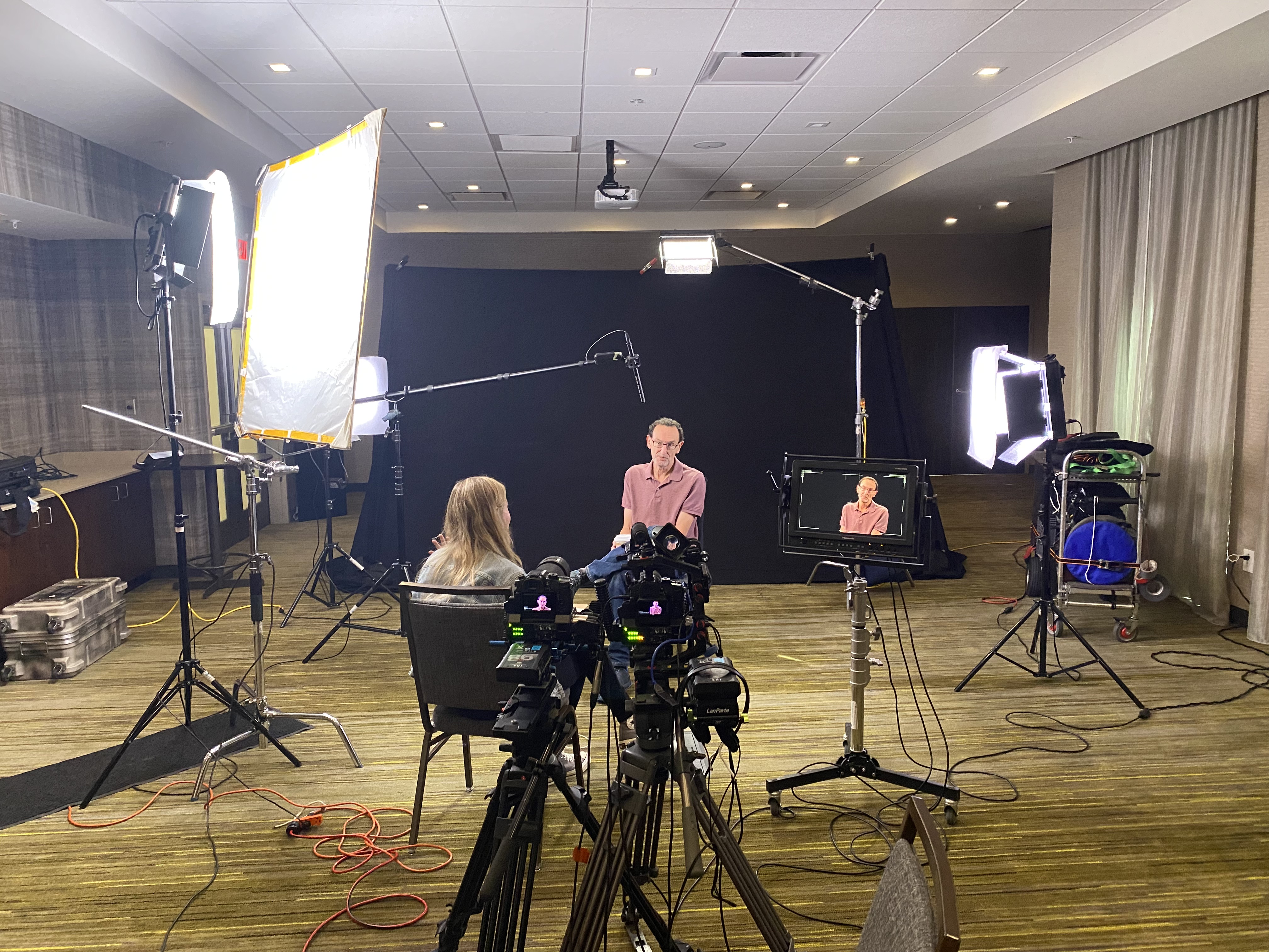
1. Pre-Production Planning Is Where Money Is Saved
The most expensive thing in any production is indecision on set. Every hour of camera time, lighting setup, location access, and crew deployment has a cost — and disorganized productions bleed that cost quickly.
Professional production companies earn their value before a single camera rolls. Thorough pre-production includes scripting or interview framework development, shot lists, location scouting, prop and wardrobe planning, and talent briefing. When every team member arrives on set knowing exactly what needs to be captured and in what order, productions finish on schedule and on budget.
For professional service businesses — where key principals are often the subject matter experts being interviewed — this preparation is especially critical. A CEO or managing partner who receives a structured interview framework in advance will deliver tighter, more authoritative responses on camera. That efficiency translates directly to fewer takes, shorter edit cycles, and lower post-production costs.
2. Content Batching Multiplies Your ROI
One of the highest-leverage tactics available to professional service organizations is content batching — scheduling a single production day to capture material for multiple campaigns, channels, and use cases at once.
Consider the possibilities from a single well-planned shoot day:
A long-form brand overview video for your website homepage
Three to five short-form video segments for LinkedIn or YouTube
A series of headshots and environmental portraits for your team page and press materials
B-roll footage of your workspace, operations, and team interactions
Quote cards and still frames for social media graphics
Testimonial segments from clients or partners
What might seem like a significant single-day investment in a professional crew, studio or location, and equipment, actually produces months of marketing content across every major platform. The cost-per-asset drops dramatically when you plan with this kind of intentionality.
3. Studio Efficiency vs. Location Flexibility
One of the more consequential decisions in production planning is the choice between a controlled studio environment and a location shoot. Both have merit, and the right answer depends on your specific goals — but understanding the cost implications of each helps you plan smarter.
Studio production offers predictability. Lighting is controlled, sound is isolated, and the environment can be dressed to match your brand aesthetic. For interview-driven content — the kind of authoritative, thought leadership video that anchors a professional service marketing strategy — a private studio setup with purpose-built interview lighting eliminates the variables that drive up location shoot costs: weather, ambient noise, foot traffic, and permitting.
Location production adds authenticity and environmental context that studio settings cannot replicate. Capturing your engineers in the field, your advisors in client-facing environments, or your properties in their actual setting provides visual storytelling that resonates differently with audiences. Location shoots require more logistical coordination, but with experienced location scouts and a disciplined production crew, they remain highly cost-efficient.
The most strategically sophisticated productions combine both: a studio anchor — such as a formal interview or branded presentation segment — paired with location B-roll that contextualizes the story. This hybrid approach gives editors the building blocks for diverse content formats without doubling the budget.
4. Post-Production Efficiency Through Proper Acquisition
Here is an industry truth that many clients learn too late: the most expensive post-production is the kind required to fix problems that should have been prevented during acquisition. Poorly exposed footage, unusable audio, shaky handheld shots, or scenes with mismatched color temperatures create edit room nightmares that add hours and cost to every project.
Professional cinematographers, audio engineers, and directors earn their rates precisely because they prevent these problems. When footage arrives in post-production clean, well-exposed, and properly organized, editors can focus on storytelling rather than remediation. The result is a faster turnaround and a better final product.
This principle extends to file management and delivery. Experienced production companies work in the file types and formats that your marketing team, agency, or distribution platforms actually require — whether that’s broadcast-ready ProRes masters, compressed web deliverables, social-optimized aspect ratios, or archival RAW files for future use.
5. Repurposing: The Force Multiplier of Visual Content
The most cost-efficient content strategy isn’t producing more — it’s extracting more value from what you’ve already produced. This is where the concept of content repurposing becomes a genuine competitive advantage.
A 90-second brand video, properly shot and edited, contains:
A 15-second version for pre-roll advertising
A 30-second cut for Instagram Reels or LinkedIn video ads
A series of still frames suitable for print or digital graphics
Audio-only segments for podcast intros or audio branding
Quote overlays and motion graphics derived from on-camera statements
Transcribed copy for blog posts, email newsletters, or sales collateral
This isn’t theoretical — it’s the standard operating model for organizations that treat their visual media as a strategic asset rather than a one-time deliverable. The businesses that get the most from their production budgets are the ones who plan for repurposing from the very first creative brief.
Aerial and Specialty Imaging: Expanding the Visual Vocabulary
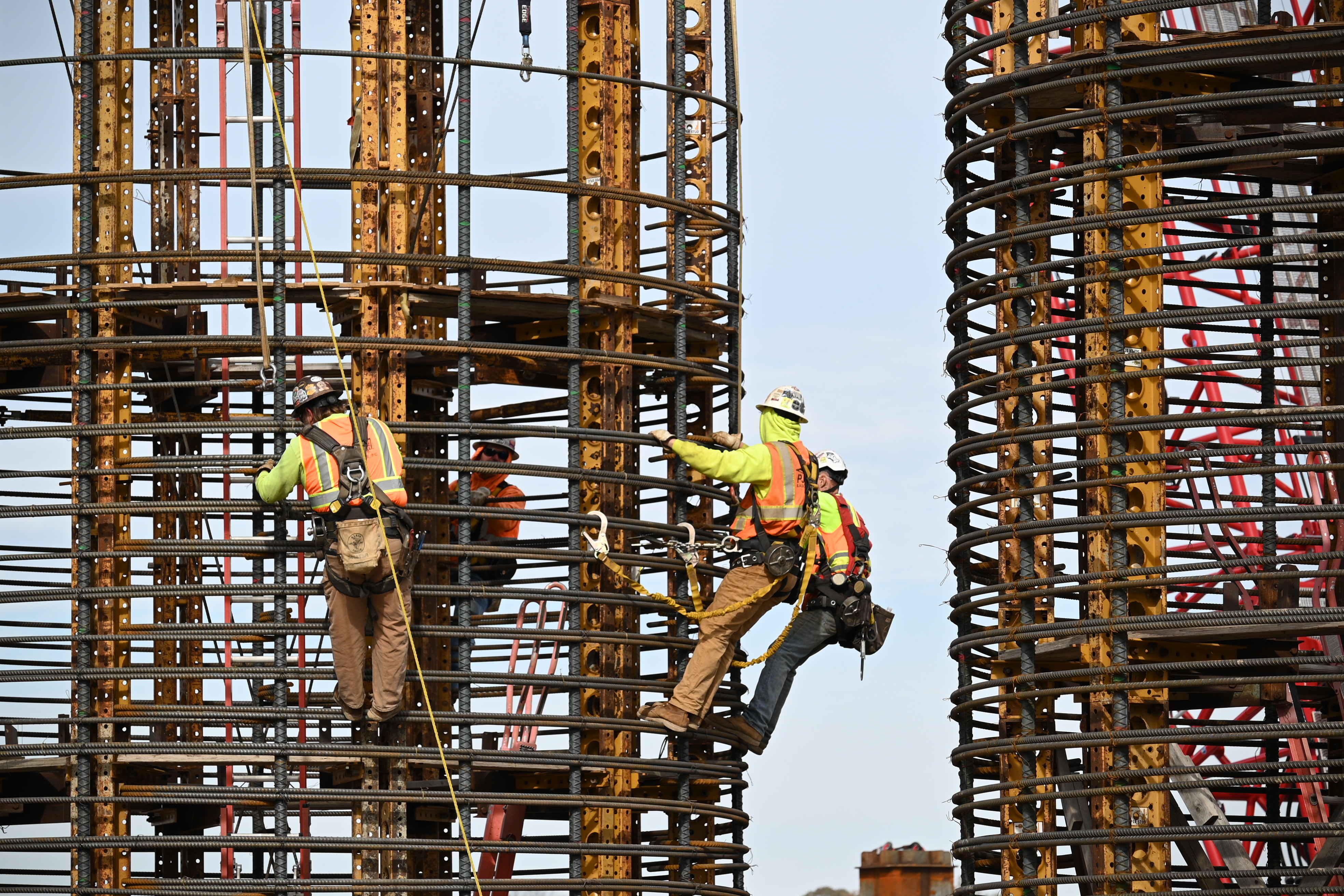
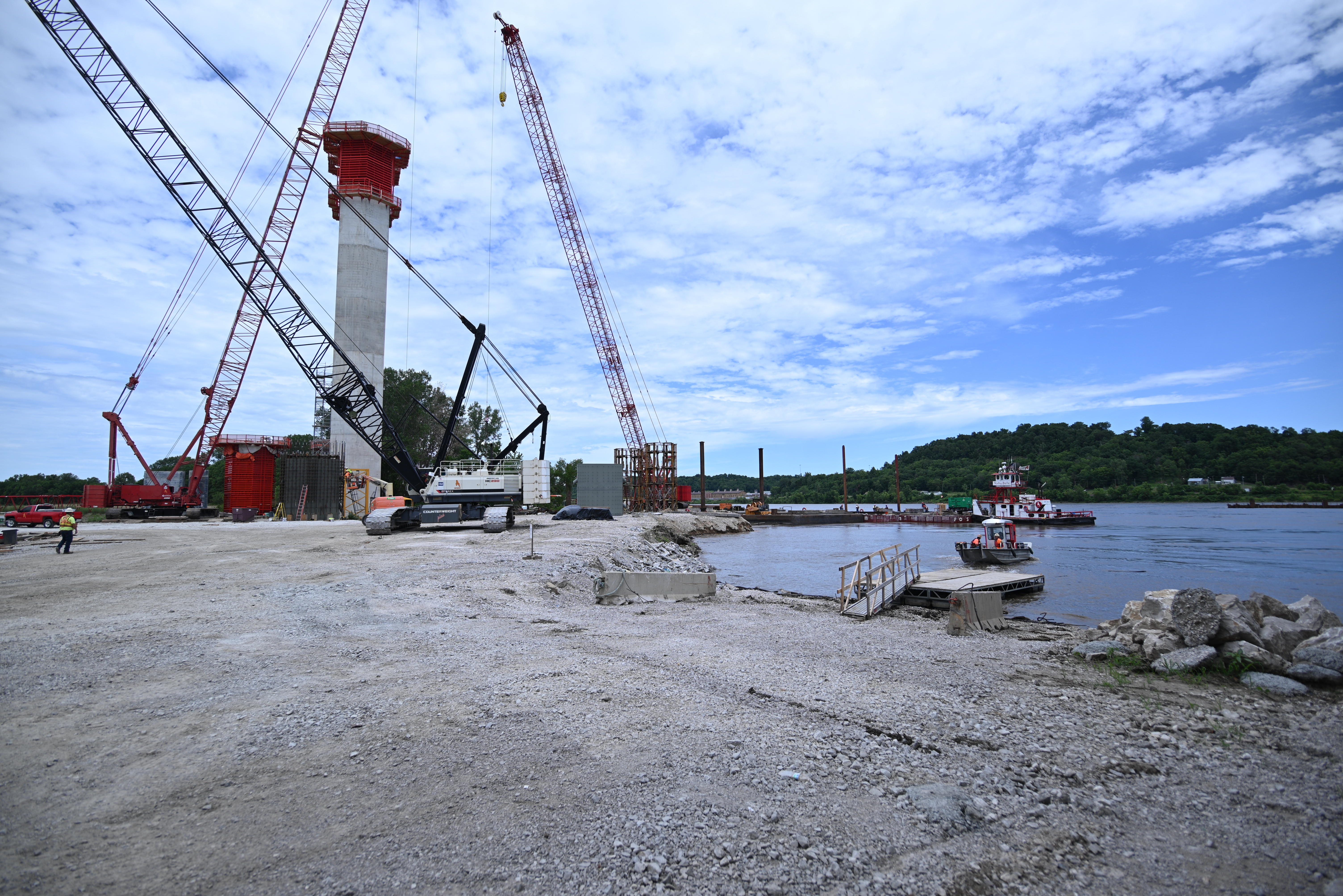
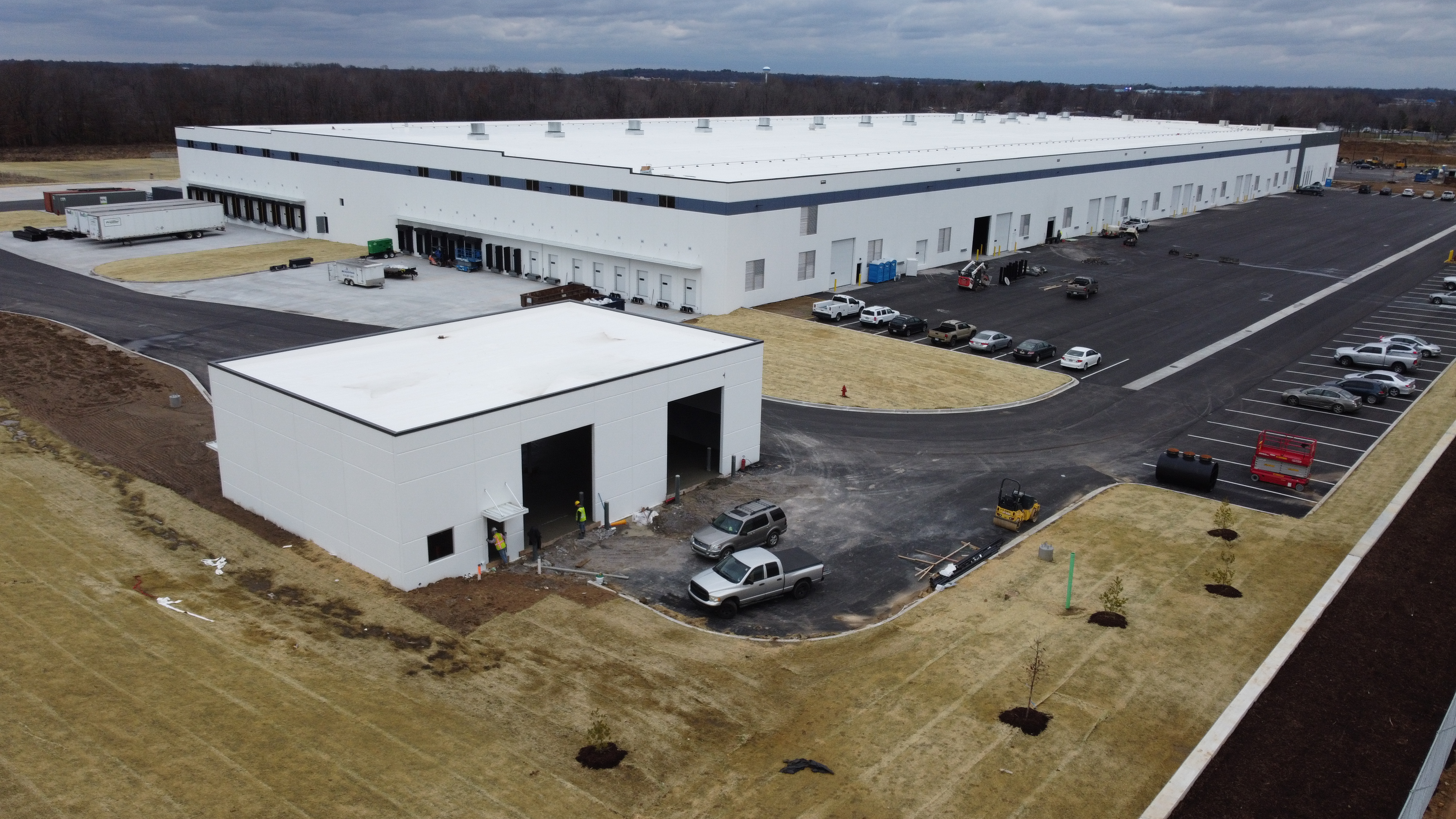
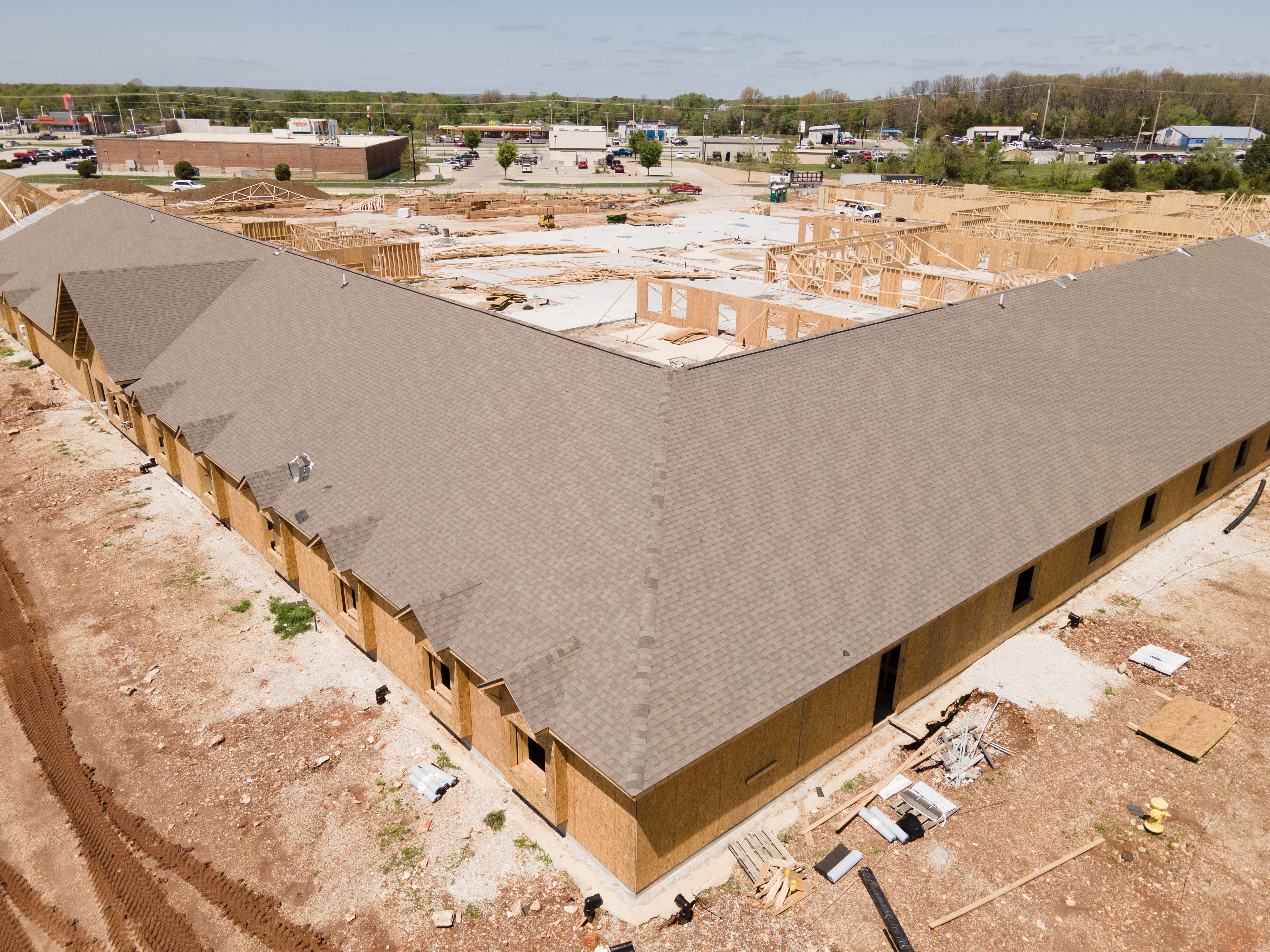
For many professional service businesses — commercial real estate, construction, engineering, infrastructure, environmental consulting, and hospitality — aerial and specialty imaging capabilities dramatically expand what’s possible from a single production engagement.
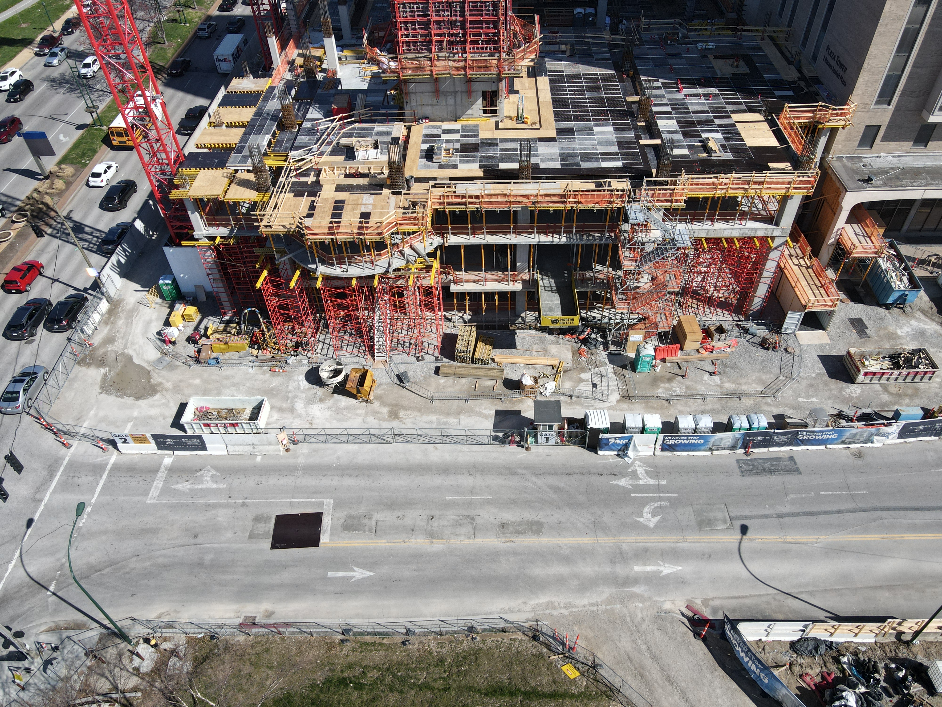
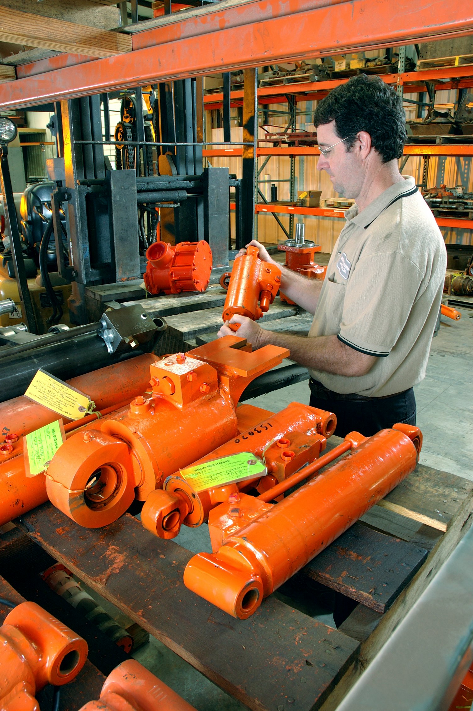
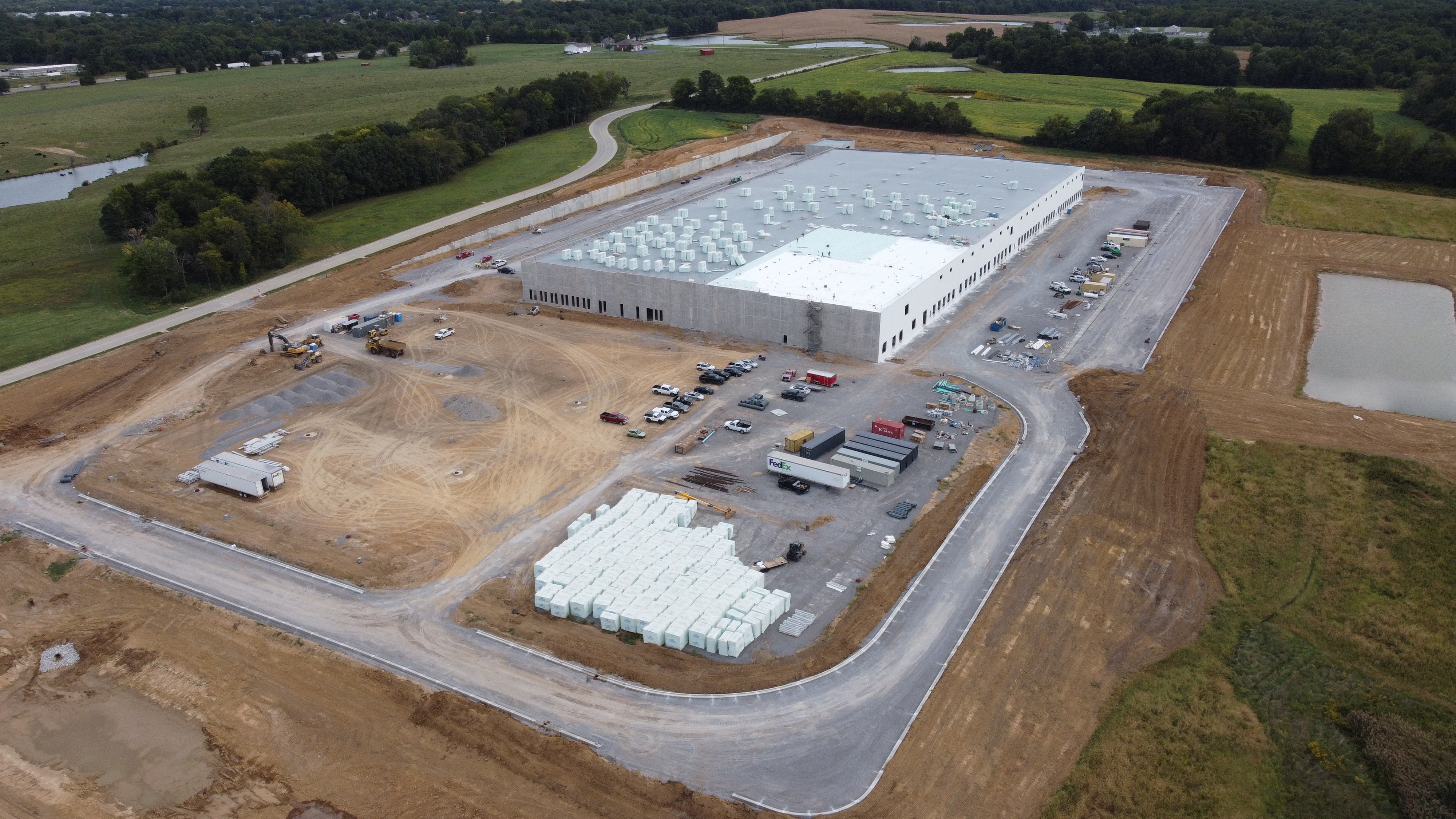
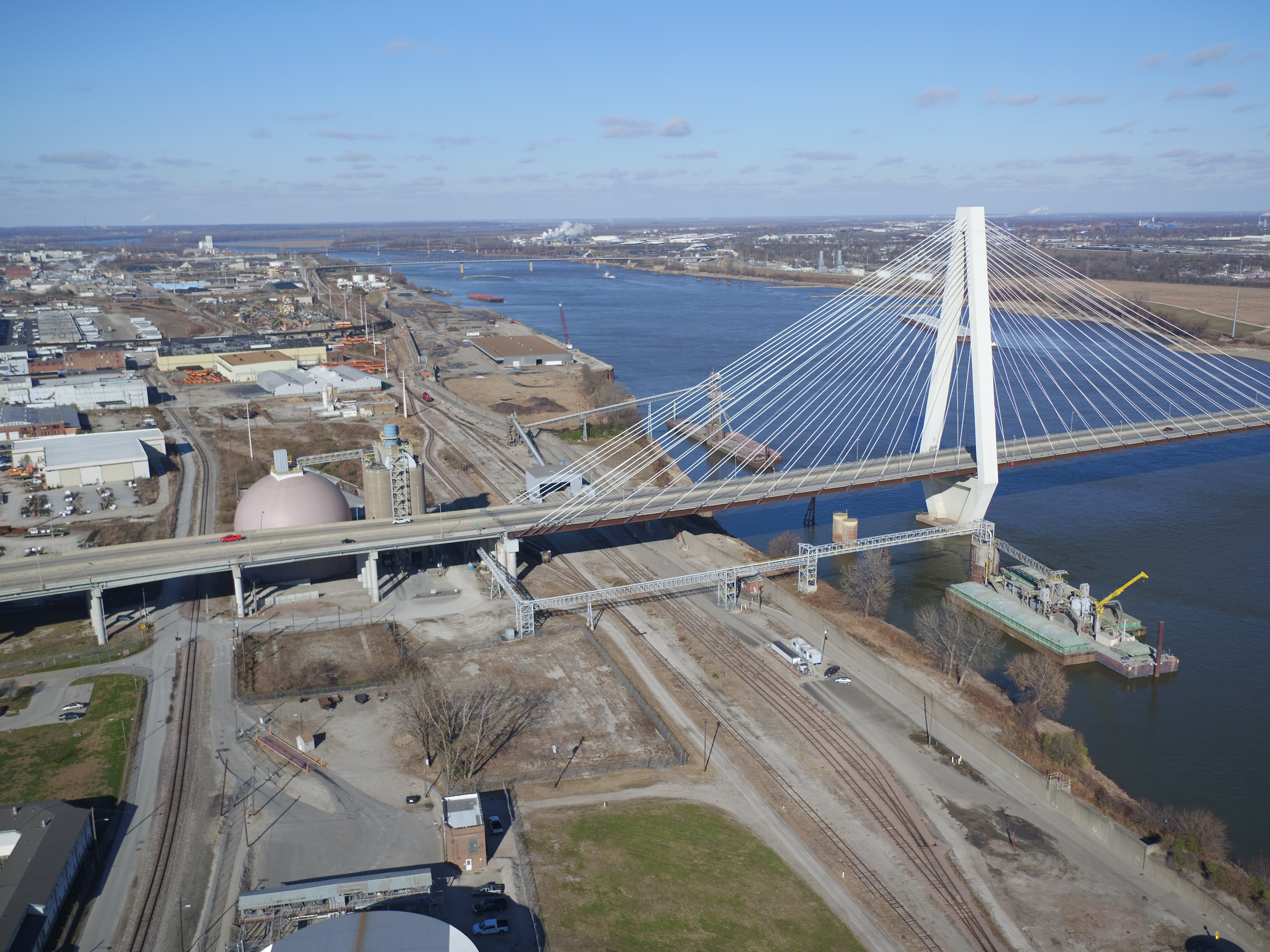
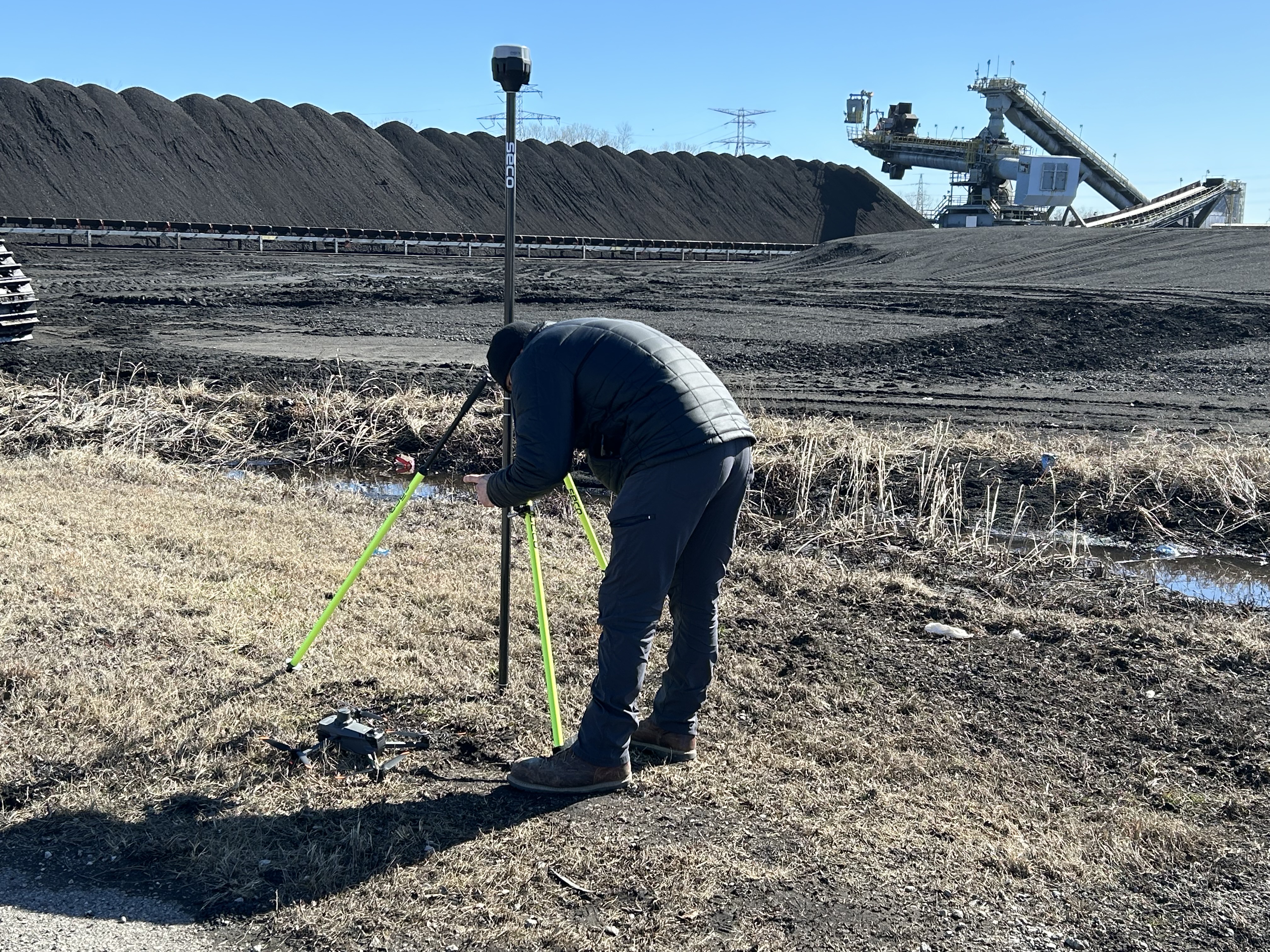
Licensed drone services have become standard in commercial production, but the range of capabilities extends well beyond simple aerial photography. Orthomosaic mapping delivers precise, georeferenced aerial imagery ideal for property analysis, site documentation, and construction progress tracking. Infrared thermal imaging identifies energy inefficiencies, structural anomalies, and environmental conditions invisible to standard cameras. LiDAR technology generates highly accurate three-dimensional point cloud data for engineering surveys, as-built documentation, and terrain analysis.
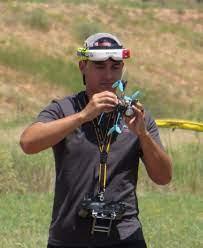
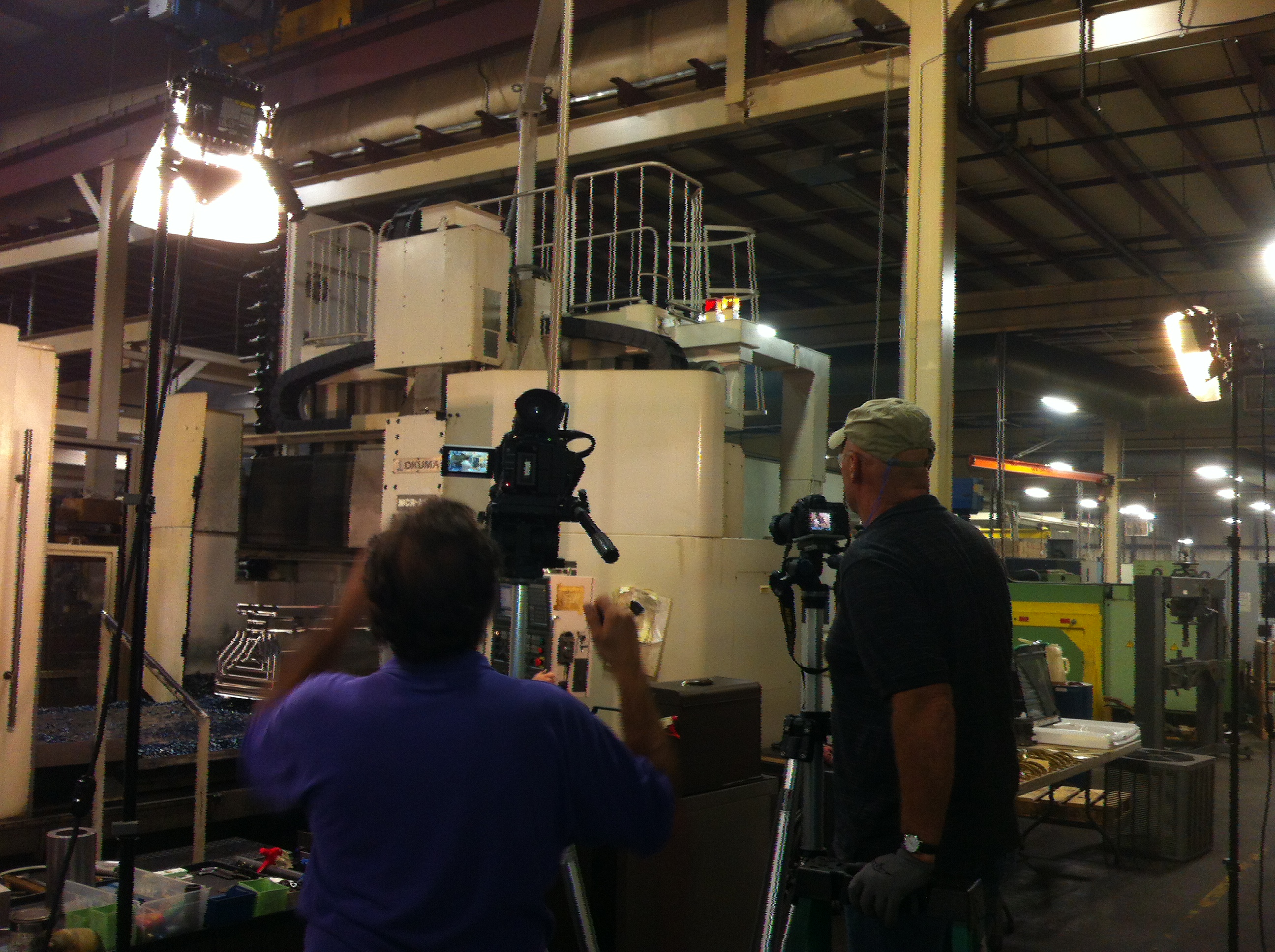
Even in environments where outdoor flight isn’t possible, specialized FPV (First-Person View) drones can now be deployed indoors — capturing dynamic, sweeping footage of interior spaces, manufacturing facilities, warehouses, and event venues with a cinematic quality previously achievable only with costly crane or jib equipment.
These capabilities are not niche extras. For the right application, they are the difference between adequate documentation and genuinely remarkable visual storytelling.
Artificial Intelligence in Modern Production Workflows
The integration of artificial intelligence into professional media workflows has meaningfully shifted what’s possible within a given budget — but only when applied by practitioners who understand where AI adds value and where human creative judgment remains irreplaceable.
AI-assisted tools now accelerate color grading, noise reduction, upscaling, transcription, search engine optimization of video content, background removal, and even preliminary cut selection. For clients, this translates into faster turnaround times and more consistent output across large volumes of content.
More significantly, AI enables smarter repurposing. Transcription and content analysis tools can identify the strongest soundbites from a long-form interview, flagging moments suitable for short-form social clips without requiring an editor to scrub through hours of footage manually. This efficiency compresses timelines and reduces post-production labor — savings that flow directly to the client.
The key distinction is that AI tools amplify skilled practitioners; they do not replace the creative and technical judgment required to plan a great production, direct compelling performances, and tell a story that connects with an audience.
What to Look for in a Production Partner
When evaluating a commercial production company, professional service decision-makers should assess several dimensions beyond simply reviewing a portfolio:
Range of capabilities. Can the company handle studio and location production, aerial services, specialty imaging, and post-production under one roof? Fragmented vendor relationships introduce coordination risk and inflate total project cost.
Technical fluency. Is the production team fluent in the file types, delivery formats, and platform specifications your content will require? A partner who needs to learn your distribution requirements after production is complete is a liability.
Pre-production discipline. Does the company invest in understanding your business objectives, audience, and existing brand standards before pitching a creative approach? The best productions begin with strategy, not cameras.
Long-term partnership orientation. The most efficient production relationships are ongoing, not transactional. A production company that understands your brand, your principals, and your content library over time produces better work faster — and at lower effective cost per asset — than one-off vendor engagements.
Flexibility for diverse media formats. Your content will live across websites, social platforms, broadcast channels, digital signage, trade show displays, and internal communications. Your production partner needs to understand the technical and aesthetic requirements of each.
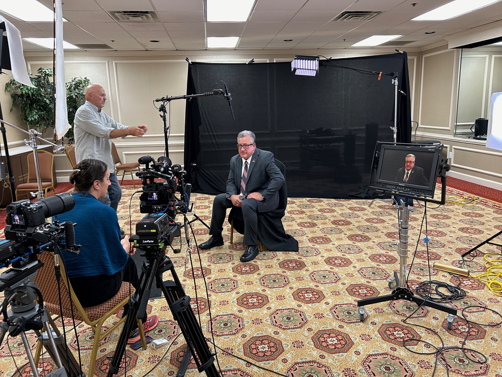
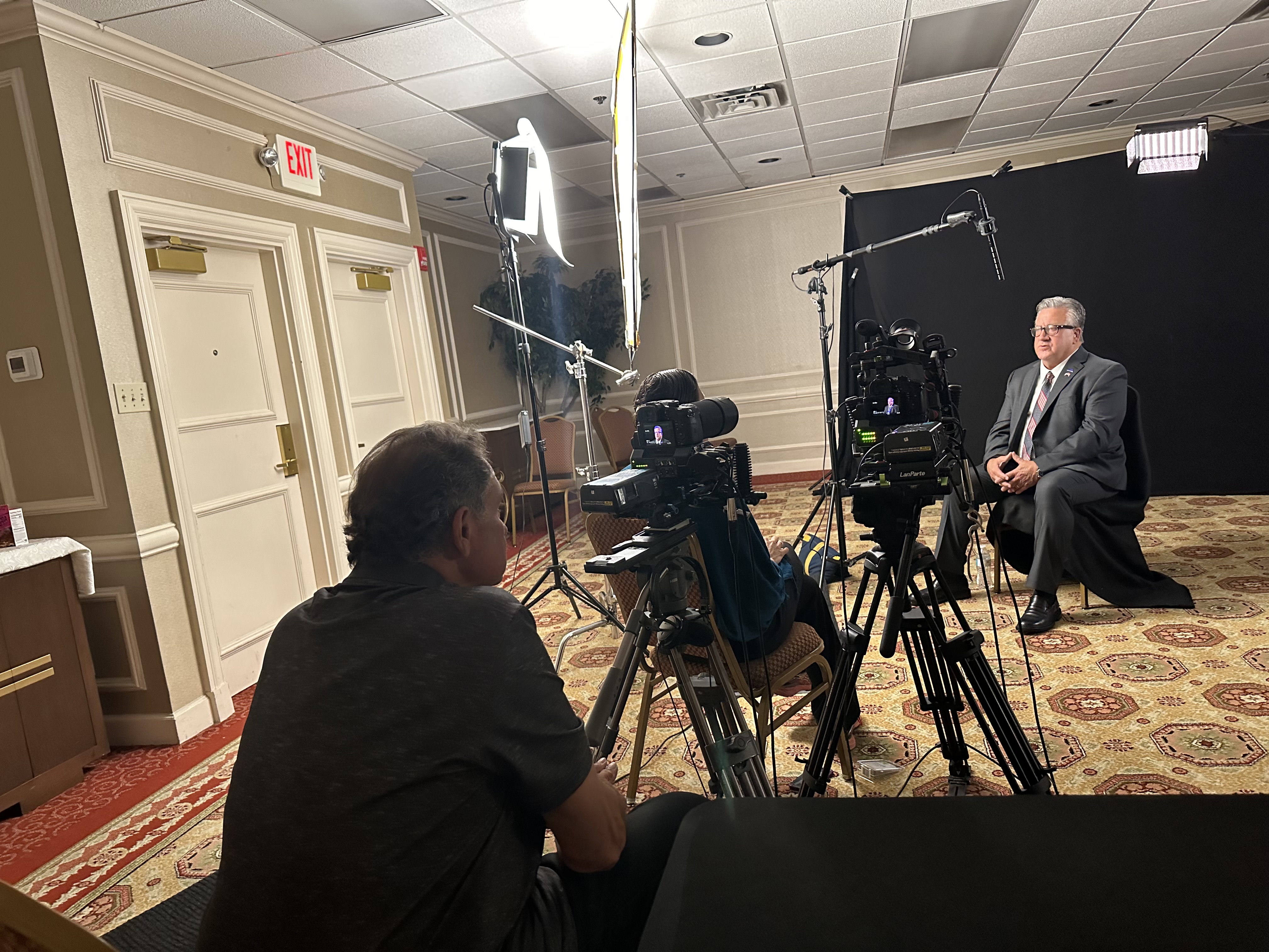
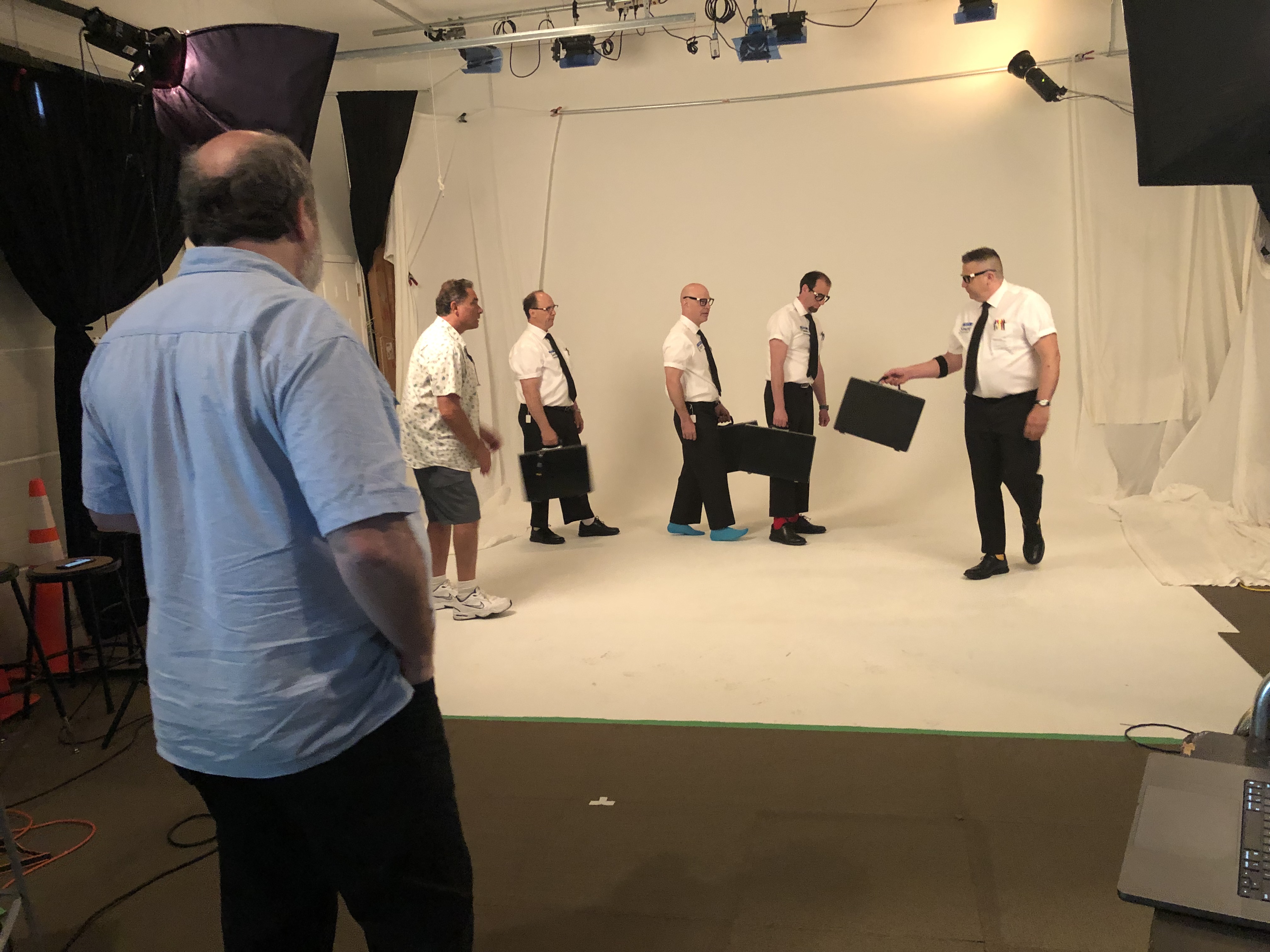
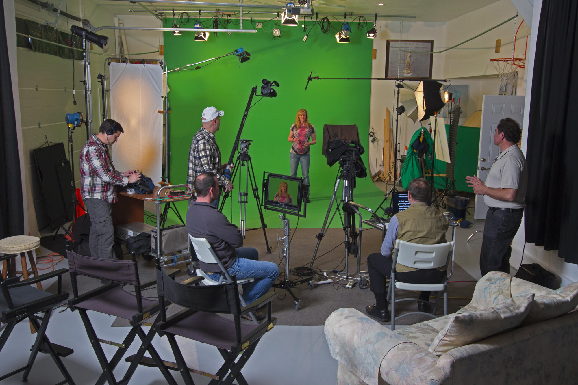
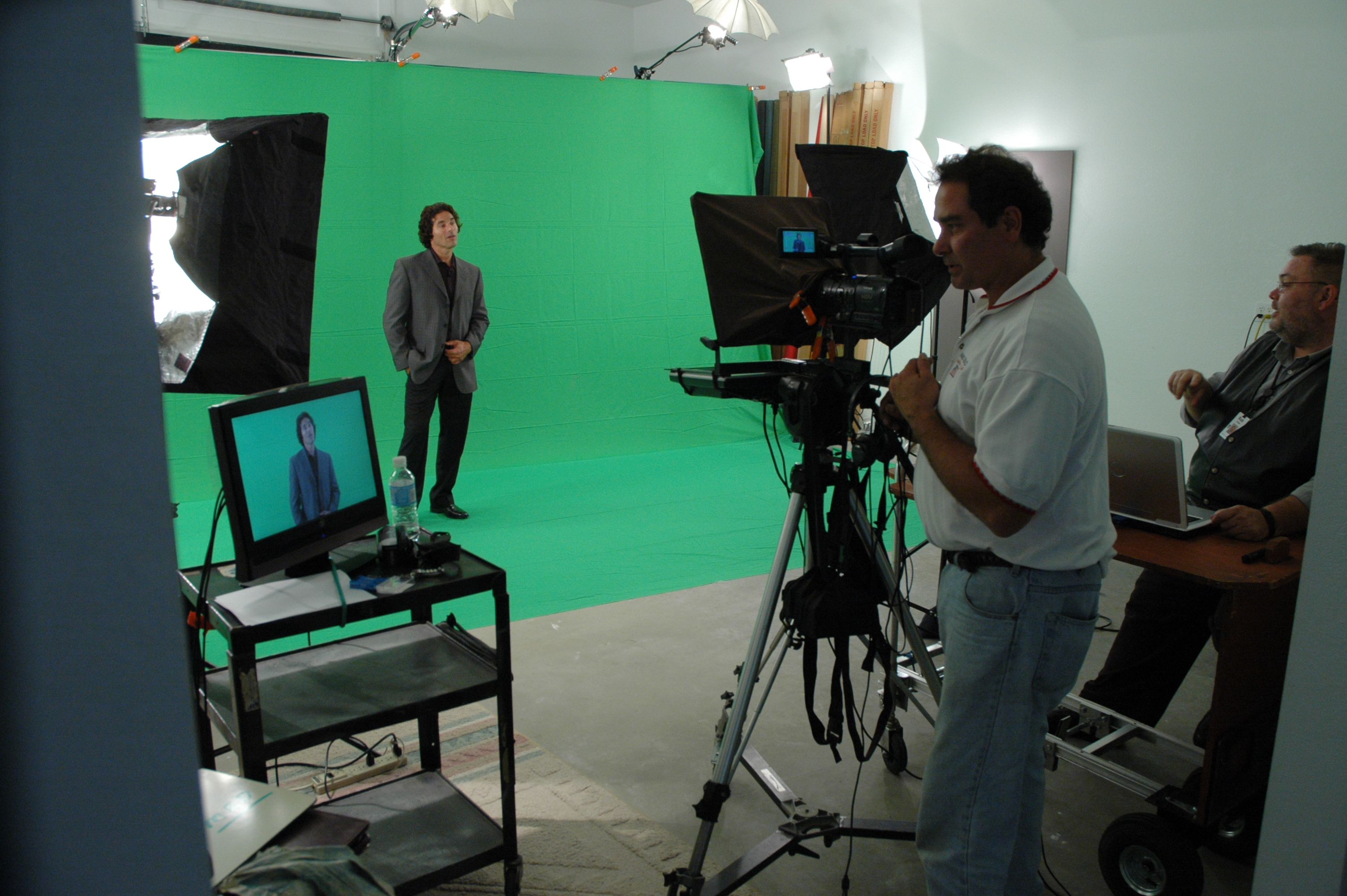
St. Louis Drones: A Full-Service Production Partner Since 1982
For businesses and organizations across the St. Louis region, St. Louis Drones has been the production partner of choice for professional commercial photography and video for over four decades. What began as a specialized imaging operation has grown into a comprehensive, full-service production corporation with the equipment, crew, and creative experience to handle every dimension of your visual media strategy.
Our studio is a private, purpose-built environment designed for the kind of productions professional service businesses need most: interview-driven thought leadership content, product showcases, executive profiles, and branded presentations. Our lighting and visual setups deliver broadcast-quality imagery, and our space is large enough to incorporate custom props and set elements that bring your brand environment to life — without the logistics and cost of a location build.
Beyond the studio, our location production capabilities include experienced camera operators, professional sound engineers, location scouts, and B-roll specialists who know how to capture the environmental context your story requires. We manage every aspect of the production process: pre-production planning, on-set direction, equipment supply, and complete post-production and editing — including AI-enhanced workflows that accelerate delivery without compromising quality.
Our licensed drone services extend far beyond standard aerial photography. We offer infrared thermal imaging, orthomosaic mapping, and LiDAR survey capabilities for clients in industries where precision matters. And for interior spaces where outdoor flight isn’t an option, our specialized FPV drones deliver dynamic, cinematic aerial perspectives from inside your facility.
We are fluent in every major file type, delivery format, and media platform — from broadcast master specifications to social-optimized short-form formats — and we apply the latest artificial intelligence tools across our production and post-production workflows to deliver faster turnarounds and smarter content extraction from every shoot.
Content repurposing is a genuine specialty. We help clients build media libraries that generate ongoing value — identifying opportunities to repackage, reformat, and redistribute existing assets across new channels and campaigns, extending the return on every production investment.
Since 1982, we have partnered with businesses, marketing firms, and creative agencies throughout the St. Louis area to produce the photography and video that drives real marketing outcomes. We understand what professional service organizations need from their visual content, and we have the experience, equipment, and creative team to deliver it — efficiently, consistently, and at a level of quality that reflects the professionalism of the businesses we serve.
When your next production needs to be seamless, on-budget, and built for long-term marketing value, St. Louis Drones is ready.
St. Louis Drones | Full-Service Commercial Photography & Video Production | Studio & Location | Drone Services | Post-Production & Editing | St. Louis, Missouri
Why Your Next Production Demands a Unified Creative Team
When a marketing campaign falls flat, the culprit is rarely the budget. More often, it’s fragmentation — a drone operator who doesn’t communicate with the ground crew, a photographer disconnected from the video director, or a post-production team working in a vacuum. The result is disjointed content that fails to tell a cohesive story.
The most effective commercial video and photography productions are built on a single, unified creative team that operates seamlessly across every dimension of the shoot — from the sky to the studio floor.
What a Full-Service Shooting Crew Actually Means
The term “full-service” gets used loosely in this industry. In practice, it means your production has a single creative intelligence coordinating every moving part — aerial and ground camera operators, lighting technicians, sound engineers, directors, and post-production editors — all working from the same creative brief toward the same visual outcome.
For decision-makers commissioning commercial photography and video, this distinction matters enormously. Here’s why.
The Case for Integrated Aerial and Ground Production
Aerial Coverage Is Only as Strong as the Ground Story That Surrounds It
Drone footage is a powerful storytelling tool. Sweeping establishing shots, dynamic flyovers of facilities and job sites, and dramatic reveals of architectural subjects can elevate a production from ordinary to cinematic. But isolated aerial footage without a complementary ground-level narrative creates visual noise, not brand value.
An integrated shooting crew plans aerial and ground coverage simultaneously. The aerial director knows what the ground team is capturing, and the ground team understands how drone footage will be woven into the final edit. This coordination eliminates redundancy, fills coverage gaps on set, and produces a seamless visual narrative across every deliverable.
Coverage Continuity Across Every Deliverable
Modern commercial productions rarely serve a single purpose. A corporate brand video may also yield social media reels, a homepage hero video, internal training content, trade show loops, and broadcast spots — all from the same shoot day. A unified aerial and ground crew plans for this from the first creative conversation, ensuring that raw footage is captured at the right resolutions, aspect ratios, and durations to serve every downstream media requirement without costly reshoots.
Aerial Production Capabilities That Go Beyond Standard Drone Work
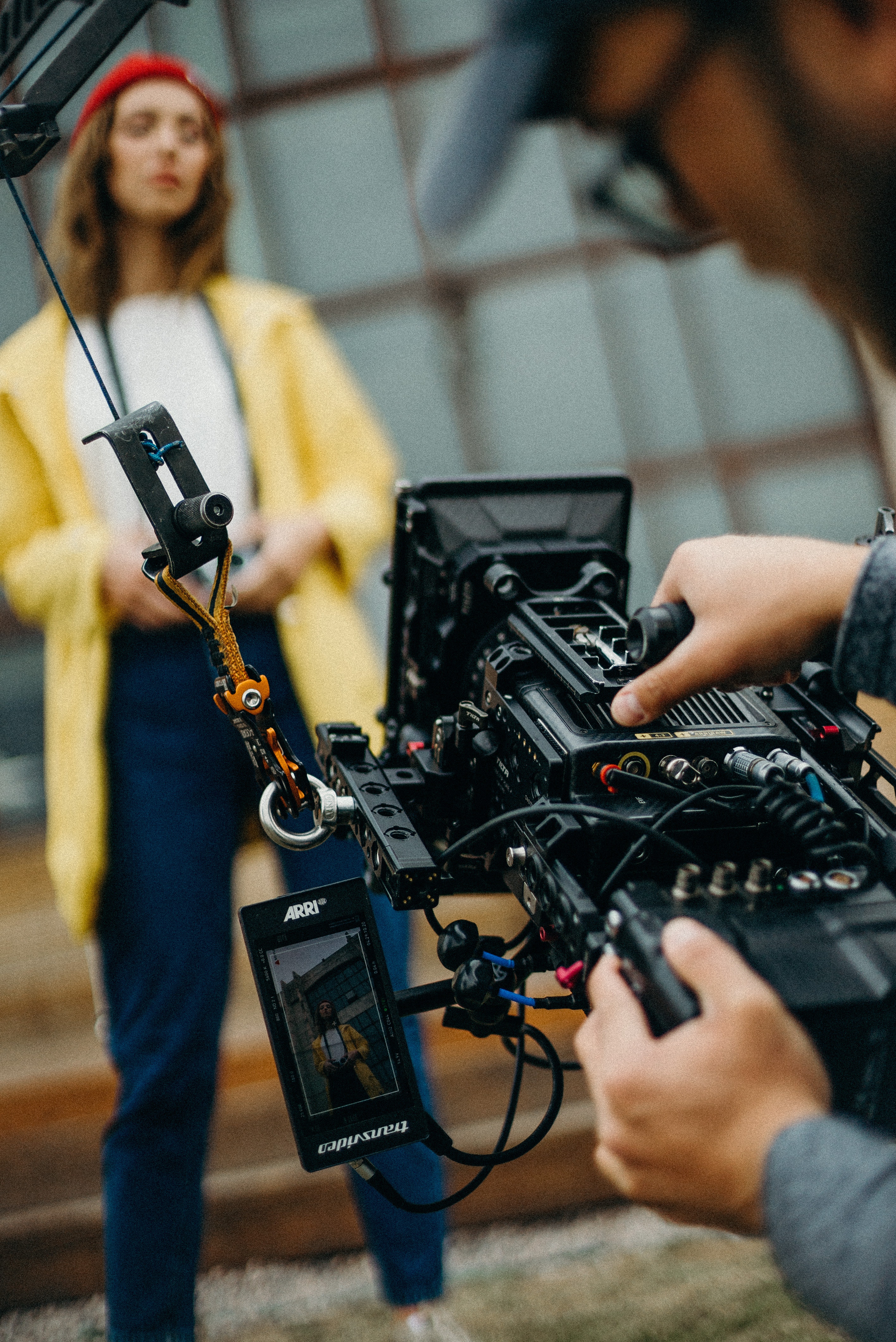
Not all aerial services are created equal. Standard drone operators capture standard drone footage. A specialized aerial production crew brings a significantly deeper toolkit to your project.
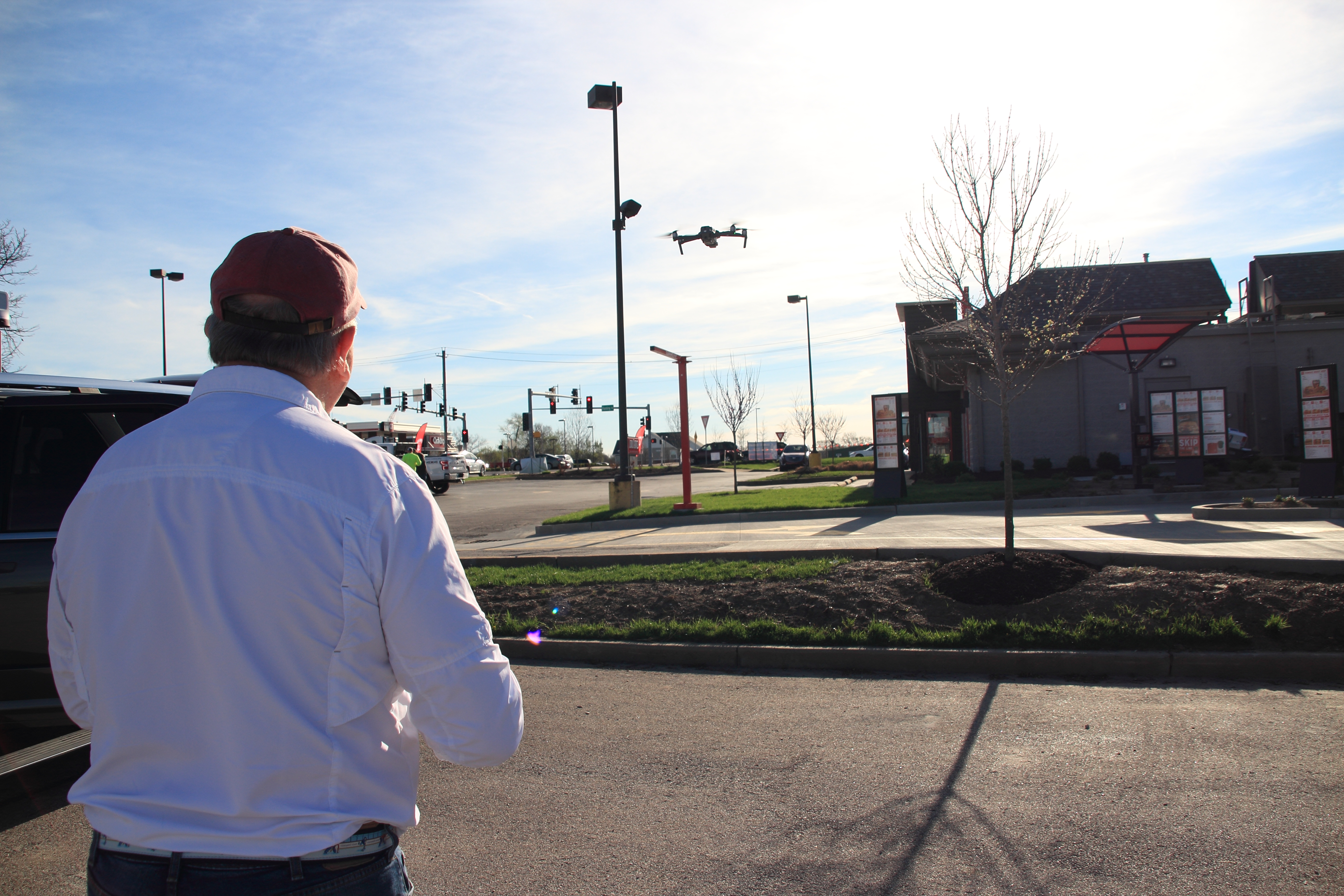
FPV Drone Services — Including Indoor Flight First-Person View (FPV) drones deliver immersive, cinematic footage that standard camera drones cannot replicate. The fluid, dynamic movement of a skilled FPV pilot creates content that commands attention — and crucially, FPV drones can be flown indoors, opening up manufacturing floors, warehouses, event venues, arenas, and architectural interiors to a style of footage most productions never consider.
Infrared Thermal Imaging Thermal drone services have critical applications for facility inspections, energy audits, agricultural surveys, roofing assessments, and industrial documentation. For businesses in construction, real estate, utilities, or environmental services, thermal imaging delivers data and documentation that standard photography simply cannot provide.
Orthomosaics and Aerial Mapping Orthomosaic mapping produces highly accurate, georeferenced aerial images that stitch together into precision overhead maps. These are essential tools for construction site documentation, land development, infrastructure projects, and large-scale facility management.
LiDAR Scanning LiDAR (Light Detection and Ranging) aerial services produce detailed three-dimensional point cloud data of terrain, structures, and environments. For engineering, architecture, urban planning, and asset management applications, LiDAR delivers a level of spatial accuracy that transforms how organizations document and analyze their physical world.
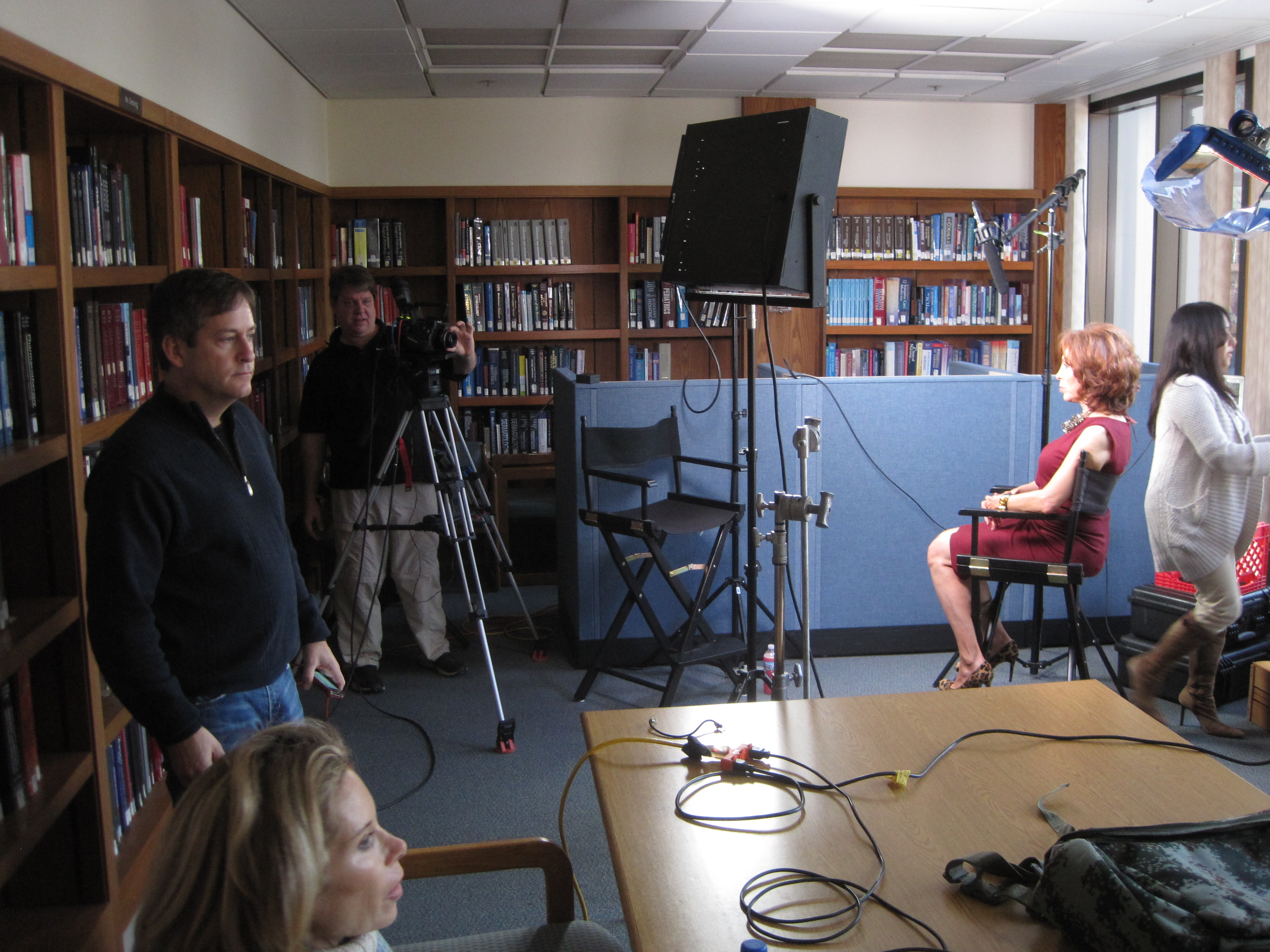
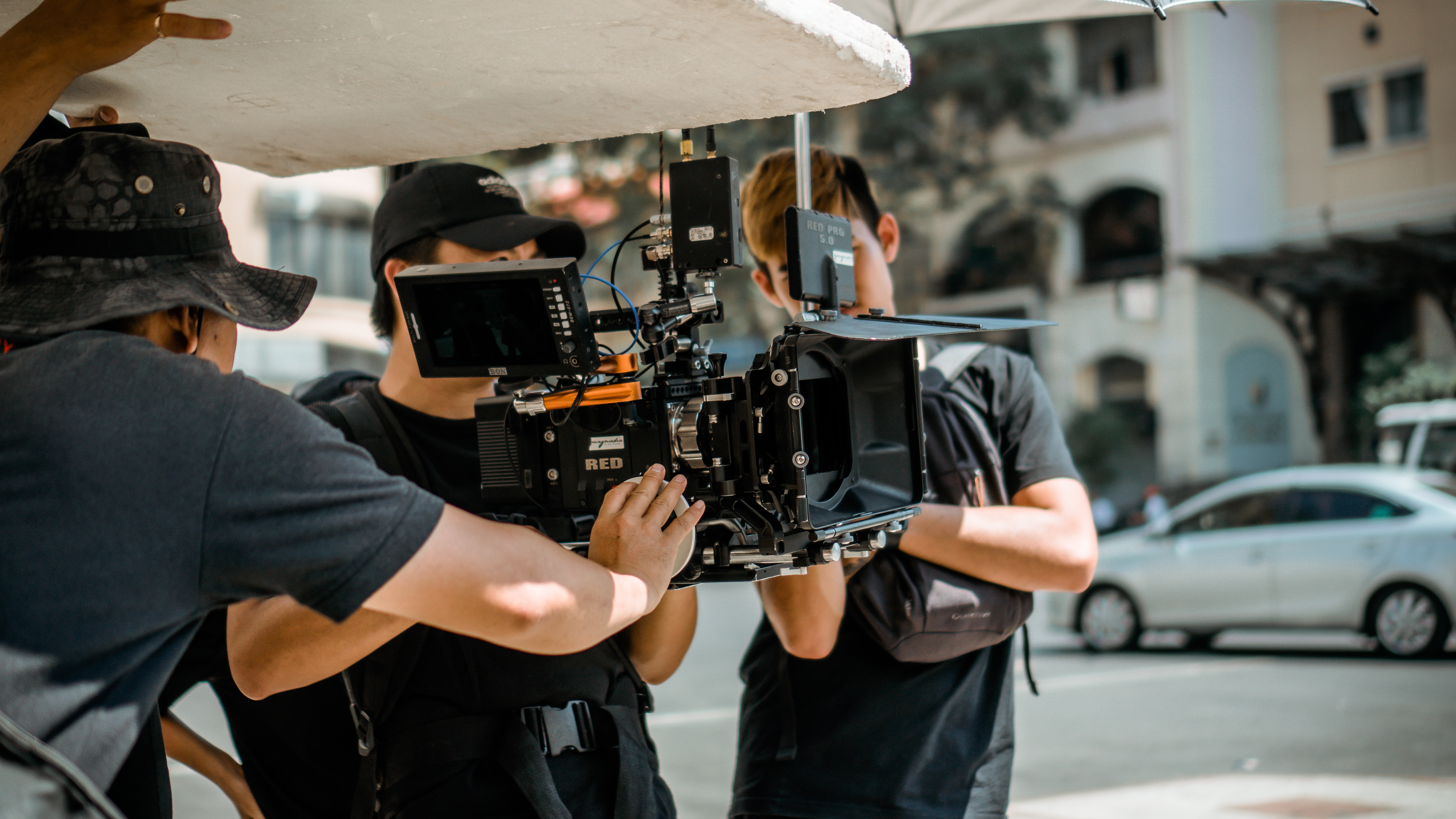
Ground Production: The Foundation of Your Visual Brand
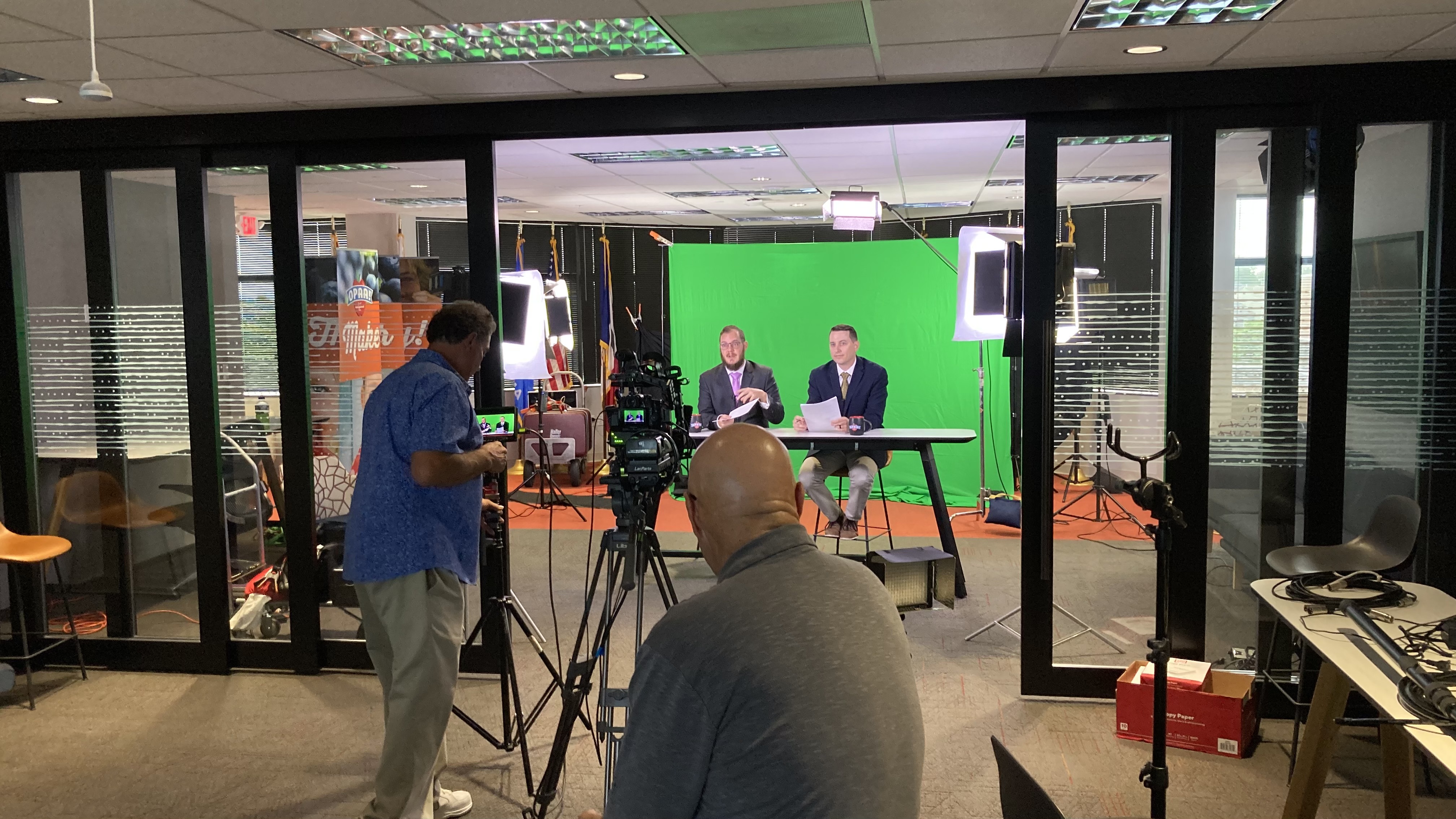
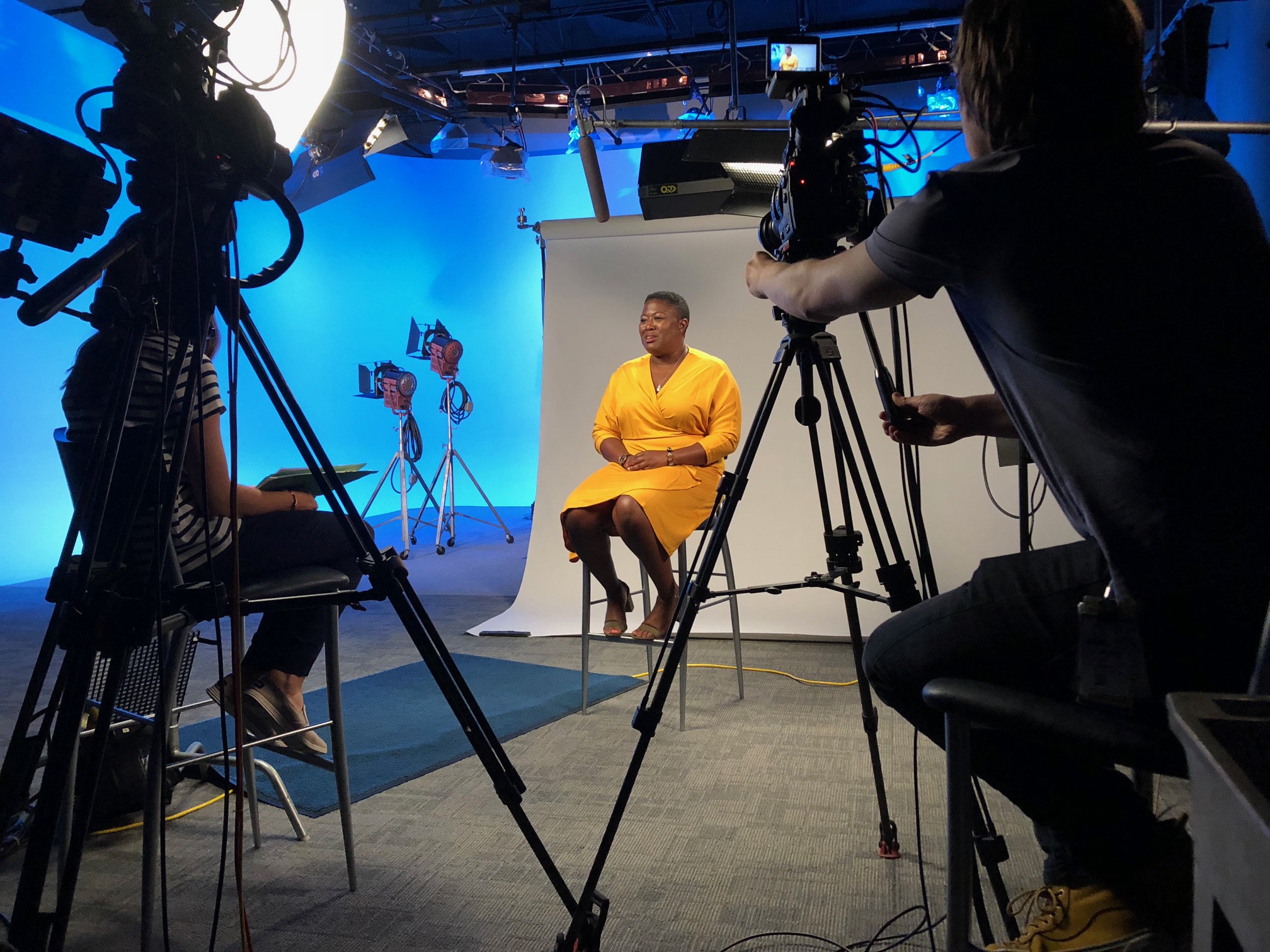
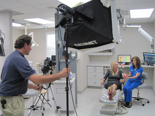
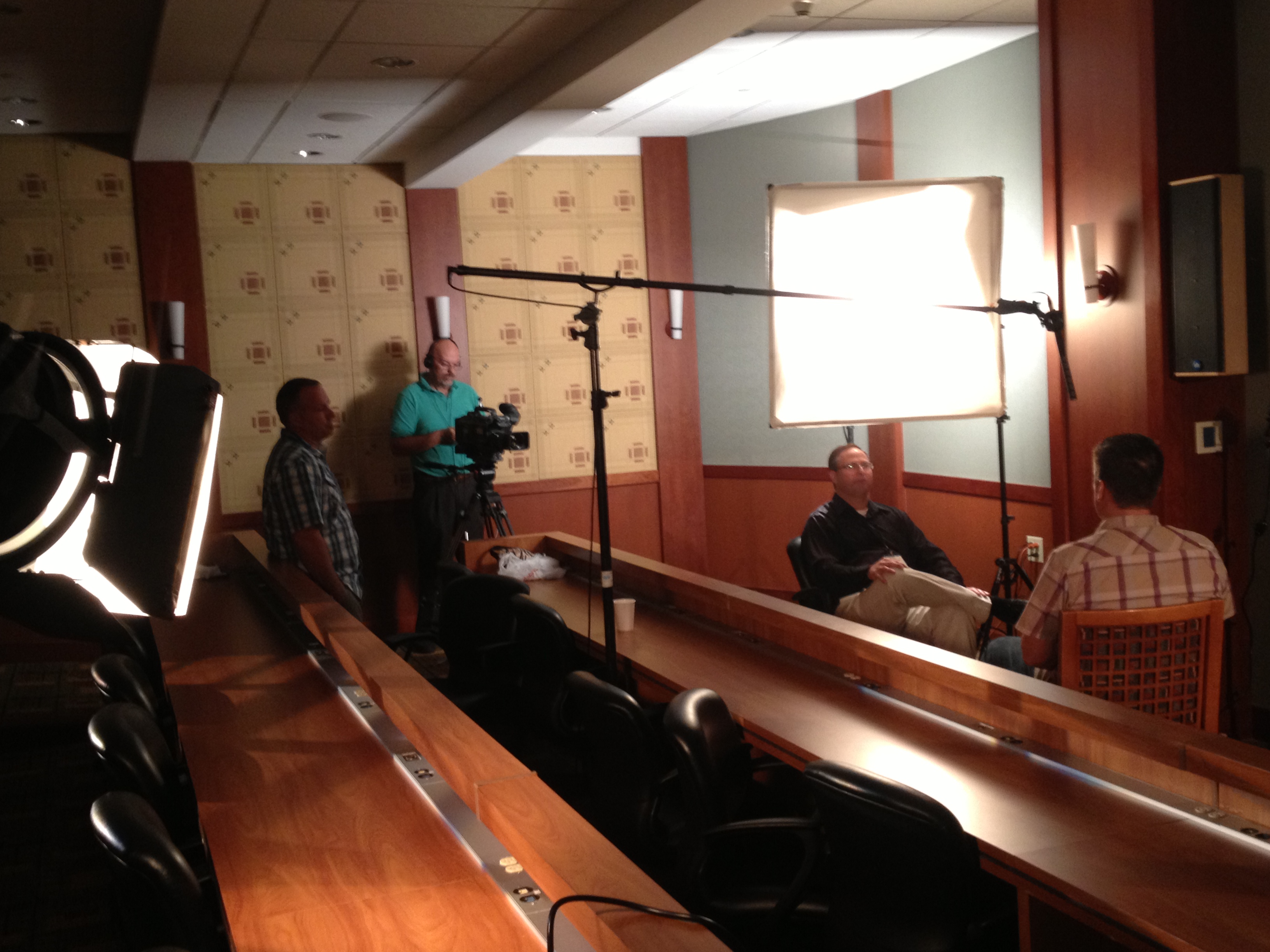
Studio Production — Controlled, Polished, Professional
Certain productions demand a controlled environment. Executive interviews, product demonstrations, spokesperson content, and brand storytelling segments require precision lighting, acoustically treated sound, and a refined visual aesthetic that only a purpose-built studio can reliably deliver.
A professional production studio equipped with customizable lighting rigs, interchangeable backdrops, and sufficient square footage for props and set elements gives your creative team the control needed to produce consistently polished content. Studio conditions eliminate the variables — weather, ambient noise, passing foot traffic, inconsistent natural light — that complicate location shooting. The result is content that looks and sounds exactly as intended, every time.
Location Production — Finding the Right Environment for Your Story
Not every production belongs in a studio. Manufacturing operations, retail environments, hospitality venues, healthcare facilities, construction sites, and outdoor landscapes all tell stories that a studio backdrop cannot replicate. Skilled location production begins with serious location scouting — evaluating sites not just for visual appeal, but for logistical viability, lighting conditions at the time of day required, ambient sound management, and the safety and permitting considerations that professional crews navigate as a matter of course.
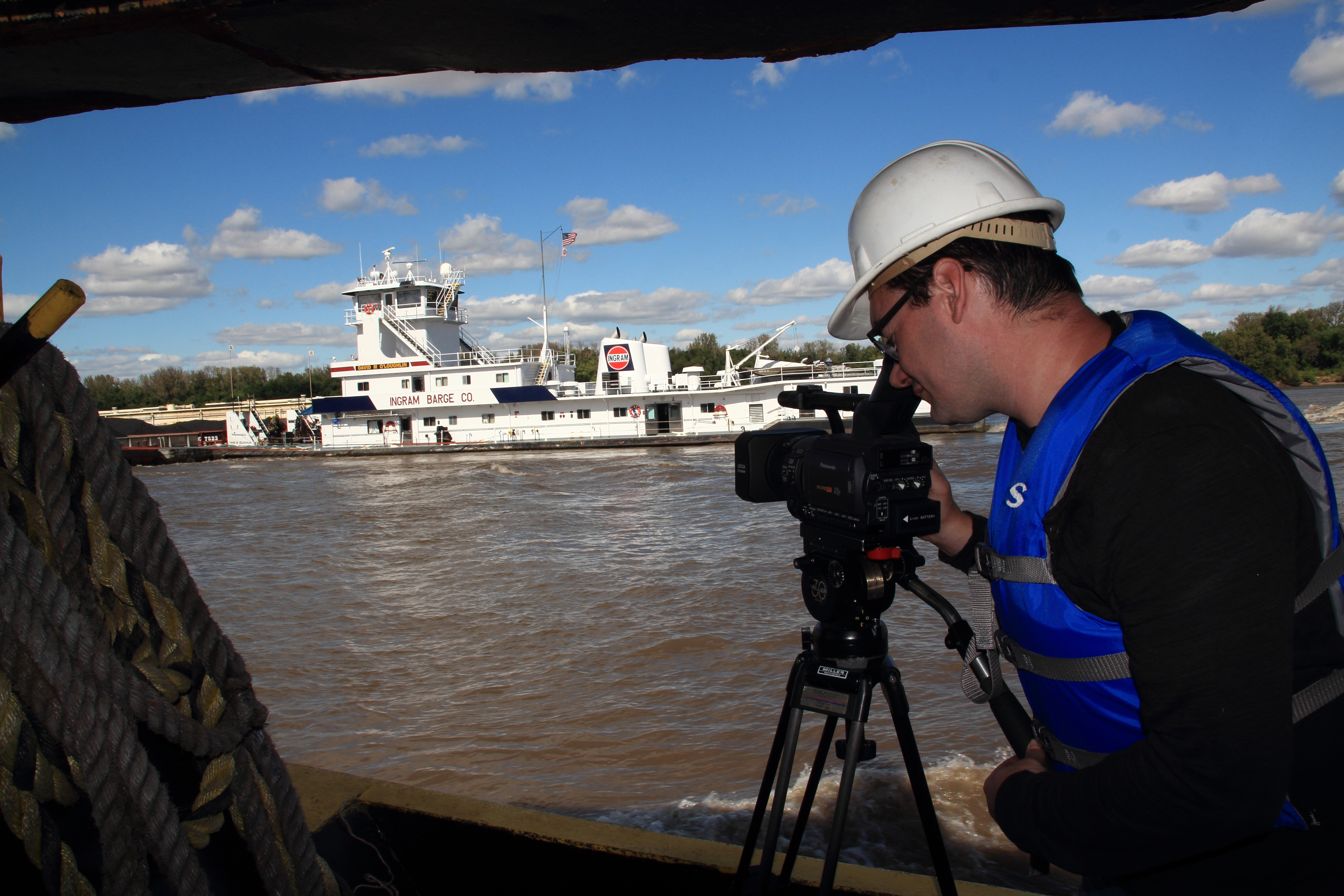
Experienced location crews also know how to capture B-roll footage — the supporting visual content that gives editors the raw material to build compelling narrative sequences. Strong B-roll is the connective tissue of professional video production, and it requires a crew that understands both the story being told and the editorial process that will shape it.
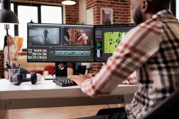
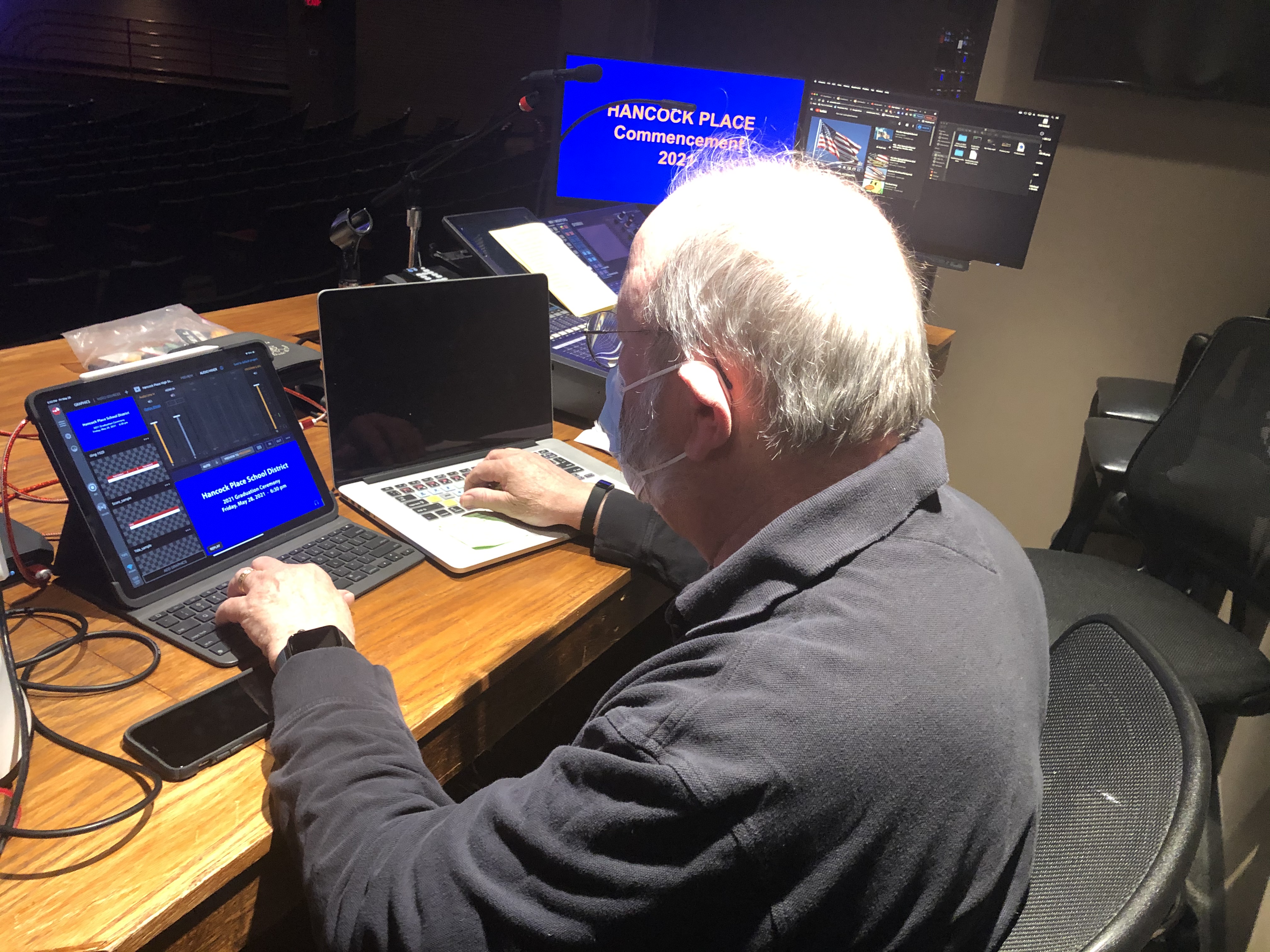
Post-Production: Where Raw Footage Becomes Strategic Content
Capturing excellent footage is half the equation. What happens in post-production determines whether that footage becomes a compelling brand asset or an expensive archive of unused files.
Professional post-production encompasses far more than assembly editing. Color grading, sound design, motion graphics, music licensing, visual effects, format optimization for each distribution channel, and file delivery in the precise specifications required by broadcasters, digital platforms, or agency partners — these are the disciplines that separate professional post-production from basic video editing.
For marketing decision-makers, this is where media repurposing strategy comes into play. A single well-executed production should yield content formatted and optimized for every channel in your media mix. Long-form brand videos become short-form social assets. Photography from a video shoot populates your digital advertising and print campaigns. Aerial footage finds its way into presentations, trade show displays, and investor communications. A post-production team fluent in every file type, platform specification, and media format ensures your production investment works as hard as possible across every touchpoint.
Artificial Intelligence in Modern Commercial Production
AI-powered tools have fundamentally changed what’s possible in professional media production — and decision-makers should understand how these capabilities translate to value for their organizations.
AI is now integrated across the production pipeline: in image enhancement and upscaling, automated transcription and captioning, intelligent color matching across large footage libraries, noise reduction in audio post-production, and content-aware editing tools that accelerate the editorial process without sacrificing creative quality. For organizations managing large volumes of photography and video content, AI-assisted workflows mean faster turnaround, more consistent output, and greater flexibility to adapt content for emerging platforms and formats.
Questions Decision-Makers Should Ask Before Commissioning a Production
Before engaging any photography and video production partner, the following questions will reveal the depth of their capabilities and creative alignment with your needs:
Can this team handle aerial and ground production under a single creative direction? Coordination between air and ground crews requires unified leadership. Productions managed by separate vendors with separate objectives rarely achieve visual coherence.
What happens after the shoot? A production company that delivers raw footage and hands off post-production to a third party introduces creative fragmentation at the most critical stage of the process. Integrated post-production keeps the creative vision intact from capture to final delivery.
How does this team approach media repurposing? If your production partner isn’t planning your content strategy around multi-channel distribution from the first creative conversation, you’re likely leaving significant value on the table.
What specialized capabilities does this team bring beyond standard photography and video? Thermal imaging, LiDAR, FPV, orthomosaics, AI-integrated workflows — these are not exotic extras. They are legitimate tools with real applications for businesses that know how to deploy them.
What is their production history with commercial clients? Experience with businesses, marketing firms, and creative agencies — not just individual or event work — indicates a team that understands the stakes, timelines, approval processes, and brand standards that commercial production requires.
The Problem With Fragmented Production Teams
Most businesses don’t think about production team structure until something goes wrong. A drone operator delivers footage that doesn’t match the ground-level visual style. A photographer shoots stills that can’t be repurposed for video. B-roll footage comes back thin because nobody briefed the ground crew on the editorial plan. Post-production inherits a disorganized footage library and burns budget trying to assemble something coherent.
These aren’t isolated failures. They’re the predictable outcome of fragmented production — multiple vendors executing in parallel without shared creative direction.
A unified shooting crew eliminates this structural problem at the source. When aerial operators, ground camera operators, lighting technicians, sound engineers, and directors are operating from the same creative brief under the same production leadership, the footage they capture is designed from the outset to work together. The story is planned before the first camera flies or rolls. The edit begins, in a real sense, on the day of the shoot.
Infrared Thermal Drone Imaging
Thermal imaging captures heat signatures invisible to standard cameras, producing documentation with direct operational and commercial value across a wide range of industries.
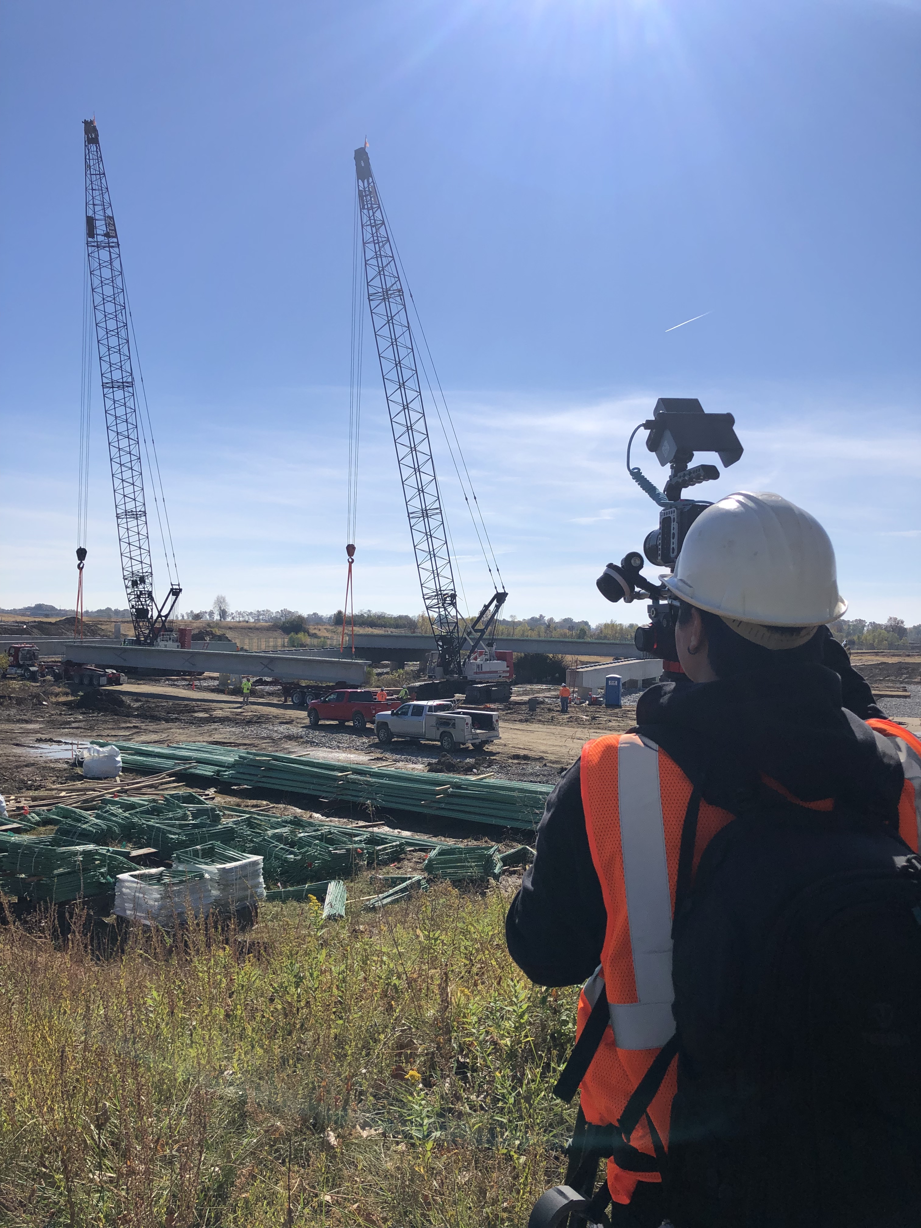
For construction and roofing professionals, thermal aerial surveys identify moisture intrusion, insulation failures, and structural anomalies with a speed and coverage that ground-level inspection cannot match. For utilities and energy providers, thermal imaging identifies inefficiencies and failure points in infrastructure. For agricultural operations, thermal data reveals crop stress and irrigation inconsistencies across large acreages. And for organizations that need to document facility conditions for insurance, compliance, or maintenance purposes, thermal aerial surveys produce defensible, detailed records that support those processes.
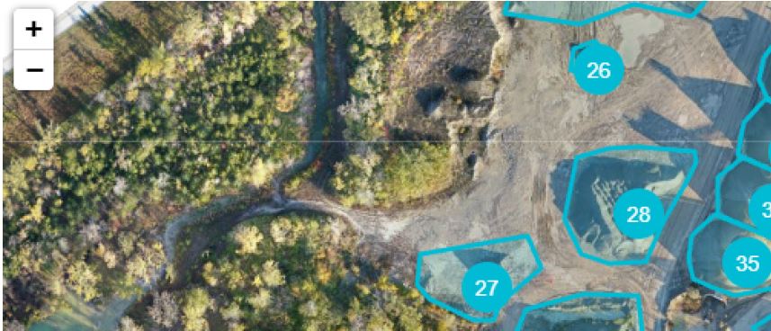
Orthomosaic Aerial Mapping
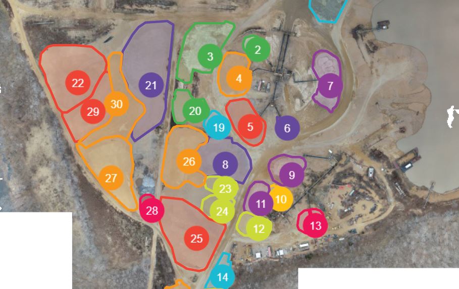
Orthomosaic mapping is the process of capturing overlapping aerial images across a defined area and processing them into a single, geometrically corrected, georeferenced overhead image or map. The result is a precision aerial document with real-world accuracy — not a stylized photograph, but a measurable, scalable representation of a site or facility.
The applications are broad: construction site documentation at defined project milestones, land development planning, infrastructure corridor mapping, large-scale facility asset management, and environmental monitoring. For businesses and organizations that manage significant physical assets, orthomosaic mapping is a production capability with direct operational utility beyond its marketing applications.
LiDAR Aerial Scanning
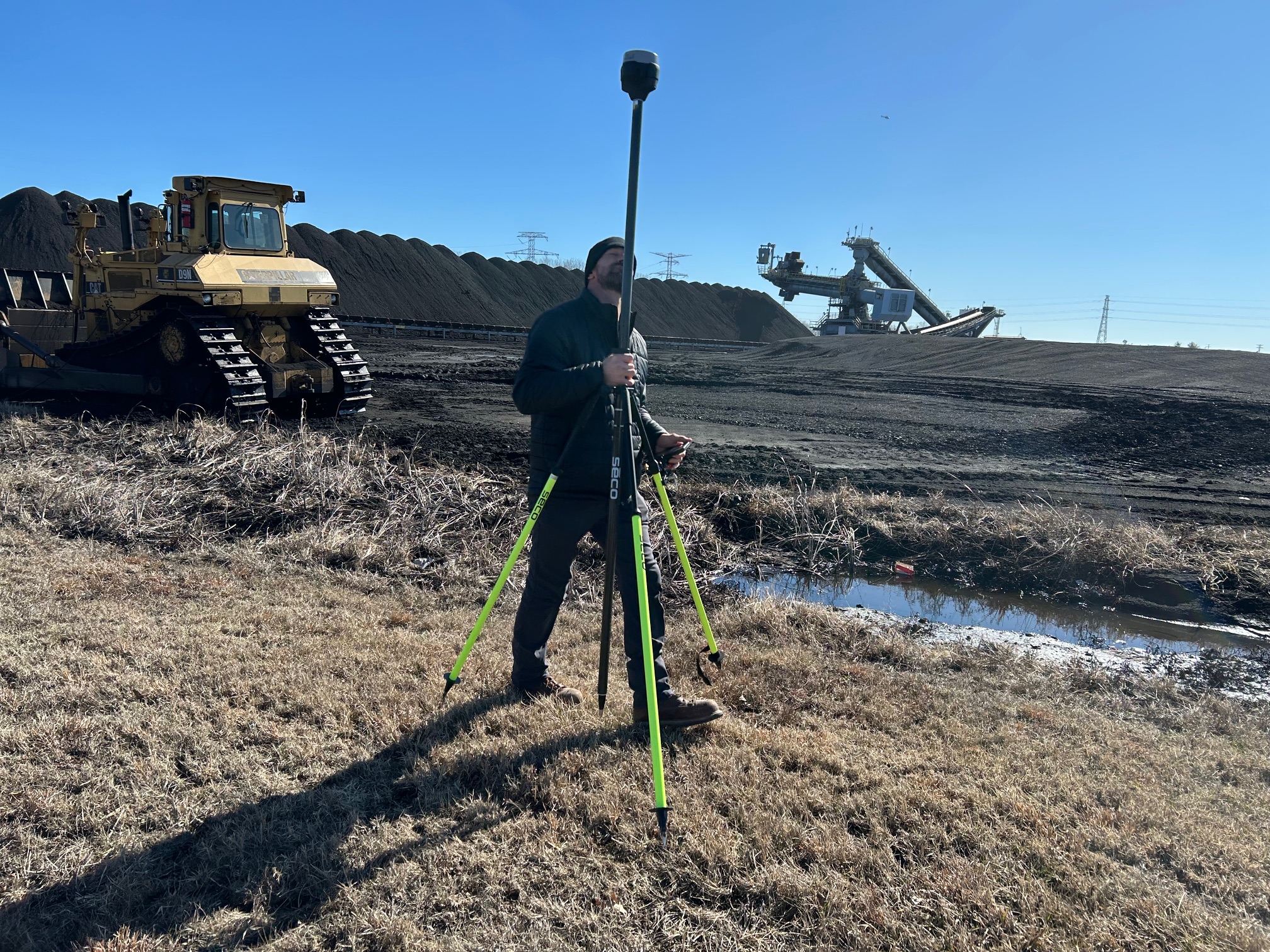
LiDAR — Light Detection and Ranging — uses pulsed laser measurements to generate precise three-dimensional point cloud data of terrain, structures, and environments. Drone-mounted LiDAR produces spatial data with millimeter-level accuracy across large areas in dramatically less time than ground-based survey methods.
For engineering firms, architects, urban planners, asset managers, and environmental consultants, LiDAR data is a foundational input for design, analysis, and documentation workflows. As drone-mounted LiDAR becomes more accessible, forward-thinking organizations are integrating aerial scanning into their standard project documentation processes — and gaining a significant informational advantage over competitors still relying on conventional survey methods.
Ground Production: Building the Story From the Inside Out
The Strategic Value of a Professional Studio Environment
There is a category of commercial content that simply performs better when produced in a controlled studio environment. Executive interviews and thought leadership segments. Spokesperson and on-camera talent productions. Product demonstrations and close-up photography. Brand narrative content requiring precise lighting and acoustic control.
A professional production studio equipped with flexible lighting infrastructure, customizable set elements, and sufficient floor space for props and set dressing gives your production team the control to deliver content that looks exactly as intended — regardless of weather, season, time of day, or the ambient chaos of an active business environment.
The value of studio control extends beyond aesthetics. Consistent, repeatable visual conditions mean that interview content shot months apart for the same campaign maintains visual coherence. Lighting setups can be documented and recreated for follow-on productions. And the elimination of location variables — noise, foot traffic, changing light conditions — translates directly into faster shoot days and more predictable post-production timelines.
Location Production and the Art of the Scouted Shot
When the story demands a real environment — an operational facility, a retail space, a construction site, an outdoor landscape — location production requires a level of pre-production discipline that separates professional crews from casual operators.
Serious location scouting evaluates sites on multiple dimensions simultaneously: visual appeal and brand alignment, lighting conditions at the specific time of day required for the shoot, ambient sound environment and noise management strategies, logistical access for equipment and crew, safety considerations, and permitting requirements for commercial production in public or regulated spaces. A crew that scouts thoroughly shoots efficiently. A crew that arrives on location without adequate pre-production burns time and budget solving problems that should have been identified weeks earlier.
B-Roll Production: The Content Most Productions Underestimate
B-roll — the supporting visual footage that editors use to build context, illustrate narrative, and maintain visual momentum — is consistently undervalued in production planning and consistently critical to the quality of the finished product.
Weak B-roll creates editing problems that no amount of post-production skill can fully solve. Strong B-roll gives editors the raw material to build sequences that feel dynamic, specific, and visually rich. It is the difference between a corporate video that holds viewer attention and one that loses it within the first thirty seconds.
Experienced B-roll specialists approach each production with an editorial mindset — capturing footage not just of what is present, but of what the editor will need to tell the story compellingly. This requires genuine familiarity with the post-production process and a deliberate, coverage-focused approach to every shoot day.
Post-Production: The Stage That Determines Your Content’s Value
Capturing excellent footage is a necessary condition for a successful production. It is not a sufficient one. Post-production — editing, color grading, sound design, motion graphics, format optimization, and final delivery — is where raw footage is transformed into strategic content. And it is where the work of an integrated production team either comes together or falls apart.
The Multi-Channel Imperative
Contemporary commercial content rarely serves a single purpose or lives on a single platform. A brand video produced for your website homepage will also generate short-form social media content, email marketing assets, trade show display loops, internal communications materials, and potentially broadcast or streaming placements — all from footage captured during the same production.
This is not an afterthought. It is a production strategy that must be planned from the first creative brief. An experienced post-production team understands the technical requirements of every distribution channel — aspect ratios, resolution specifications, compression standards, caption and accessibility requirements, platform-specific duration norms — and works backward from those requirements to inform how footage is captured and organized on set.
Media Repurposing as a Long-Term Strategy
Every photography and video production your organization invests in represents a body of creative assets with potential value beyond its original application. Still photography captured during a video shoot can populate digital advertising, print collateral, social media channels, and website imagery. Aerial footage captured for a specific campaign can be licensed for ongoing use across future productions. Interview content shot for one initiative can be reedited and recontextualized for another.
A production partner who understands media repurposing helps you extract maximum value from every dollar invested in content creation. Rather than treating each production as a discrete event, they help you build and manage a growing library of brand assets — strategic raw material for every creative and marketing initiative your organization undertakes.
AI-Integrated Production Workflows
Artificial intelligence has become a legitimate production tool with real implications for output quality, turnaround efficiency, and creative capability across the post-production pipeline.
AI-powered tools are now integrated into professional workflows for image enhancement and upscaling, automated transcription and closed captioning, intelligent noise reduction in audio post, color matching across large and varied footage libraries, content-aware editing assistance, and format conversion for multi-platform distribution. For organizations managing substantial volumes of photography and video content, AI-assisted workflows deliver faster turnarounds, more consistent quality across large asset libraries, and greater adaptability to the evolving technical requirements of emerging platforms and distribution channels.
Key Questions for Decision-Makers Evaluating Production Partners
Before committing to a commercial photography and video production engagement, these questions will give you a meaningful picture of your potential partner’s capabilities and professional depth:
Is aerial and ground production managed under unified creative direction? Coordination between air and ground requires more than scheduling — it requires shared creative intent and a single directing perspective. Productions pieced together from separate aerial and ground vendors rarely achieve visual coherence.
Does this team own post-production, or do they hand off to third parties? Integrated post-production preserves the creative vision from capture to delivery. Third-party hand-offs introduce creative fragmentation at the most critical stage of the process.
How does the team approach multi-channel distribution and media repurposing? A production partner focused only on the immediate deliverable is not maximizing your investment. The conversation about downstream use should begin at the creative brief stage.
What specialized drone capabilities does this team offer? Standard aerial coverage is a baseline expectation. FPV indoor flight, thermal imaging, orthomosaic mapping, and LiDAR scanning are specialized capabilities with real commercial applications — and not every production company offering “drone services” has the equipment, licensure, or operator experience to deliver them.
What is the company’s track record with commercial clients? Experience with businesses, marketing agencies, and creative firms — not just event, real estate, or individual client work — demonstrates familiarity with the approval workflows, brand standards, and production accountability that commercial projects demand.
How does this team leverage AI in their production workflow? AI integration is no longer a differentiator — it is a baseline expectation for professional production. A team that is not actively using AI-powered tools across their pipeline is operating at a competitive and efficiency disadvantage.
St. Louis Drones — Full-Service Commercial Production Since 1982
For more than four decades, St. Louis Drones has served businesses, marketing firms, and creative agencies throughout the St. Louis region as a trusted full-service commercial photography and video production company.
Our integrated creative shooting crews operate seamlessly across aerial and ground productions — coordinating licensed drone services, professional studio and location photography and video, and complete post-production services under unified creative direction. That integration is deliberate and foundational. It is what ensures every production we deliver achieves visual coherence, strategic utility, and lasting brand value.
Our full-service capabilities include:
Complete studio and location video and photography production
Licensed commercial drone services including FPV indoor flight, infrared thermal imaging, orthomosaic aerial mapping, and LiDAR scanning
Professional sound and camera operators across all production environments
Private production studio with customizable lighting, set design, and prop integration — engineered for executive interviews, spokesperson content, product demonstration, and focused small-scale productions
Expert location scouting and B-roll specialist services
Full post-production and editing services across all file types, formats, and platform delivery specifications
AI-integrated production workflows for enhanced efficiency, consistency, and output quality
Media repurposing strategy and multi-channel content execution
Comprehensive fluency across all media file types, production styles, and industry-standard software
We support every dimension of your production from initial creative brief through final asset delivery — whether that means constructing a polished private interview studio, deploying a coordinated aerial and ground crew on location, or executing a comprehensive multi-day brand content campaign designed to fuel your marketing across every channel.
Since 1982, St. Louis Drones has built its reputation on one commitment: giving commercial clients the equipment, the expertise, and the creative crew experience to walk away from every production with content that works — visually, strategically, and over time.
Contact St. Louis Drones to discuss your next commercial photography or video production project. Our team is ready to help you plan, produce, and deliver content that elevates your brand and serves your organization for years to come.
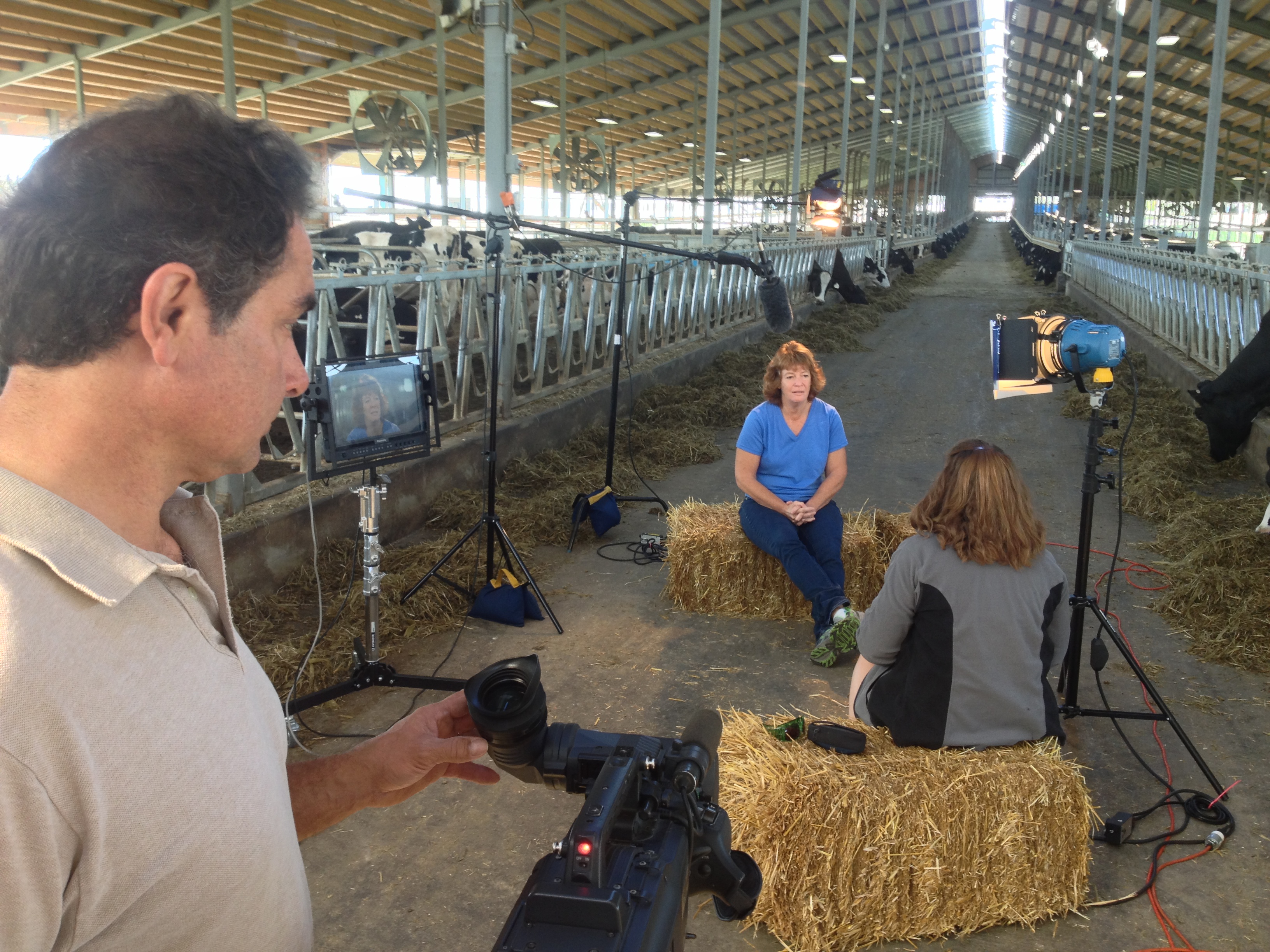
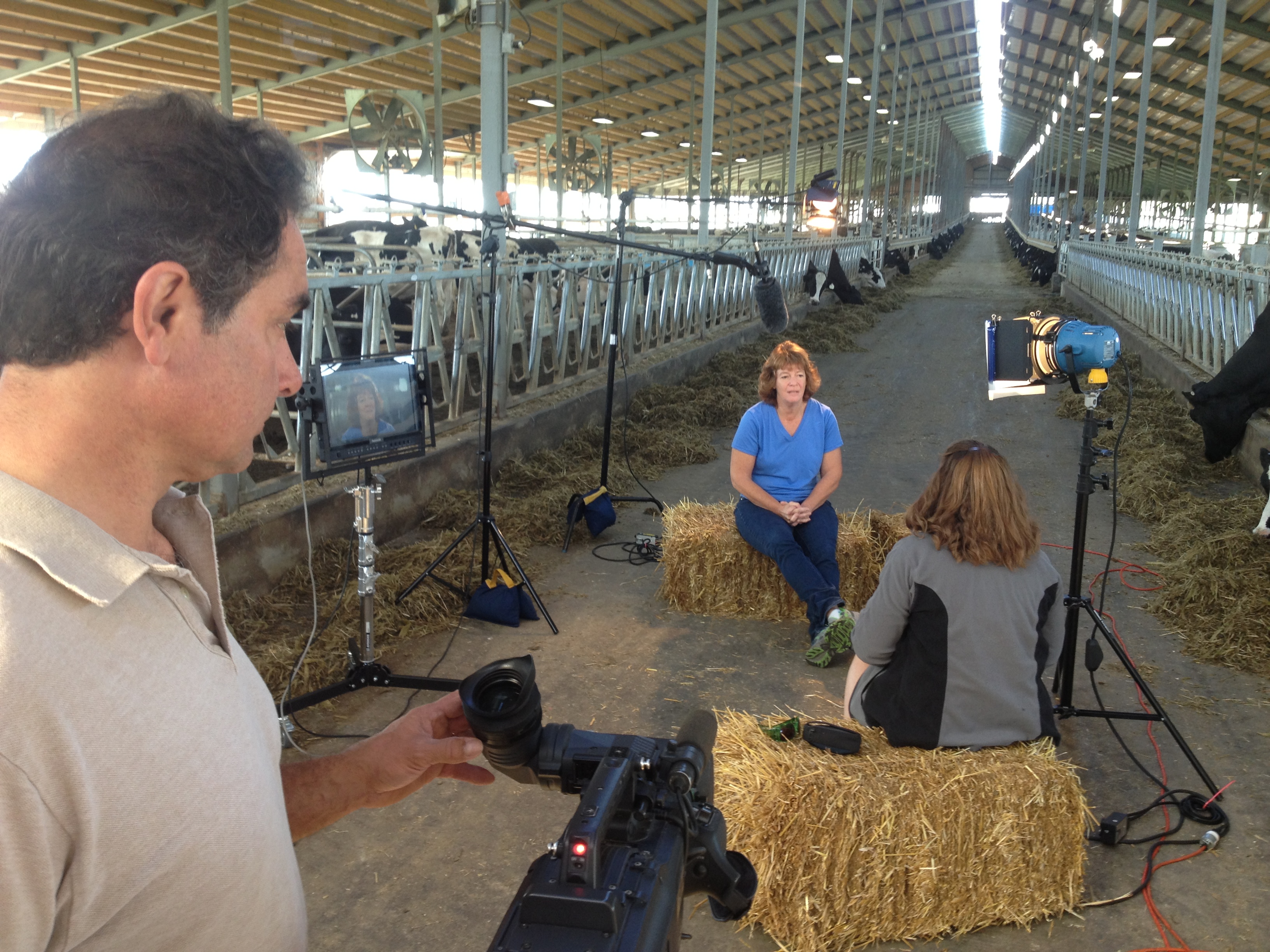
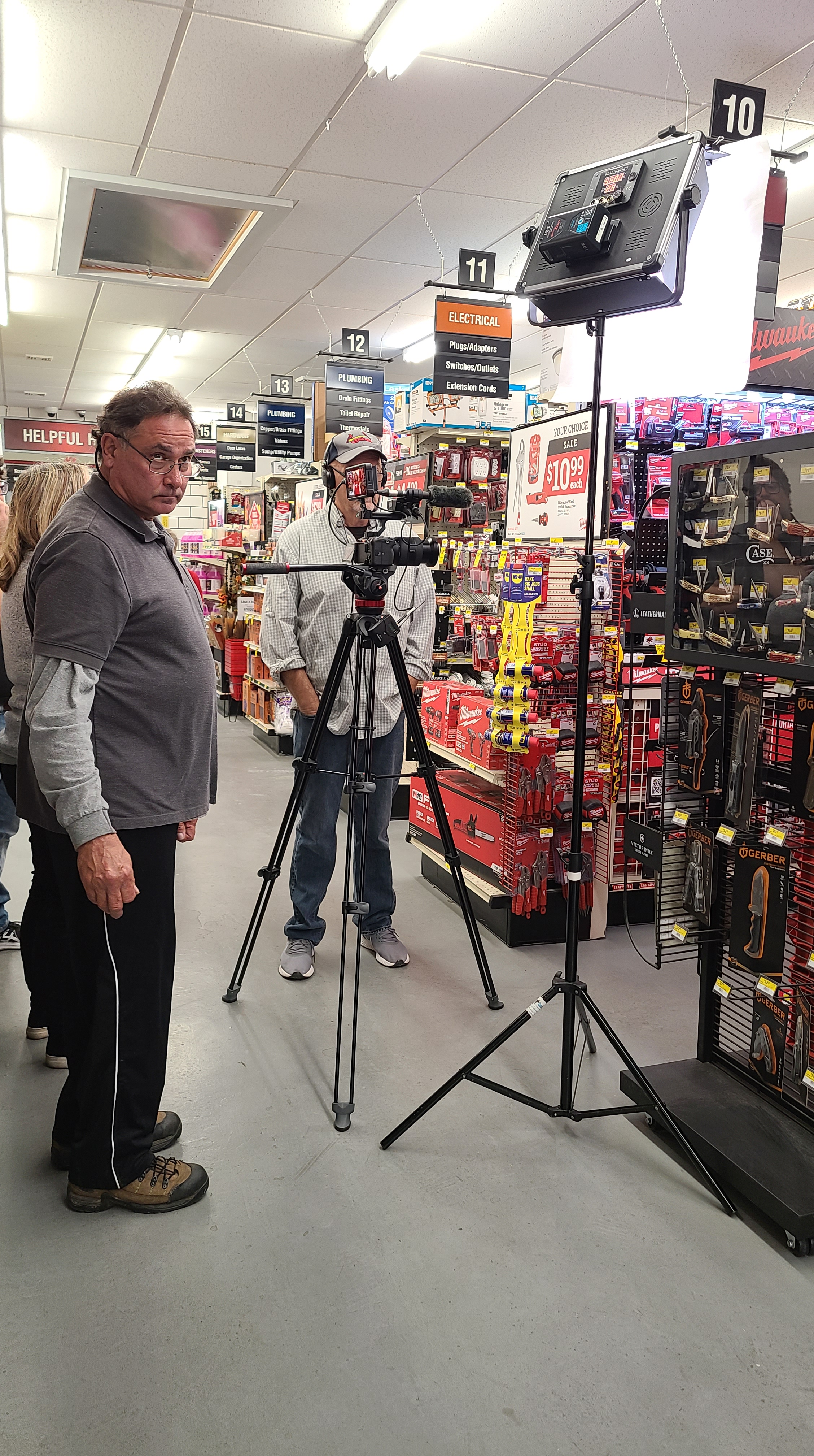
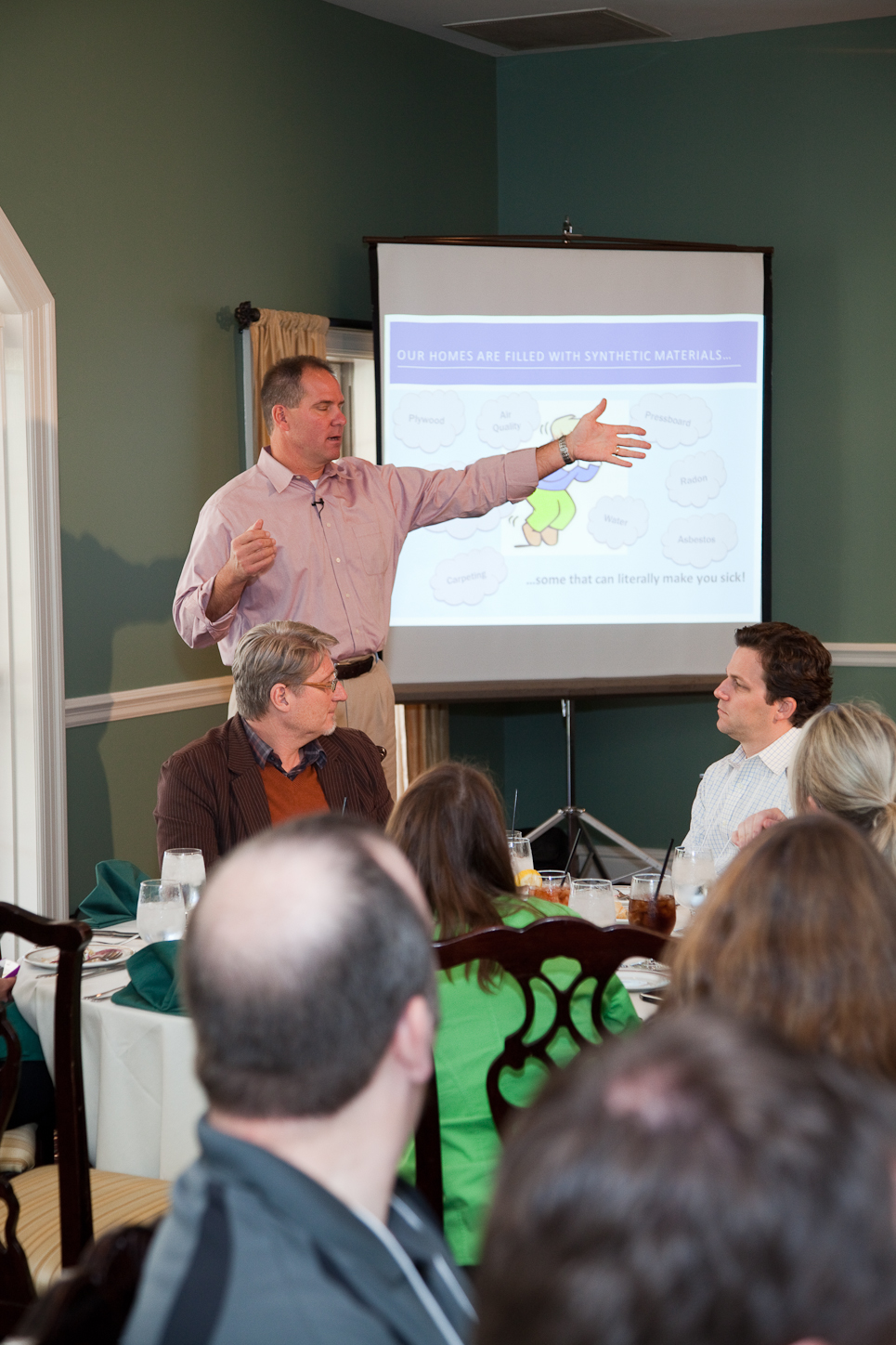
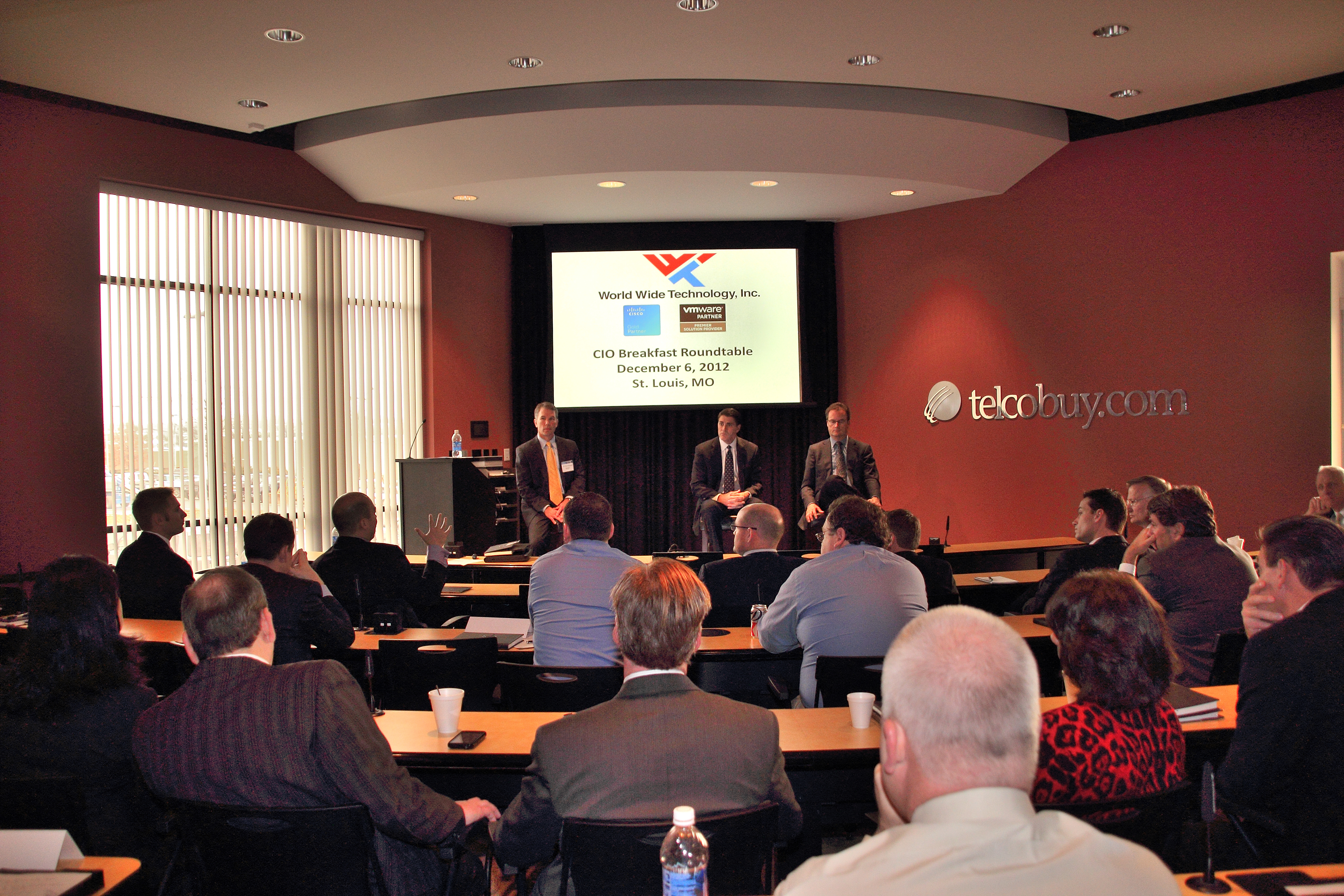
For businesses and organizations trying to create strong marketing content without overextending budgets, interview-driven video remains one of the smartest production investments available. A well-produced interview can communicate authority, explain services, highlight customer experiences, support recruiting, and strengthen brand trust. When that interview is paired with purposeful b-roll, the production becomes even more valuable, delivering a flexible library of content that can be repurposed across websites, social media, presentations, digital campaigns, and internal communications.
For decision makers in marketing, communications, and corporate branding, the real question is not whether video interviews work. It is how to produce them economically while still protecting quality, efficiency, and brand standards. That is where an experienced production team makes the difference.
At St Louis Drones, economical interview and b-roll production is not about cutting corners. It is about planning intelligently, scaling the crew appropriately, using the right equipment, and capturing the kind of footage that continues working long after the production day is over.
Why Interview-Based Video Continues to Deliver Strong Value
Interview-centered video has remained one of the most practical formats in commercial production because it is efficient, credible, and adaptable. A single interview session can be developed into multiple pieces of content for different audiences and channels. That makes it one of the most economical ways to create a meaningful media package.
Organizations regularly use interview-based video for:
company overview videos
executive messaging
customer testimonials
recruiting and culture videos
training content
case studies
educational or informational campaigns
service and product explainers
internal messaging
website and landing page content
The core strength of an interview format is that it gives the audience a real voice, a real face, and a clear message. For businesses that want to appear credible and accessible, that matters. For marketing teams that need practical content with a long shelf life, it matters even more.
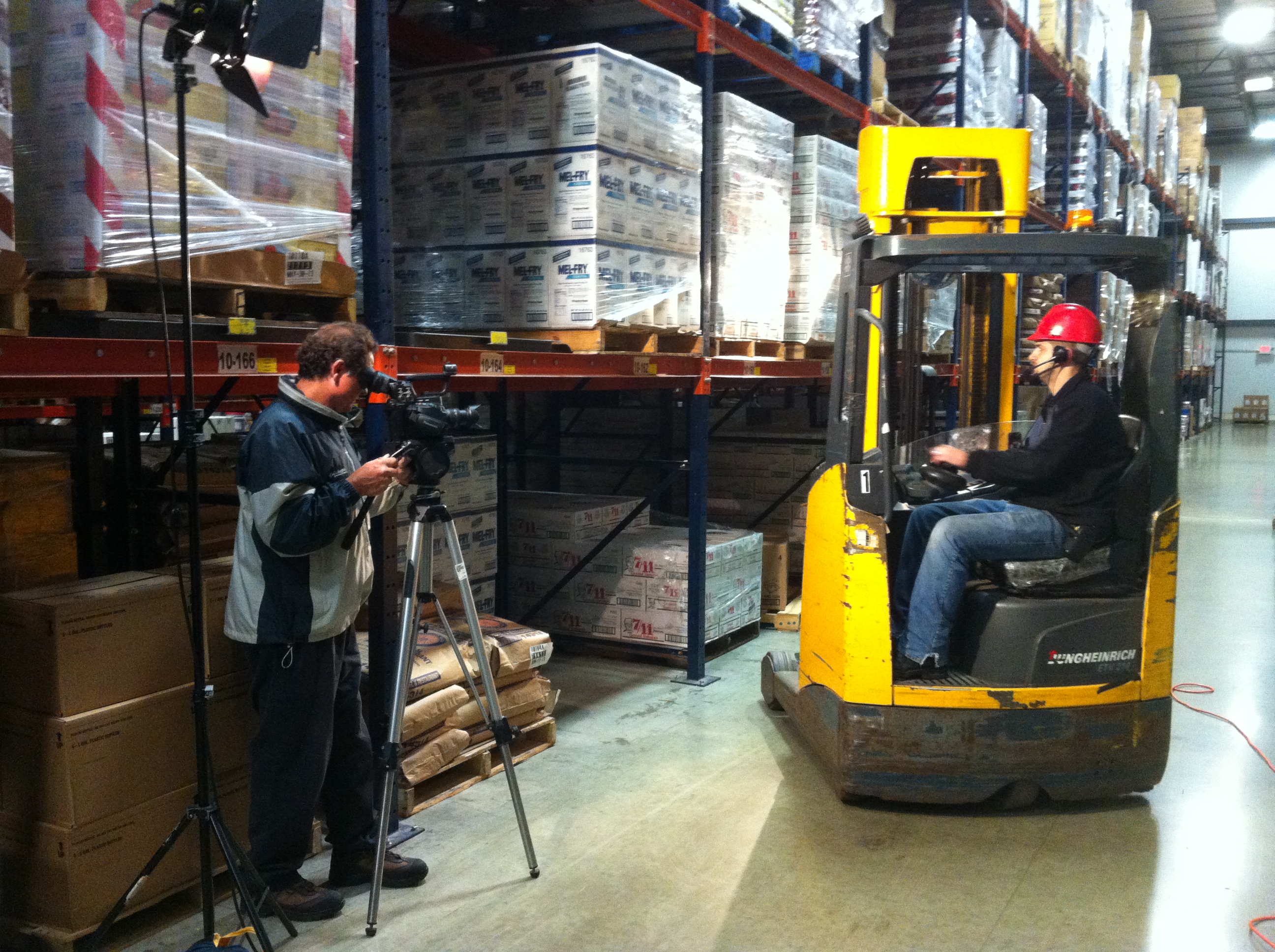
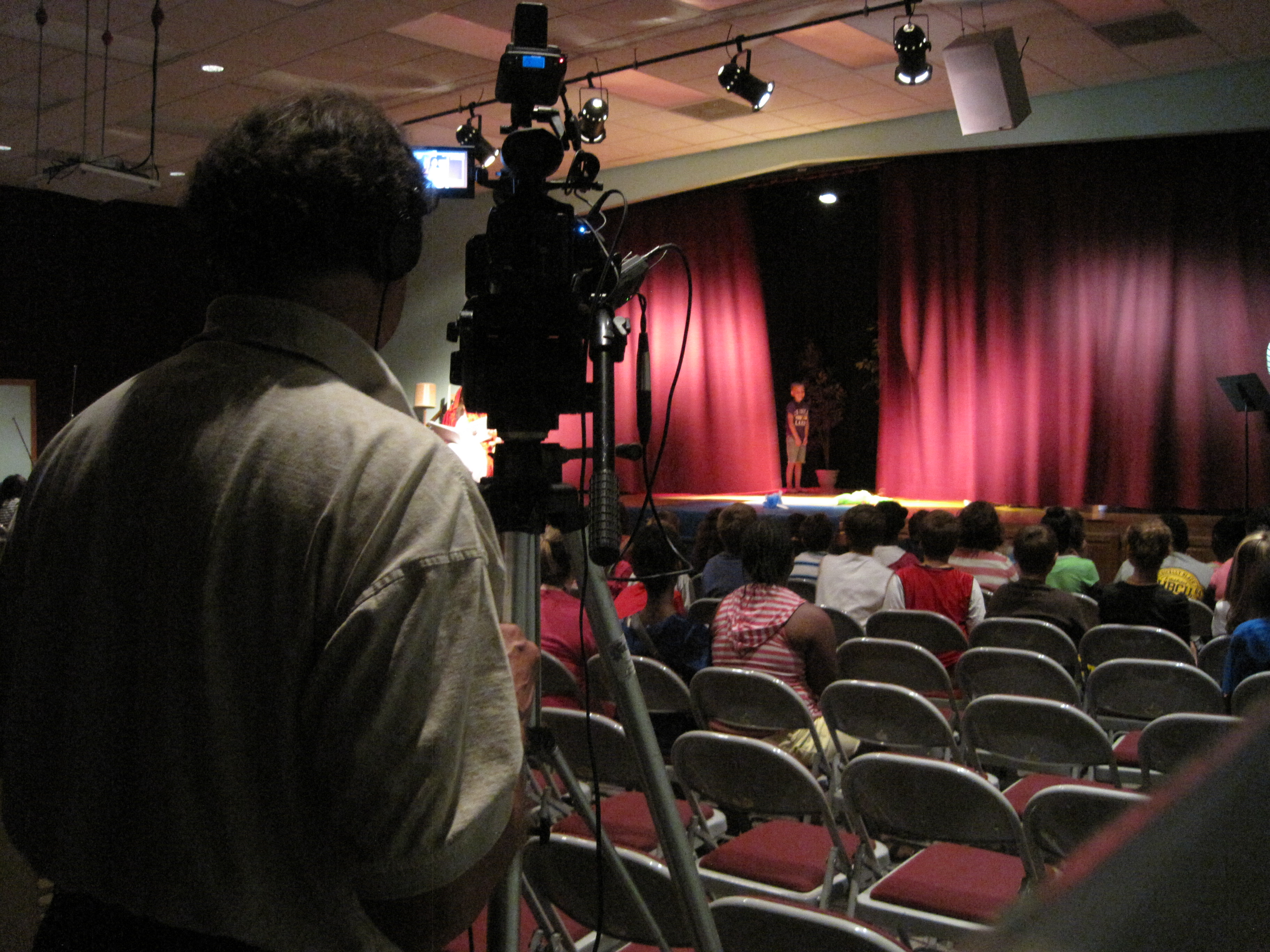
Why B-Roll Is Essential to a Strong Final Edit
An interview alone rarely carries the full weight of a finished brand piece. B-roll gives a video movement, context, visual evidence, and editorial flexibility. It allows the audience to see operations, people, spaces, products, and processes while the interview supports the message. It also helps editors tighten pacing, smooth cuts, and create multiple versions of the same project.
Effective b-roll may include:
workplace activity
offices and facilities
manufacturing or production processes
product interaction
service demonstrations
collaboration scenes
branded details
exterior and interior environment shots
drone footage for context and scale
lifestyle and environmental visuals
When b-roll is captured strategically, it does far more than fill space. It helps tell the story, increases production value, and expands the usefulness of the footage for future campaigns.
Economical Production Means Greater Value, Not Just a Smaller Budget
A project is not truly economical simply because the quote is lower. It is economical when the production is planned well, executed efficiently, and delivers a wide range of usable content without unnecessary reshoots, delays, or missed opportunities.
That usually comes down to several factors.
Strong Pre-Production Planning
A smooth shoot begins before the first light is placed or the first camera is turned on. Efficient production starts with identifying the purpose of the video, the audience, the interview subjects, the location needs, and the b-roll priorities. When this step is done properly, production days move faster and the final edit is stronger.
Good planning helps answer questions such as:
Should the interview happen in a studio, on location, or both?
How many interviews should be scheduled in one day?
What supporting visuals are essential?
Is aerial footage valuable to the story?
What equipment is truly necessary for the production goals?
What deliverables should be captured now for future use?
The Right-Size Crew
One of the keys to economic efficiency is building the right crew for the assignment. Some projects work best with a nimble, highly experienced small crew. Others benefit from a larger team that can move faster, manage more gear, handle multi-camera coverage, and keep production on schedule.
The best production partner understands how to scale properly. Too small a crew can slow the day down and compromise the final product. Too large a crew can create unnecessary cost. The right approach is a tailored one.
Smart Use of Studio and Location Options
Some interviews benefit from the controlled conditions of a studio. Others need the authenticity and context of a real-world location. Often, the most economical solution is a combination of both.
A studio interview may provide the cleanest sound, the most polished lighting, and the most consistent visual brand presentation. A location interview may show the organization in action and create stronger storytelling. When used strategically, each environment has its advantages.
Capturing Footage for Repurposing
One of the biggest reasons interview and b-roll productions can be so cost-effective is that they can serve many purposes at once. A single production day can yield a primary video, short social clips, vertical edits, website cutdowns, internal communications content, and visual assets for future use.
That is how a production becomes more than a one-time expense. It becomes a content investment.
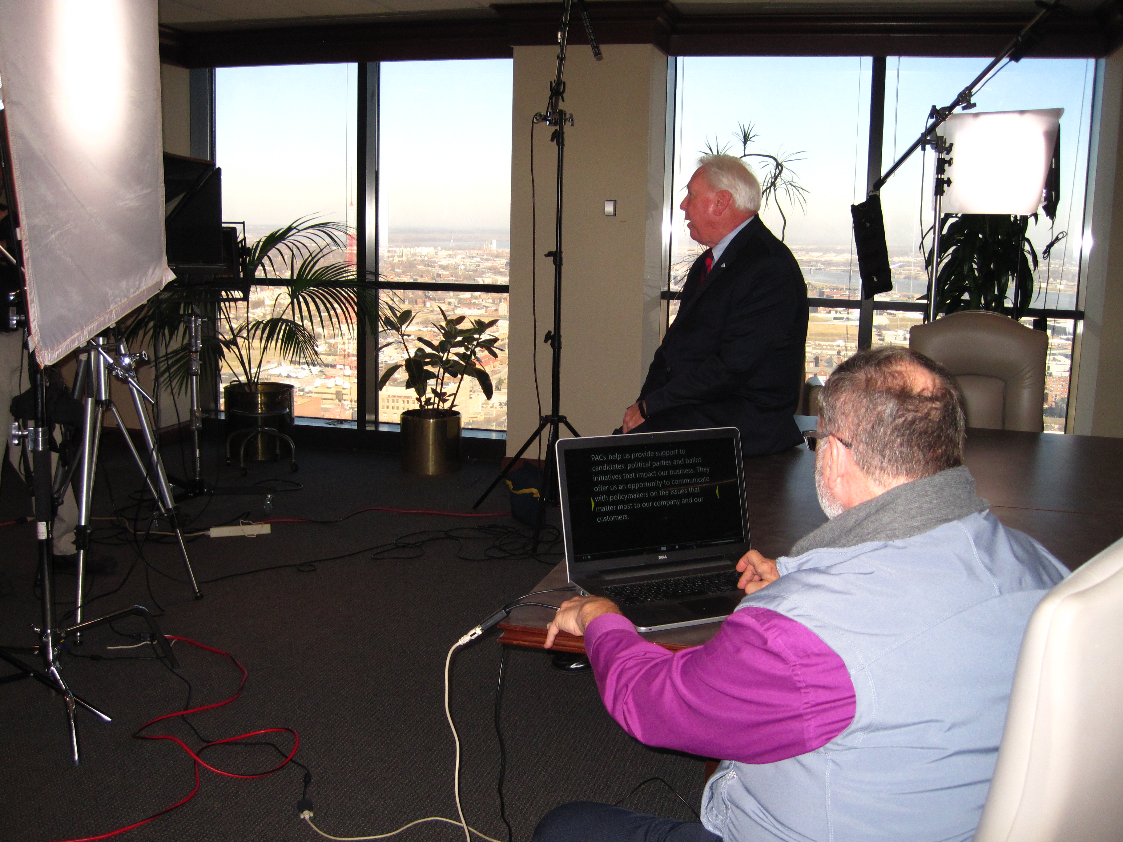
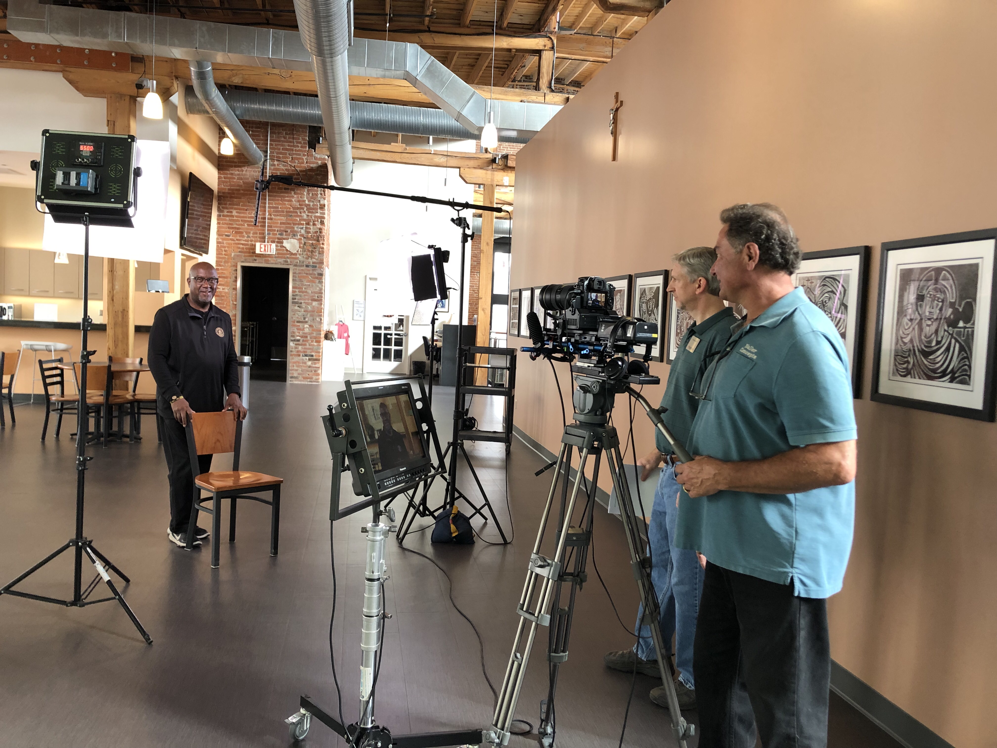
When Studio Interviews Are the Best Choice
Studio interviews are often the most efficient option when consistency and control matter most. Lighting, sound, composition, and background can all be managed carefully. The result is a clean, professional presentation that aligns well with polished brand messaging.
Studio production is especially effective for:
executive thought leadership
spokesperson videos
educational messaging
recurring content series
product explainers
formal interviews with controlled branding
green screen or custom set productions
Studio work can also reduce time lost to uncontrolled sound, shifting daylight, weather concerns, or logistical disruptions. For organizations looking for a dependable and visually refined result, studio production often offers excellent value.
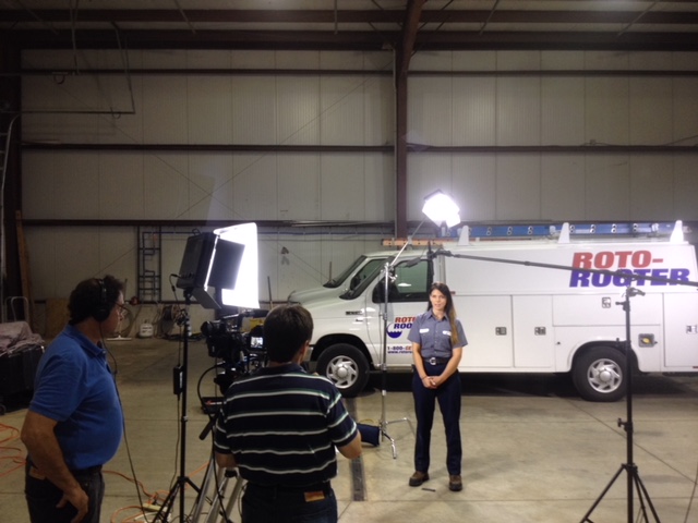
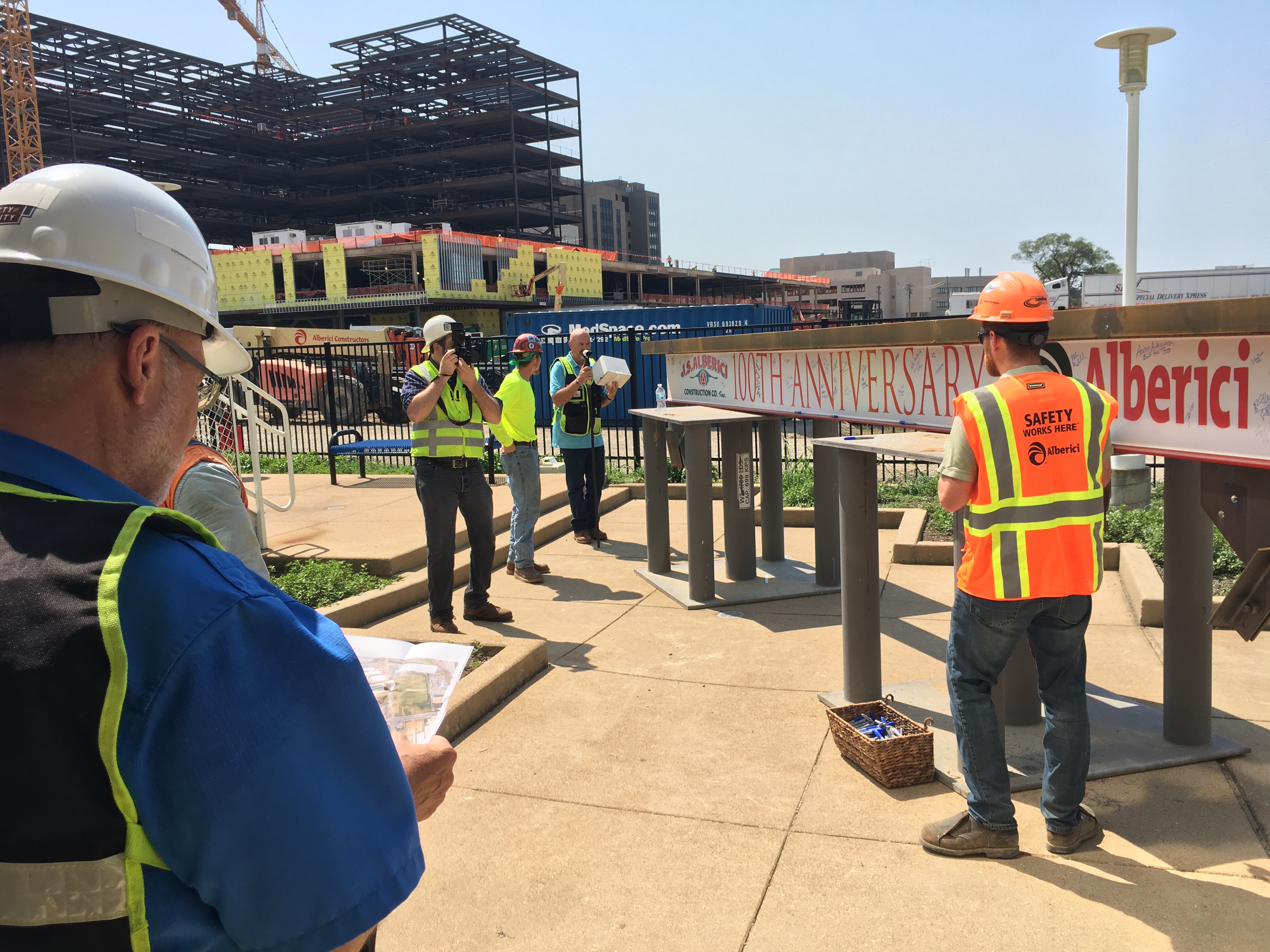
When Location Interviews Make More Sense
Location interviews bring a different kind of strength. They place the speaker in an environment that supports the message and adds authenticity. For many industries, that surrounding context is an important part of the visual story.
Location-based interviews are especially useful for:
customer testimonial videos
recruiting pieces
facility tours
industrial or manufacturing storytelling
healthcare and service environments
nonprofit and community messaging
company culture videos
project documentation
A location can help establish credibility, but only if it is handled well. Lighting, audio, framing, and background control still matter. A professional crew knows how to work in real business environments without making the result look improvised.
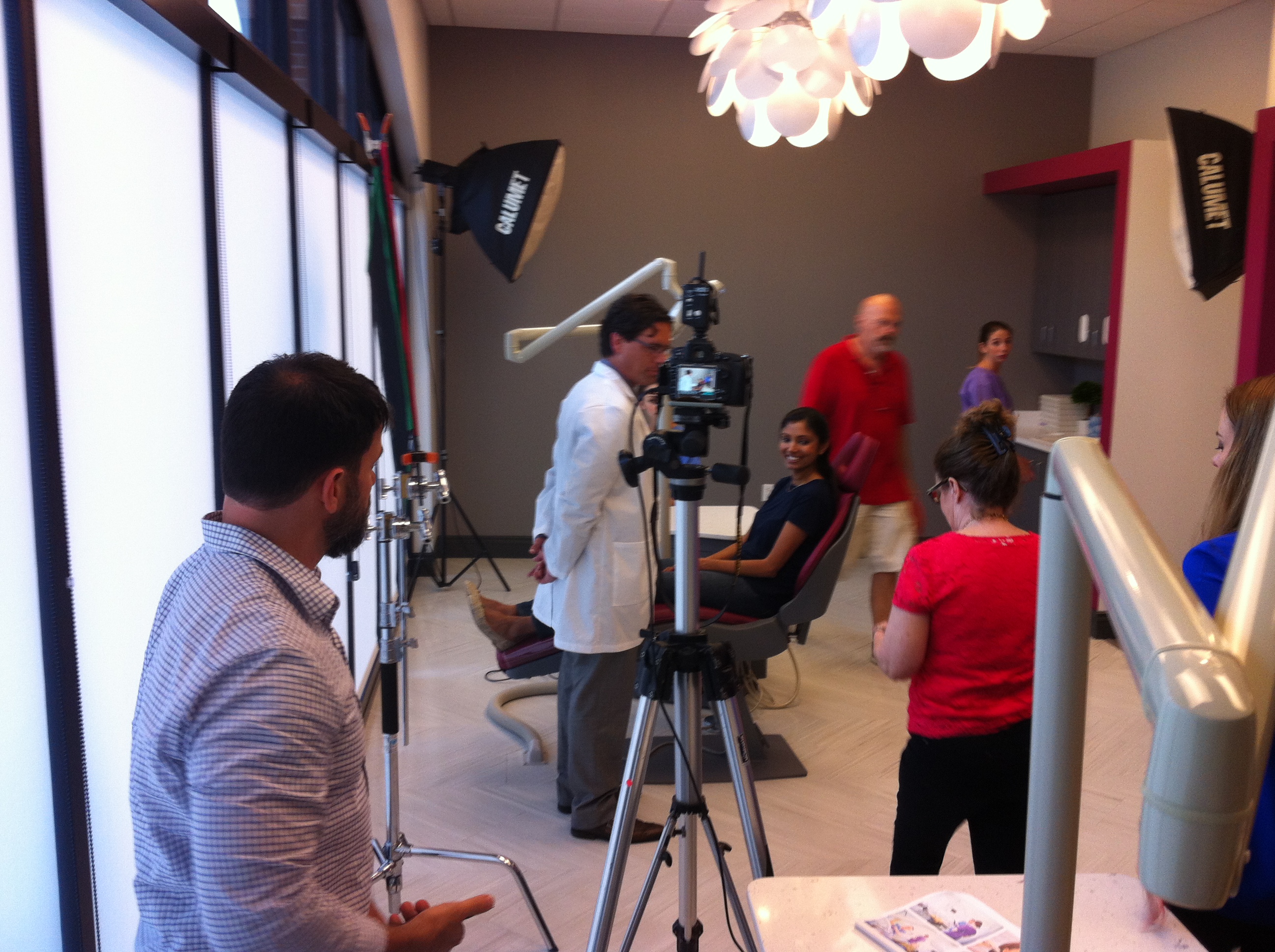
Why a Hybrid Approach Often Creates the Best Return
Many companies benefit from a production plan that uses both studio and location settings. Interviews may be filmed in a controlled studio environment, while b-roll and drone footage are captured on location. This gives the finished piece both polish and authenticity.
That combination is often ideal because it offers:
better sound and lighting control for interviews
more visual interest through environmental coverage
stronger storytelling
increased footage variety
greater flexibility in editing
more total value from one coordinated production effort
For organizations that want a refined result but still need real-world context, a hybrid production strategy is often the smartest route.
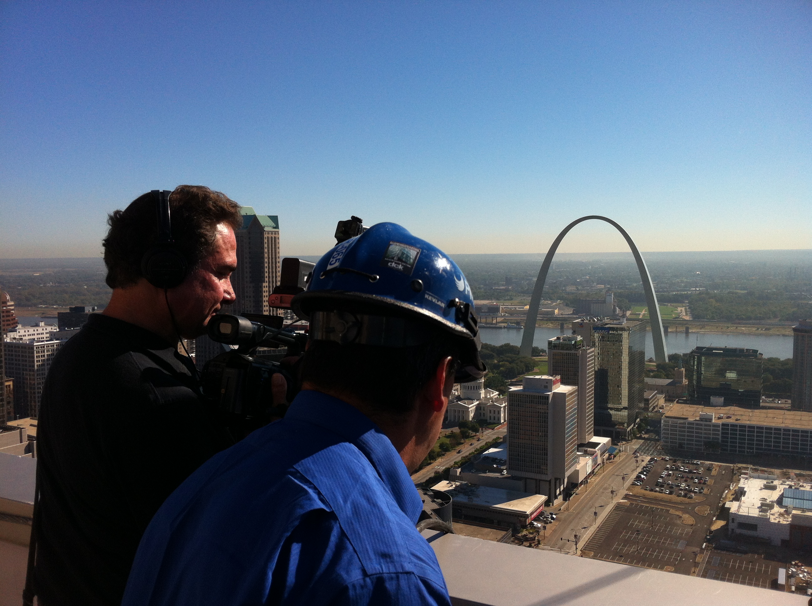
How Drone Footage Increases Value in Interview and B-Roll Production
Drone coverage can transform a standard interview and b-roll project into a more visually compelling and informative piece. For many businesses, aerial footage helps establish scale, location, infrastructure, property layout, traffic flow, operational footprint, or environmental context in a way that ground footage cannot.
Drone footage can be particularly valuable for:
commercial property and construction content
industrial and logistics operations
campuses and large facilities
tourism and destination marketing
corporate overview pieces
event coverage
agricultural and land-based businesses
municipal and infrastructure projects
Used thoughtfully, drone footage adds more than visual flair. It adds clarity. It helps the audience understand the physical environment and gives the final edit greater production value.
Indoor FPV Drones Open New Creative Options
In some cases, standard drone footage is only part of the opportunity. Specialized FPV drone systems can create immersive indoor and mixed-environment visuals that move through a space in a dynamic way. These shots can be especially effective for warehouses, manufacturing facilities, showrooms, offices, gyms, hospitality spaces, and other large interiors.
Indoor FPV drone work can help businesses show:
workflow and space utilization
customer experience paths
facility layout
energy and movement within a location
production capability
a more cinematic brand presentation
When integrated into an interview and b-roll production, FPV footage can make a project feel much more sophisticated without requiring an entirely separate large-scale shoot.
Specialized Drone Services Can Extend the Value of Production
Beyond cinematic aerials, specialized drone services can serve practical and visual purposes across many industries. Depending on the project, these services can support both marketing and operational documentation.
Specialized capabilities may include:
infrared thermal imaging
orthomosaic mapping
LiDAR applications
aerial inspection support
roof and site documentation
property visualization
land development imaging
For some organizations, this means one production partner can support not only promotional content, but also technical imaging and project documentation needs.
The Importance of Location Scouting and B-Roll Planning
Economical production also depends on choosing the right spaces and planning the right visuals before the shoot begins. Location scouting can significantly reduce wasted time, avoid technical issues, and improve the overall look of the production.
A well-considered location strategy addresses:
background quality
audio environment
lighting conditions
access and logistics
staging possibilities
power availability
best times of day for visual coverage
opportunities for supporting b-roll and drone footage
B-roll planning is equally important. Capturing random visuals wastes time and often leaves editors without the footage they actually need. Capturing specific, story-driven footage creates a final product that feels intentional and well built.
What Decision Makers Should Look for in a Production Partner
Businesses and organizations shopping for economical interview and b-roll production in St. Louis should look beyond simple pricing. The more important question is whether the crew understands how to create valuable content efficiently.
That means looking for a team that can provide:
interview direction
professional audio and lighting
studio and location flexibility
strong b-roll acquisition
drone capability
production planning
efficient post-production
content repurposing strategy
local location knowledge
A good crew protects the budget by preventing wasted time, weak footage, and avoidable production mistakes.
Making One Shoot Work Harder for Marketing
Today’s marketing teams often need content for multiple formats and platforms at once. That is why economical production should always be built with repurposing in mind. A single interview and b-roll shoot can often support:
a main website or campaign video
short social edits
vertical videos
internal communications
recruiting cutdowns
digital ad assets
still frame grabs
a future footage library
The more intentional the planning, the more return an organization can generate from one day of production.
Final Thoughts
Economical video interviews and b-roll production in St. Louis should never mean settling for generic work or underpowered production. It should mean using experience, planning, and the right tools to create strong, flexible content without waste. Interview-driven projects continue to offer one of the best returns in commercial media because they are credible, scalable, and highly adaptable. When supported by thoughtful b-roll, location strategy, and drone coverage, they become even more effective.
At St Louis Drones, we understand how to build efficient productions that still deliver the professional quality businesses and organizations need. As a full-service video and photography production corporation serving the St. Louis area since 1982, St Louis Drones has worked with many businesses, marketing firms, and creative agencies for their marketing photography and video. We are a full-service professional commercial photography and video production company with the right equipment and creative crew service experience for successful image acquisition. We offer full-service studio and location video and photography, as well as editing, post-production, and licensed drone services. St Louis Drones can customize your productions for diverse types of media requirements. Repurposing your photography and video branding to gain more traction is another specialty. We are well-versed in all file types and styles of media and accompanying software. We use the latest in Artificial Intelligence for all our media services. Our private studio lighting and visual setup is perfect for small productions and interview scenes, and our studio is large enough to incorporate props to round out your set. We support every aspect of your production, from setting up a private, custom interview studio to supplying professional sound and camera operators, as well as providing the right equipment, ensuring your next video production is seamless and successful. We are also location scouting and b-roll specialists. We can fly our specialized FPV drones indoors, and our other drone special services include infrared thermal, orthomosaics, and LiDAR.
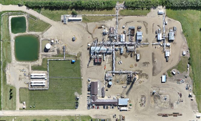
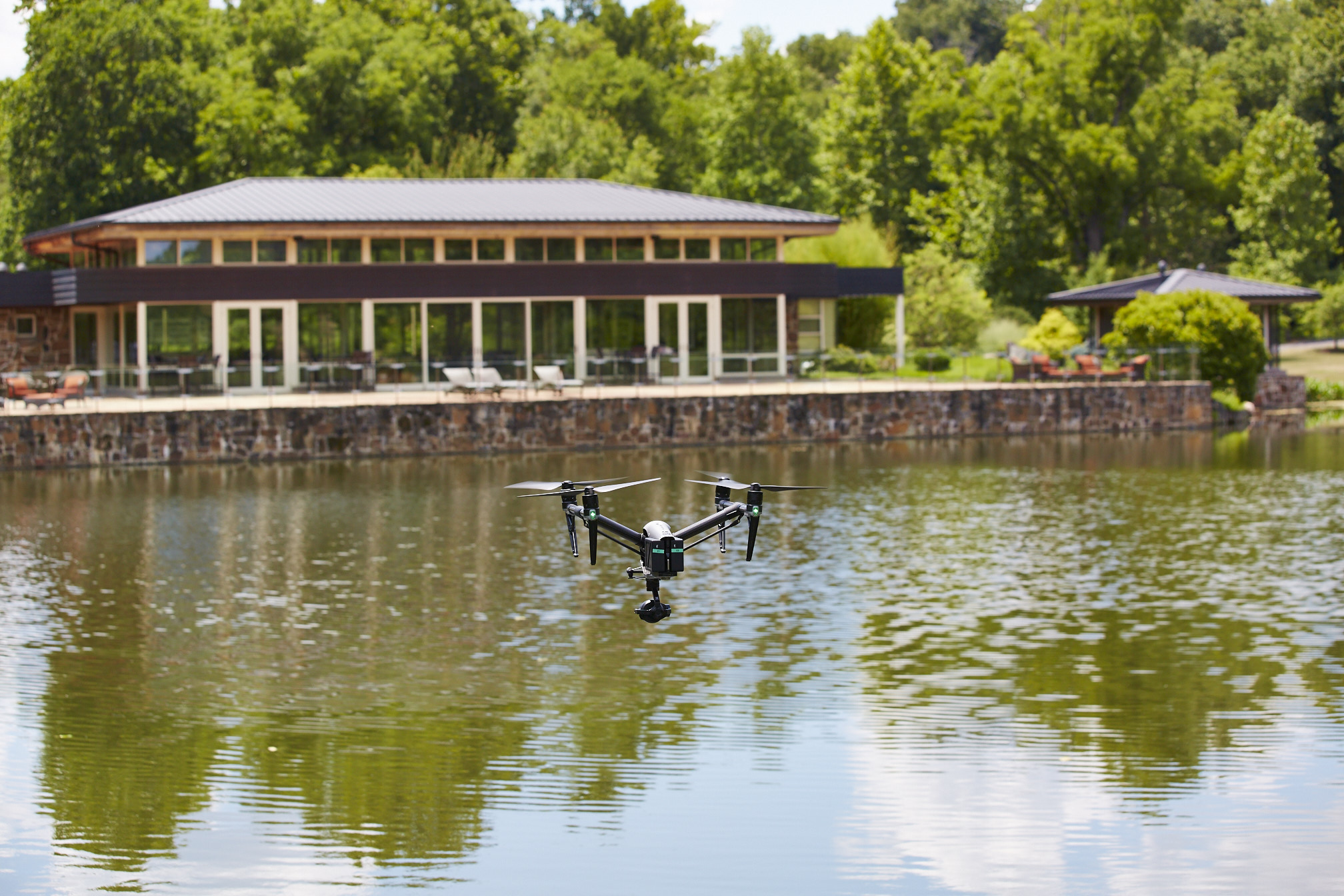
Drone technology has expanded well beyond beautiful aerial views and cinematic flyovers. For businesses and organizations in St. Louis, drones equipped with FLIR thermal imaging and LiDAR capabilities now offer practical, high-value tools for inspection, analysis, mapping, documentation, and strategic visual communication. These are not just specialty services for engineers or surveyors. They are increasingly relevant to facility managers, property owners, contractors, developers, manufacturers, utilities, municipalities, marketers, and decision makers who need better information and stronger visual assets.
When deployed correctly, FLIR thermal drones and LiDAR drones can help organizations see what standard cameras cannot show, measure what ground crews may struggle to capture efficiently, and communicate technical information with clarity. For companies that want actionable aerial intelligence as well as polished media deliverables, these technologies represent a major advantage.
Why FLIR Thermal and LiDAR Drones Matter
Traditional aerial photography and video are extremely effective for showing scale, access, property layout, architecture, and overall site conditions. But there are many business situations where visible-light imagery alone is not enough. A roof may look fine from above while still hiding trapped moisture. A site may appear straightforward from standard video while still requiring far more precise elevation and terrain data for planning or engineering purposes. Large facilities, industrial systems, construction sites, and commercial properties often demand deeper levels of analysis.
That is where FLIR thermal and LiDAR drone services become so valuable.
FLIR thermal imaging detects temperature variations across surfaces and systems. These thermal differences can indicate moisture intrusion, insulation failures, energy loss, overheating components, electrical concerns, or abnormal building behavior. LiDAR, on the other hand, uses laser pulses to generate precise three-dimensional measurements of land, structures, and surface conditions. It is especially valuable when detailed spatial understanding is needed for planning, documentation, modeling, and analysis.
Together, these tools allow organizations to collect far more meaningful aerial information than standard video or photography alone can provide.
Understanding FLIR Thermal Drone Imaging
FLIR thermal imaging is one of the most useful drone-based technologies for organizations that need to identify hidden issues quickly and efficiently across large areas. Instead of relying solely on what is visible to the eye, a FLIR-equipped drone measures heat patterns and temperature differences across roofs, walls, equipment, mechanical systems, and outdoor assets.
In commercial and industrial settings, this can be extremely useful. A thermal drone can help detect moisture beneath roof membranes where temperature retention differs from surrounding areas. It can assist in identifying building envelope inconsistencies, overloaded electrical components, uneven HVAC behavior, and heat signatures that may point to maintenance needs or system inefficiencies. For large properties or difficult-to-access surfaces, drones can gather this information far faster and with less disruption than many conventional inspection approaches.
For businesses in St. Louis, this matters because the region has a broad mix of industrial properties, healthcare campuses, educational institutions, office buildings, logistics sites, manufacturing operations, utility infrastructure, and aging commercial buildings. Many of these facilities can benefit from faster, more comprehensive temperature-based aerial reviews.
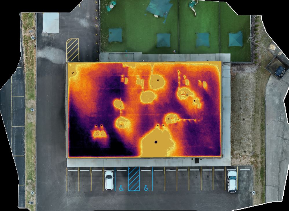
FLIR Thermal Drones for Roof Inspections
One of the most common and valuable uses for FLIR drone imaging is commercial roof inspection. Large flat roofs often present significant challenges for visual-only assessment. Problems beneath the surface may not be obvious until damage becomes more severe or more expensive to address. Moisture trapped within insulation or membrane systems can create thermal anomalies that show up under the right conditions during a properly planned FLIR inspection flight.
This does not mean thermal drones replace all other inspection methods, but they can provide highly useful guidance for identifying suspect areas, prioritizing follow-up evaluation, and documenting conditions over time. For property managers, facility operators, and building owners, that can mean better planning and more informed maintenance decisions.
The key is not simply owning a thermal camera. The real value comes from understanding when to fly, how environmental conditions affect readings, how building materials behave thermally, and how to separate meaningful anomalies from misleading surface effects. Experienced drone operation and interpretation are essential.
Industrial and Facility Applications for FLIR Thermal Drones
Thermal drones are also highly useful across industrial and institutional environments. Large manufacturing properties, utility assets, warehouses, mechanical systems, and infrastructure sites often include areas that are difficult, time-consuming, or costly to assess manually. Aerial thermal imaging can help teams look for unusual heat signatures, monitor asset conditions, and visualize problem areas in a way that standard photography cannot.
This can be useful for maintenance planning, facilities documentation, pre-project evaluation, or communication with internal stakeholders and outside consultants. In many organizations, one of the greatest values of thermal imaging is that it helps people clearly see the problem. It becomes much easier to explain a roof concern, a heat irregularity, or a suspect system condition when the issue can be shown visually rather than described only in text.
For organizations that need to support decisions with clear documentation, FLIR drone imagery can become an important business tool.
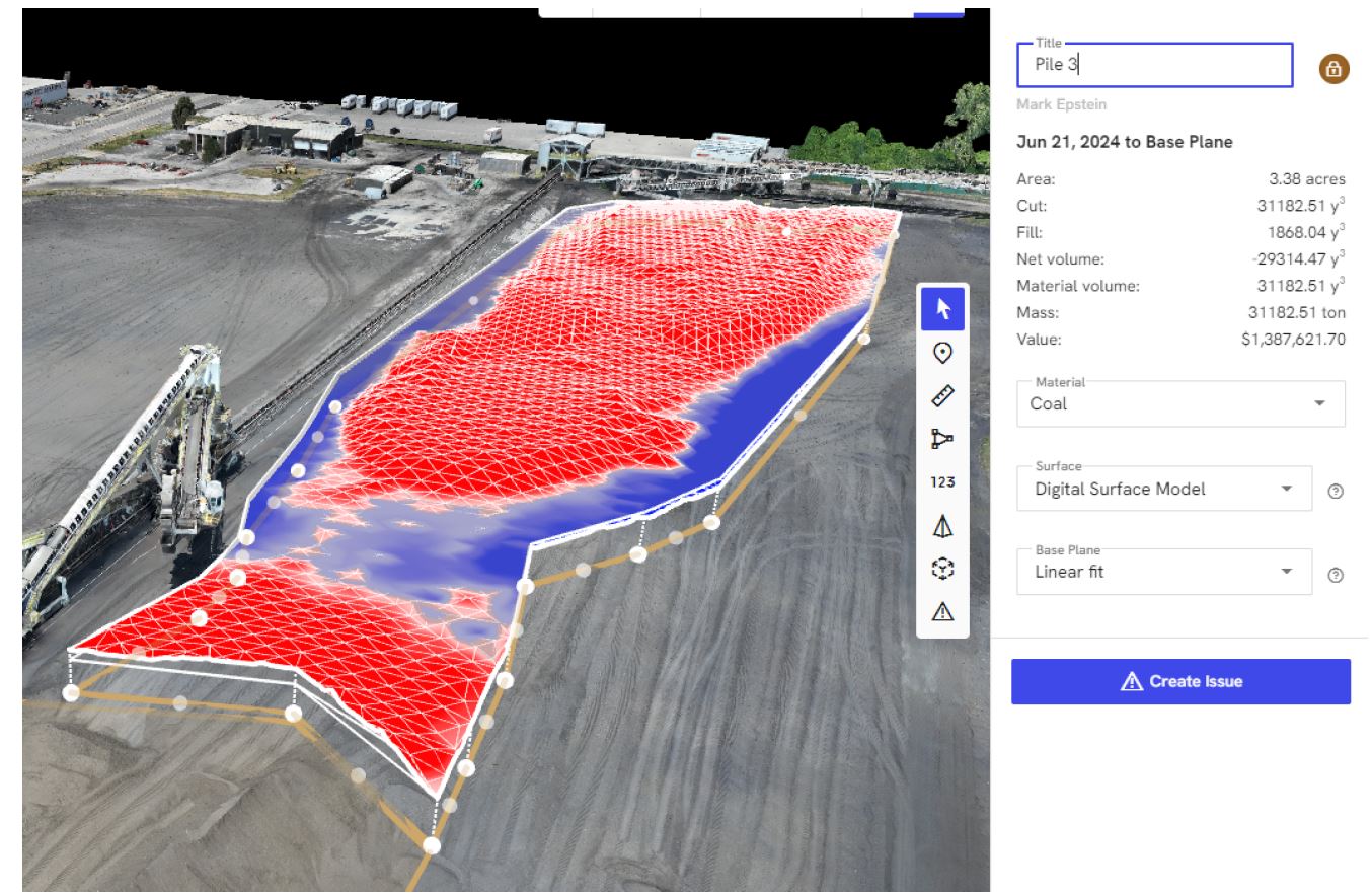
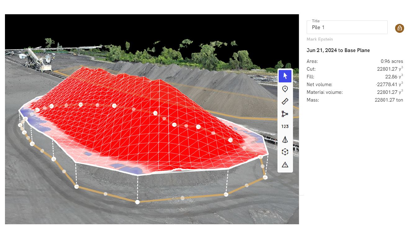
What LiDAR Drones Bring to the Table
LiDAR offers a different but equally powerful set of advantages. While thermal imaging focuses on heat patterns, LiDAR focuses on spatial precision. A LiDAR drone emits laser pulses and measures the return of those pulses to generate detailed point cloud data and highly accurate three-dimensional representations of land and structures.
This makes LiDAR particularly valuable for projects where precision mapping, terrain understanding, elevation data, or spatial measurement are critical. It is widely useful in construction, development, engineering support, infrastructure assessment, site planning, corridor mapping, and large-property documentation.
Unlike standard aerial photography, which relies on visible surface imagery, LiDAR captures measurable geometry. That allows businesses and organizations to move beyond general impressions and into usable spatial intelligence. In some environments, especially where vegetation, uneven terrain, or complex surface relationships are involved, LiDAR can provide clearer and more dependable data than methods based entirely on standard imagery.
LiDAR Drone Uses in St. Louis
In the St. Louis area, LiDAR drone services can be valuable for land developers, civil engineering teams, construction managers, municipalities, industrial property operators, utilities, and organizations managing large or changing sites. A construction team may use LiDAR to better understand grading progress or site conditions. A developer may want more accurate terrain context before design work proceeds. Municipal or infrastructure projects may require efficient mapping of corridors, easements, drainage paths, or large public properties.
LiDAR can also support documentation over time. Repeated flights can help teams compare site conditions, track changes, and maintain a visual-spatial record of project evolution. This can be useful not only for operations and engineering but also for executive reporting, stakeholder presentations, and case-study development.
That crossover value is important. The most successful drone projects often serve more than one purpose. The data may support analysis, while the visuals support communication, marketing, or planning.
FLIR Thermal and LiDAR Are Strategic Business Assets
It is easy to think of FLIR thermal and LiDAR drones as niche technical tools, but that view is too limited. For many businesses, these services are strategic assets because they combine operational value with communication value.
A thermal roof survey can support maintenance planning while also providing compelling visuals for insurance discussions, internal reporting, or capital improvement presentations. A LiDAR-supported site documentation project can help engineers and planners while also supplying visual material for project promotion, investor presentations, public communication, or marketing content.
This matters because modern organizations increasingly need content that is informative, credible, and visually persuasive. Technical drone services can help bridge the gap between raw analysis and polished storytelling. When handled by an experienced production team, the resulting deliverables can support multiple departments at once, from operations and engineering to sales and marketing.
Why Experience Matters in Advanced Drone Services
FLIR thermal and LiDAR drone work are not commodity services. They require more than pilot skill. They require planning, site awareness, technical understanding, equipment knowledge, safety discipline, and a clear understanding of how the final deliverables will be used. Thermal imaging can be affected by time of day, weather, reflections, surface materials, and ambient conditions. LiDAR capture requires careful mission planning, data handling, and an understanding of the intended output.
Just as important, clients often need more than raw files. They may need edited visuals, still images, annotation-ready frames, presentation graphics, processed media, or integrated production assets that can be used across multiple platforms. A provider who understands both the technical capture and the communication side of the project can deliver much more value than one who simply flies and hands off data.
For decision makers, that means the right drone partner should understand not only the technology, but also the business purpose behind the flight.
Combining Technical Capture with Professional Media Production
One of the major advantages of working with a full-service production company for FLIR thermal and LiDAR drone projects is the ability to transform specialized capture into usable business media. Many organizations do not just need inspection imagery or mapping visuals. They need deliverables that work in presentations, websites, proposals, project updates, sales materials, training pieces, recruiting campaigns, and stakeholder communications.
That requires more than technical acquisition. It requires editing, post-production, visual consistency, formatting flexibility, and an understanding of how to shape technical material into clear communication. When drone services are backed by an experienced photography and video production team, the results are more versatile and more valuable.
A single project can often yield technical documentation, branded visuals, aerial stills, edited case-study videos, presentation support graphics, and content for multiple communication channels. That type of repurposing is exactly where organizations can gain more traction from one well-planned production effort.
The Future of Drone Services in St. Louis
As businesses continue to seek faster assessments, clearer documentation, safer data collection methods, and better visual content, the role of drones in commercial production will only grow. In St. Louis, where businesses operate across construction, manufacturing, healthcare, logistics, infrastructure, education, utilities, real estate, and corporate services, FLIR thermal and LiDAR drones offer practical solutions for both technical and communication needs.
The organizations that benefit most are often the ones that think beyond the flight itself. They view drone services not just as an aerial add-on, but as part of a broader strategy for better information, better media, and better decision-making.
Experienced FLIR Thermal and LiDAR Drone Services from St Louis Drones
At St Louis Drones, we understand that advanced drone work must do more than capture images from above. It must produce useful, professional results that help businesses and organizations solve problems, communicate clearly, and present their capabilities with confidence. As an experienced full-service professional commercial photography and video production company, St Louis Drones has the right equipment and creative crew service experience for successful image acquisition.
We offer full-service studio and location video and photography, as well as editing, post-production, and licensed drone services. St Louis Drones can customize your productions for diverse types of media requirements. Repurposing your photography and video branding to gain more traction is another specialty. We are well-versed in all file types and styles of media and accompanying software. We use the latest in Artificial Intelligence for all our media services.
Our private studio lighting and visual setup is perfect for small productions and interview scenes, and our studio is large enough to incorporate props to round out your set. We support every aspect of your production, from setting up a private, custom interview studio to supplying professional sound and camera operators, as well as providing the right equipment, ensuring your next video production is seamless and successful. We can fly our specialized drones indoors. As a full-service video and photography production corporation, since 1982, St Louis Drones has worked with many businesses, marketing firms, and creative agencies in the St. Louis area for their marketing photography and video.
For organizations exploring drones for FLIR thermal and LiDAR in St. Louis, experience, production quality, and strategic thinking all matter. St Louis Drones brings those strengths together to help clients capture more than footage. We help them capture meaningful information and turn it into media that works.
As experienced producers in the competitive St. Louis market, we recognize that the demand for high-quality video content is insatiable. Marketing directors and business leaders are under constant pressure to deliver visually arresting narratives across multiple platforms, often with tightening budgets.
In corporate, industrial, and commercial video production, the narrative backbone—the interviews or scripted messaging—is often called “A-Roll.” But the soul of the production, the elements that provide context, visual engagement, and cinematic production value, is the “B-Roll.”
Historically, acquiring high-end, dynamic B-Roll—especially aerials or sweeping motion shots—was distinctively not cost-efficient. It required helicopters, expensive jibs, extensive track systems, and large, specialized crews. Today, professional drone technology has democratized this cinematic quality, but only when deployed by experienced operators.
This article addresses how utilizing specialized, local St. Louis drone crews for B-Roll acquisition is no longer just a stylistic choice—it is a strategic, cost-efficient business decision.
The New Economics of Cinematic Acquisition
For decision-makers, “cost-efficiency” doesn’t mean “cheap”; it means maximizing the return on every production dollar spent.
A professional drone team replaces tons of legacy equipment. Where a sweeping shot of a manufacturing facility once required renting a boom lift or a piloted aircraft, a two-person certified drone crew can capture the same shot—often with greater stability and lower altitudes—in a fraction of the time and cost.
Furthermore, the speed of acquisition is unparalleled. A skilled drone operator and visual observer can relocate rapidly across a corporate campus or industrial site. We can capture establishing shots of the exterior, dynamic tracking shots of fleet vehicles, and revealing architectural movements all within a single battery cycle. This speed translates directly to reduced crew hours on site and more footage in the can.
Beyond the Sky: Specialized Indoor Applications
A common misconception among our commercial clients is that drones are solely an outdoor tool. This is outdated thinking.
Modern, specialized drones—often referred to as “cinewhoops” or guarded-propeller aircraft—have revolutionized indoor B-Roll. We can now fly cameras safely through active warehouses, along assembly lines, through real estate developments, and inside large office atriums.
This capability allows for seamless transitions from exterior grandeur to interior detail in a single, fluid movement. It provides a “fly-on-the-wall” perspective that standard ground cameras simply cannot achieve, adding immense production value to facility tours or operational overview videos without disrupting the workflow on the ground.
The Importance of the “Local” Crew
When budgeting for a production in the St. Louis region, utilizing a local, experienced drone team immediately eliminates significant line items: travel costs, lodging, and per diems for out-of-town specialists.
More importantly, local knowledge is an operational asset. As long-standing St. Louis producers, we understand the specific airspace regulations overlapping the metro area, from Lambert International to regional airports. We know the lighting conditions at specific times of day for key local landmarks and industrial zones. This local expertise ensures faster permitting, safer flight planning, and more efficient shoot days.
The Professional Difference: Why Experience Matters
While the technology is accessible, high-level B-Roll acquisition is an art form requiring professional discipline. It is not merely about flying a drone; it is about understanding composition, camera movement, lens choices, and how a specific shot will edit into the final sequence.
An experienced producer knows that B-Roll must serve the story, not just look pretty. We approach drone cinematography with the same rigor as traditional camera work, ensuring the footage we capture integrates seamlessly with ground-based cameras in terms of color science, frame rate, and resolution.
St Louis Drones: Your Full-Service Production Partner
While specialized drone B-Roll is a powerful tool for efficiency, it is usually just one component of a successful marketing campaign. You need a partner who understands the entire production ecosystem.
St Louis Drones is more than just an aerial provider. We are a full-service professional commercial photography and video production company with deep roots in the industry, serving businesses, marketing firms, and creative agencies in the area since 1982. We possess the right equipment, creative crew service experience, and logistical know-how for successful image acquisition across any terrain.
We support every aspect of your production to ensure a seamless experience. Our capabilities extend far beyond aerials:
Full-Service Studio and Location Production: Whether on-site at your facility or in our controlled environment, we handle all aspects of video and photography.
Private Studio Facilities: Our private studio offers professional lighting and visual setups perfect for small productions and interview scenes. The space is large enough to incorporate props to round out your set, providing a controlled environment for pristine audio and video capture.
Comprehensive Post-Production: We offer end-to-end editing and post-production services. We are well-versed in all file types, media styles, and accompanying professional software.
AI Integration: We utilize the latest in Artificial Intelligence tools throughout our media services to enhance workflow efficiency, footage culling, and post-production processes.
Content Repurposing: A successful shoot shouldn’t just yield one video. A specialty of ours is repurposing your high-quality photography and video branding across diverse media requirements to gain more traction on social media, websites, and internal communications.
From supplying professional sound and camera operators for a ground shoot to flying specialized drones indoors for unique perspectives, St Louis Drones has the experience and technology to execute your vision cost-effectively.
If your team manages aggregates, coal, scrap, salt, mulch, grain, or any other bulk material, you already know the uncomfortable truth: stockpiles are expensive to measure poorly.
Inaccurate volumes distort inventory valuation, create production planning headaches, trigger procurement mistakes, and invite disputes between operations, finance, and vendors. And traditional measurement methods—survey crews on foot, loader “bucket counts,” or sporadic ground scans—often cost too much time, expose people to unnecessary risk, or simply can’t keep up with how quickly inventory changes.
That’s where LiDAR-equipped drones earn their keep.
This article breaks down (in practical, decision-maker terms) how LiDAR drones work for stockpile reporting, why they’re often more reliable than photogrammetry in tough conditions, what you should demand from a deliverable, and how to deploy drone-based reporting as a repeatable business process—not a one-off experiment.
The Real Problem With Stockpiles: Change, Complexity, and Confidence
Stockpiles don’t behave like neat geometric shapes. They’re irregular, constantly changing, and often located in messy environments:
Dozers and loaders reshape piles daily
Moisture changes density and surface texture
Piles merge, split, and spread into berms
Windrows and uneven terrain distort baselines
Conveyor drops create steep slopes and voids
Operations continue while measurement is needed
Decision makers typically care about three outcomes:
Speed: How quickly can you measure and report without disrupting operations?
Accuracy: Can you trust the number enough to base financial and operational decisions on it?
Repeatability: Will the method produce consistent results month after month, site after site?
LiDAR drones are designed to hit all three.
What LiDAR Is and Why It Matters for Stockpiles
LiDAR (Light Detection and Ranging) measures distance by emitting laser pulses and timing how long they take to return. Each pulse becomes a point in a 3D “point cloud.” Multiply that by hundreds of thousands to millions of points per flight, and you get a highly detailed surface model.
For stockpile reporting, this translates into:
Clear 3D pile definition
Accurate pile-to-ground separation
Strong performance in low-texture or low-contrast environments
Better results in vegetation-adjacent areas or cluttered sites
Reliable modeling when imagery struggles
LiDAR vs Photogrammetry: A Useful Way to Think About It
Photogrammetry builds 3D models from overlapping images. It can be excellent—especially in ideal lighting, with textured surfaces, and well-defined edges.
But in stockpile environments, you often face conditions where image-based reconstruction becomes fragile:
uniform material (dark coal, wet sand, uniform salt)
harsh shadows from conveyors or high walls
reflective or glittery surfaces
dusty haze or low light
LiDAR doesn’t “guess” surfaces from pixels. It measures physical distance directly. That’s why many high-volume sites use LiDAR when they need confidence and consistency across seasons and site conditions.
How LiDAR Drone Stockpile Reporting Works: A Clean, Repeatable Workflow
A professional LiDAR stockpile workflow should look like a production pipeline—not an improvisation.
1) Site Goals and Reporting Definitions (Before the Drone Takes Off)
This step is where many projects succeed or fail. The best reporting starts by agreeing on:
Which piles count (and how they’re named)
Where pile boundaries are drawn
How the base surface is defined (ground plane, pad, or reference model)
You’re not buying “a drone flight.” You’re buying a measurement system.
2) Flight Planning for Clean Coverage
A LiDAR stockpile flight is planned around:
consistent altitude and overlap
safe standoff from structures and operations
coverage angles that reduce occlusions (important near conveyors or tall piles)
timing to minimize traffic conflicts and maximize visibility
3) Control and Georeferencing (The “Trust Layer”)
Accuracy depends on how well the data is tied to reality. Depending on your required precision, a workflow may use:
RTK/PPK positioning
ground control / checkpoints
existing site benchmarks
A serious provider should be able to explain: how the data is referenced, how it’s verified, and what the expected error range is.
4) Processing: From Raw Point Cloud to Usable Volumes
After the flight, LiDAR data is processed into:
classified point clouds (ground vs non-ground)
digital terrain models (DTM)
digital surface models (DSM)
pile segmentation surfaces
Then volumes are computed using a defined base surface and boundary polygon for each pile.
5) Reporting: Executive-Friendly and Audit-Friendly
A professional stockpile report should be readable by operations and defensible for finance.
Expect things like:
pile ID / name
measured volume (with units)
date/time of capture
maps or annotated visuals showing boundaries
change over time (optional but powerful)
data exports for ERP/accounting integration
Why LiDAR Makes Stockpile Reporting Easier
Fewer Re-Measurements and Less Second-Guessing
The biggest hidden cost in stockpile measurement isn’t the first number—it’s the argument that follows.
LiDAR helps reduce:
“That number feels off…”
“We measured it differently last month…”
“The pile footprint changed…”
“We can’t reproduce that method…”
Better data reduces internal friction.
Less Disruption to Operations
You’re not shutting down loaders or moving people into hazardous zones for hours. With drone capture, you can often document the site quickly, then do the heavy lifting in processing.
A Repeatable Cadence That Fits Business Rhythms
Most organizations don’t need heroic one-time surveys. They need reliable measurement on a schedule:
month-end close
quarterly inventory
post-storm washout assessment
pre/post shipment validation
dispute resolution documentation
LiDAR drone workflows scale naturally into repeatable reporting.
Where LiDAR Shines in the Real World
LiDAR tends to outperform (or simplify) reporting when you have:
multi-site standardization needs (same process everywhere)
What to Ask a Provider Before You Buy Anything
If you’re evaluating LiDAR stockpile services, these questions separate professionals from hobbyists:
How do you establish accuracy and verify it? Look for checkpoints, QA notes, and an explanation you can pass to finance.
How do you define pile boundaries and base surfaces? If the method changes each time, your trendline becomes meaningless.
What deliverables do you provide—and in what formats? Ask for sample reports, CAD exports, and a volume spreadsheet template.
What’s your workflow for repeat monthly reporting? You want a process, not a one-off.
How do you handle safety and operational coordination? A professional team works around your site, not against it.
Turning LiDAR Stockpile Reporting Into a Strategic Advantage
Once you have a repeatable LiDAR reporting pipeline, you can start doing more than just measuring piles.
You can:
monitor shrinkage and loss over time
validate vendor quantities more confidently
optimize site layout and material flow
document storm damage and erosion
create 3D site models for planning and marketing
produce visuals that support proposals, audits, and stakeholder updates
The same dataset can serve operations + finance + leadership + marketing when it’s captured correctly.
Why St. Louis Drones Is Built for This Work
At St. Louis Drones, we approach LiDAR stockpile reporting like we approach any high-stakes production: with planning, repeatability, and deliverables that hold up under scrutiny.
We’re a full-service professional commercial photography and video production company with the right equipment and experienced creative crew for successful image acquisition. We provide full-service studio and location video and photography, plus editing and post-production, and we operate with licensed drone professionals. We customize productions for diverse media requirements, and we specialize in repurposing photography and video branding to help your content travel farther and work harder across platforms.
We’re well-versed in all file types, media styles, and the software ecosystems businesses and agencies rely on. We also use the latest Artificial Intelligence tools across our media services—supporting smarter workflows, faster turnarounds, and scalable production pipelines.
Need indoor capture? We can fly specialized drones indoors when a project requires tight spaces, complex environments, or controlled conditions.
And we’re not new to serving demanding clients. As a full-service video and photography production corporation since 1982, St. Louis Drones has worked with many businesses, marketing firms, and creative agencies across the St. Louis area—bringing the same production discipline to industrial measurement, corporate marketing, and everything in between.
If your organization needs stockpile reporting that’s easier to run, faster to deliver, and more reliable to trust, LiDAR drones can turn a chronic problem into a clean, repeatable process—and we can help you implement it end-to-end.
Every facilities leader and marketing decision maker has seen it: a “small” roof leak becomes mold remediation, a minor electrical hot spot becomes downtime, or a hidden moisture pocket turns into a full replacement. The common thread is timing. When you detect heat loss, moisture intrusion, or electrical anomalies early—before they show up as visible damage—you dramatically reduce repair scope, disruption, and cost.
That’s where infrared (thermal) drone inspections shine. They let you scan large, complex assets quickly, safely, and repeatably, producing visual evidence you can act on (and share internally) while problems are still in the “maintenance” category—not the “emergency” category.
What infrared drone detection actually reveals (and what it doesn’t)
Thermal imaging doesn’t “see water” or “see electricity.” It measures surface temperature differences and maps them to color values. Those differences can indicate underlying conditions such as:
Moisture intrusion (wet insulation or saturated roof materials retain heat and cool differently than dry areas)
Heat loss (missing insulation, air leakage, thermal bridging)
Electrical resistance (loose connections and overloaded components often present as localized hot spots)
Mechanical stress (bearings, motors, and equipment under abnormal load can show elevated temperatures)
Thermal is powerful, but it’s not magic. The best outcomes come from pairing thermal capture with proper conditions, correct calibration, and an experienced interpretation workflow—then validating with targeted ground truth where needed.
Why drones make infrared more cost-effective than traditional methods
Infrared cameras have been used for years, but drones change the economics and practicality:
1) Scale without scaffolding
Large roofs, façades, and multi-building campuses can be surveyed without lifts, ladders, or risky rooftop foot traffic.
2) Faster detection = faster decisions
You can move from “We think something’s wrong” to “Here’s the exact location and severity” in a single inspection cycle.
3) Repeatable documentation
Because drone flights are structured and georeferenced, you can build a baseline and track change over time—perfect for budgeting, warranty discussions, and vendor accountability.
4) Safer for teams and sites
Reduced exposure to heights, fragile roofs, and hazardous areas means fewer safety risks and fewer operational disruptions.
High-ROI applications for early infrared detection
Roofs and building envelopes
Infrared drone scans are especially effective for:
Flat and low-slope commercial roofs
Roof sections with a history of leakage
Recently repaired areas (quality verification)
Large facilities where manual inspection is slow and inconsistent
What you get: a prioritized map of suspected moisture zones or insulation anomalies so you can repair surgically, not wholesale.
Electrical systems and solar arrays
With the right safety constraints and coordination, thermal inspections can flag:
Hot connectors or imbalanced loads
Inverter-related heating patterns
Solar module hot spots indicating underperformance or failure
What you get: early warnings that can reduce downtime risk and improve maintenance planning.
HVAC and mechanical equipment
Thermal can highlight:
Abnormal motor temperatures
Heat exchange inefficiencies
Duct leakage patterns at the building envelope level
What you get: evidence to justify preventive maintenance—before energy bills and comfort complaints pile up.
The conditions that make (or break) a thermal drone inspection
Thermal results are only as good as the environment and method. A professional workflow accounts for:
Temperature differential (ΔT): You need enough contrast between inside/outside or between wet/dry materials to make anomalies readable.
Timing: Many roof moisture scans perform best after solar loading and during cooling cycles (conditions vary by material and season).
Wind and weather: Wind can mask heat signatures; rain can distort moisture interpretation; reflective surfaces can create false readings.
Emissivity and reflectivity: Shiny metals, glass, and some roof membranes can reflect heat sources and mislead interpretation unless handled correctly.
A credible provider will talk about these constraints up front—because correct planning is what turns thermal from “cool imagery” into defensible insight.
What decision makers should demand as deliverables
If your goal is to reduce repair costs and justify maintenance budgets, insist on deliverables that drive action:
Annotated thermal + visible images (side-by-side or picture-in-picture) so non-technical stakeholders can understand the finding
Location context (roof plan references, elevation context, or map overlays)
Severity prioritization (what to fix now vs monitor)
Clear recommendations for verification steps (core sample locations, moisture meter checks, electrician follow-up, etc.)
Versioned reporting so you can compare baseline vs post-repair scans
This turns the inspection into a decision tool, not just a media asset.
Where AI helps—and where it must be controlled
Modern production workflows increasingly use AI to:
Speed sorting and clustering of anomalies
Improve reporting consistency
Track change across repeated inspections
Enhance deliverable packaging for stakeholders (summaries, captions, structured callouts)
But AI should support expert review—not replace it. The right approach is human-led interpretation with AI-assisted workflow acceleration, plus transparent notes on assumptions and limitations.
A practical ROI frame you can use internally
Infrared drone detection tends to pay off when it prevents one of these:
A roof leak that becomes interior damage and business interruption
An electrical issue that escalates into equipment failure or downtime
A small insulation/air leak problem that inflates energy costs over seasons
A maintenance project that becomes larger because the problem area wasn’t precisely identified
A useful way to explain ROI is: “We’re buying certainty early.” Certainty reduces waste—wasted labor, wasted materials, wasted time, and wasted disruption.
A simple readiness checklist before you schedule
Do you have an asset map / roof plan or site drawings?
Are there known problem zones or prior repairs to verify?
What outcome matters most: moisture detection, heat loss, electrical risk, or documentation?
Who will receive the report—and what format helps them act fast?
If you can answer those four, your inspection can be scoped for maximum value.
Why St Louis Drones is built for this kind of work
St Louis Drones is a full-service professional commercial photography and video production company with the right equipment and creative crew service experience for successful image acquisition. We offer full-service studio and location video and photography, plus editing, post-production, and licensed drone pilots. St Louis Drones can customize your productions for diverse media requirements, and repurposing your photography and video branding to gain more traction is a specialty. We’re well-versed in all file types, media styles, and the accompanying software, and we use the latest Artificial Intelligence across our media services. Our private studio lighting and visual setup is perfect for small productions and interview scenes, and our studio is large enough to incorporate props to round out your set. We support every aspect of production—from building a private, custom interview studio to supplying professional sound and camera operators and the right equipment—ensuring your next video production is seamless and successful. We can also fly specialized drones indoors. And as a full-service video and photography production corporation serving the St. Louis area since 1982, we’ve worked with many businesses, marketing firms, and creative agencies on marketing photography and video that performs.