Tag Archives: artificial-intelligence

Reveal Hidden Roof Moisture with FLIR Thermal Infrared Drone Services

Roof leaks rarely begin where they’re first discovered. Long before water stains appear inside a building, moisture may already be trapped beneath the roofing membrane, quietly saturating insulation, reducing energy efficiency, and accelerating the deterioration of valuable roofing systems. By the time interior damage becomes visible, repairs are often far more extensive and costly than they would have been if the problem had been detected early.

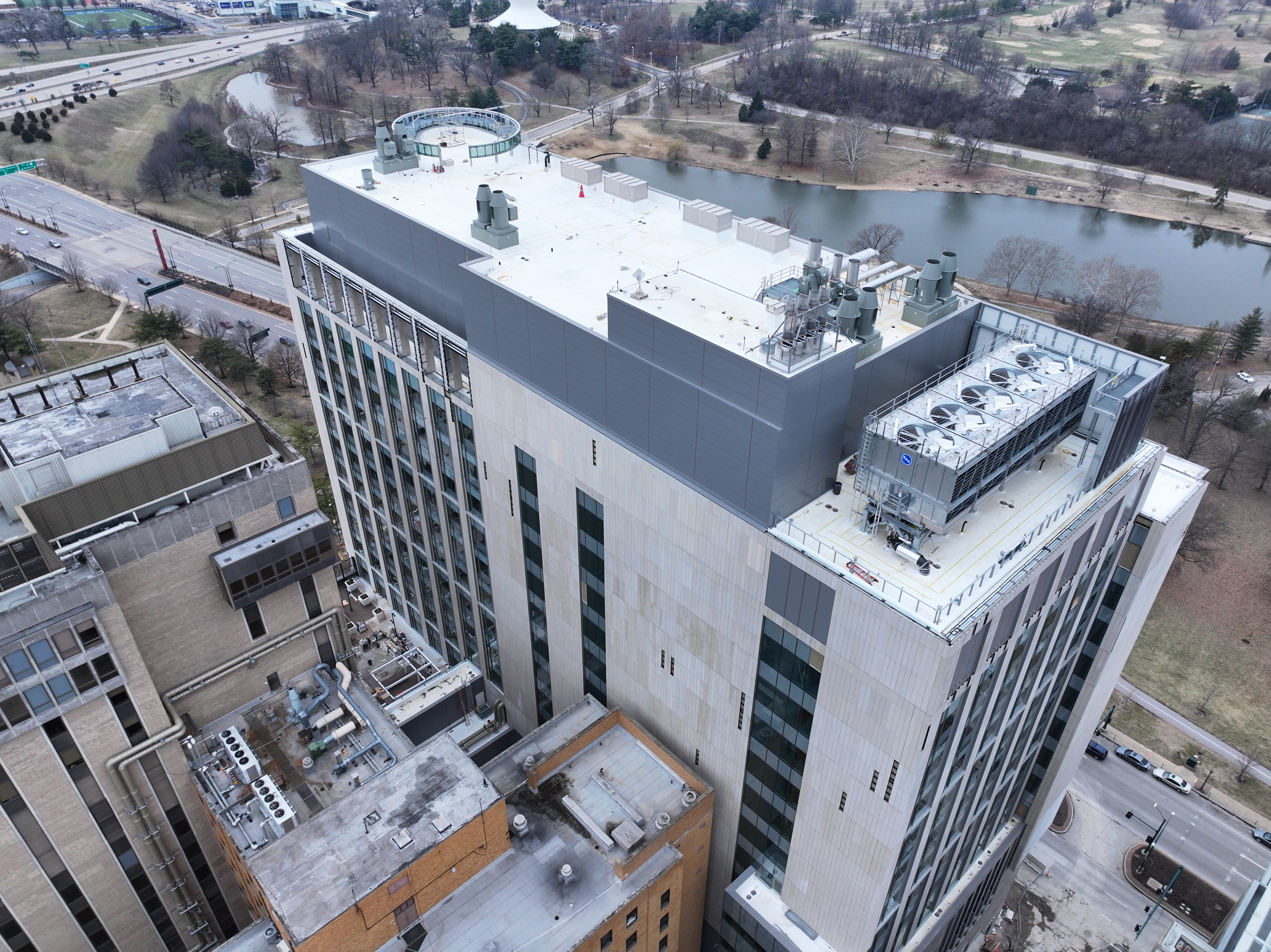
At St Louis Drones, we help facility managers, property owners, engineers, architects, and commercial building professionals identify hidden roofing issues before they become expensive emergencies. Our advanced FLIR thermal infrared drone inspections combine radiometric thermal imaging, high-resolution aerial photography, and precision mapping to deliver objective, data-driven information about the health of your roofing assets.

Rather than reacting to leaks after damage occurs, organizations can use thermal drone inspections to proactively monitor roof conditions, prioritize maintenance, and make informed decisions that extend the life of their buildings.

Why Hidden Roof Moisture Is So Difficult to Detect

Many commercial roofing systems conceal moisture beneath membranes or insulation where it cannot be identified during a traditional visual inspection. Water often travels away from the original point of entry, making the actual source of the problem difficult to locate.
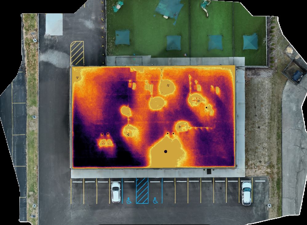
Hidden moisture can result from:

  • Aging roofing systems
  • Storm or hail damage
  • Failed flashing
  • Roof penetrations around HVAC equipment
  • Mechanical damage
  • Poor drainage
  • Expansion joint failures
  • Previous repair deficiencies

Without advanced diagnostic technology, these conditions often remain unnoticed until interior leaks or structural damage occur.

How FLIR Thermal Infrared Drone Inspections Work

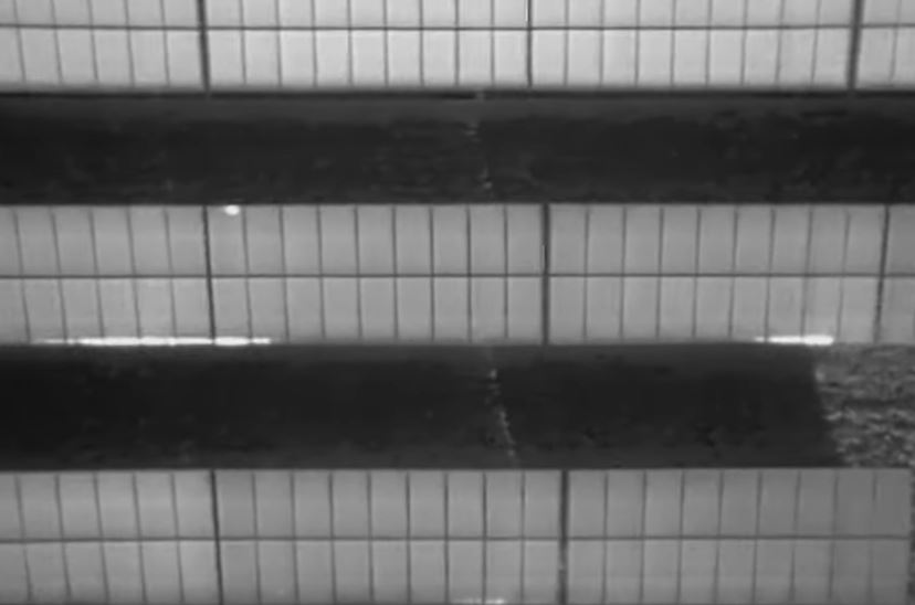
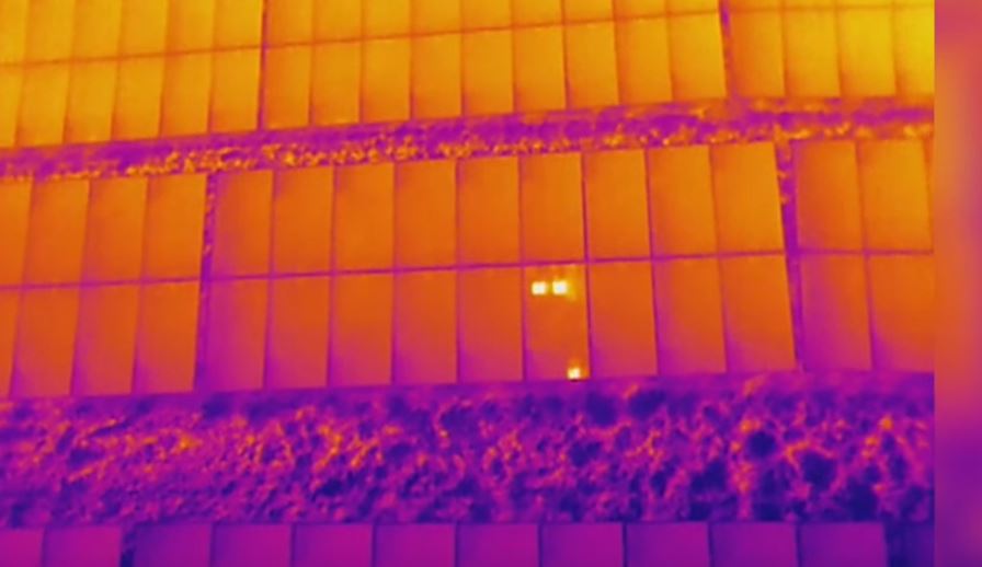
Thermal imaging detects temperature differences that are invisible to the human eye.

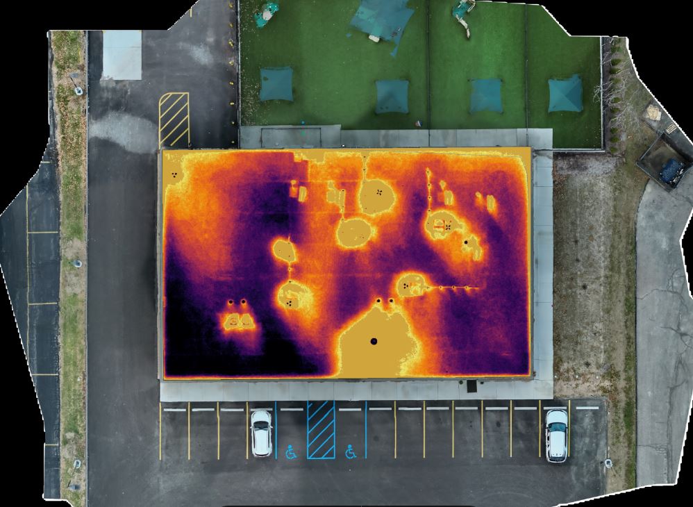
As roofing materials absorb heat throughout the day, dry insulation cools differently than insulation containing trapped moisture. Wet areas retain thermal energy longer, producing temperature patterns that can be identified using professional FLIR radiometric thermal cameras mounted on our drone platforms.
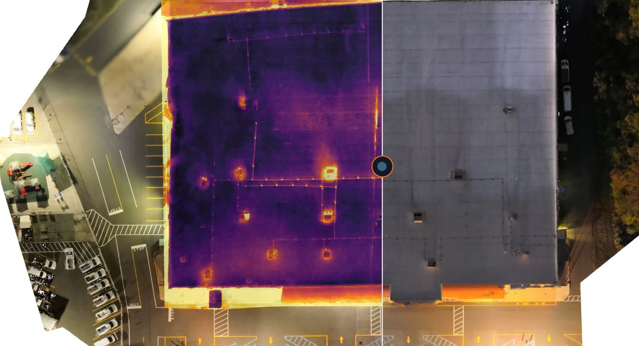
Unlike conventional infrared images, radiometric thermal imagery records precise temperature information throughout every image, providing measurable data for detailed evaluation and documentation.

Our inspections help identify:

  • Suspected moisture intrusion
  • Saturated insulation
  • Thermal anomalies
  • Potential leak locations
  • Areas requiring additional investigation
  • Heat loss patterns
  • Roofing system irregularities

The result is a fast, non-invasive assessment that minimizes disruption while delivering valuable insight into roof conditions.

The Advantages of Drone-Based Roof Inspections

Drone technology has transformed commercial roof inspections by making them safer, faster, and more comprehensive.

Improved Safety

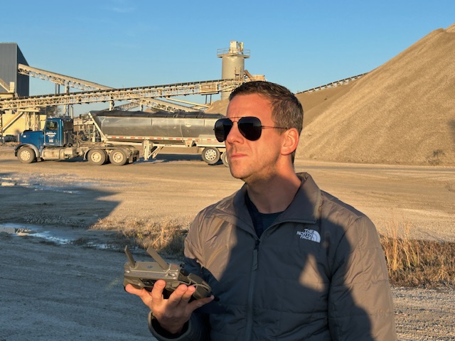
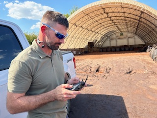
Our pilots perform inspections while remaining safely on the ground, reducing the need for personnel to walk large or difficult roofing systems.
Efficient Data Collection

Large commercial facilities can be documented quickly without interrupting daily operations.

Exceptional Image Quality

Professional thermal sensors and high-resolution cameras capture detailed imagery suitable for engineering analysis, maintenance planning, and documentation.

Access to Challenging Roofs

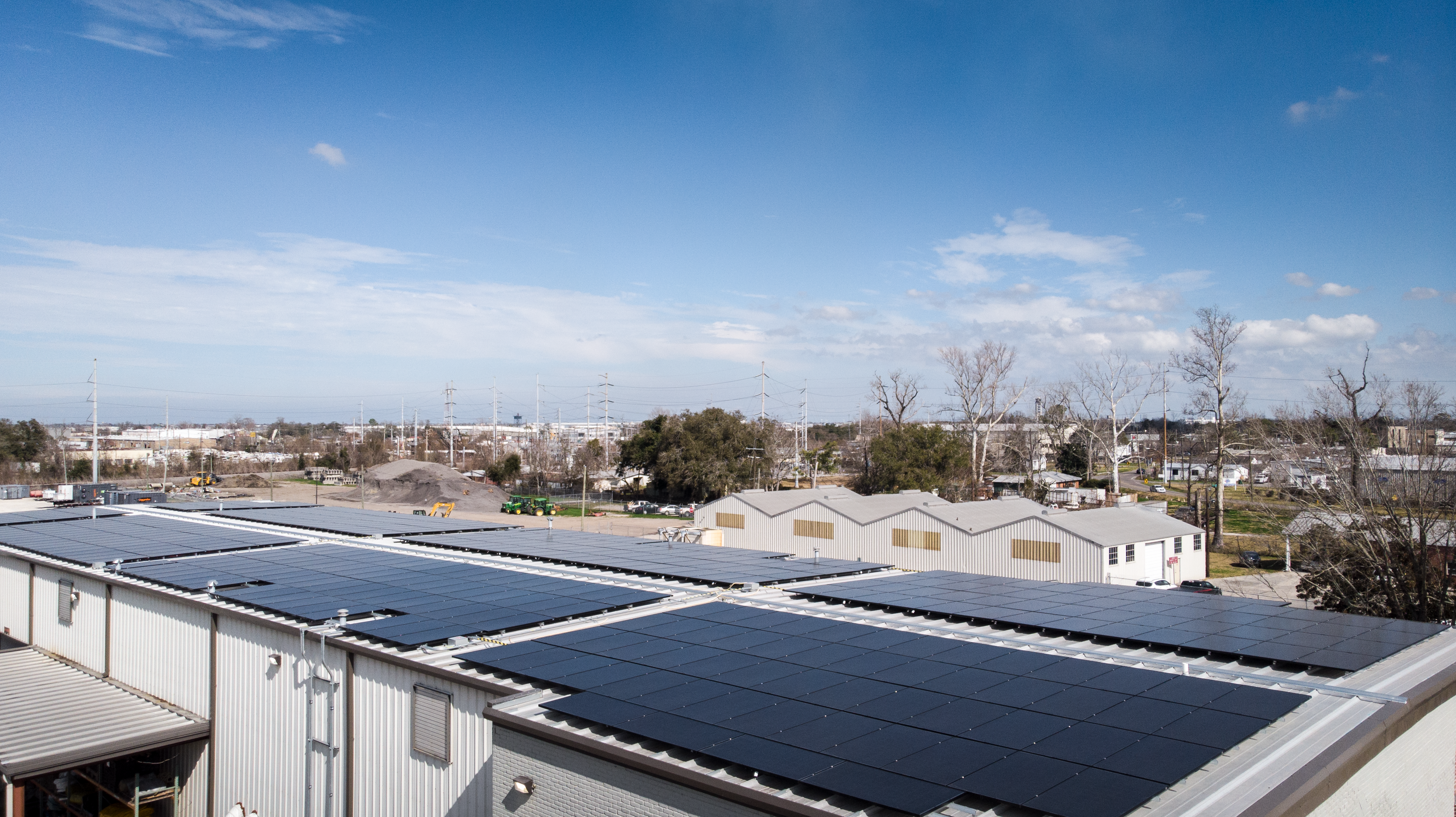
Drones efficiently inspect multi-level buildings, steep roof sections, mechanical equipment areas, solar arrays, and other locations that may be difficult to reach safely.
Repeatable Documentation

Routine inspections establish valuable historical records that help facility managers monitor roof conditions over time and identify developing issues before they become costly failures.

Radiometric Data Supports Better Decisions

Every inspection performed by St Louis Drones produces timestamped thermal imagery and measurable radiometric data that can become part of your long-term facility management strategy.

Objective documentation can support:

  • Preventive maintenance planning
  • Insurance claims
  • Warranty evaluations
  • Contractor verification
  • Capital improvement planning
  • Historical roof condition records
  • Asset management programs

Reliable data helps eliminate guesswork while supporting informed maintenance decisions.
High-Resolution Roof Mapping

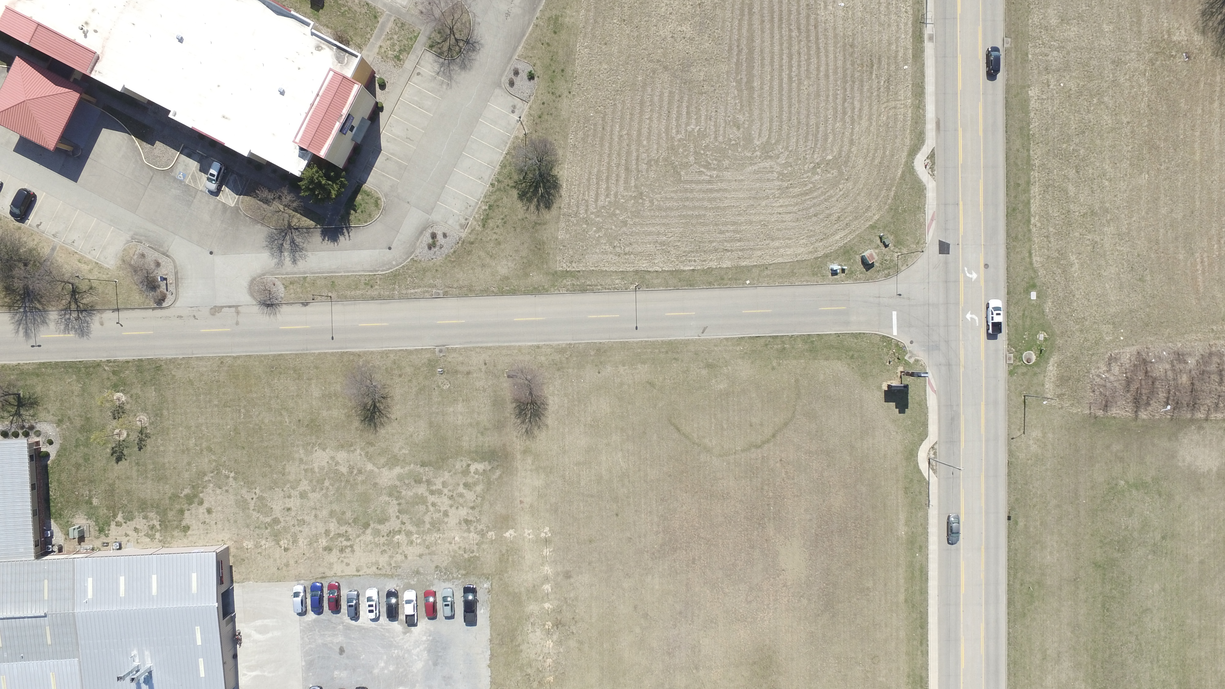
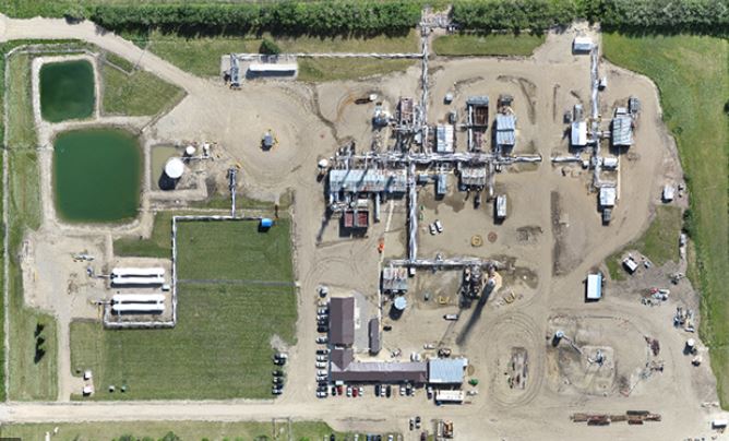
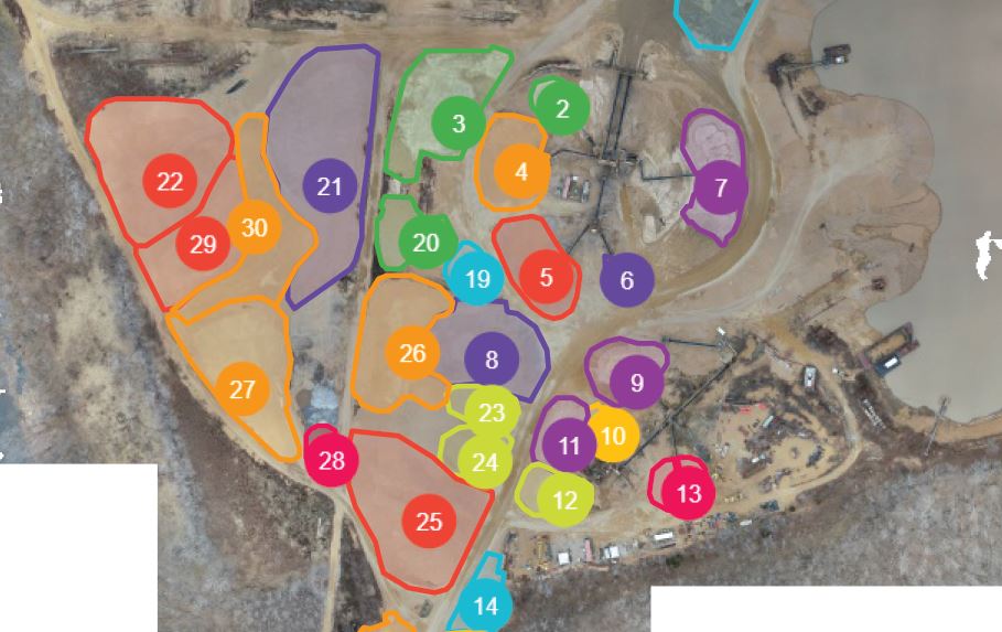
Our aerial mapping services produce highly detailed orthomosaic images by combining hundreds of overlapping photographs into one accurate, high-resolution map.

These detailed maps allow facility managers to:

  • Measure roof areas
  • Locate defects precisely
  • Document rooftop equipment
  • Monitor repairs
  • Share accurate information with consultants, contractors, and insurance providers

Combining thermal imagery with aerial mapping provides a comprehensive understanding of roofing conditions.
Supporting Schools, Healthcare, Manufacturing, and Commercial Facilities

Every facility has unique operational requirements, but they all share the same goal—protecting valuable infrastructure while minimizing unexpected costs.

Our drone inspection services are ideal for:

  • School districts managing multiple campuses
  • Hospitals and healthcare facilities protecting critical operations
  • Manufacturing facilities seeking predictive maintenance solutions
  • Warehouses and distribution centers
  • Office complexes
  • Municipal buildings
  • Commercial real estate portfolios
  • Industrial facilities

Routine thermal inspections help identify developing issues before they interrupt operations or require costly emergency repairs.

Building Long-Term Facility Intelligence

At St Louis Drones, we believe inspections should provide more than images—they should generate actionable information.

We help organizations establish proactive maintenance programs through:

  • FLIR thermal infrared inspections
  • Radiometric temperature analysis
  • High-resolution aerial photography
  • Orthomosaic mapping
  • Timestamped inspection records
  • Historical condition monitoring
  • Repeatable inspection workflows

This data-driven approach gives facility managers greater confidence when making maintenance and capital planning decisions.

Advanced Drone LiDAR Services

In addition to thermal roof inspections, St Louis Drones provides professional Drone LiDAR services for engineering, surveying, construction, and infrastructure applications.

LiDAR technology rapidly captures millions of elevation points to create highly accurate three-dimensional models for:

  • Topographic surveys
  • Construction planning
  • Engineering projects
  • Utility corridor mapping
  • Infrastructure inspections
  • Site development
  • Earthwork analysis
  • Environmental documentation

These highly accurate datasets support architects, engineers, surveyors, contractors, and public agencies with dependable geospatial information.

Professional Aerial Cinematography

Drone technology also offers tremendous creative possibilities.

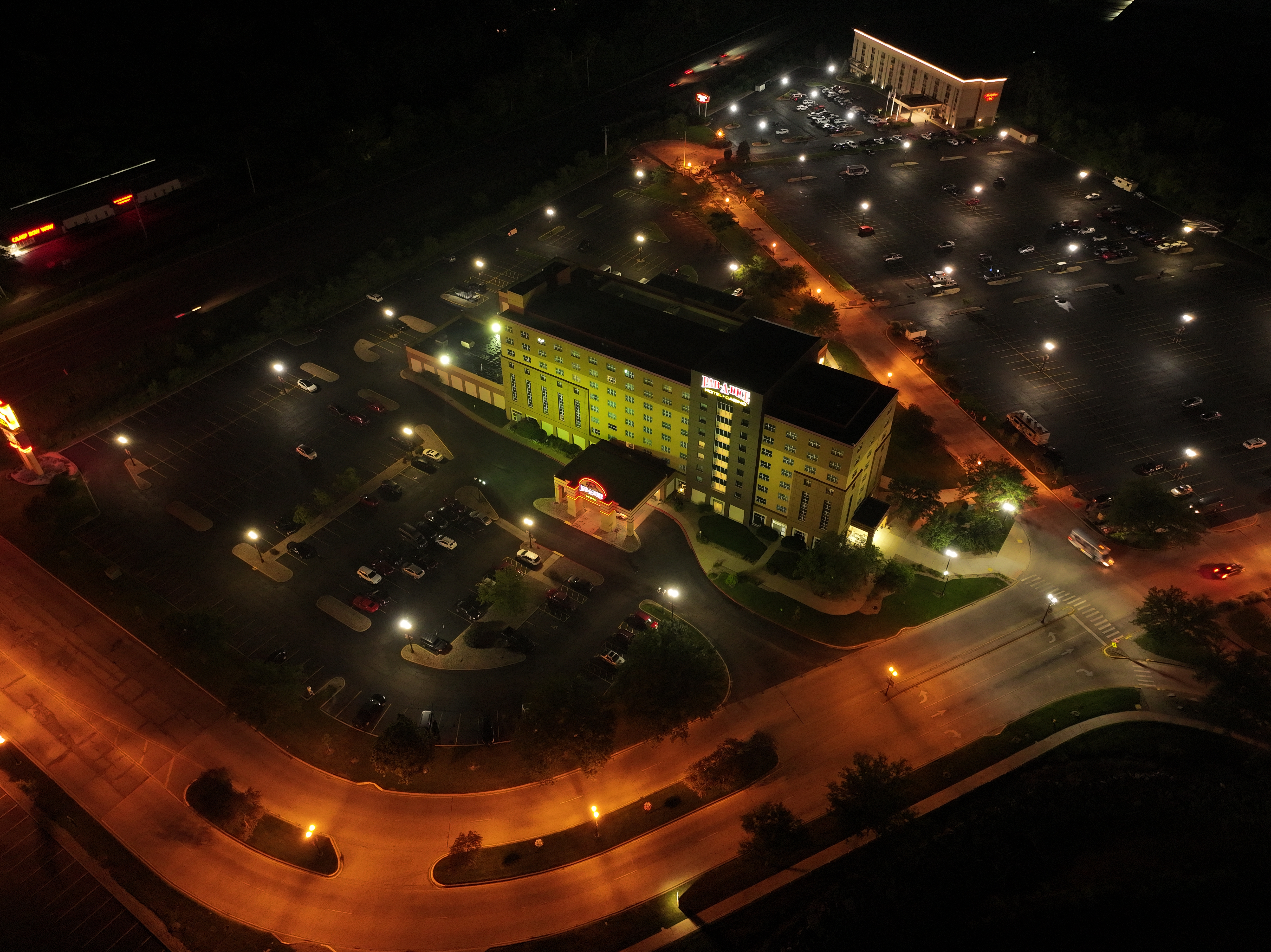
St Louis Drones produces cinematic aerial photography and video for marketing, corporate communications, construction progress documentation, tourism, industrial promotions, commercial real estate, and broadcast-quality productions.
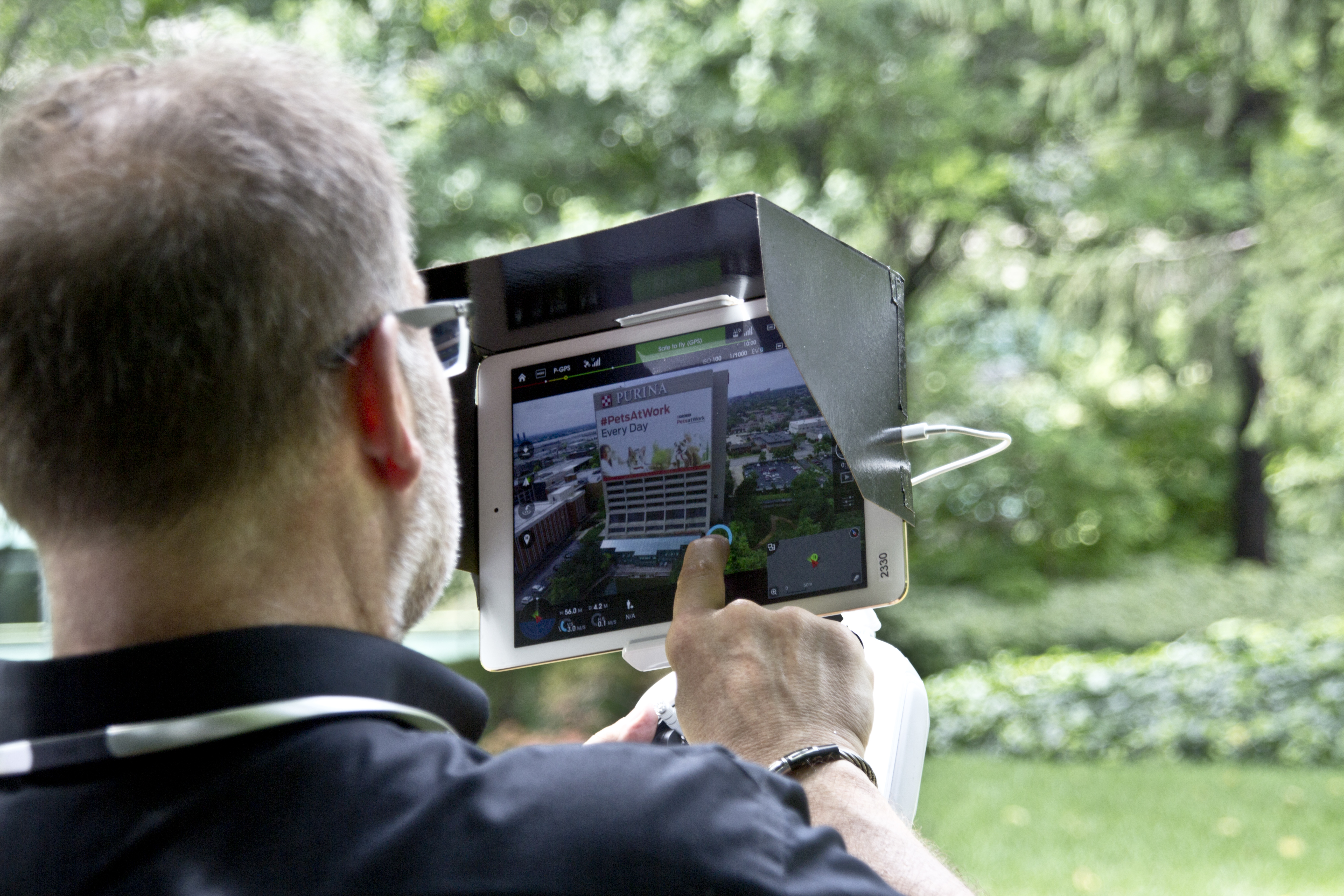
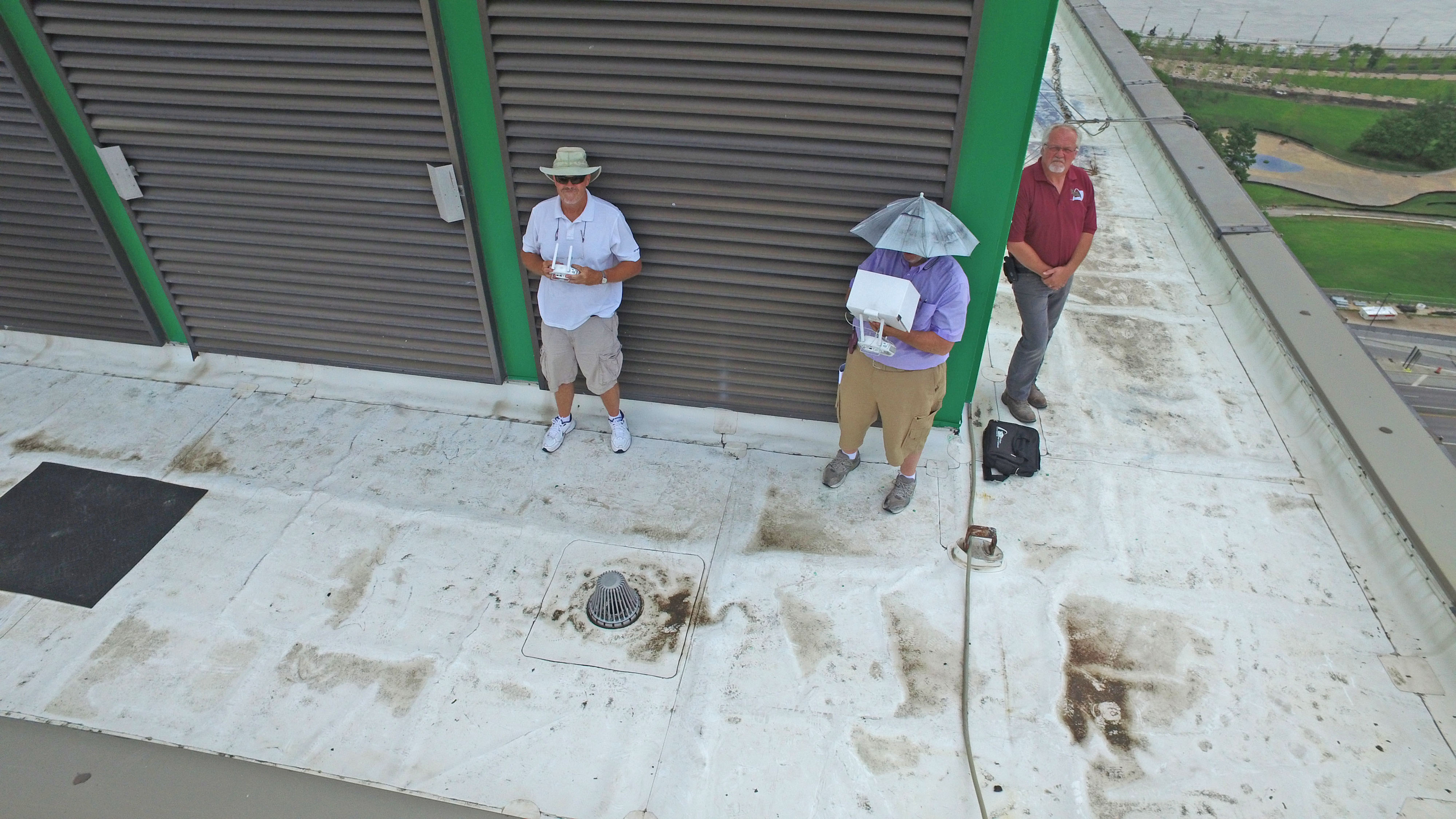
Our experienced drone pilots combine advanced flight techniques with professional imaging equipment to create compelling aerial visuals that strengthen marketing campaigns and tell engaging stories from perspectives impossible to achieve from the ground.

Why Choose St Louis Drones?

Commercial drone operations require far more than simply flying an aircraft. They require experience, planning, regulatory compliance, technical expertise, and a commitment to delivering accurate, dependable results.

At St Louis Drones, we combine advanced drone technology with professional imaging expertise to provide actionable information that helps clients protect valuable assets, improve maintenance planning, and make confident business decisions.

Whether performing FLIR thermal roof inspections, generating high-resolution aerial maps, capturing LiDAR datasets, or producing cinematic aerial content, our focus is on delivering exceptional quality, precise data, and outstanding customer service.

Protect Your Roofing Investment with Advanced Drone Technology

A commercial roof is one of the most valuable assets a facility owner manages. Detecting hidden moisture early can reduce repair costs, extend roof life, improve maintenance planning, and help prevent costly operational disruptions.

With advanced FLIR thermal infrared drone inspections from St Louis Drones, hidden roofing problems become visible before they become expensive failures.
Partner with St Louis Drones

St Louis Drones provides professional commercial drone services for businesses, government agencies, schools, healthcare systems, manufacturers, engineers, architects, contractors, and commercial property owners throughout the St. Louis region and beyond. Our capabilities include FLIR thermal infrared inspections, radiometric imaging, orthomosaic mapping, Drone LiDAR, aerial photography, aerial video production, construction documentation, infrastructure inspections, and cinematic drone services. Using the latest drone technology and advanced imaging systems, we deliver accurate data, actionable insights, and exceptional aerial imagery that help organizations protect assets, improve decision-making, and elevate their visual communications.
314-604-6544  stlouisdrones@gmail.com

How LiDAR Drones Make Stockpile Reporting Easier and More Accurate

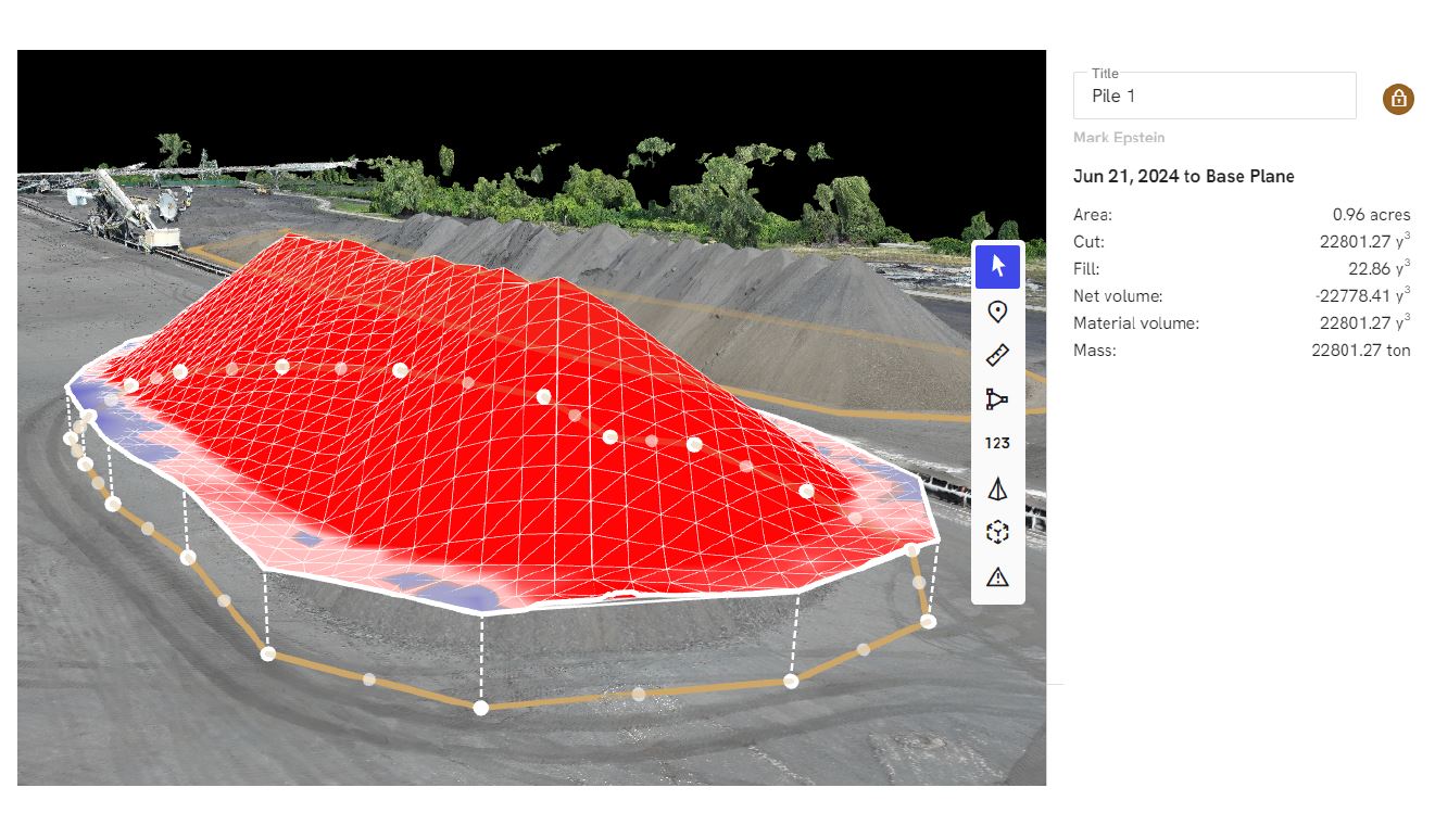
If your team manages aggregates, coal, scrap, salt, mulch, grain, or any other bulk material, you already know the uncomfortable truth: stockpiles are expensive to measure poorly.

Inaccurate volumes distort inventory valuation, create production planning headaches, trigger procurement mistakes, and invite disputes between operations, finance, and vendors. And traditional measurement methods—survey crews on foot, loader “bucket counts,” or sporadic ground scans—often cost too much time, expose people to unnecessary risk, or simply can’t keep up with how quickly inventory changes.

That’s where LiDAR-equipped drones earn their keep.

This article breaks down (in practical, decision-maker terms) how LiDAR drones work for stockpile reporting, why they’re often more reliable than photogrammetry in tough conditions, what you should demand from a deliverable, and how to deploy drone-based reporting as a repeatable business process—not a one-off experiment.


The Real Problem With Stockpiles: Change, Complexity, and Confidence

Stockpiles don’t behave like neat geometric shapes. They’re irregular, constantly changing, and often located in messy environments:

  • Dozers and loaders reshape piles daily
  • Moisture changes density and surface texture
  • Piles merge, split, and spread into berms
  • Windrows and uneven terrain distort baselines
  • Conveyor drops create steep slopes and voids
  • Operations continue while measurement is needed

Decision makers typically care about three outcomes:

  1. Speed: How quickly can you measure and report without disrupting operations?
  2. Accuracy: Can you trust the number enough to base financial and operational decisions on it?
  3. Repeatability: Will the method produce consistent results month after month, site after site?

LiDAR drones are designed to hit all three.


What LiDAR Is and Why It Matters for Stockpiles

LiDAR (Light Detection and Ranging) measures distance by emitting laser pulses and timing how long they take to return. Each pulse becomes a point in a 3D “point cloud.” Multiply that by hundreds of thousands to millions of points per flight, and you get a highly detailed surface model.

For stockpile reporting, this translates into:

  • Clear 3D pile definition
  • Accurate pile-to-ground separation
  • Strong performance in low-texture or low-contrast environments
  • Better results in vegetation-adjacent areas or cluttered sites
  • Reliable modeling when imagery struggles

LiDAR vs Photogrammetry: A Useful Way to Think About It

Photogrammetry builds 3D models from overlapping images. It can be excellent—especially in ideal lighting, with textured surfaces, and well-defined edges.

But in stockpile environments, you often face conditions where image-based reconstruction becomes fragile:

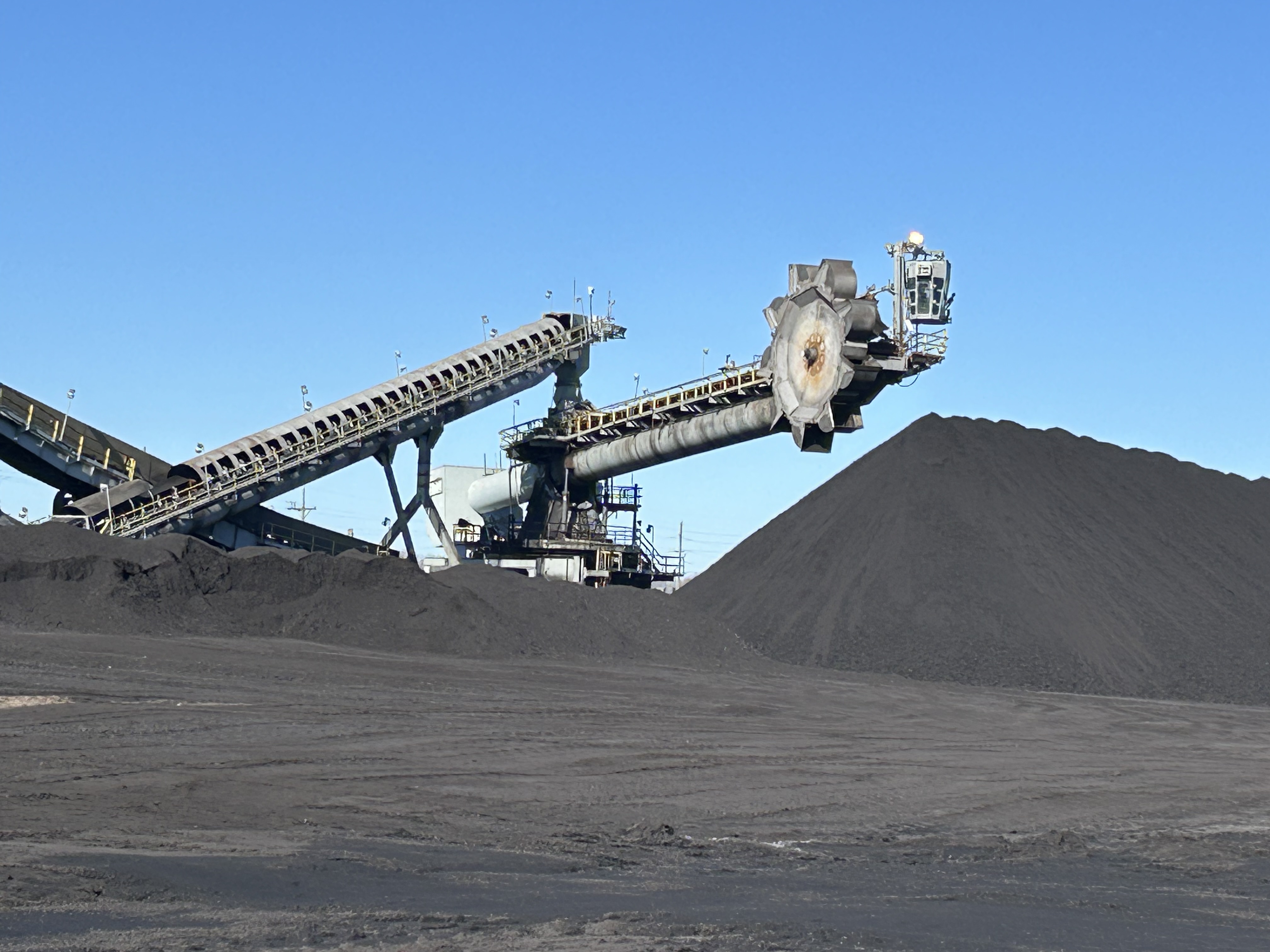
  • uniform material (dark coal, wet sand, uniform salt)
  • harsh shadows from conveyors or high walls
  • reflective or glittery surfaces
  • dusty haze or low light

LiDAR doesn’t “guess” surfaces from pixels. It measures physical distance directly. That’s why many high-volume sites use LiDAR when they need confidence and consistency across seasons and site conditions.


How LiDAR Drone Stockpile Reporting Works: A Clean, Repeatable Workflow

A professional LiDAR stockpile workflow should look like a production pipeline—not an improvisation.

1) Site Goals and Reporting Definitions (Before the Drone Takes Off)

This step is where many projects succeed or fail. The best reporting starts by agreeing on:

  • Which piles count (and how they’re named)
  • Where pile boundaries are drawn
  • How the base surface is defined (ground plane, pad, or reference model)
  • Desired reporting cadence (weekly, monthly, quarterly)
  • Required outputs (PDF report, CSV volumes, CAD surfaces, orthomosaic, etc.)

You’re not buying “a drone flight.” You’re buying a measurement system.

2) Flight Planning for Clean Coverage

A LiDAR stockpile flight is planned around:

  • consistent altitude and overlap
  • safe standoff from structures and operations
  • coverage angles that reduce occlusions (important near conveyors or tall piles)
  • timing to minimize traffic conflicts and maximize visibility

3) Control and Georeferencing (The “Trust Layer”)

Accuracy depends on how well the data is tied to reality. Depending on your required precision, a workflow may use:

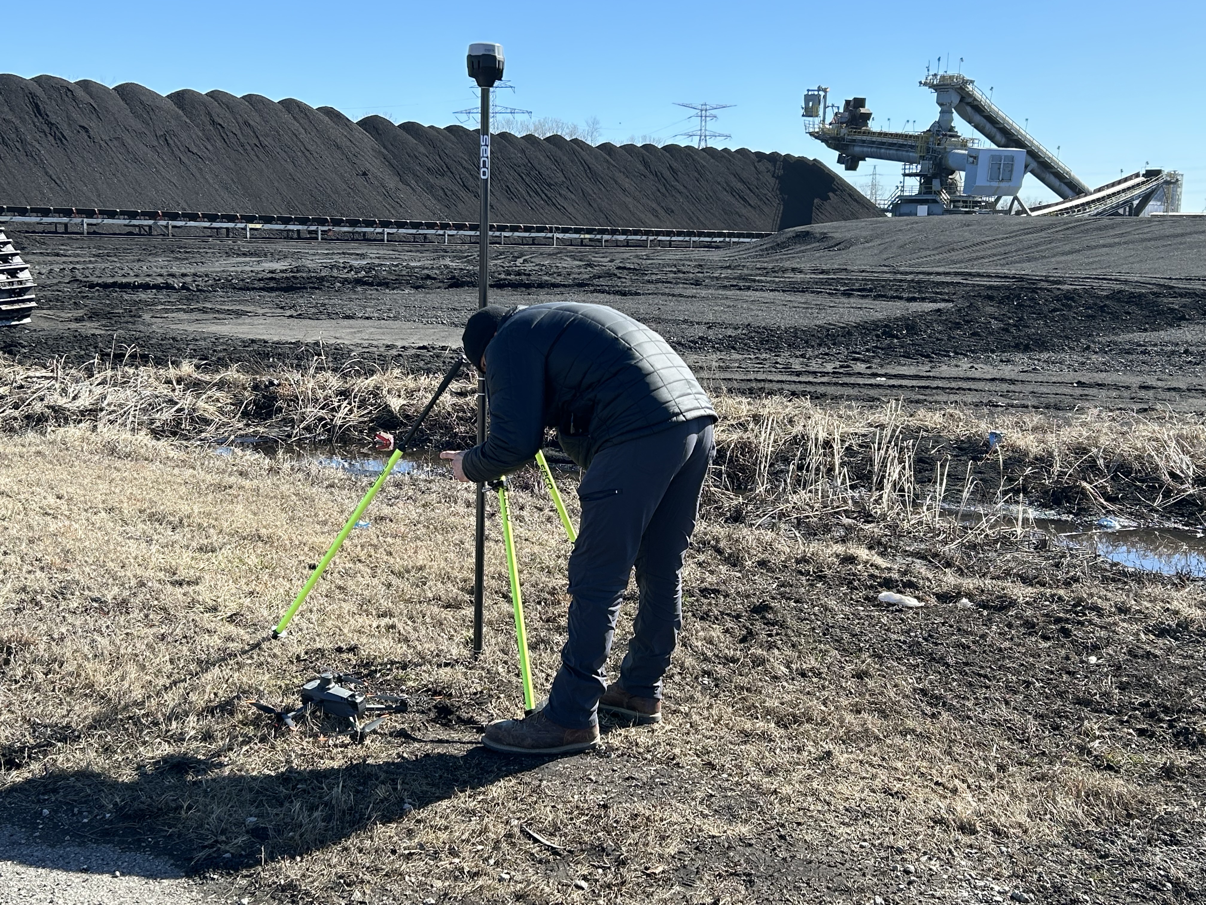
  • RTK/PPK positioning
  • ground control / checkpoints
  • existing site benchmarks

A serious provider should be able to explain:
how the data is referenced, how it’s verified, and what the expected error range is.

4) Processing: From Raw Point Cloud to Usable Volumes

After the flight, LiDAR data is processed into:

  • classified point clouds (ground vs non-ground)
  • digital terrain models (DTM)
  • digital surface models (DSM)
  • pile segmentation surfaces

Then volumes are computed using a defined base surface and boundary polygon for each pile.

5) Reporting: Executive-Friendly and Audit-Friendly

A professional stockpile report should be readable by operations and defensible for finance.

Expect things like:

  • pile ID / name
  • measured volume (with units)
  • date/time of capture
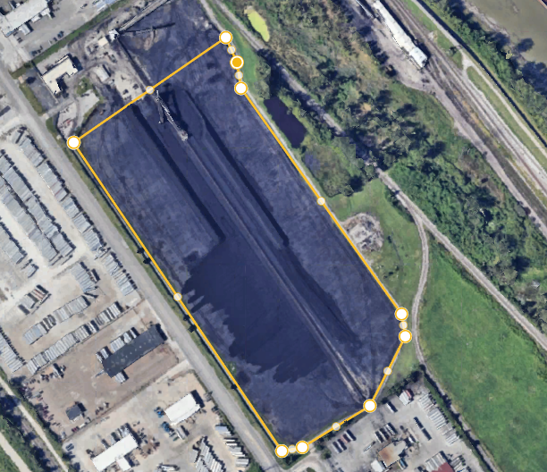
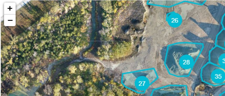
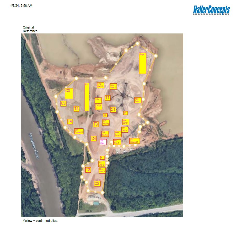
  • maps or annotated visuals showing boundaries
  • change over time (optional but powerful)
  • data exports for ERP/accounting integration

Why LiDAR Makes Stockpile Reporting Easier

Fewer Re-Measurements and Less Second-Guessing

The biggest hidden cost in stockpile measurement isn’t the first number—it’s the argument that follows.

LiDAR helps reduce:

  • “That number feels off…”
  • “We measured it differently last month…”
  • “The pile footprint changed…”
  • “We can’t reproduce that method…”

Better data reduces internal friction.

Less Disruption to Operations

You’re not shutting down loaders or moving people into hazardous zones for hours. With drone capture, you can often document the site quickly, then do the heavy lifting in processing.

A Repeatable Cadence That Fits Business Rhythms

Most organizations don’t need heroic one-time surveys. They need reliable measurement on a schedule:

  • month-end close
  • quarterly inventory
  • post-storm washout assessment
  • pre/post shipment validation
  • dispute resolution documentation

LiDAR drone workflows scale naturally into repeatable reporting.


Where LiDAR Shines in the Real World

LiDAR tends to outperform (or simplify) reporting when you have:

  • complex pile geometry (steep slopes, multiple lobes, stacked piles)
  • busy sites with lots of equipment, structures, and occlusions
  • low-contrast materials (coal, wet sand, dark aggregate)
  • variable lighting (deep shadows near walls or conveyors)
  • tight reporting deadlines (month-end, audit windows)
  • multi-site standardization needs (same process everywhere)

What to Ask a Provider Before You Buy Anything

If you’re evaluating LiDAR stockpile services, these questions separate professionals from hobbyists:

  1. How do you establish accuracy and verify it?
    Look for checkpoints, QA notes, and an explanation you can pass to finance.
  2. How do you define pile boundaries and base surfaces?
    If the method changes each time, your trendline becomes meaningless.
  3. What deliverables do you provide—and in what formats?
    Ask for sample reports, CAD exports, and a volume spreadsheet template.
  4. What’s your workflow for repeat monthly reporting?
    You want a process, not a one-off.
  5. How do you handle safety and operational coordination?
    A professional team works around your site, not against it.

Turning LiDAR Stockpile Reporting Into a Strategic Advantage

Once you have a repeatable LiDAR reporting pipeline, you can start doing more than just measuring piles.

You can:

  • monitor shrinkage and loss over time
  • validate vendor quantities more confidently
  • optimize site layout and material flow
  • document storm damage and erosion
  • create 3D site models for planning and marketing
  • produce visuals that support proposals, audits, and stakeholder updates

The same dataset can serve operations + finance + leadership + marketing when it’s captured correctly.


Why St. Louis Drones Is Built for This Work

At St. Louis Drones, we approach LiDAR stockpile reporting like we approach any high-stakes production: with planning, repeatability, and deliverables that hold up under scrutiny.

We’re a full-service professional commercial photography and video production company with the right equipment and experienced creative crew for successful image acquisition. We provide full-service studio and location video and photography, plus editing and post-production, and we operate with licensed drone professionals. We customize productions for diverse media requirements, and we specialize in repurposing photography and video branding to help your content travel farther and work harder across platforms.

We’re well-versed in all file types, media styles, and the software ecosystems businesses and agencies rely on. We also use the latest Artificial Intelligence tools across our media services—supporting smarter workflows, faster turnarounds, and scalable production pipelines.

Need indoor capture? We can fly specialized drones indoors when a project requires tight spaces, complex environments, or controlled conditions.

And we’re not new to serving demanding clients. As a full-service video and photography production corporation since 1982, St. Louis Drones has worked with many businesses, marketing firms, and creative agencies across the St. Louis area—bringing the same production discipline to industrial measurement, corporate marketing, and everything in between.

If your organization needs stockpile reporting that’s easier to run, faster to deliver, and more reliable to trust, LiDAR drones can turn a chronic problem into a clean, repeatable process—and we can help you implement it end-to-end.

314-604-6544 stlouisdrones@gmail.com

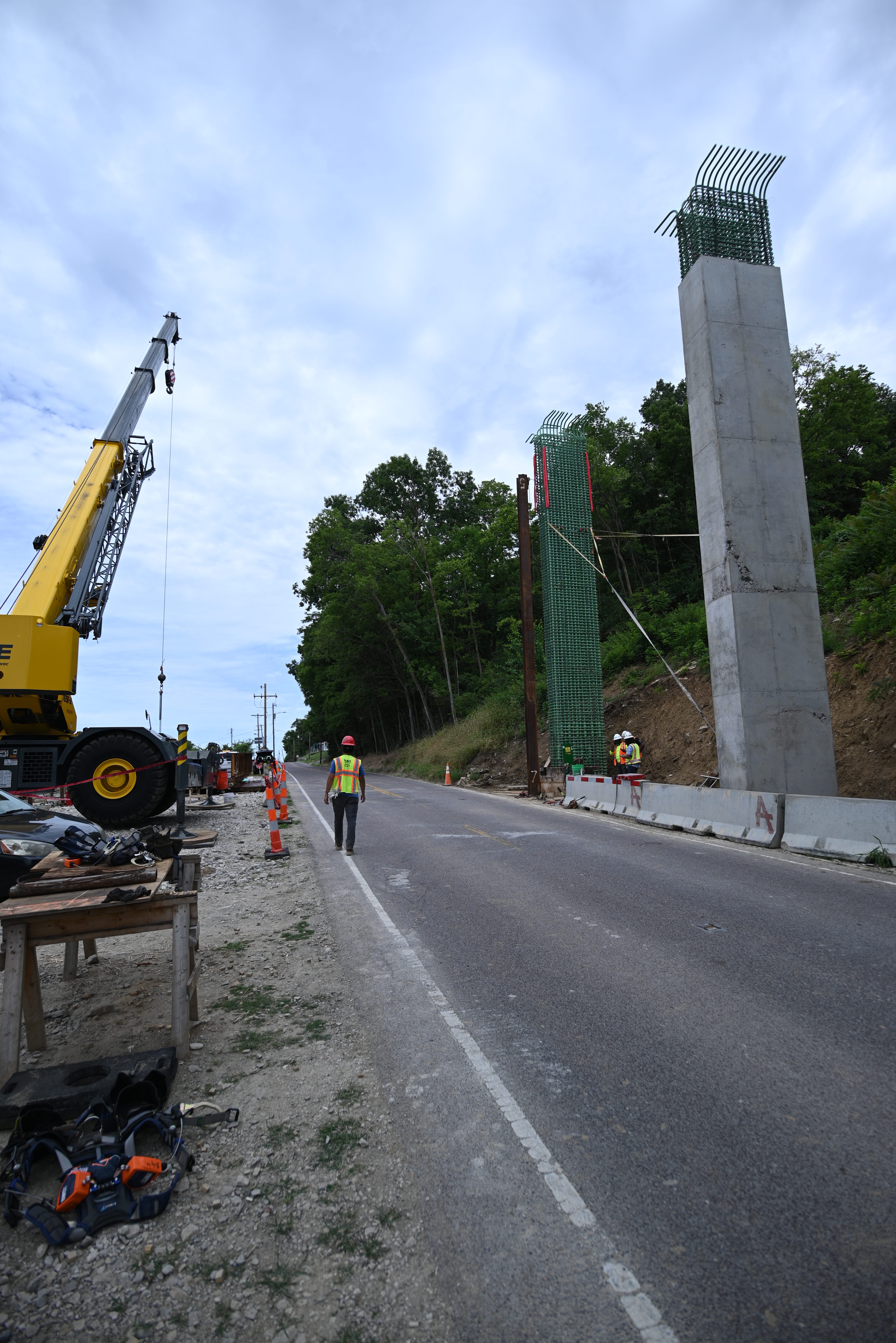
How Drones Help Construction Managers Make Better Plans: Aerial Insights That Drive Smarter Building Decisions

In the fast-paced world of construction, every decision—whether related to planning, safety, or budgeting—can significantly affect the timeline and success of a project. One of the most impactful tools reshaping how construction managers plan and execute their work is drone technology. Aerial imagery and data collected by drones are now vital components in construction project planning, offering unmatched visibility, accuracy, and efficiency.

The Power of Aerial Perspective in Construction Planning

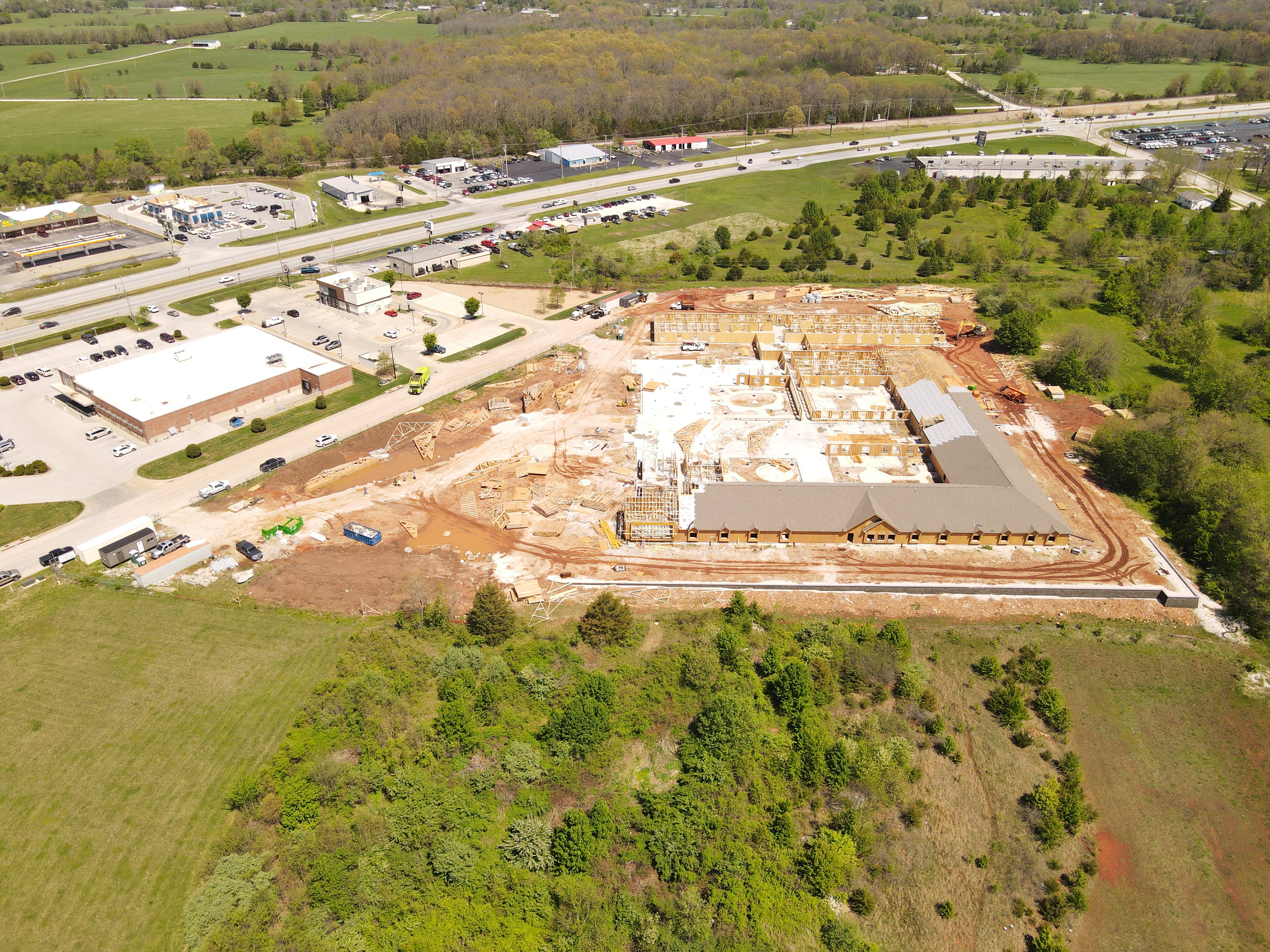
Drones provide real-time, high-resolution imagery and 3D data that traditional methods can’t match. From pre-construction assessments to final inspections, drones give construction managers a bird’s-eye view of job sites, allowing for:

  • Site Surveys & Mapping: Drone-generated orthomosaic maps and topographic data offer quick, cost-effective alternatives to traditional land surveys. Managers can evaluate terrain, plan logistics, and detect potential site limitations before ground is even broken.
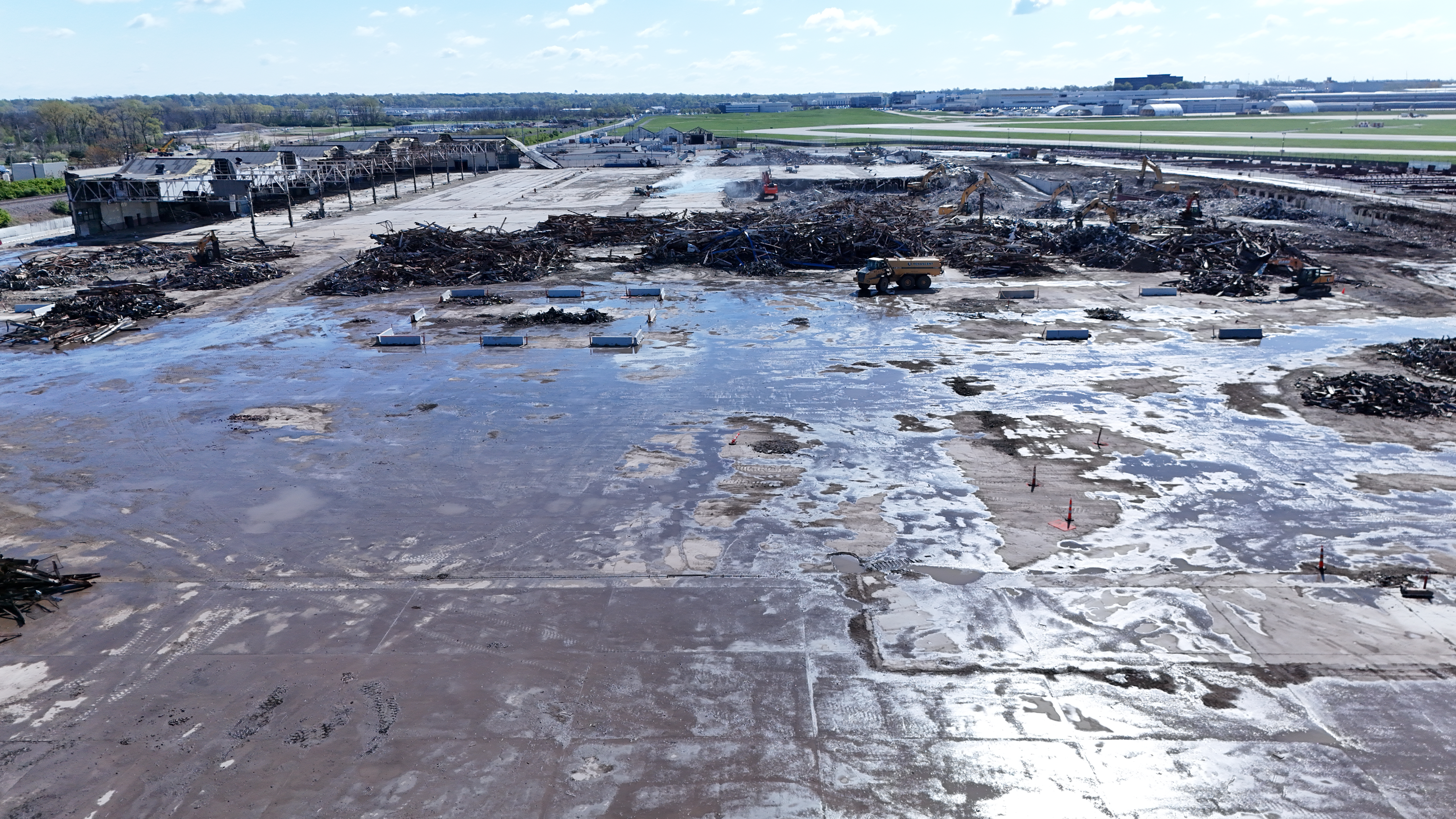
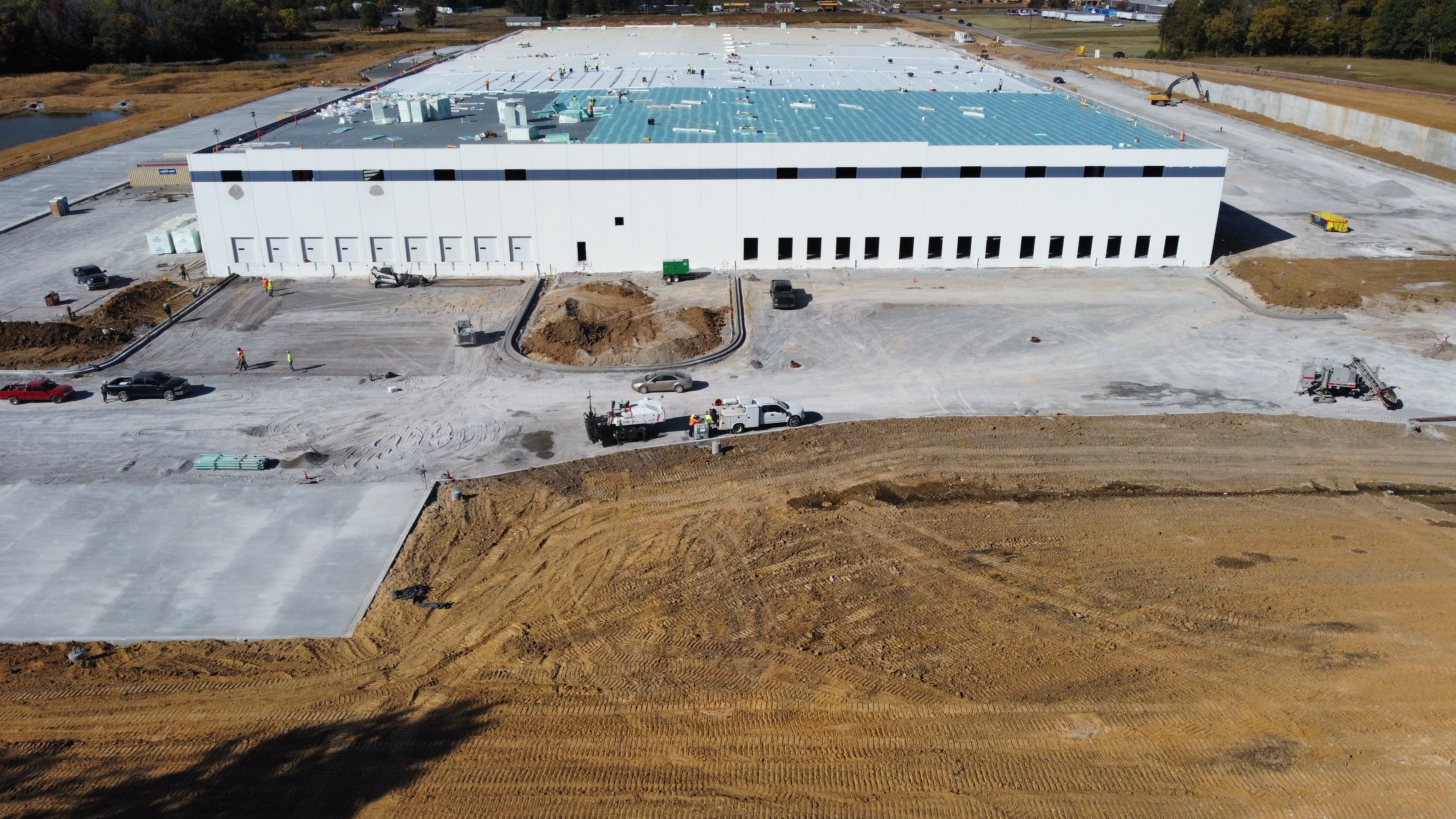
  • Progress Monitoring & Reporting: High-definition aerial photos and videos provide a visual record of progress over time. These updates help managers spot discrepancies, verify contractor performance, and maintain transparency with stakeholders.
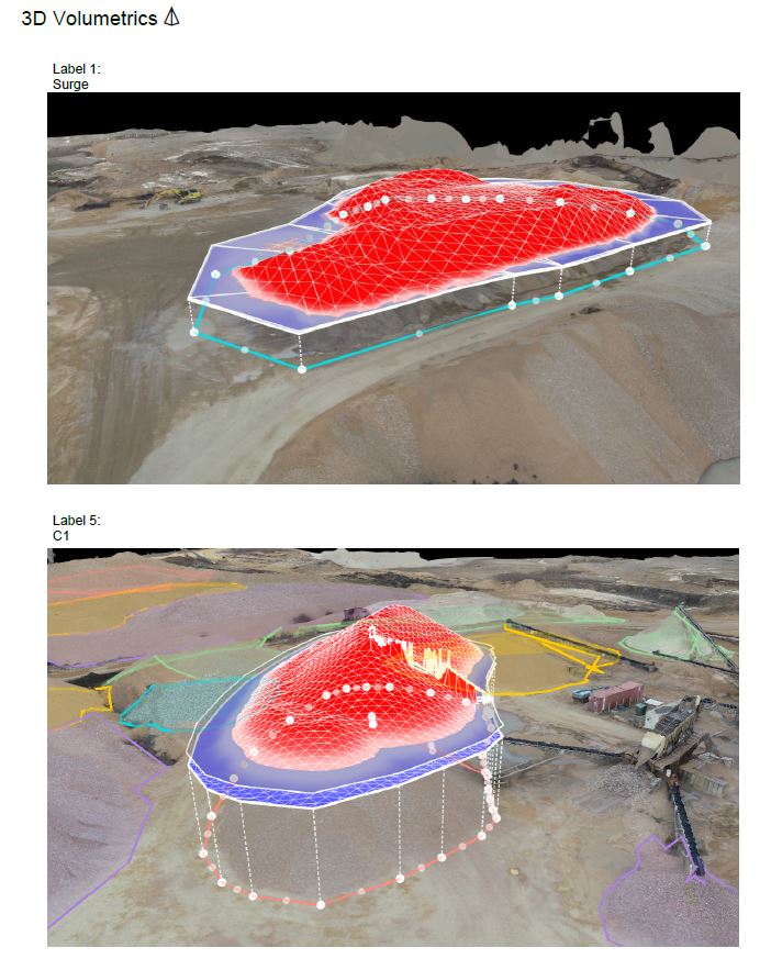
  • Enhanced Accuracy with 3D Modeling: Drones can create accurate 3D models and digital elevation models (DEMs), enabling more precise planning and volume calculations for excavation or material stockpiles. These data-driven insights reduce waste and ensure better allocation of resources.

Safer, Smarter, and More Efficient

Drones significantly reduce the need for manual inspections of hard-to-reach or hazardous areas such as rooftops, scaffolding, or deep excavations. This not only improves job site safety but also increases the frequency and reliability of inspections.

By eliminating the delays associated with traditional surveying methods and manual reporting, drones streamline communication between departments, contractors, and project owners—enhancing decision-making and ultimately accelerating project timelines.

Real-Time Data for Real-World Decisions

Construction sites are dynamic environments. With drone data, managers can overlay current conditions against original plans to ensure alignment and catch deviations early. Integration with BIM (Building Information Modeling) platforms makes this data even more powerful, allowing teams to simulate and plan the next phase with confidence.

Additionally, real-time drone data can help in managing logistics—such as verifying material deliveries, optimizing equipment placement, and planning staging areas—which are crucial to keeping large projects on track.


Why Construction Teams Trust St Louis Drones

At St Louis Drones, we specialize in providing the construction industry with powerful aerial tools to enhance project planning and management. As a full-service professional commercial photography and video production company, we bring together the latest drone technology, AI-powered image analysis, and a seasoned creative crew to deliver exceptional results.

Whether you’re documenting a high-rise project downtown or managing a sprawling infrastructure site, our licensed drone pilots and experienced videographers ensure safe, accurate, and timely aerial imaging. Our services go beyond drone footage—we offer full-service studio and location video and photography, editing, and post-production solutions tailored to your project’s unique media needs.

We are experts in repurposing photography and video assets to maximize brand visibility and engagement across platforms. With fluency in all major file types, styles, and media software, we seamlessly integrate drone visuals into your broader marketing or documentation strategy.

Our private studio setup is also ideal for interview scenes and small-scale productions, and we have the space and flexibility to incorporate props and custom lighting designs to support your brand narrative.

Best of all, we’re equipped to fly specialized drones indoors for controlled environment shots—perfect for industrial, promotional, or progress documentation purposes.

Since 1982, we’ve partnered with construction firms, creative agencies, and marketing teams across St. Louis to deliver compelling imagery and data-driven insights. Let St Louis Drones help you plan better, work smarter, and build stronger with the power of aerial production.

314-604-6544 stlouisdrones@gmail.com