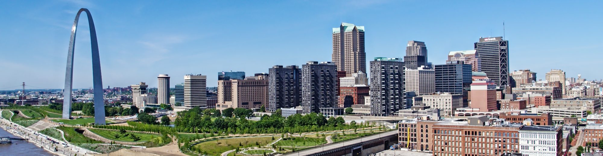
St Louis Arch Stock Aerial Photography and Video. We have an abundant assortment of aerials for you. In many instances, we can shoot requested footage for a reasonable price also. St Louis Drones is a fully insured aerial cinematography company offering professional photography and video for the St Louis and Midwest region. Our drones use the latest safety and technology in aerial cinematography.
Drone Services strive on safely capturing aerial footage that will highlight your unique vision and produce stunning visuals from a diverse perspective. We offer cost efficient drone packages that enable our clients to obtain aerial footage where it once would have been too expensive. Safety is always our first priority.
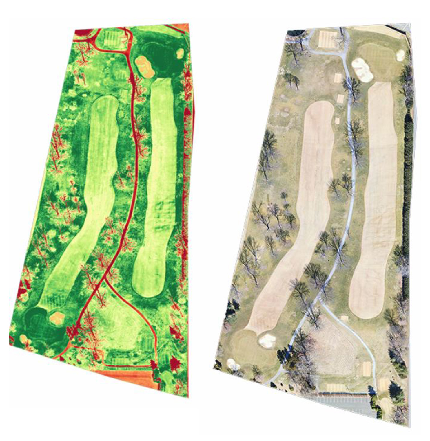
The green shows the healthy areas of the course. The yellow areas document the unhealthy areas that need attention. The red areas show vegetation dormancy, roads, dirt and buildings.
Our NDVI Drone camera has the ability to decipher differences of up to three-hundredths of a degree Celsius. The thermal image is then scaled down to a narrow temperature spectrum and a color palate is applied to assess the variation.
With these images, you can see the problem areas of the golf course, and then go out and address these specific areas.
Call us today to review your project requirements.
stlouisdrones@gmail.com
Robert Haller, Drone Specialist
314-604-6544
Drone aerial photography from St Louis Drones provides high quality Drone and ground photography and video services for virtually anyone needing a bird’s eye view. We operate throughout St Louis, Missouri and Southwestern Illinois.
We work by examining your visual media needs from a marketing perspective and providing you with photographs that are designed to bring customers and clients from the internet to your door. Utilizing drone photography we are also able to provide you with the unique perspective offered by low level aerial imaging.
St Louis Drones is fully insured and FAA Certified for Commercial Drone operations.
314-892-1233
stlouisdrones@gmail.com
Robert Haller, St Louis Video Producer
Due to their size drones are able to fly into areas that were once not possible. They can fly from only a few feet off of the ground to 400 feet in the air as one long continuous shot, while panning and framing a chosen subject. With our unique filming tools our crew can video tape aerial views inside a room and out through a window or door, giving the aerial film makers a very unique shot.
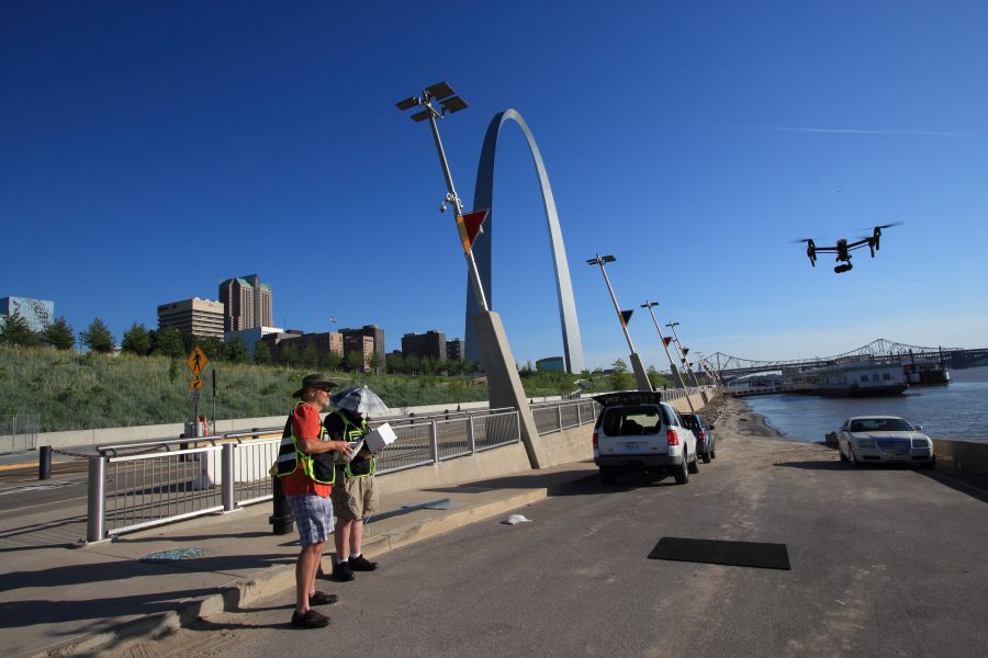
St Louis Drone Navigator and Pilot. Certified and fully insured.
Drones can 360-degree rotate on the spot, move left, right up or down, all at the touch of the pilot’s command, while giving the navigator total autonomy to position the camera to frame the perfect shot.
314-892-1233
stlouisdrones@gmail.com
Robert Haller, St Louis Video Producer
Using drone videos and photos to market your properties shows prospective sellers that you take advantage of every opportunity to make their property look awesome – and to stand out.
The visual advantages of camera drones have most impacted the way that expensive luxury homes are presented on the MLS and on agent’s websites.
Buyers of multi-million dollar homes often shop online first, so they expect high-quality photography and video in the online listing or they won’t bite.
It’s hard to argue that in the luxury property market, drone photography has upped the real estate marketing game in a big way.
St Louis Drone Video and Photography for Luxury Homes.
Whether it’s to highlight the waterfront view, a gorgeous garden, or a really cool swimming pool, aerial drone photography captures the beauty and the utility of a home far better than ground-based photography or video can.
Our experts use the latest technology to create photo-realistic 3D point-cloud and mesh models of structures and landscapes, which are interactive, high-resolution and highly accurate. This allows us to create model data that is of real use to our customers and not simply a bit of eye-candy.
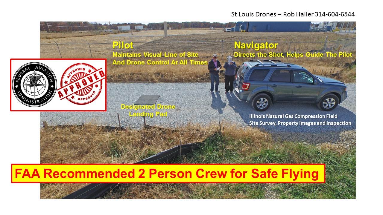
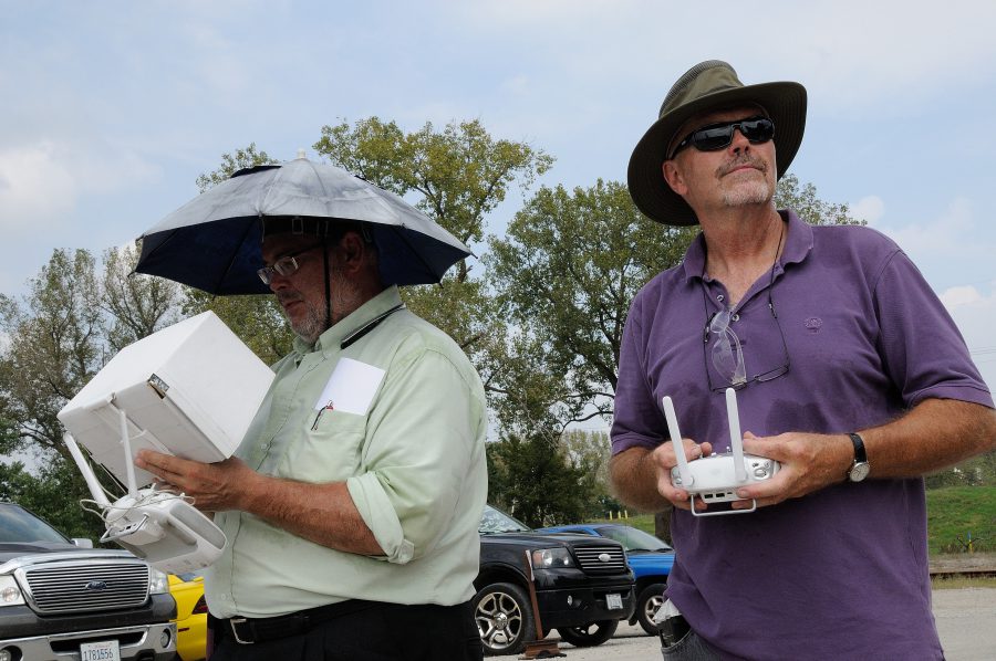
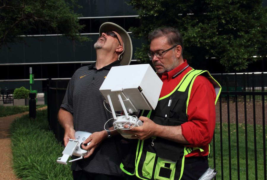
Safe to Fly 333 exemption. Two person drone crew.
Visual Inspections become:
MORE EFFICIENT. Space and structure can be modelled in immense detail once and then reviewed and re-reviewed indefinitely thereafter. With traditional inspections, the inspection team would need to revisit the site if the initial pass was not satisfactory
QUICKER. Drones can cover surfaces or structures faster than traditional methods
CHEAPER. Avoid costs associated with engaging traditional inspections teams, associated equipment and insurance costs.
COMPARABLE to previous traditional and 3d modelled inspections. A 3D model created from drone-captured data is a photo-realistic, point-in-time copy of the subject space or structure. Mapping changes over time is made possible in a way never achievable before.
MEASURABLE. Our 3D models are accurate. Engineers, Architects, Planners can measure structures and landscapes, the height of stockpiles or the depth of excavations to a degree of accuracy acceptable to regulatory bodies and inspectors.
3D mapping and surveying become:
POSSIBLE in areas where manned aircraft borne LiDAR is not suitable
CHEAPER. Avoid costs associated with engaging traditional methods, associated equipment and insurance costs. Drone based 3D modelling is up to 5x cheaper than LiDAR for areas under 60km2*
COMPARABLE to previous traditional and 3D modelled surveys. In effect, a 3D model created from drone-captured data is a photo-realistic, point-in-time-copy of the subject (space of structure). Mapping changes over time is made possible in a way never possible before.
MEASURABLE. Our 3D models are accurate. 3D Game Designers, Surveyors and planners can use our 3D models to develop realistic simulations of current and proposed structures for use in Games, Environmental analysis among many industries
Some wonderful opening sunrise video shots with our Cinematography camera on our Inspire Drone with 4K video. Our clients were as pleased as our team was with the creative visual results.
Drone aerials add a unique blend of imagery for just about any type of marketing or training production. FAA Certified, Two Person Crew for safer and better aerial results.
Fly safely and get better images with an FAA Certified Two Person Crew! We specialize in commercial video production and photography for marketing, advertising commercials and training.
We have safely documented hundreds of live events! St Louis Drones is a Video Production and Photography company. We are a small firm that has been in the photography and video business since 1982. In the past we’ve shot traditional aerials, but over the past two years we have logged many thousands of hours with our aerial drones.
We have our 333 exemption from the FAA as Safe-To-Fly. We adhere to all FAA guidelines. For safety and quality, we shoot with a two-man crew, and we are fully insured. Our pilot always keeps visual contact with the drone, while our navigator guides and directs the shot.
The Inspire has a curved lens design which eliminates distortion, and the 20mm focal length opens up your shots to a remarkably wide angle without that fish-eye look. The camera shoots video at 4K, 4096 x 2150 High Definition.
Safely drone document your live events.
314-892-1233
stlouisdrones@gmail.com
Robert Haller, St Louis Video Producer