Tag Archives: FPV drones

Aerial FLIR Thermal Building Inspections | Investigate Roof Leak Problems

Drones make roof inspections safer, faster, and more efficient by reducing the need for dangerous treks up and across rooftops. Drones equipped with thermal and visible cameras can more easily track down moisture under roof membranes or find indications of missing or damaged insulation.

This allows the roofer or roof inspector to determine which sections are performing well, and which need further investigation. They may still need to get up on the roof and use traditional (often destructive) test methods to quantify the extent of a problem, but the overall time needed from initial scan to diagnosis is greatly reduced.

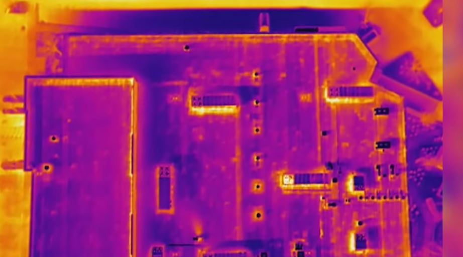
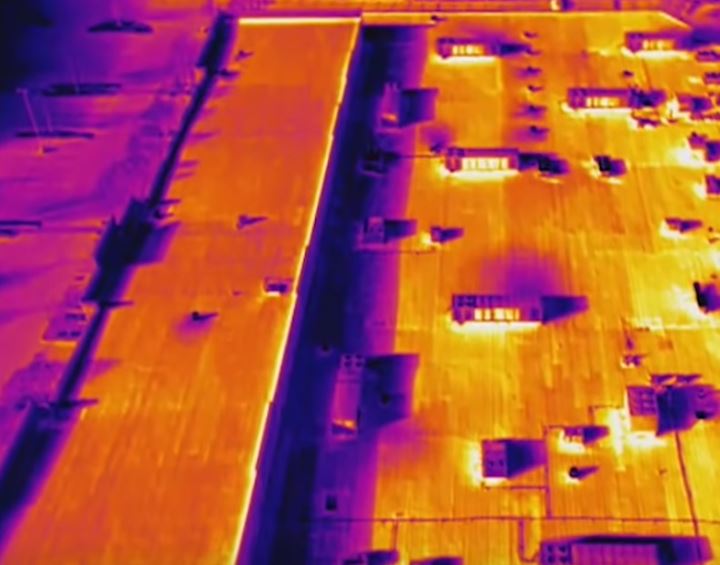
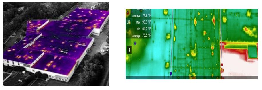
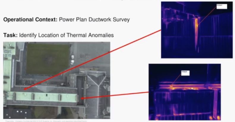
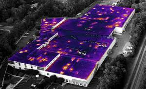
Adding thermal imaging cameras to drones allows inspectors to scan large areas for moisture trapped underneath roof membranes, and look for the effects of structural issues such as missing insulation. The presence of water and the absence of insulation can both cause changes to the surface temperature of the roof. The thermal camera detects this temperature difference and displays it as colors—for example, dark tones indicating cold moisture or light tones indicating heat escaping through the uninsulated roof. Finally, the camera does not require visible light, so flights can take place at night or in areas that are shadowed.

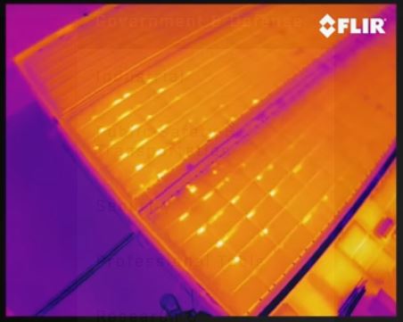
FLIR, an industry leader in thermal imaging cameras, manufactures several types of thermal cameras that are both drone-agnostic and plug-and-play with systems made by DJI Innovations. Our gear will help you find potential leakage issues in your building.

Building owners and inspectors practicing commercial drone inspections can recoup the cost fairly quickly.

stlouisdrones@gmail.com
Robert Haller, Drone Specialist
314-604-6544

Create Accurate Industry Reports with our Drone services.

Drone Mapping for Mining & Quarries – Stockpile Inventory Management
Make planning and fulfillment decisions with more accurate, timely information to avoid waste and recognize revenue faster. Measure stockpiles more often for a fraction of the cost of traditional methods. Report the total quantity and value of materials on site. Export all drone data easily to your recording systems.

Aerial Site Intelligence for Surveying & Construction
Site Surveys – Turn aerial images into new Business Insights. Understand what’s happening and make better decisions with drone data. Track and communicate progress at any stage.

St Louis Construction Drone Crews

Insurance Inspections Better Data – In Dramatically Less Time!
Whether you’re inspecting a new building or investigating an insurance claim, it’s important to capture accurate data quickly. Drone mapping is a powerful new tool for inspection — allowing you to safely and easily capture a high-resolution aerial view of a site in minutes.

Drone Mapping for Mining & Quarries – Stockpile Inventory Management
Make planning and fulfillment decisions with more accurate, timely information to avoid waste and recognize revenue faster. Measure stockpiles more often for a fraction of the cost of traditional methods.

Roofing Inspections
Accurately Generate Roof Reports & Models! Roof reports provide square footage, roof features, pitch, surface area, and slope.

Back in the office, or out in the field, it’s easy to analyze your aerial high-fidelity reconstructions of sites, make measurements and share comments to help you make better and faster decisions.

stlouisdrones@gmail.com
Robert Haller, Drone Specialist
314-604-6544

Aerial video of downtown St Louis Arch.

Aerial photography is a great way to capture your audience’s attention. The first 10 to 15 seconds of each video should be the make or break period. By using an unusual perspective (like aerial videos or aerial photography) to draw them in for the beginning of the video.

Aerial photography and video with drones and airplanes

stlouisdrones@gmail.com
Robert Haller, Drone Specialist
314-604-6544