Tag Archives: technology

Why More Companies Are Using Drones for Stockpile Reports: Elevating Accuracy, Efficiency, and ROI


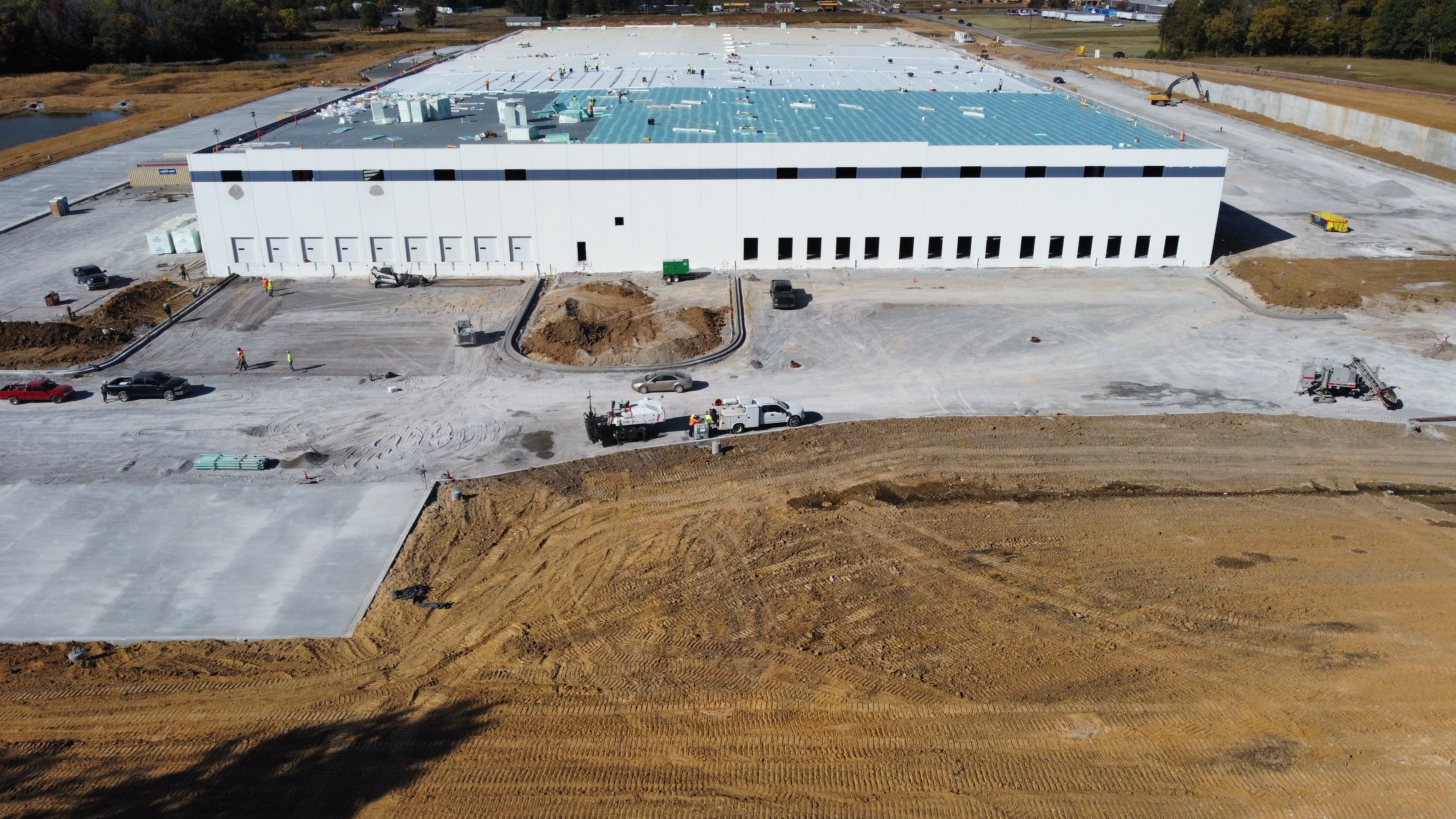
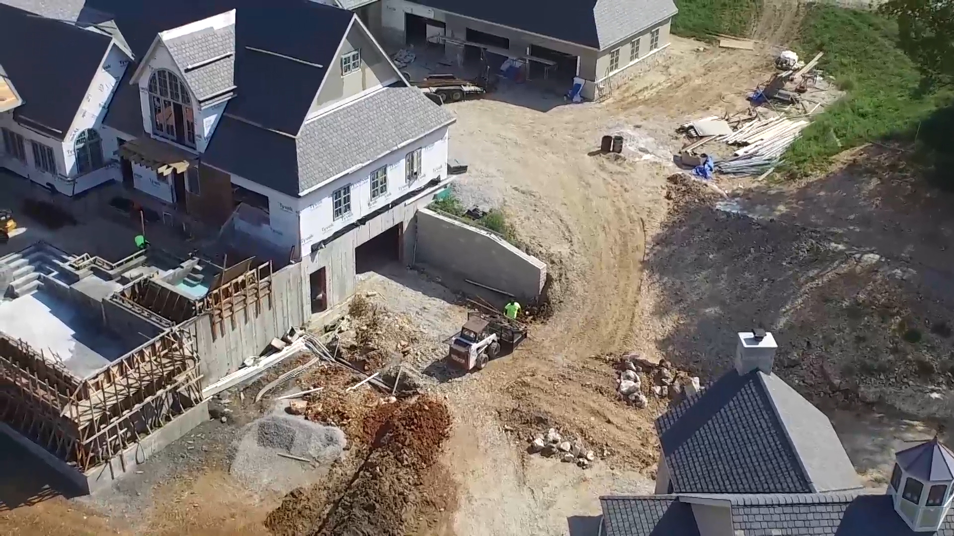
In the fast-paced world of logistics, mining, construction, and materials management, precision and speed are critical. Whether you’re reporting inventory to stakeholders, conducting compliance audits, or planning future procurement, accurate stockpile measurements can directly impact financial forecasting and operational success. Increasingly, companies are turning to drone technology to handle stockpile reporting—and for good reason.

At St Louis Drones, we’ve seen firsthand how aerial solutions are transforming traditional inventory tracking, reducing risk, and enhancing operational insight. Below, we break down why more businesses are trading manual surveys and ground-based estimates for drone-powered stockpile reports.


1. Precision That Outperforms Manual Methods

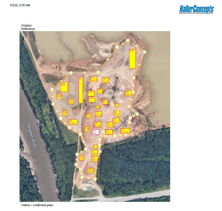
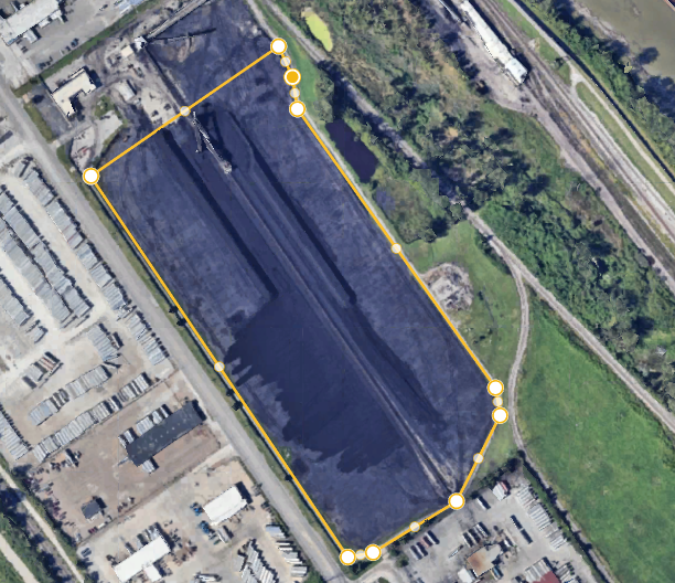
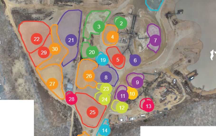
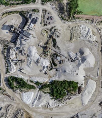
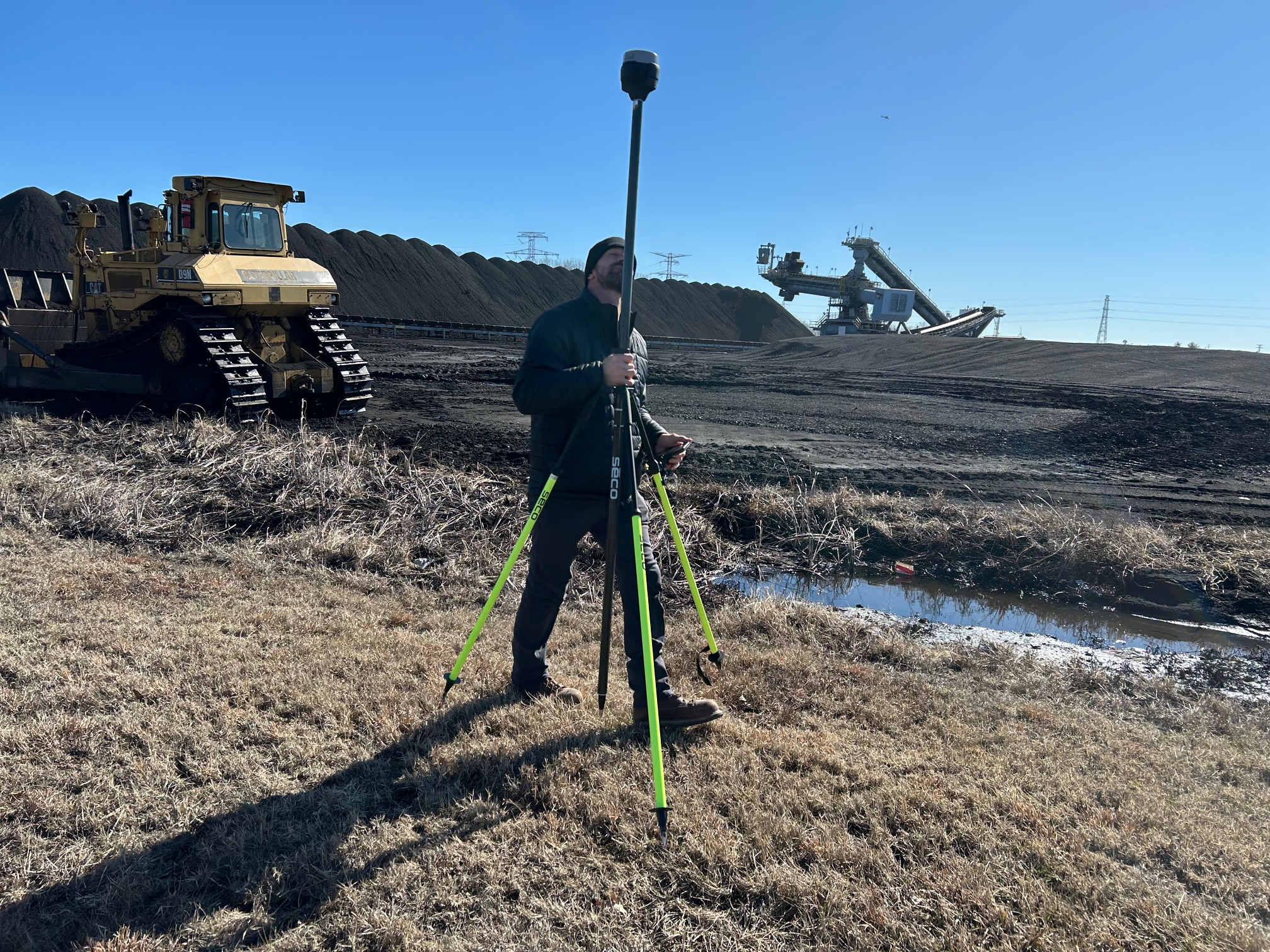
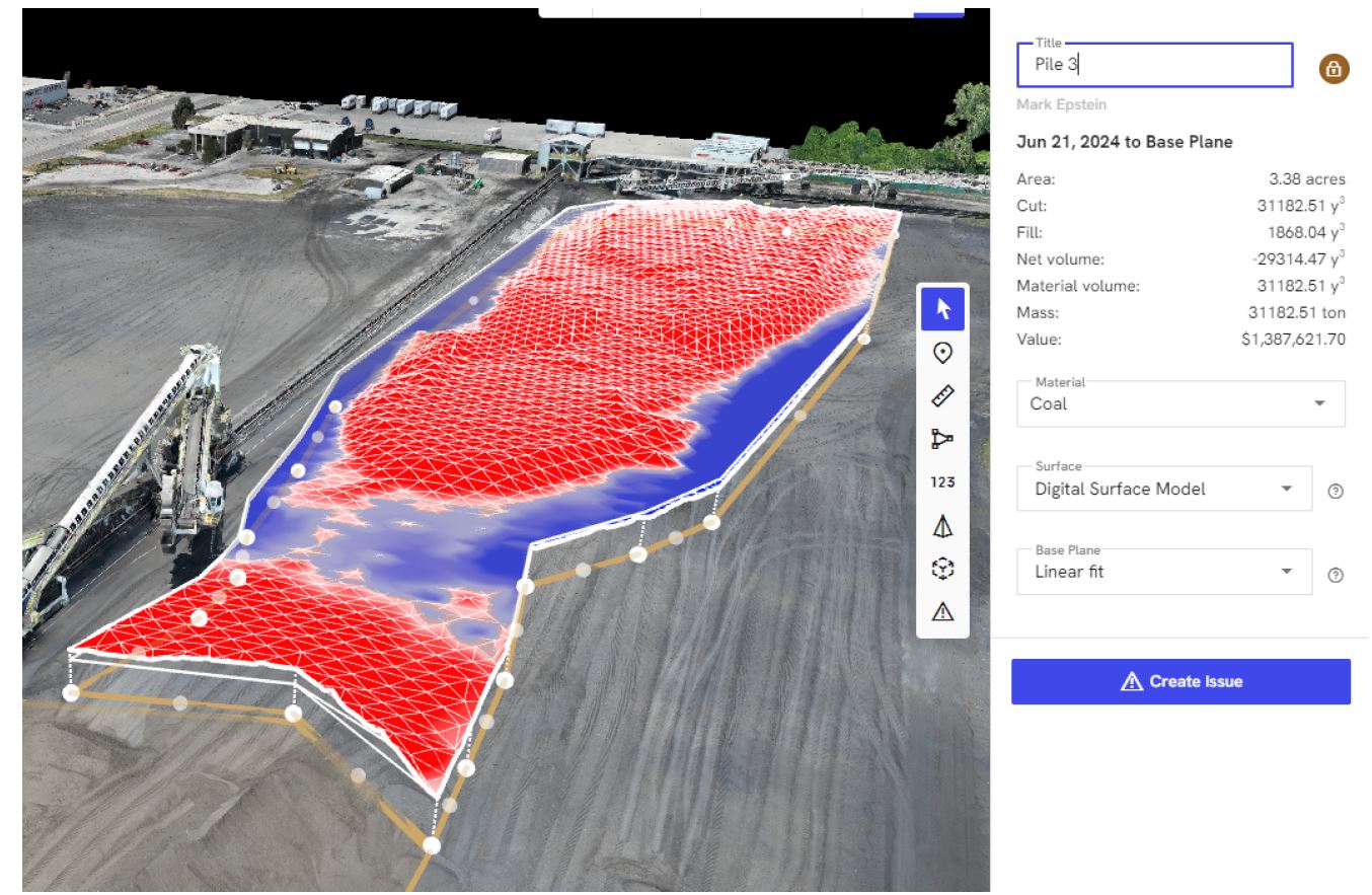
Manual stockpile measurement techniques—such as walking the perimeter with a GPS rover or using ground-based laser scans—are time-consuming and prone to human error. Drones, however, use advanced photogrammetry and LiDAR (Light Detection and Ranging) to create accurate 3D models that provide volumetric data down to a few centimeters of error. This level of precision allows for better resource management, waste reduction, and stronger forecasting.

2. Time-Saving and Cost-Effective

Traditional survey methods can require shutting down operations, rerouting equipment, and coordinating multiple teams. A licensed drone pilot can collect all necessary data in a fraction of the time—often in under an hour. Faster data collection means you can complete more frequent stockpile reports without affecting your daily workflow. The resulting operational savings quickly offset the cost of drone services.

St Louis Drones shooting with REM Tech, Mark Epstein (l) and Karl Remick for volumetric stockpile reporting.

3. Improved Safety and Risk Mitigation

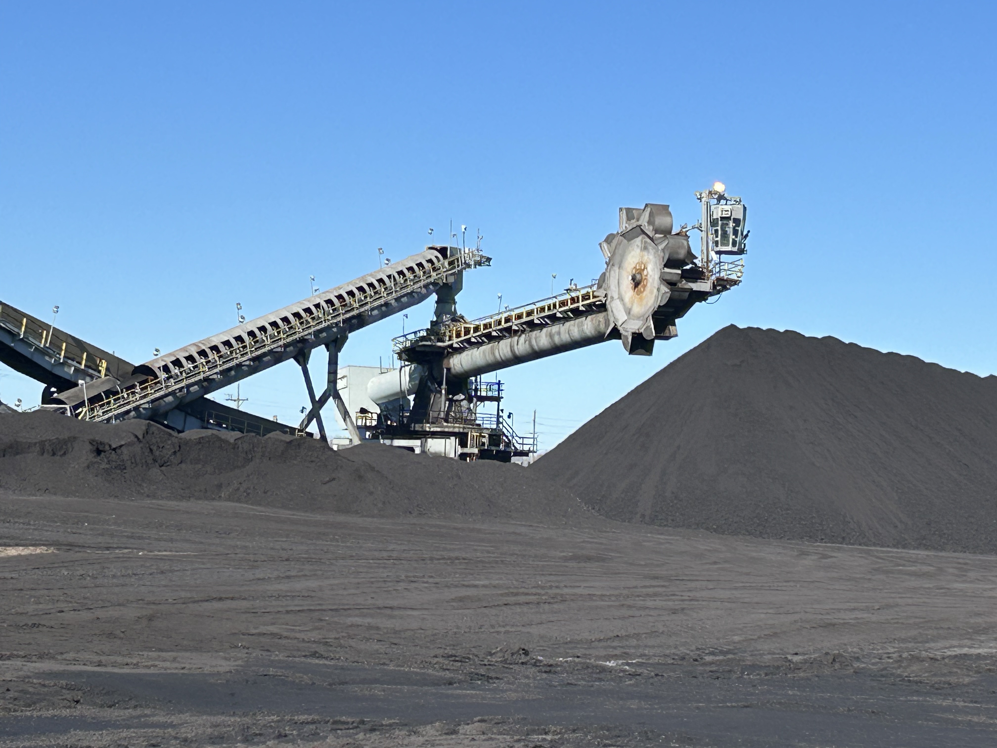
Climbing piles of aggregate, sand, coal, or scrap metal poses serious safety risks. Using drones eliminates the need for personnel to physically access stockpiles. Aerial surveys keep your employees on the ground, away from unstable terrain and heavy machinery—reducing liability and ensuring compliance with OSHA safety standards.

4. Data That Drives Decisions

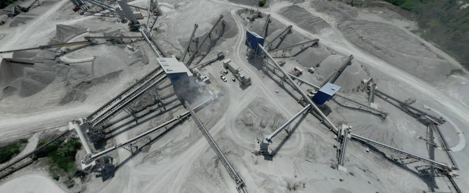
Drones capture high-resolution imagery, which can be processed into 3D point clouds, contour maps, and orthomosaic images. These deliverables don’t just look impressive—they provide actionable insights. Operations managers, procurement specialists, and finance teams can easily compare stockpile volumes over time, identify shrinkage or overstock trends, and streamline inventory reconciliation processes.

5. Scalable and Repeatable

Whether you manage a single facility or dozens across the region, drone stockpile reporting is a scalable solution. Once the flight plan is established, recurring surveys can be scheduled at weekly, monthly, or quarterly intervals. The repeatable nature of drone workflows ensures consistent data over time, which is ideal for long-term project tracking or year-over-year comparisons.


How St Louis Drones Helps You Get the Most from Drone Technology

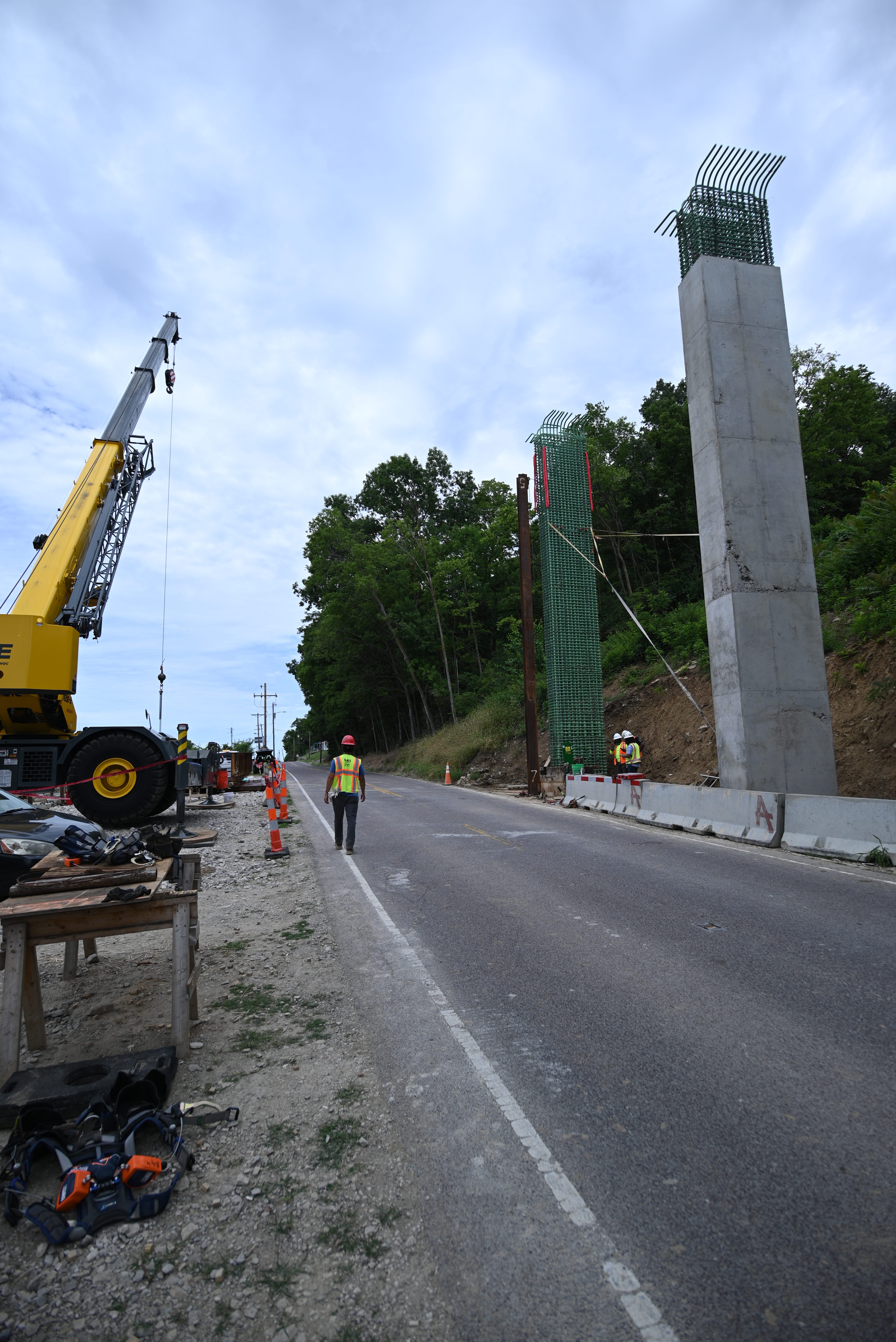
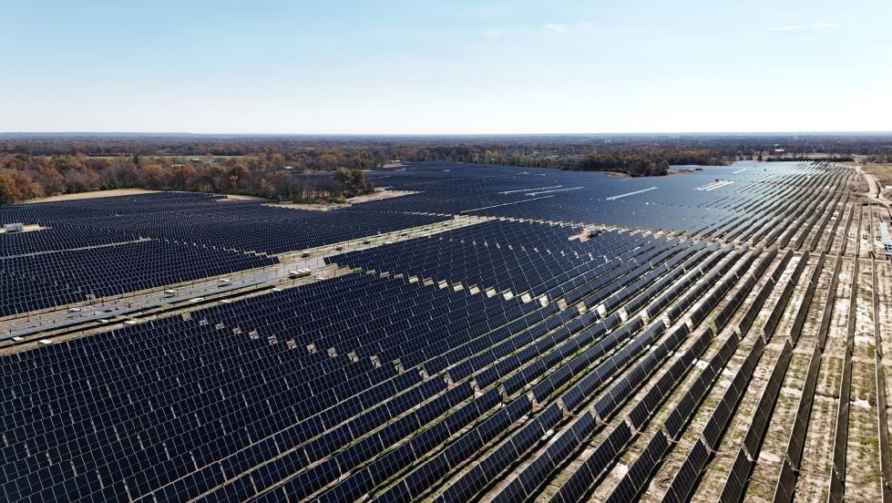
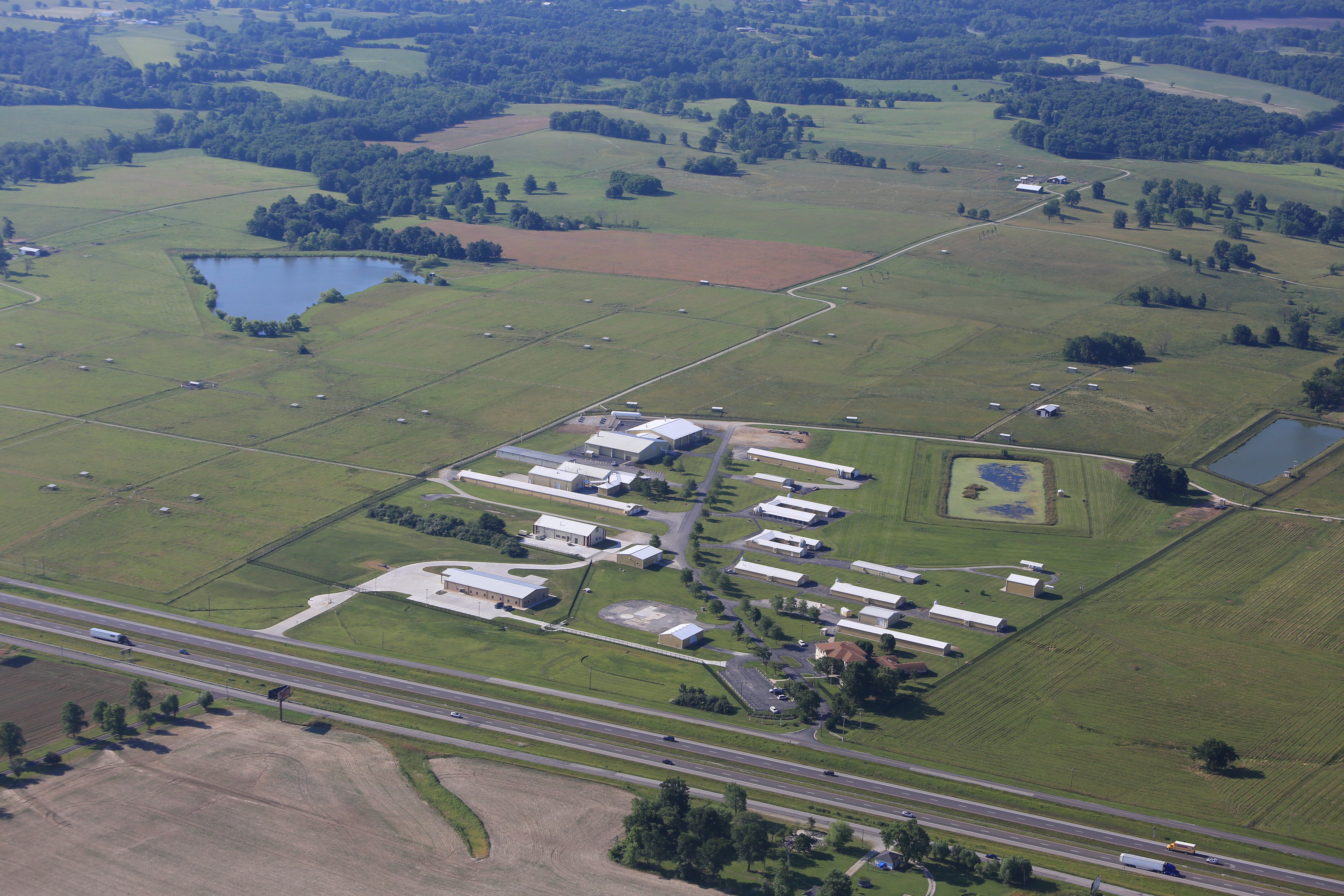
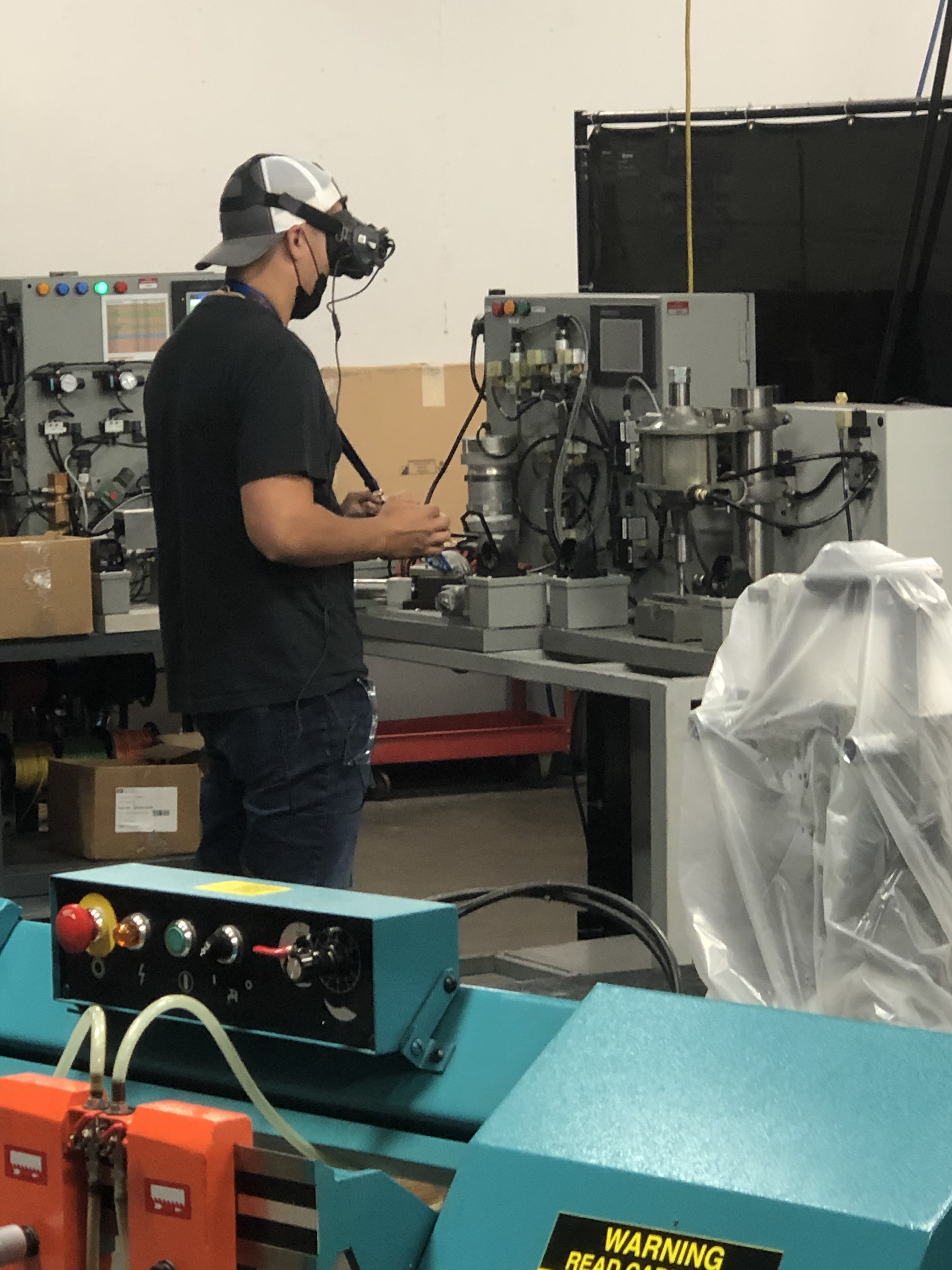
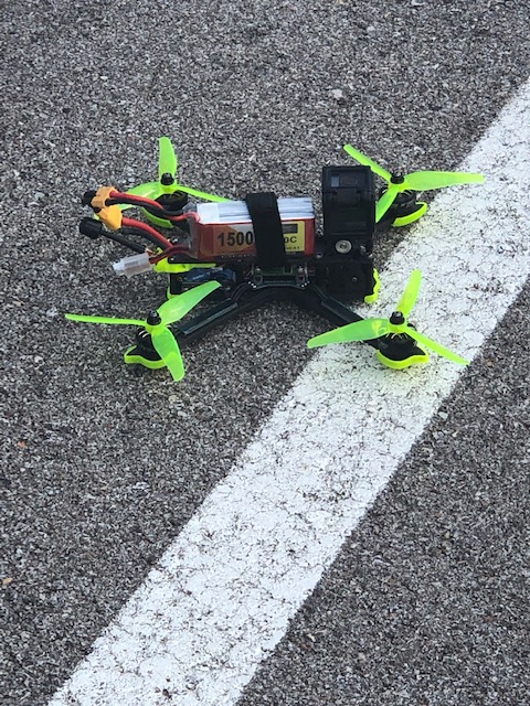
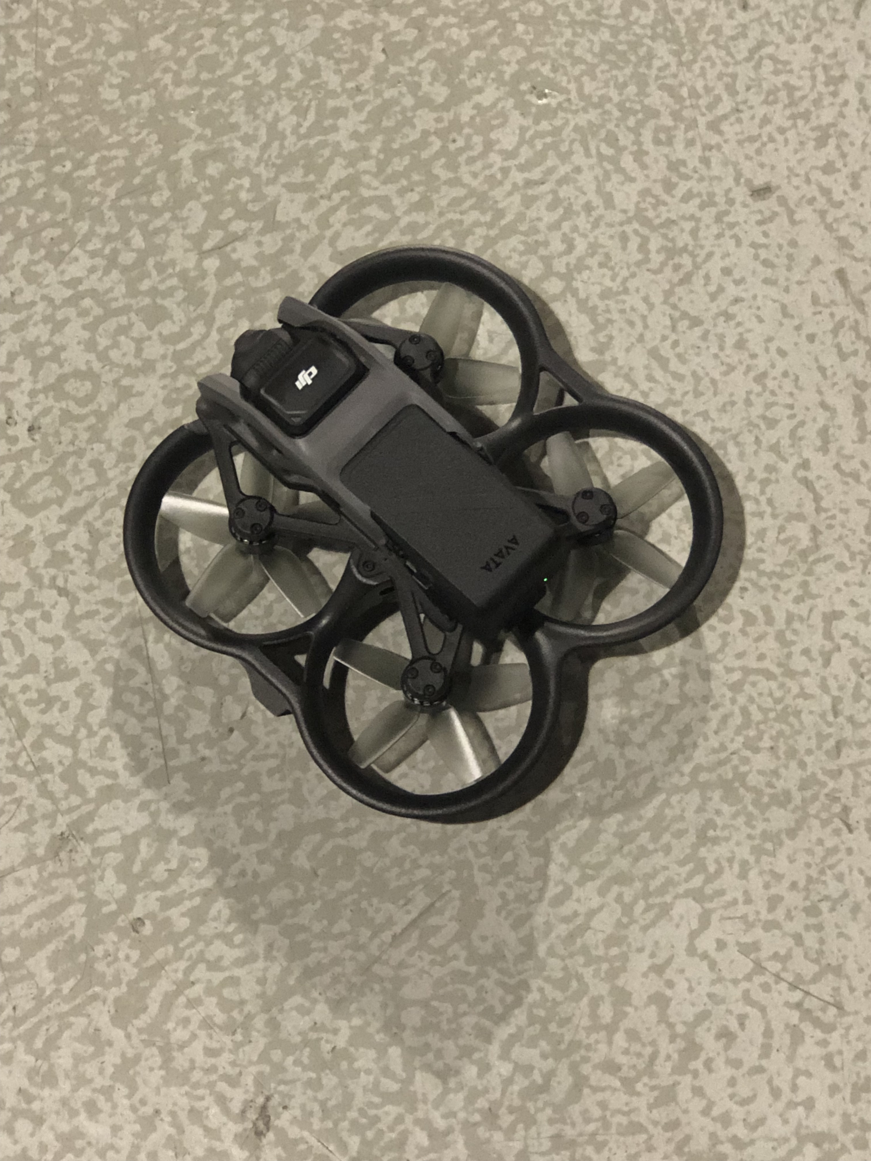
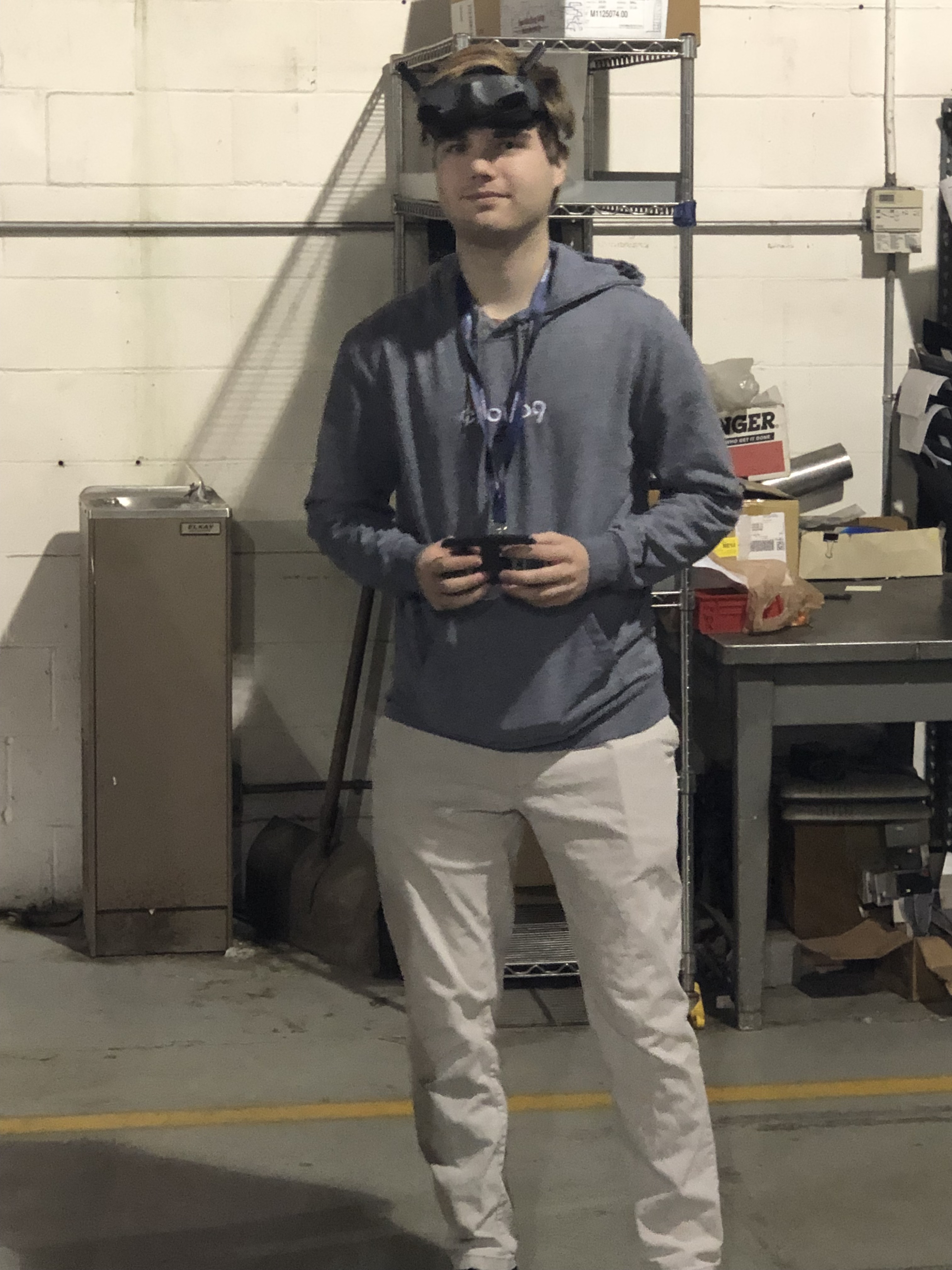
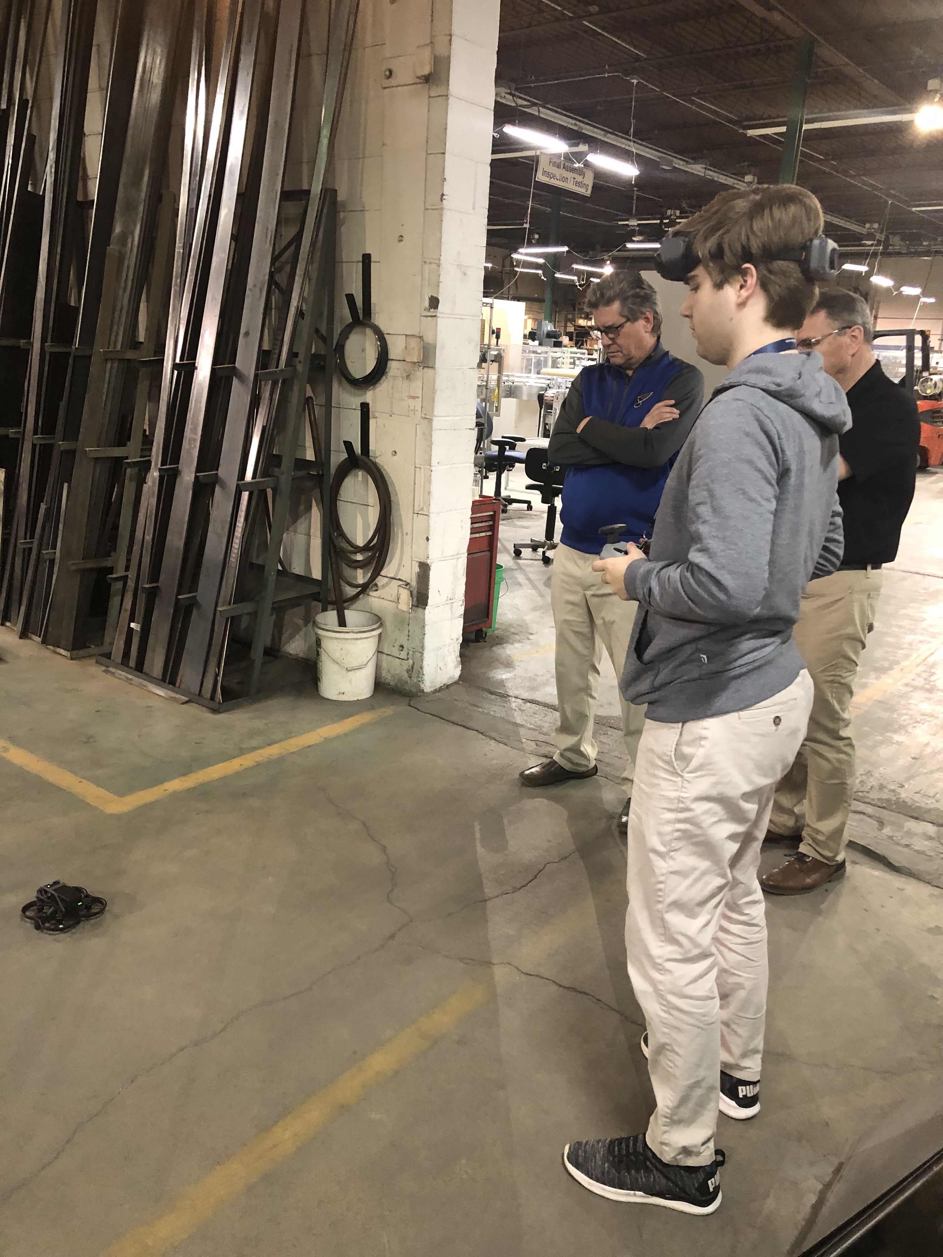
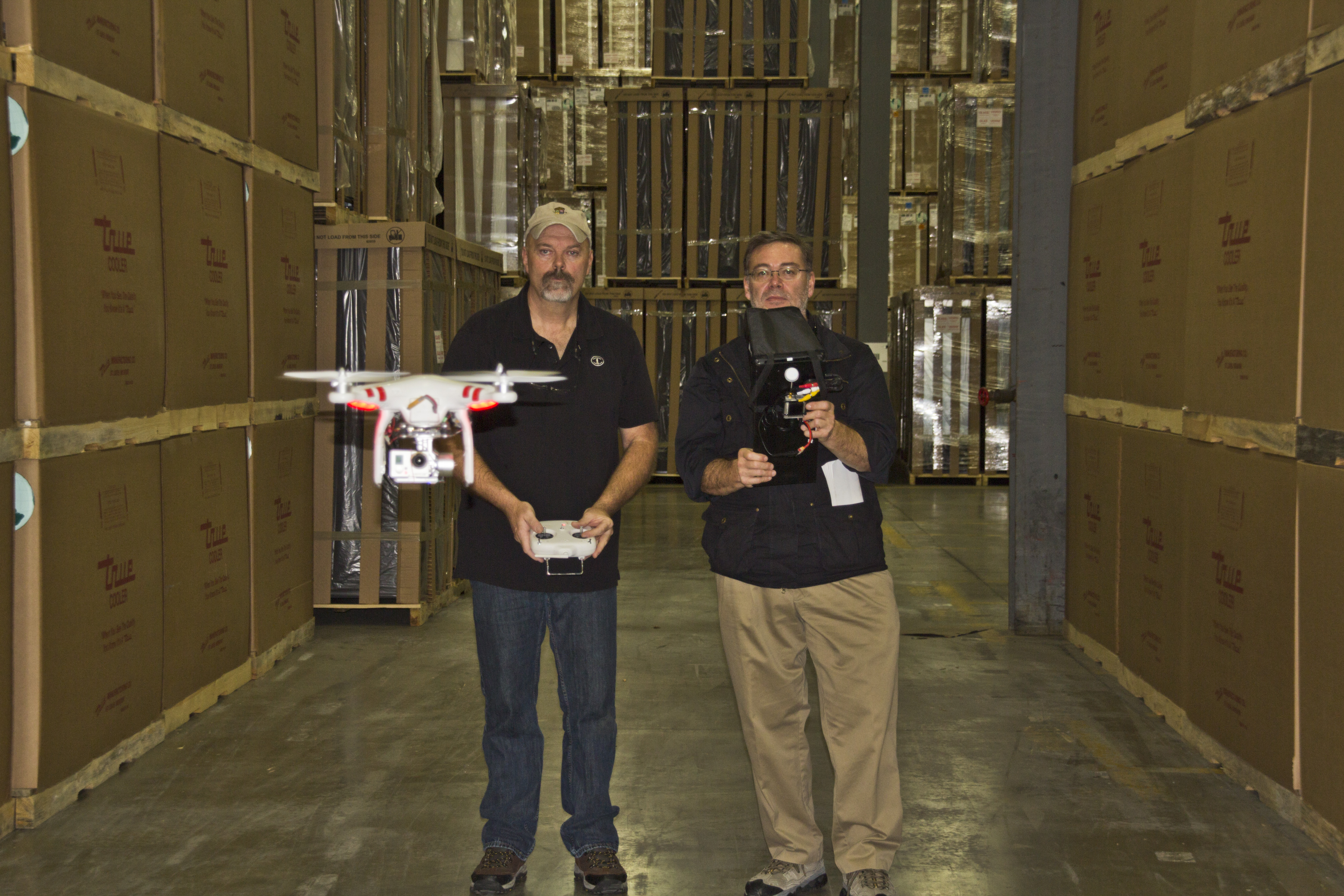
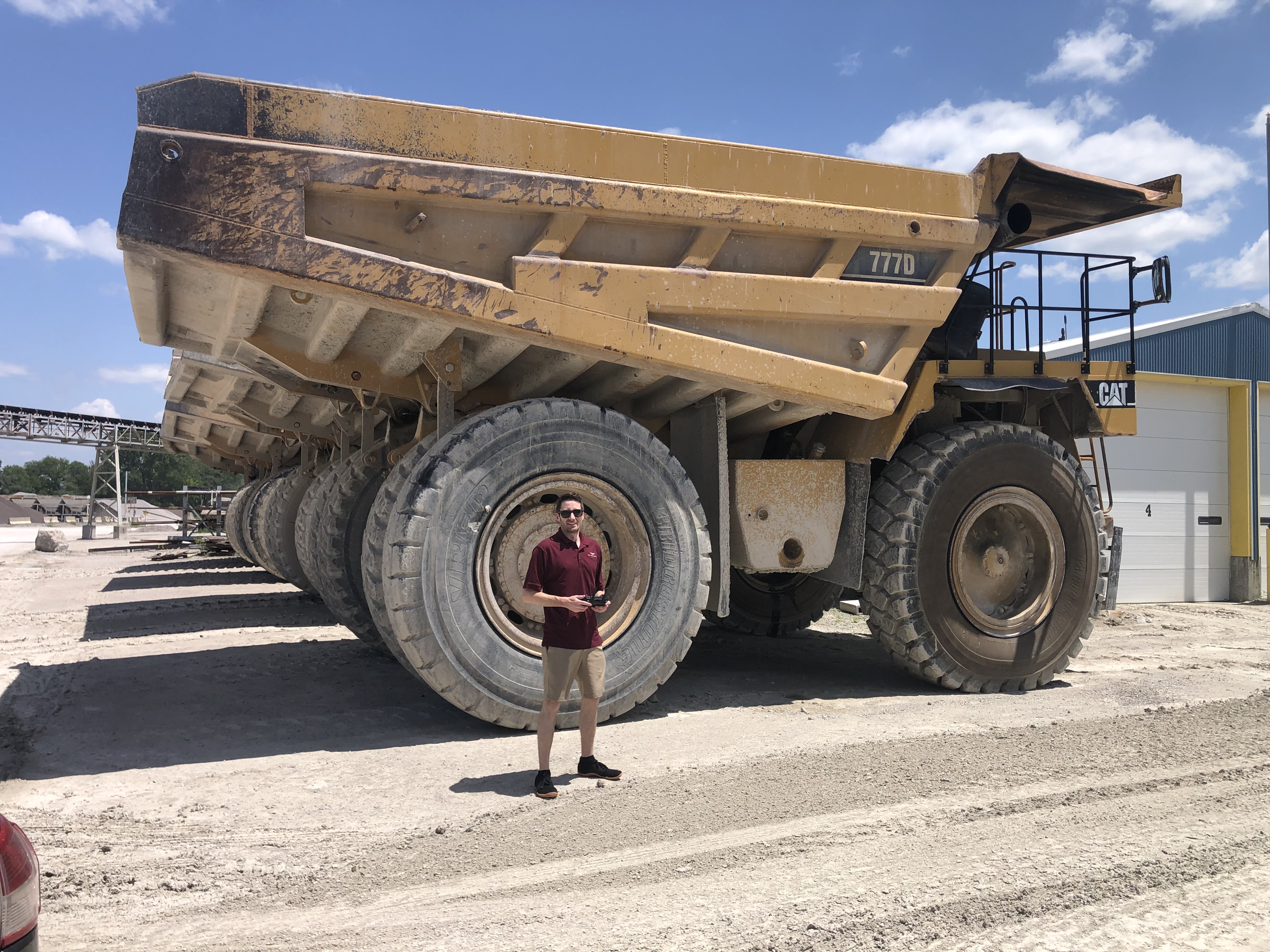
At St Louis Drones, we specialize in full-service commercial drone photography and video production—including stockpile documentation. We bring decades of visual production expertise and the latest drone mapping tools to every project. Our licensed drone pilots are trained to operate in complex environments, including indoor facilities, industrial sites, and restricted airspace.

In addition to field capture, our in-house post-production team uses cutting-edge AI-enhanced software to process your drone data quickly and accurately. From delivering clean volumetric reports to repurposing aerial visuals for marketing, we know how to transform raw drone imagery into strategic business tools.

Since 1982, our expert crews have supported organizations across St. Louis—partnering with businesses, marketing firms, and creative agencies to deliver successful video and photography projects tailored to each client’s unique goals.

St Louis Drones offers:

  • Licensed and insured drone pilots
  • Full-service aerial video and photography
  • Studio and on-location production
  • AI-powered editing and post-production
  • Customized solutions for construction, logistics, and industrial sites
  • Indoor drone operations for challenging environments
  • Safe and accurate stockpile measurement solutions
  • Scalable visual asset creation for ongoing needs

We are well-versed in all file types, media styles, and software ecosystems, ensuring that your deliverables are compatible with your internal reporting systems or external marketing platforms.

When precision, safety, and visual quality matter, St Louis Drones delivers. Let us help you elevate your next stockpile report—literally.

Rob Haller 314-604-6544 stlouisdrones@gmail.com

How Drones Help Construction Managers Make Better Plans: Aerial Insights That Drive Smarter Building Decisions

In the fast-paced world of construction, every decision—whether related to planning, safety, or budgeting—can significantly affect the timeline and success of a project. One of the most impactful tools reshaping how construction managers plan and execute their work is drone technology. Aerial imagery and data collected by drones are now vital components in construction project planning, offering unmatched visibility, accuracy, and efficiency.

The Power of Aerial Perspective in Construction Planning

Drones provide real-time, high-resolution imagery and 3D data that traditional methods can’t match. From pre-construction assessments to final inspections, drones give construction managers a bird’s-eye view of job sites, allowing for:

  • Site Surveys & Mapping: Drone-generated orthomosaic maps and topographic data offer quick, cost-effective alternatives to traditional land surveys. Managers can evaluate terrain, plan logistics, and detect potential site limitations before ground is even broken.
  • Progress Monitoring & Reporting: High-definition aerial photos and videos provide a visual record of progress over time. These updates help managers spot discrepancies, verify contractor performance, and maintain transparency with stakeholders.
  • Enhanced Accuracy with 3D Modeling: Drones can create accurate 3D models and digital elevation models (DEMs), enabling more precise planning and volume calculations for excavation or material stockpiles. These data-driven insights reduce waste and ensure better allocation of resources.

Safer, Smarter, and More Efficient

Drones significantly reduce the need for manual inspections of hard-to-reach or hazardous areas such as rooftops, scaffolding, or deep excavations. This not only improves job site safety but also increases the frequency and reliability of inspections.

By eliminating the delays associated with traditional surveying methods and manual reporting, drones streamline communication between departments, contractors, and project owners—enhancing decision-making and ultimately accelerating project timelines.

Real-Time Data for Real-World Decisions

Construction sites are dynamic environments. With drone data, managers can overlay current conditions against original plans to ensure alignment and catch deviations early. Integration with BIM (Building Information Modeling) platforms makes this data even more powerful, allowing teams to simulate and plan the next phase with confidence.

Additionally, real-time drone data can help in managing logistics—such as verifying material deliveries, optimizing equipment placement, and planning staging areas—which are crucial to keeping large projects on track.


Why Construction Teams Trust St Louis Drones

At St Louis Drones, we specialize in providing the construction industry with powerful aerial tools to enhance project planning and management. As a full-service professional commercial photography and video production company, we bring together the latest drone technology, AI-powered image analysis, and a seasoned creative crew to deliver exceptional results.

Whether you’re documenting a high-rise project downtown or managing a sprawling infrastructure site, our licensed drone pilots and experienced videographers ensure safe, accurate, and timely aerial imaging. Our services go beyond drone footage—we offer full-service studio and location video and photography, editing, and post-production solutions tailored to your project’s unique media needs.

We are experts in repurposing photography and video assets to maximize brand visibility and engagement across platforms. With fluency in all major file types, styles, and media software, we seamlessly integrate drone visuals into your broader marketing or documentation strategy.

Our private studio setup is also ideal for interview scenes and small-scale productions, and we have the space and flexibility to incorporate props and custom lighting designs to support your brand narrative.

Best of all, we’re equipped to fly specialized drones indoors for controlled environment shots—perfect for industrial, promotional, or progress documentation purposes.

Since 1982, we’ve partnered with construction firms, creative agencies, and marketing teams across St. Louis to deliver compelling imagery and data-driven insights. Let St Louis Drones help you plan better, work smarter, and build stronger with the power of aerial production.

314-604-6544 stlouisdrones@gmail.com

Drone Inspections: How to Spot Solar Panel Problems Fast

As the adoption of solar energy continues to rise, businesses and organizations are increasingly investing in solar panel installations to reduce their carbon footprint and energy costs. However, maintaining these systems requires regular inspections to ensure optimal performance. Traditional inspection methods can be costly, time-consuming, and potentially hazardous. This is where drone technology revolutionizes solar panel inspections—offering a faster, safer, and more cost-effective solution.

Using high-resolution and thermal imaging cameras, our drones capture detailed data across the entire solar installation.

Why Drone Inspections for Solar Panels?

Drones equipped with high-resolution cameras and thermal imaging sensors allow for comprehensive inspections of solar panel arrays without the need for manual checks. Here are some key benefits of using drones for solar panel inspections:

  1. Speed and Efficiency – Drones can inspect vast solar farms or rooftop installations in a fraction of the time it would take for manual inspections.
  2. Enhanced Accuracy – With advanced imaging technology, drones can detect even minor anomalies that might go unnoticed during manual checks.
  3. Cost Savings – By reducing labor costs and minimizing equipment downtime, businesses can significantly lower maintenance expenses.
  4. Safety – Eliminating the need for technicians to climb onto rooftops or walk through large solar farms minimizes risks associated with falls and other workplace hazards.
  5. Comprehensive Data Collection – Drones capture high-resolution images and thermal scans, allowing for in-depth analysis of panel performance and potential failures.

Common Solar Panel Issues Drones Can Detect

  1. Hot Spots – Thermal imaging allows drones to detect hot spots, which indicate potential electrical issues, shading problems, or panel malfunctions.
  2. Cracked or Damaged Panels – High-resolution photography can identify physical damage from hail, debris, or poor installation practices.
  3. String Failures – A group of solar panels failing simultaneously may indicate inverter or wiring issues, which drones can quickly pinpoint.
  4. Dirt and Debris Accumulation – Dust, leaves, bird droppings, and other debris can reduce panel efficiency. Drones provide an aerial perspective for maintenance planning.
  5. Wiring and Connection Issues – Thermal sensors can detect uneven heating patterns, signaling potential wiring or connection failures.

How Drone Inspections Work

At St. Louis Drones, we follow a streamlined process to ensure thorough and reliable solar panel inspections:

  1. Pre-Flight Planning – Our team assesses the location and determines optimal flight paths to maximize coverage.
  2. Data Collection – Using high-resolution and thermal imaging cameras, our drones capture detailed data across the entire solar installation.
  3. Data Analysis – Our experts analyze the images and thermal scans, identifying potential problem areas that need attention.
  4. Detailed Reporting – We provide clients with comprehensive reports, including annotated images, thermal maps, and recommended actions.
  5. Actionable Solutions – If issues are detected, we collaborate with businesses to plan necessary repairs or maintenance, ensuring minimal downtime and maximum efficiency.

Partner with St. Louis Drones for Your Solar Panel Inspections

At St. Louis Drones, we bring decades of experience in professional aerial photography and video production, offering cutting-edge drone technology for efficient and accurate solar panel inspections. Our full-service commercial photography and video production company is equipped with state-of-the-art imaging tools and a highly skilled creative crew dedicated to successful image acquisition.

We provide:

  • Licensed Drone Pilots – Our FAA-certified pilots ensure safe and compliant operations.
  • Customizable Production Services – From studio and location video shoots to post-production and editing, we cater to diverse media requirements.
  • Expertise in Branding and Repurposing Media – We help businesses optimize their photo and video assets for maximum engagement.
  • Advanced Studio Capabilities – Our private studio lighting and visual setup are ideal for interviews and small productions, with enough space to incorporate props and create a dynamic set.
  • Indoor Drone Flying Capabilities – Our specialized drones can operate indoors, allowing for close-up inspections even in challenging environments.

Since 1982, St. Louis Drones has been the trusted partner for businesses, marketing firms, and creative agencies in the St. Louis area, delivering high-quality photography and video solutions. Whether you need drone inspections for solar panels or full-scale video production services, we have the expertise and equipment to make your project a success.

Contact us today to schedule your next drone inspection and ensure your solar energy investment operates at peak performance!

314-604-6544 stlouisdrones@gmail.com

Simple Ways to Use Drone Shots in Your Storytelling

In today’s visually-driven world, the use of drone shots in photography and video production is more than just a trend—it’s an opportunity to elevate your storytelling. Whether you’re creating a corporate video, a promotional piece, or even a documentary, drone shots offer a dynamic perspective that can bring a fresh, cinematic touch to your project. For decision makers in photography and video production services, integrating drones into your work can significantly enhance the emotional and visual impact of your content.

A slow, steady drone shot over a quiet landscape can create a peaceful or reflective mood, while a fast-moving drone shot can add a sense of urgency or exhilaration.

Why Drone Shots Are Essential for Modern Storytelling

Drone shots are versatile tools for filmmakers and videographers, providing sweeping landscapes, aerial perspectives, and smooth motion that elevate the overall quality of video productions. Here are some simple ways to incorporate drone shots into your storytelling:

1. Establishing Shots: Setting the Scene

Drone shots are perfect for establishing a location. A bird’s-eye view of the landscape, building, or surrounding area helps orient your audience and sets the tone for the scene. Whether you’re shooting a corporate video, a marketing campaign, or a promotional piece for a real estate company, drones allow you to capture stunning visuals that give your viewers an immediate understanding of the environment.

An establishing shot from above can make even the simplest setting appear grand and cinematic, building anticipation for what’s to come.

2. Aerial Tracking Shots: Creating Dynamic Movement

Aerial tracking shots—where the drone follows a subject from above—are excellent for creating dynamic movement in your video. This technique can be particularly useful for corporate videos, event photography, or product showcases. Imagine a drone following a person walking through a modern office, highlighting the workspace or product. This shot creates a smooth, continuous visual that engages the viewer and maintains their interest.

In addition to its aesthetic appeal, aerial tracking provides context, showing how a subject moves within a space, giving a sense of freedom and scale that traditional shots cannot achieve.

3. Unique Perspectives: Turning Ordinary into Extraordinary

One of the most exciting aspects of drone shots is their ability to provide unique perspectives. What might be an ordinary shot from the ground level becomes extraordinary when viewed from above or from an unconventional angle. Whether it’s filming a construction site, a busy city, or a company event, drones can capture moments from an entirely new perspective.

This perspective creates visual interest and can evoke specific emotions. For example, a sweeping overhead shot of a corporate event or outdoor team-building activity can emphasize the scale of the event and highlight the energy and excitement of the participants.

4. Highlighting Movement and Motion: Showcasing Action

Drone footage excels at capturing action shots with its smooth, cinematic movements. This can be particularly useful in promotional videos, where motion and energy are key to engaging viewers. A drone can follow a moving vehicle, capture athletes in motion, or track a product’s journey from start to finish—offering a seamless and engaging experience.

Incorporating drone shots into your action sequences allows you to take your storytelling to new heights—literally and figuratively. The fluidity and grace of aerial footage enhance the overall pace and excitement of your narrative.

5. Enhancing the Emotional Impact: Creating Mood and Atmosphere

Drone shots are also powerful tools for setting the emotional tone of a scene. The ability to move in and out of a scene at various heights and speeds allows you to shift the mood and draw your audience into the story. A slow, steady drone shot over a quiet landscape can create a peaceful or reflective mood, while a fast-moving drone shot can add a sense of urgency or exhilaration.

In corporate storytelling, where emotion often plays a central role in messaging, drone footage can emphasize the feelings you want to evoke, such as the serenity of a product or the excitement of an event.

St. Louis Drones: Your Expert Partner in Drone Photography and Video Production

At St. Louis Drones, we understand the power of drone shots and are experts in using them to tell compelling, visually stunning stories. As a full-service professional commercial photography and video production company, we have the right equipment and experienced creative crew to bring your vision to life.

We offer both studio and location video and photography services, complete with editing, post-production, and licensed drone pilots. Whether you need breathtaking aerial shots for your marketing video, sweeping views for an event recap, or custom interview setups, St. Louis Drones has you covered. Our ability to customize productions for a diverse range of media requirements ensures that your content is tailored to your specific goals.

We are also experts in repurposing your photography and video branding to increase engagement and visibility. Our experience with various file types, media styles, and accompanying software means that we can deliver high-quality, optimized footage for all your digital platforms.

Our private studio lighting and visual setups are perfect for small productions and interviews, and large enough to accommodate props for complete set designs. From sound and camera operators to specialized drones that can be flown indoors, we provide everything you need to ensure your next production is flawless.

With over 40 years of experience, St. Louis Drones has been helping businesses, marketing firms, and agencies in the St. Louis area achieve their corporate photography and video goals. Let us help you create the stunning, impactful visual story you need to captivate your audience and leave a lasting impression.

Contact St. Louis Drones today and let us show you how our expert drone photography and video production services can take your storytelling to new heights.

Rob Haller 314-604-6544 stlouisdrones@gmail.com

Using Drones to Optimize Solar Panel Layouts: A Game-Changer for Renewable Energy Planning

In the fast-evolving world of renewable energy, solar power continues to take center stage as one of the most efficient and sustainable energy sources. As demand for solar energy increases, so does the need for innovative methods to maximize the efficiency and output of solar panel installations. One of the most transformative tools in solar panel layout planning is drone technology. By offering aerial perspectives and precise data collection, drones are revolutionizing how businesses and energy companies design, implement, and optimize their solar panel layouts.

Drone services typically cost less than traditional survey methods, such as hiring a team of surveyors or using expensive ground-based equipment.

The Power of Drones in Solar Panel Layout Planning

When planning a solar panel installation, it’s essential to carefully consider factors such as land topography, sunlight exposure, and potential obstacles. Traditionally, this process involved extensive on-the-ground surveys and manual measurements, which were time-consuming and limited in scope. However, with the advent of drones, this process has become faster, more accurate, and more cost-effective.

Drones equipped with high-definition cameras and specialized mapping software can easily capture detailed aerial imagery of the land, providing engineers with a comprehensive view of the area. These aerial insights allow for precise calculations, and through software, they can create detailed 3D models that provide optimal placement recommendations for solar panels. With drones, solar companies can ensure that each panel is positioned to achieve maximum sunlight exposure, ultimately increasing the system’s efficiency.

The Benefits of Drone Technology for Solar Panel Layouts

  1. Faster Data Collection: Drones can cover large areas in a short amount of time, providing quick data collection for solar panel layout planning. This accelerated survey process speeds up the decision-making timeline, allowing projects to move forward more swiftly.
  2. Cost-Effective Solutions: Drone services typically cost less than traditional survey methods, such as hiring a team of surveyors or using expensive ground-based equipment. Additionally, drones reduce the need for specialized machinery, making the entire process more affordable.
  3. Unmatched Precision: Drones capture high-resolution imagery, ensuring that all data collected is both accurate and detailed. This data can be processed into 3D models, offering valuable insights into the best placement of solar panels based on terrain and environmental factors.
  4. Access to Challenging Terrain: Drones are capable of accessing difficult-to-reach areas, such as steep slopes or densely vegetated land, that would be challenging or unsafe for surveyors. This ability ensures a thorough analysis of the entire project site, even in the most challenging environments.
  5. Real-Time Adjustments: Drones provide immediate, real-time feedback during the surveying process. This allows engineers and solar designers to make adjustments on the fly, improving the layout and avoiding potential issues before they arise.

St. Louis Drones: Empowering Solar Projects with Advanced Aerial Solutions

At St. Louis Drones, we specialize in providing high-quality drone services tailored to the renewable energy sector, including solar panel layout planning. With years of experience in commercial photography and video production, we offer comprehensive drone services that support the energy industry’s growing demand for innovative solutions.

As a full-service commercial photography and video production company, St. Louis Drones brings the right equipment and creative expertise to ensure your solar projects are executed with precision. From aerial photography and video to mapping and 3D modeling, our drones deliver the high-resolution imagery and detailed data that are crucial for effective solar panel layout design.

Our licensed drone pilots are experienced in flying specialized drones indoors, giving us an edge when working in controlled environments or tight spaces. We can also help with every aspect of your production, from creating a custom interview studio setup to providing sound and camera operators, ensuring a smooth and professional video production process.

Whether you’re looking to capture detailed aerial footage for solar site assessments or need expert assistance in repurposing your video and photography for marketing, St. Louis Drones offers the expertise and creativity needed for your project’s success. We understand the unique requirements of renewable energy companies and work closely with businesses, marketing firms, and agencies in the St. Louis area to provide cutting-edge solutions.

Since 1982, St. Louis Drones has been at the forefront of innovation, offering full-service commercial photography, video production, and drone services. We are well-versed in all file types and media styles and can customize your production to meet any specific requirements. Our private studio is perfect for small productions and interviews, while our larger setups are ideal for accommodating props and creating more complex scenes.

Let St. Louis Drones elevate your solar panel layout planning. We have the tools, experience, and team to help you achieve more efficient, effective, and accurate solar energy solutions.

314-604-6544 stlouisdrones@gmail.com

Using Drone Clips to Spot Issues in Your Building Projects

In the ever-evolving landscape of construction and building projects, ensuring quality and efficiency is paramount. One innovative approach that has gained significant traction in recent years is the use of drone technology to enhance project monitoring and management. Drones equipped with high-resolution cameras provide unparalleled aerial views and insights, making it easier to identify potential issues before they escalate. This blog post explores how drone clips can be instrumental in spotting issues in your building projects and how St Louis Drones can support your needs in this area.

This visual evidence can be invaluable during meetings with clients and contractors, providing clear documentation of progress and any areas requiring attention.

Enhanced Visual Documentation

Drones offer a unique vantage point that traditional methods simply cannot match. By capturing high-resolution aerial footage, project managers and stakeholders can obtain comprehensive visual documentation of the site. This enhanced visibility allows for better assessment of site conditions, progress tracking, and identification of any discrepancies from the project plans.

For instance, using drone footage, you can quickly assess the alignment of structures, the positioning of utilities, and the overall layout of the site. This immediate visual feedback is crucial in the early stages of construction, where rectifying errors can save significant time and costs.

Identifying Safety Hazards

Safety is a top priority in any construction project. Drones can help identify potential safety hazards that might not be visible from the ground. For example, aerial footage can reveal unsafe working conditions, such as areas where workers may be exposed to falling debris or unsafe scaffolding.

By conducting regular drone inspections, project managers can proactively address these issues, ensuring a safer working environment for their teams. This not only enhances worker safety but also minimizes the risk of project delays caused by accidents or injuries.

Monitoring Construction Progress

Regular monitoring of construction progress is essential to stay on schedule and within budget. Drones can be deployed at various project phases to capture real-time footage, allowing stakeholders to compare actual progress against project timelines. This visual evidence can be invaluable during meetings with clients and contractors, providing clear documentation of progress and any areas requiring attention.

In addition, drones can facilitate remote project updates for clients who may not be able to visit the site in person. This transparency helps build trust and confidence, as clients can see firsthand the progress being made.

Conducting Inspections of Hard-to-Reach Areas

Certain areas of a construction site can be difficult or dangerous to access. Drones eliminate the need for scaffolding or ladders, allowing for quick and safe inspections of roofs, tall structures, and confined spaces. This capability ensures that even hard-to-reach areas are regularly monitored, reducing the risk of overlooked issues that could lead to costly repairs later on.

Streamlining Communication

The integration of drone technology into construction projects enhances communication among stakeholders. Aerial footage can be shared easily with project teams, clients, and other interested parties, facilitating discussions about project status, challenges, and solutions. This shared visual language fosters collaboration and ensures everyone is on the same page regarding project objectives.

Conclusion

Utilizing drone clips for building projects is a game-changer for construction management. From enhanced visual documentation to improved safety and communication, drones offer a wealth of benefits that can lead to more successful project outcomes.

At St Louis Drones, we bring over 40 years of experience in commercial photography and video production to the table. As a full-service professional company, we are equipped with the right tools and a creative crew ready to assist you in achieving successful image acquisition. Our offerings include full-service studio and location video and photography, editing, post-production, and licensed drone pilots.

We specialize in customizing productions to meet diverse media requirements, ensuring your branding gains maximum traction. Our expertise spans all file types and media styles, allowing us to adapt to your unique needs. With our private studio, complete with tailored lighting setups, we can create the perfect environment for small productions and interview scenes, incorporating props to enrich your set.

From custom interview studio setups to providing sound and camera operators, St Louis Drones has everything you need to ensure your next video production is flawless. Notably, our specialized drones are capable of flying indoors, offering even more flexibility for your projects. Since 1982, we have proudly collaborated with numerous businesses, marketing firms, and agencies in the St. Louis area for their corporate photography and video needs. Trust St Louis Drones to elevate your building projects with our cutting-edge drone technology and unparalleled expertise.

314-604-6544 stlouisdrones@gmail.com

How to Use Drones to Measure Stockpiles and Track Volumes More Accurately

In the world of mining, construction, and aggregate industries, accurate measurement and management of stockpiles are critical. Traditionally, this process involved labor-intensive and time-consuming methods, often yielding inconsistent results. However, with the advent of drone technology, these industries have found a more efficient, accurate, and safer way to measure stockpiles and track volumes. In this comprehensive guide, we will explore how drones can revolutionize your stockpile measurement processes.

The Advantages of Using Drones for Stockpile Measurement

Efficiency and Time Savings

Using drones to measure stockpiles significantly reduces the time required for data collection. Traditional methods may take hours or even days, depending on the site’s size and complexity. In contrast, a drone can complete the same task in a fraction of the time, often within minutes. This efficiency translates to cost savings and allows for more frequent surveys, ensuring up-to-date inventory data.

Enhanced Accuracy

Drones equipped with high-resolution cameras and advanced sensors capture geo-referenced images from above the worksite. These images are processed using photogrammetry software to create precise 3D maps of the site. The accuracy of these measurements is unparalleled, often within a few centimeters, providing reliable data for inventory management and project planning.

Safety Improvements

Traditional stockpile measurement methods often involve personnel climbing unstable piles or navigating heavy machinery, posing significant safety risks. Drones eliminate the need for physical contact with the stockpiles, enhancing worker safety and reducing the likelihood of accidents.

How Drone Surveys Work

Data Collection

A drone equipped with a high-resolution camera flies over the worksite, capturing a series of overlapping images. These images are geo-referenced, meaning they are tagged with precise GPS coordinates, ensuring accurate spatial data.

Data Processing

The captured images are processed using photogrammetry software, which stitches them together to create a detailed 3D map of the site. This map can be analyzed to take various measurements, including stockpile volumes, surface areas, and elevation changes.

Data Analysis and Reporting

Drone survey visualization software leverages the accuracy of the 3D maps to provide actionable data. Users can compare current stockpile volumes to previous surveys, track site progress, and even compare stockpile surveys to final grade design files. This capability allows for precise calculations of how much material needs to be added or removed.

Applications of Drone Technology in Stockpile Management

Mining and Aggregates

For professionals in the mining and aggregates industries, drone surveys offer a reliable way to manage stockpile inventories. The precise volume calculations help in maintaining optimal stock levels, planning extraction activities, and ensuring efficient resource utilization.

Construction Sites

Construction sites benefit from drone surveys by quickly and accurately surveying large areas. The 3D maps generated provide valuable insights into site progress, material requirements, and compliance with design specifications.

Environmental Monitoring

Drones also play a crucial role in environmental monitoring by tracking changes in landscapes and ensuring compliance with environmental regulations. The ability to capture high-resolution images and generate 3D models aids in assessing the impact of mining and construction activities on the surrounding environment.

Why Choose St Louis Drones and Photo for Your Drone Survey Needs

At St Louis Drones and Photo, we are a full-service professional commercial photography and video production company with extensive experience in image and stockpile inventory data acquisition. Our team is equipped with the latest technology and creative expertise to deliver exceptional results for your business.

Comprehensive Services

We offer a wide range of services, including full-service studio and location video and photography, editing, post-production, and licensed drone pilots. Our capabilities allow us to customize productions to meet diverse media requirements, from repurposing your photography and video branding to ensuring you gain more traction in your market.

State-of-the-Art Equipment and Expertise

Our private studio lighting and visual setup are perfect for small productions and interview scenes. The studio is large enough to incorporate props, creating a complete set for your production. We also offer specialized drones capable of indoor flights, providing versatile solutions for various production needs.

Experienced and Dedicated Team

Our experienced team can assist with every aspect of your production, from custom interview studio setups to providing sound and camera operators. We have the equipment and expertise to make your next video production perfect.

Proven Track Record

St Louis Drones and Photo has successfully partnered with numerous businesses to gather data and measure stockpiles. Our commitment to accuracy, efficiency, and safety has made us a trusted provider in the industry.

In conclusion, leveraging drone technology for stockpile measurement and volume tracking offers significant advantages in terms of efficiency, accuracy, and safety. With St Louis Drones and Photo, you can trust that your data acquisition needs are in expert hands, ensuring the best outcomes for your projects. Contact us today to learn more about how we can assist with your next drone survey and production needs.

Rob Haller 314-604-6544 stlouisdrones@gmail.com

Understanding the Importance of Proper Lighting for Indoor FPV Flying at Your Business

In the dynamic realm of photography and video production, lighting stands as an indispensable element, dictating the overall quality and impact of the final product. When it comes to indoor FPV (First-Person View) flying, the significance of proper lighting takes center stage, influencing not only the clarity of footage but also the safety and efficiency of operations within your business premises.

Regularly monitor and adjust lighting throughout the filming process to maintain consistency and adapt to changing conditions.

The Essence of Lighting in Indoor FPV Flying

Indoor FPV flying, often utilized for aerial photography and videography within confined spaces, demands meticulous attention to lighting conditions. Unlike outdoor environments where natural light may dominate, indoor settings present unique challenges that require strategic illumination solutions.

1. Visibility and Clarity:

  • Adequate lighting ensures optimal visibility for pilots navigating drones within indoor spaces, enhancing control and reducing the risk of collisions or accidents.
  • Clear visibility facilitates precise framing and composition, enabling photographers and videographers to capture desired shots with accuracy.

2. Image Quality:

  • Proper lighting is paramount for achieving high-quality footage and images, minimizing graininess, shadows, and other visual distortions.
  • Balanced lighting enhances color accuracy and detail, resulting in captivating visuals that resonate with viewers.

3. Safety Considerations:

  • Well-lit environments contribute to a safer flying experience, allowing pilots to detect obstacles and hazards more effectively.
  • Adequate illumination reduces the likelihood of accidents or damage to equipment, safeguarding both personnel and property.

Strategies for Effective Indoor Lighting

Achieving optimal lighting for indoor FPV flying involves a strategic approach, integrating various techniques and equipment to create an ideal visual environment.

1. Natural Light Utilization:

  • Leverage existing natural light sources such as windows or skylights to supplement artificial lighting.
  • Position drones and cameras strategically to capitalize on natural light while minimizing glare and shadows.

2. Artificial Lighting Setup:

  • Invest in high-quality LED lights or softboxes specifically designed for indoor photography and videography.
  • Experiment with different lighting angles and intensities to achieve desired effects and eliminate undesirable shadows.

3. Lighting Control and Adjustment:

  • Implement dimmers, diffusers, and reflectors to fine-tune lighting conditions according to specific shooting requirements.
  • Regularly monitor and adjust lighting throughout the filming process to maintain consistency and adapt to changing conditions.

4. Color Temperature Consideration:

  • Pay attention to the color temperature of light sources to ensure uniformity and coherence in visual aesthetics.
  • Balance warm and cool lighting tones to complement the ambiance and highlight key elements of the scene.

St Louis Drones: Your Partner for Professional Indoor FPV Flying

At St Louis Drones, we recognize the paramount importance of proper lighting in indoor FPV flying and photography. With our extensive experience and state-of-the-art equipment, we offer comprehensive solutions tailored to meet your business’s unique needs and objectives.

As a full-service professional commercial photography and video production company, St Louis Drones provides:

  • Studio and Location Services: Whether you require a private studio setup or on-site filming at your business premises, we have the expertise and resources to deliver exceptional results.
  • Editing and Post-Production: Our skilled team handles all aspects of editing and post-production, ensuring seamless integration of visuals and audio for captivating final products.
  • Licensed Drone Pilots: With licensed drone pilots on our team, we adhere to strict safety regulations and operational standards, guaranteeing safe and compliant indoor FPV flying.
  • Customized Productions: We tailor our services to accommodate diverse media requirements, offering flexibility and versatility to adapt to your specific project goals.
  • Media Repurposing: Maximize the impact of your photography and video branding by repurposing content across various platforms and marketing channels.
  • Technical Expertise: Our team is proficient in all file types, styles of media, and accompanying software, ensuring compatibility and optimal performance throughout the production process.

From small-scale productions to large-scale corporate projects, St Louis Drones is your trusted partner for professional indoor FPV flying and photography. Contact us today to discover how we can elevate your visual storytelling and enhance your brand presence through the power of exceptional imagery.


St Louis Drones
Your Partner for Professional Commercial Photography and Video Production

Rob Haller 314-604-6544 stlouisdrones@gmail.com